All
Hiking
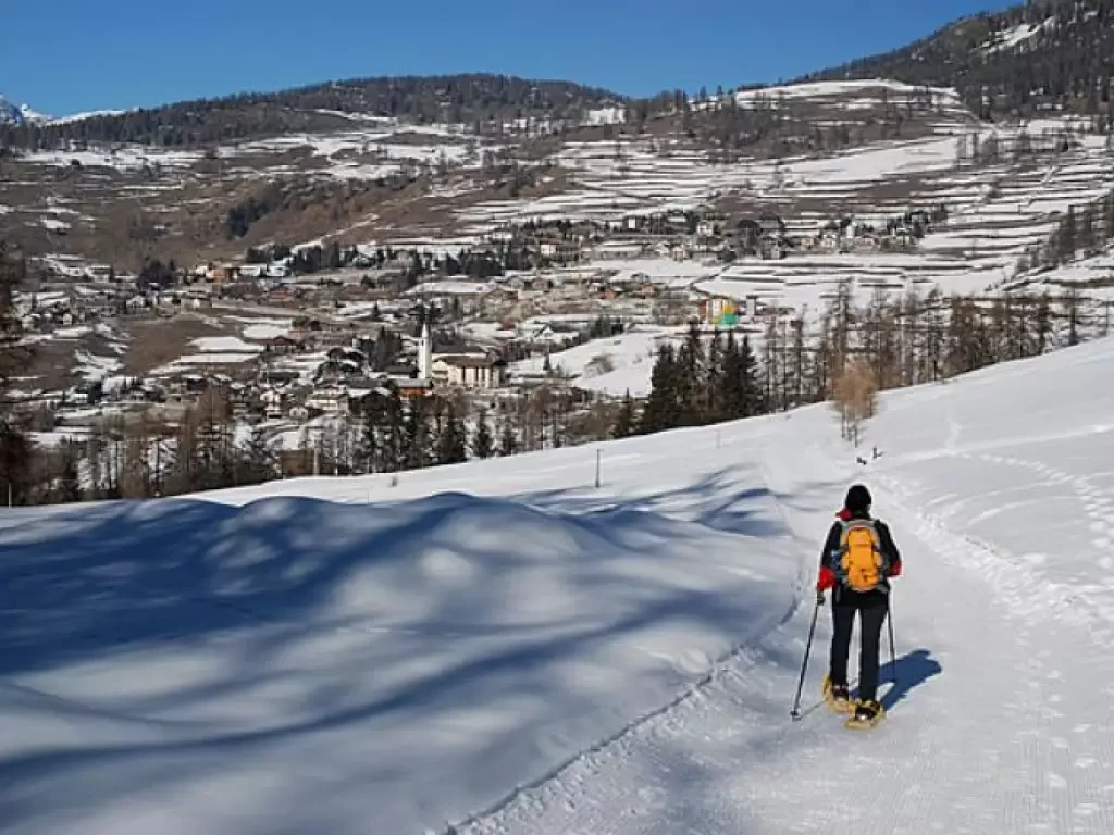
Snowshoeing
Ski-mountaineering
Mountaineering
Via ferrata
Climbing
Mountain bike
Trekking

Edited by:
Massimo Martini
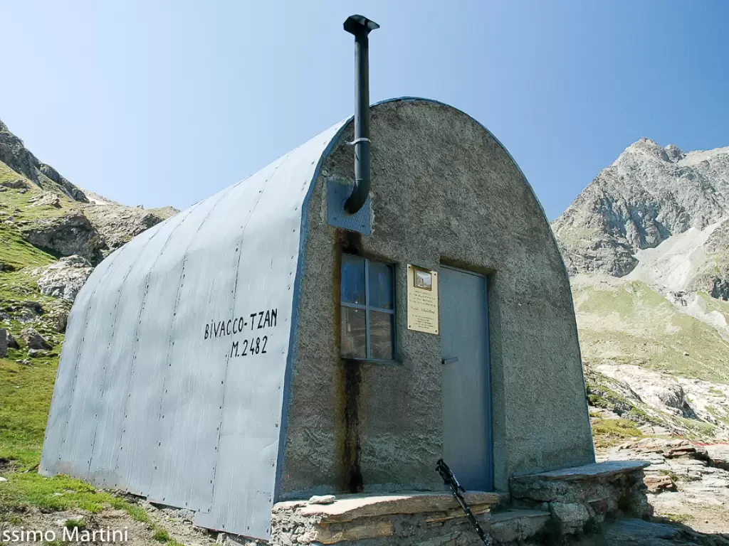
Tsan Bivouac, from Champtorné
A walk that can also be done by bicycle (on the farm road section) and that without much effort will...
T2
0.00 Km
586 m
Edited by:
Massimo Martini
Brengon, from Promiod
Simple walk through the woods of the middle Valtournenche. Short, easy and scenic: a good starting point for taking your...
WT2
5.00 Km
219 m
Edited by:
Massimo Martini
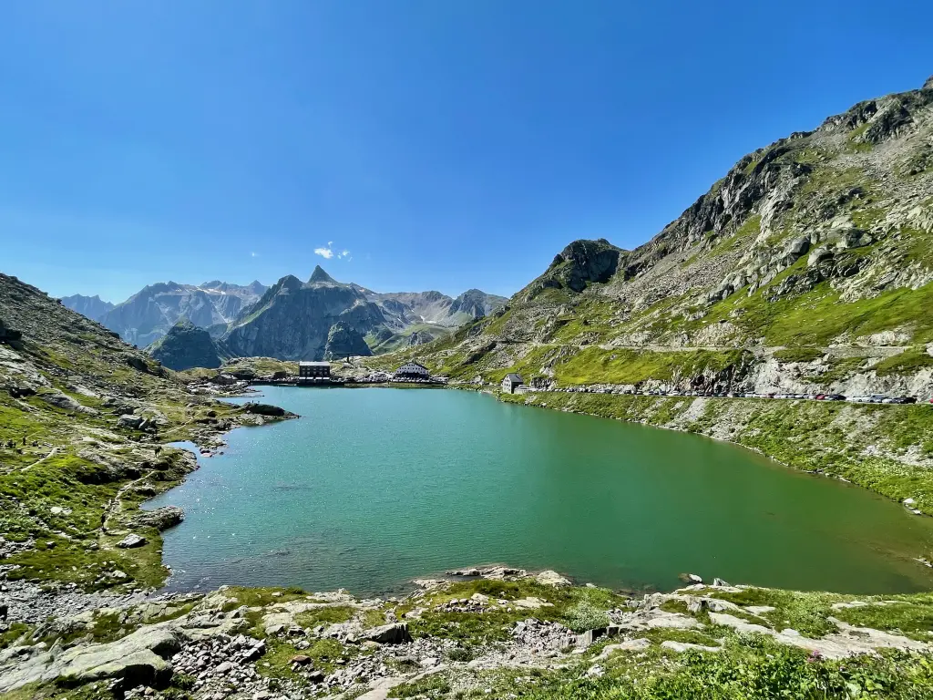
Tour des Col du Grand Saint-Bernard
A pleasant excursion, never monotonous, for good walkers. The panorama is rare and enchanting. We cross 3 hills to complete...
T2
11.69 Km
1000 m
Edited by:
Massimo Martini
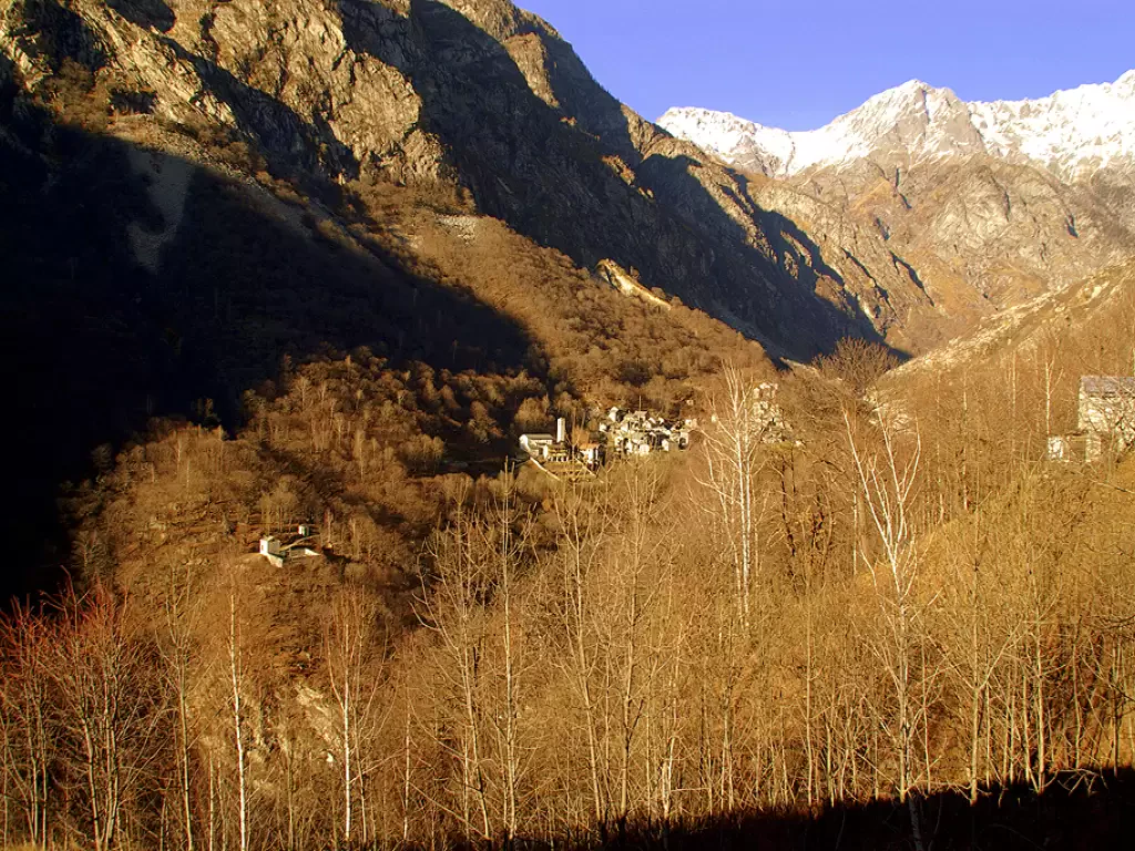
Tête de Comagne, from Sommarèse
An interesting walk in the middle of the woods of the middle Valle d'Aosta. This is an extremely easy itinerary...
WT2
0.00 Km
576 m

Edited by:
Marco Bonati
Val Codera, from Campo Mezzola to San Giorgio
A loop trail that intercepts a long stretch of the "Tracciolino", a gutter route that joins the hydroelectric plants of...
T2
0.00 Km
649 m
Edited by:
Massimo Martini
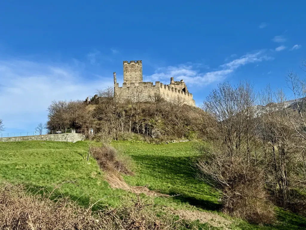
Castle of Cly, from the Bourg de Chambave
Between neat rows of vines and sunny slopes sloping down towards the Dora Baltea, the path to the Castle of...
T2
3.40 Km
305 m
Edited by:
Massimo Martini
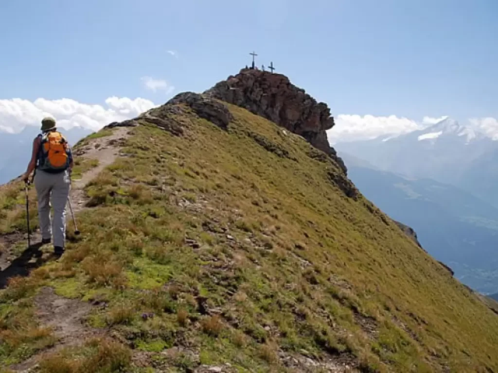
Pointe de Chaligne, from Mendey to the Crête de Tardiva
The Pointe de Chaligne is the highest peak in the municipalities of Aosta and Gignod. Every year, on 16 August,...
T2
13.00 Km
1087 m


Edited by:
Rita Tarussello
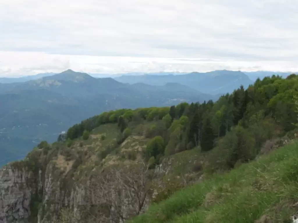
Monte Coltignone
Il Coltignone è il monte più alto della Costiera di S. Martino, un gruppo di cime che dal Pian dei...
T4
13.00 Km
1262 m

Edited by:
sonia_f
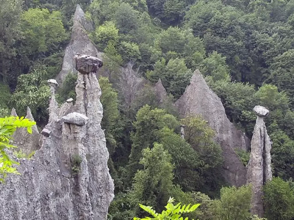
Piramidi di Zone
Situate sull'altipiano di Cislano, nel territorio del comune di Zone, ad un'altitudine di 600 metri, le piramidi di Zone sono...
T2
0.00 Km
133 m

Edited by:
mbuffa
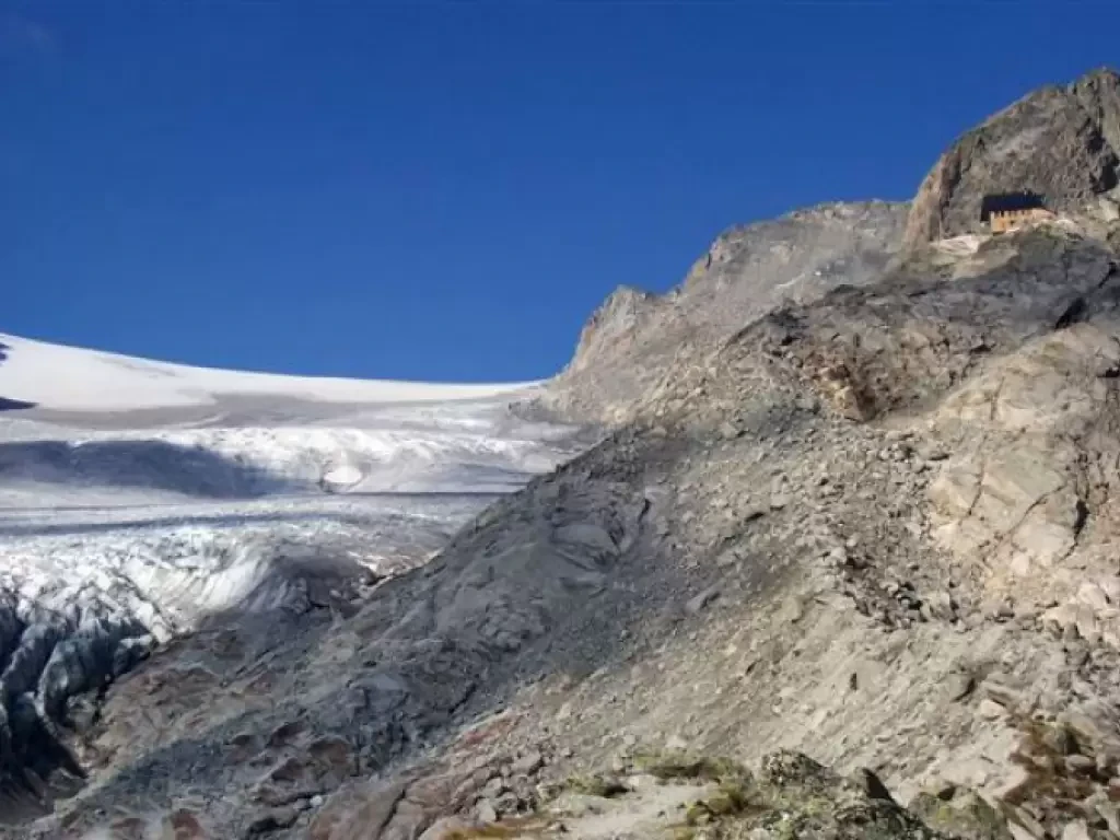
Cabane du Trient
High-altitude route to discover the northernmost foothills of Mont Blanc; the final destination, Cabane du Trient, overlooks the Plateau du...
T3
12.00 Km
976 m
Edited by:
Massimo Martini
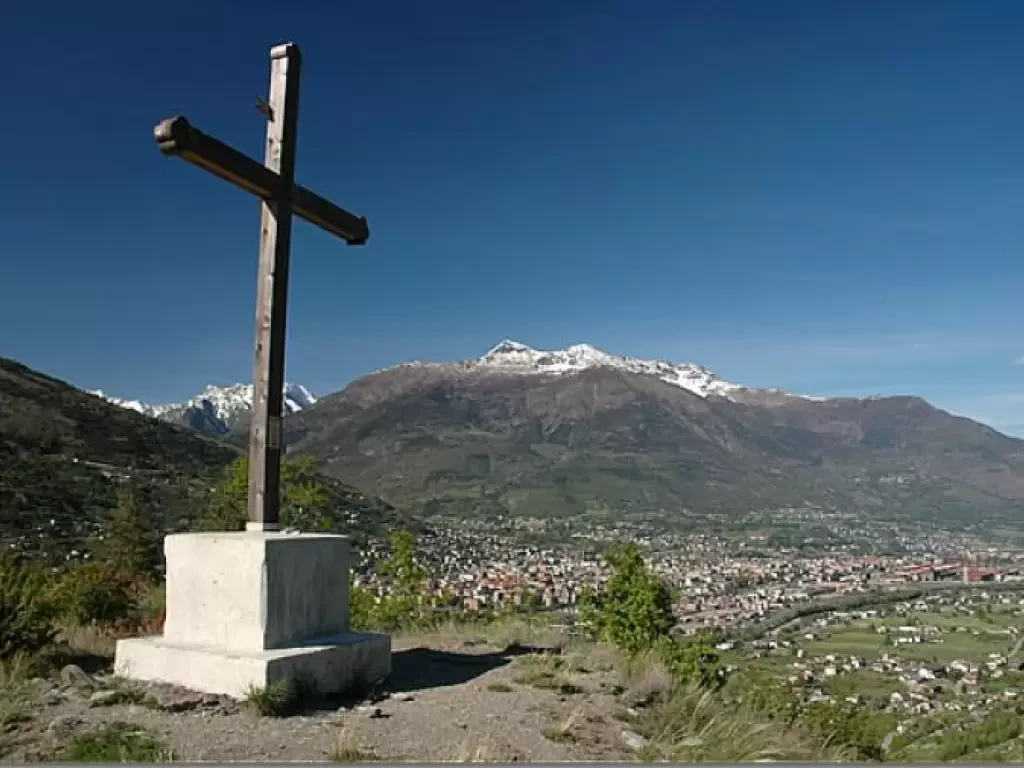
Côte de Gargantua
Breve ma interessante itinerario nei pressi di Aosta. La passeggiata sulla Côte de Gargantua permette di godere di interessanti spunti...
T2
1.00 Km
100 m