Lasciare lo svincolo autostradale di Châtillon, svoltare a sinistra e procedere per 300m (0,3km) fino alla rotonda. Imboccare la terza uscita e proseguire su Via Émile Chanoux. Attraversare il centro storico di Châtillon per 600m (0,9km), quindi svoltare leggermente a destra su Via Menabreaz e proseguire per 450m (1,35km) fino alla rotatoria con il Cervino. Prendere la seconda uscita e imboccare la della Valtournenche per 7,7km (9,05km) fino ad Antey-Saint-André. Svoltare a destra e imboccare la in direzione La Magdeleine. Risalire la regionale per 8,4km (17,45km), superando Brengon, fino al parcheggio di Artaz.
Parcheggio
Ad Artaz si trova un parcheggio 🅿️ gratuito, punto di partenza dell'itinerario.
Accesso con mezzi pubblici
Per raggiungere il punto di partenza dell'itinerario è necessario un mezzo privato, poiché Artaz non è servita da trasporti pubblici.
Le indicazioni fornite sono state verificate alla data del rilievo dell'itinerario. Prima della partenza si consiglia di verificare possibili variazioni del percorso o delle condizioni stradali. Per informazioni aggiornate si raccomanda di consultare Google Maps o Apple Maps.
Introduction
Circular itinerary in the municipal area of La Magdeleine, without excessive altitude difference. Immersed in the beautiful mountainous setting of the lower Valtournenche, this route offers excellent thrills without requiring excessive physical effort.
Description
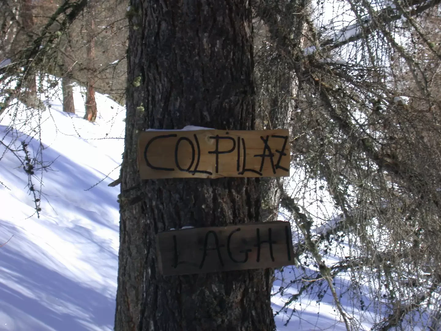
Leaving the car in one of the small car parks along the road, we immediately take a small tarmac road which branches off from the bend: here we find a signpost indicating Col Pilaz (Signpost 2, 1954m, 1h00').
We follow the little road which, after a wide turn to the left, turns successively to the right, while in front of us a splendid view opens up over the territory of Torgnon, the Becca d'Aver, Mont Méabé and Punta Tzan. After about ten minutes, we meet, at a hairpin bend to the right, the junction for Chamois: we ignore it and continue along the little road, follow another large hairpin bend to the left, pass the Fioc pasture and finally reach a barrier indicating the start of our snowshoe route (1827m,0h30').
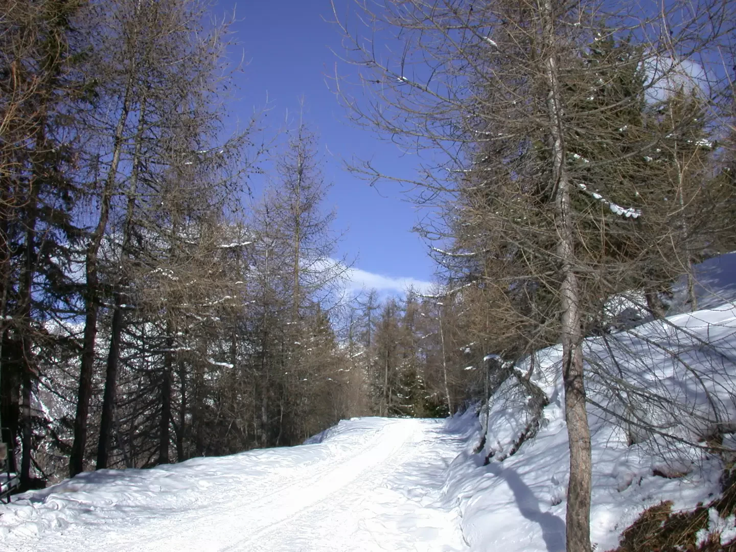
The route is now snow-covered and goes up the road that leads to Col Pilaz, enters a forest of firs and larches, and every now and then there are interesting glimpses of Monte Zerbion and Mont Tantané. Having passed a slightly steeper stretch of road, the route continues in an almost straight line, we are on the watershed with the municipality of Chamois and every now and then, among the branches of the fir trees, we catch a glimpse of the unmistakable outline of the Cervino. Having passed the point of maximum elevation (2005m), we start to descend towards a fork: we ignore the road that continues straight ahead and turn right, continuing our descent to Col Pilaz (1975m, 1h20').
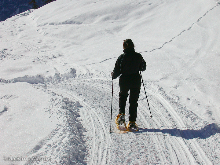
From here we begin the descent, pass some characteristic huts, leave them on our right, and continue following the track of the cross-country hiking track: we can clearly make some nice digressions into the fresh snow, while in front of us appears a very suggestive spectacle of peaks. After an initial downhill section, the track heads towards Lake Croux, to the left, which we reach without seeing it. We leave the huts near the lake on the right (1932m, 2h00') and conclude our descent by taking the track in front of us, which follows the hairpin bends of the farm road: after a first fork (1876m, 2h10') where we turn right, we make a long traverse, first through the woods, which reaches a mountain pasture and a second fork (1835m, 2h20'): here we turn left. Our itinerary has now come to an end, below us we can already see the ski lifts and the little church of La Magdeleine; after two hairpin bends, we reach the end of the road with the no-entry sign (1745m, 2h35') and the end of the snow, with snowshoes being put on! From here, you reach the houses of Artaz and finally the starting point, concluding the loop.
Condizioni via o sentiero: ottima, traccia battuta e neve portante Pericolo Oggettivo: nessuno Tratti esposti: nessuno Rischio valanghe: 2 moderato su scala 5 Affollamento: discreto
Condizioni meteo
Cielo: velato Temperatura: appena sotto lo 0 Condizioni neve: traccia fatta in un breve tratto di pascolo prima di Valery, generalmente portante.
da qualche parte c'era BertoMeansBerto... ma non lo abbiamo visto :(


Comments (0)
Sign in to leave a comment