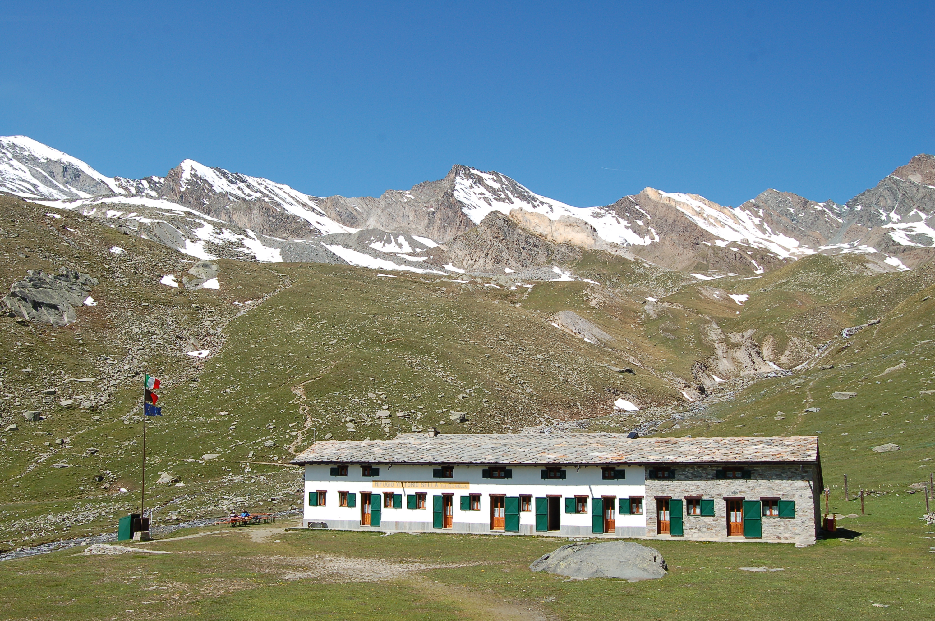
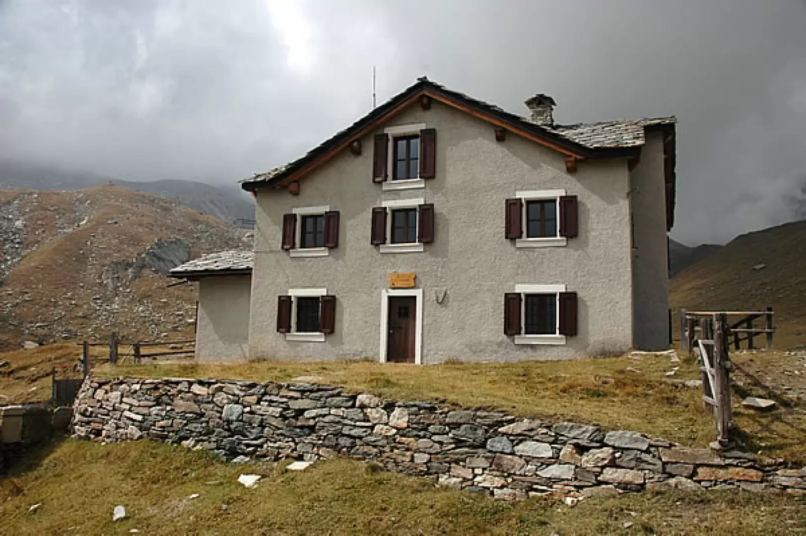
Vittorio Sella Refuge, from the Valnontey car park

Edited by:
Massimo Martini
Updated at: 07/06/2026
Access
Road navigation
At the motorway junction of Aosta West, enter the roundabout and take the second exit following the signs for / Cogne / Aymavilles. Continue on for 20.0km (20.0km) to the roundabout at the entrance to Cogne, where take the first exit onto Avenue G.F. Cavagnet (350m, 20.35km). Continue on Via Bourgeois (120m, 20.5km), then turn right onto Rue Grand Paradis. Follow Rue Grand Paradis for 2.4km (22.9km), continue on Frazione Valnontey for 210m (23.1km) and turn right to reach the car park.
Parking
At the end of the road is the 🅿️ car park in Valnontey, the access point to the Gran Paradiso National Park. Check on site for access conditions and any seasonal restrictions imposed by the park authority.
Access by public transport
The Valnontey car park can be reached by the Cogne urban circular line run by SVAP. The reference stop is Cogne Valnontey. The winter service runs every weekday and on public holidays, except 25 December and the summer period; the runs serving the Valnontey stop depart from Cogne Revettaz at 09:00, 10:05, 11:10, 12:40 and 15:00, arriving in Valnontey at 09:25, 10:30, 11:35, 13:05 and 15:25 respectively. For updated timetables please consult the timetable SVAP - Cogne Urban Line.
Distance and travel time
🕒Travel time: 35 minutes
📏 Distance: 23.5km
GPS navigation
Information note
The information provided has been verified as of the date of the survey of the itinerary. Before departure, it is recommended to check possible changes in the route or road conditions. Please consult Google Maps or Apple Maps for the latest information.
.Introduction
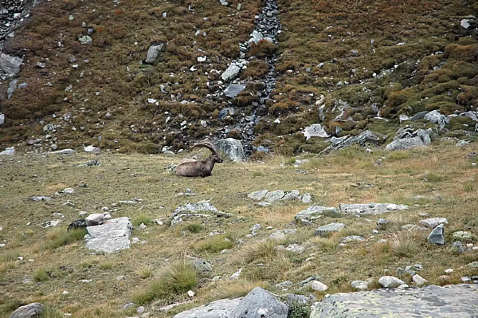
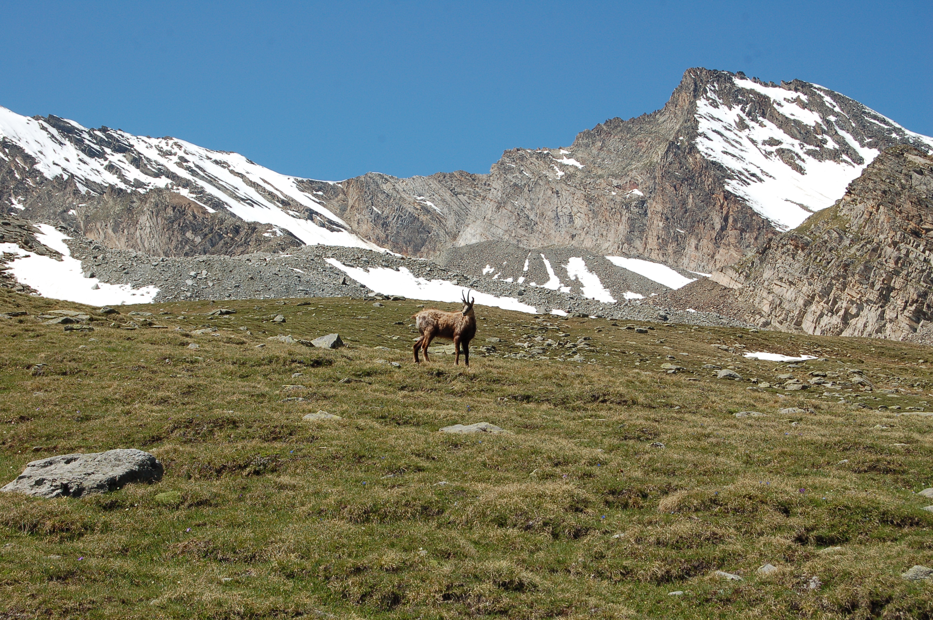
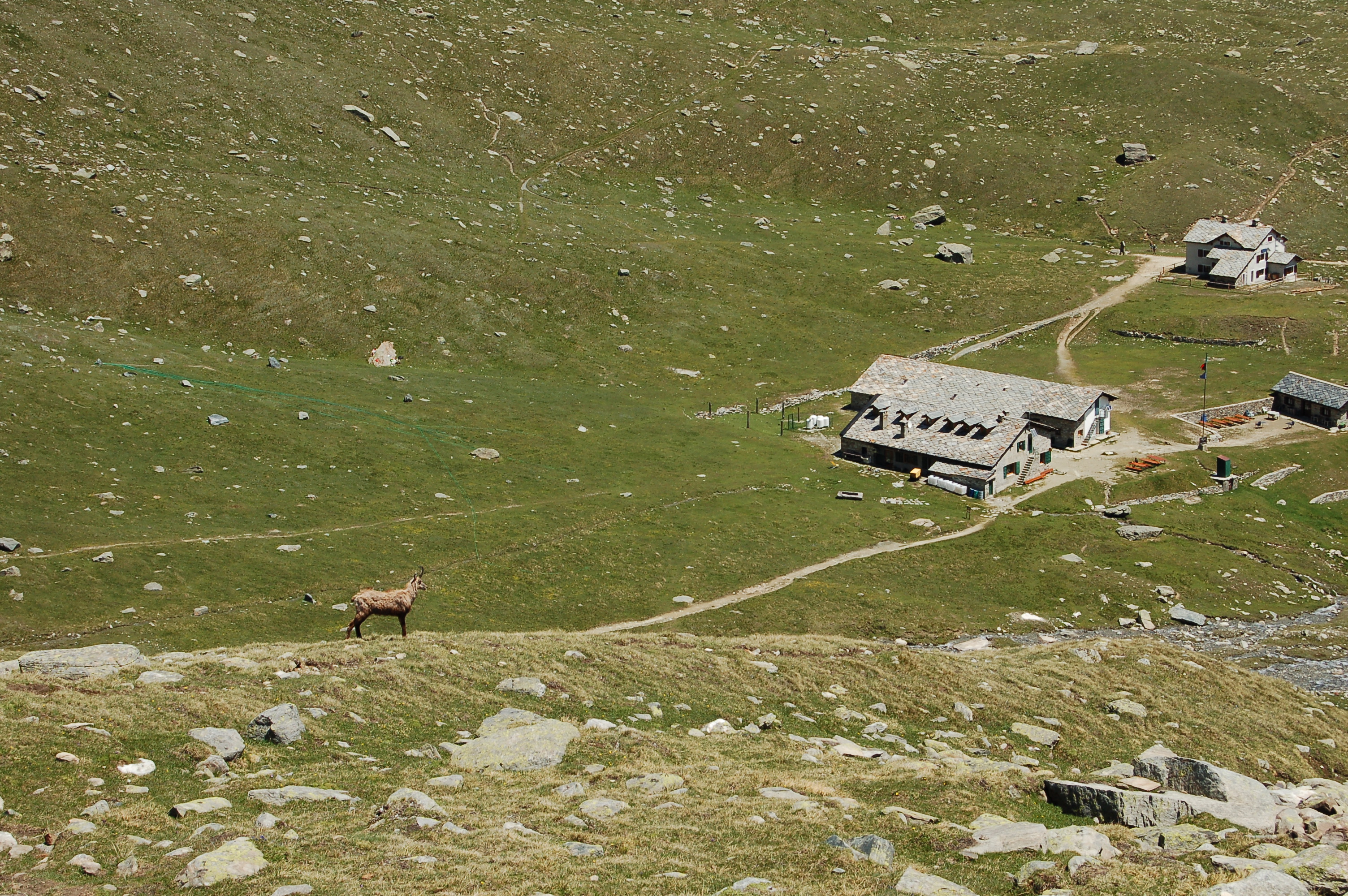
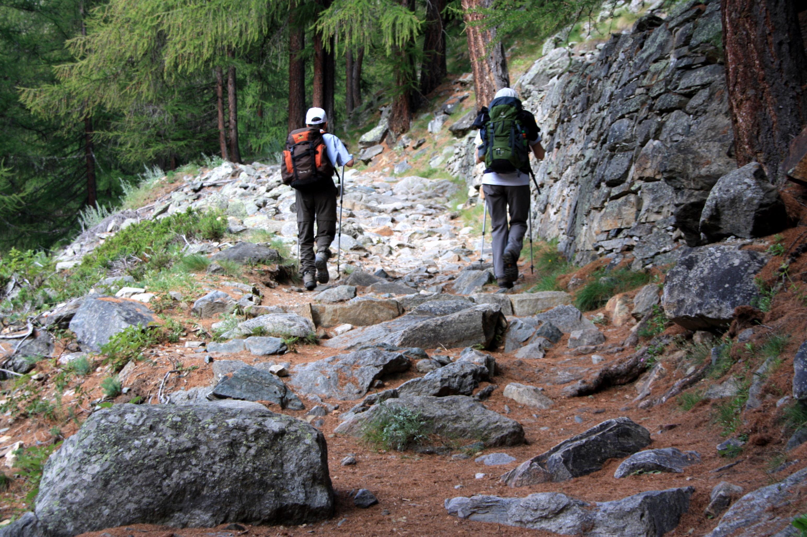
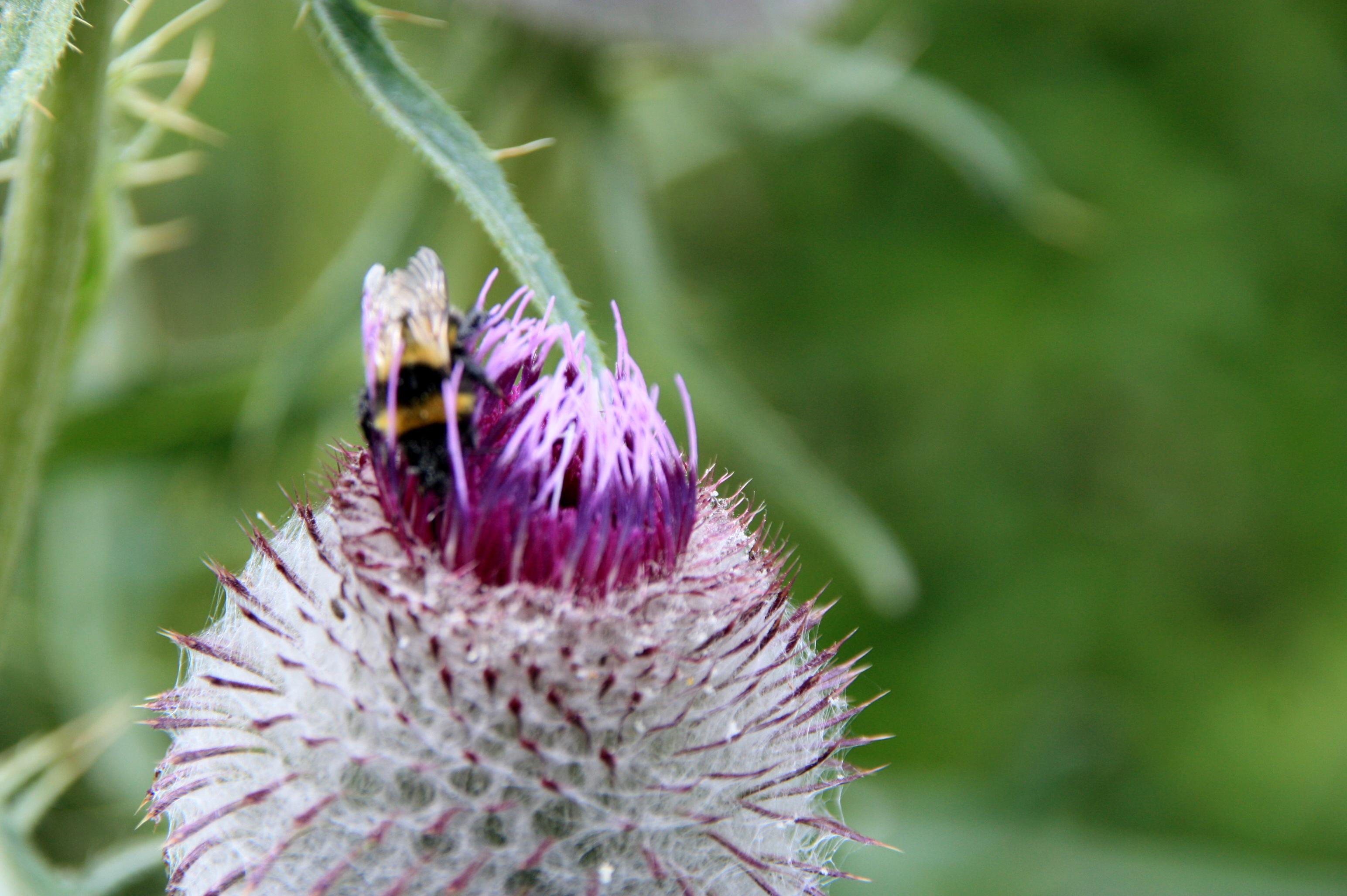
A route suitable for animal sightings: we are in the middle of the Gran Paradiso National Park and encounters with its guests are not uncommon.Description
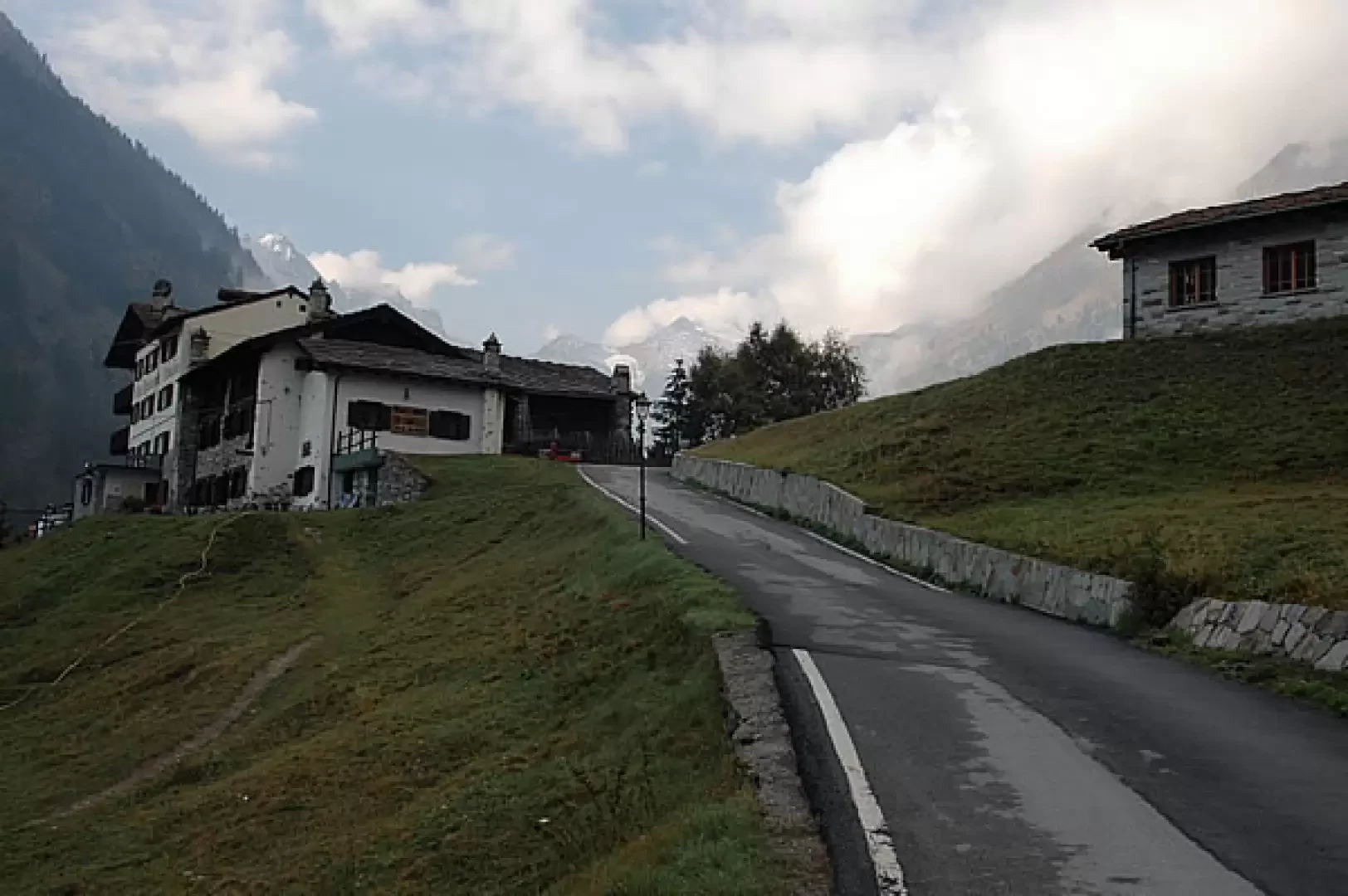
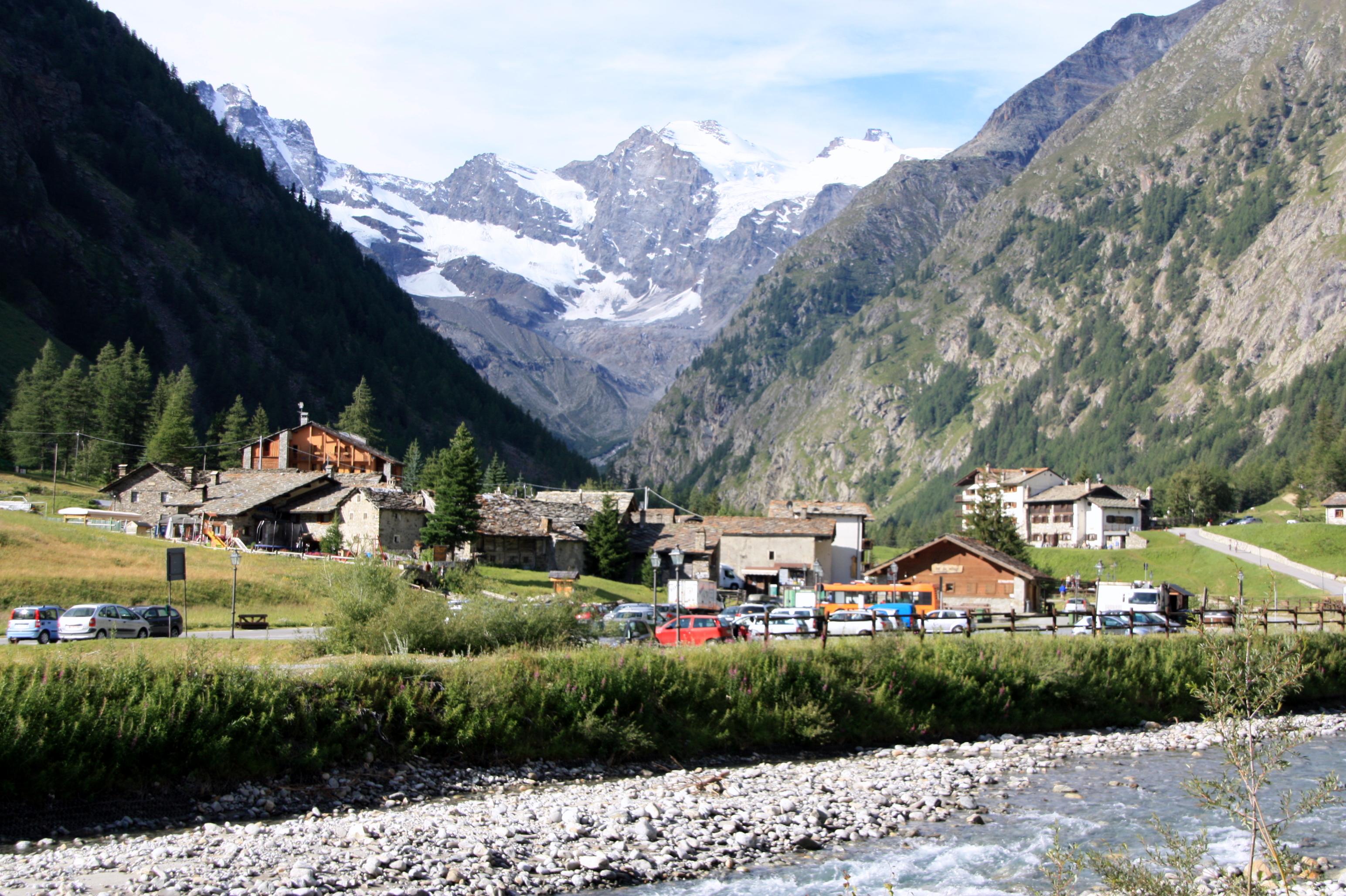
0h00' From the car park, follow the tarmac road briefly until you reach the village of Valnontey, where there is a fountain💧, and the small bridge crossing the stream of the same name: turn right and continue along the tarmac road until you reach the Hotel "Lou Tsantelet" and the signs indicating the itineraries along the Alta Via 2.
0h05' Take the easy path that crosses the pastureland and soon reaches the entrance to the "Paradisia" Alpine Garden. Walk along the south-eastern side of the garden, marching along the comfortable mule track and entering the larch forest. Slowly gain height, following the long spirals of the mule track, enjoying a few views of the Valnontey below until you reach a fork in the road.
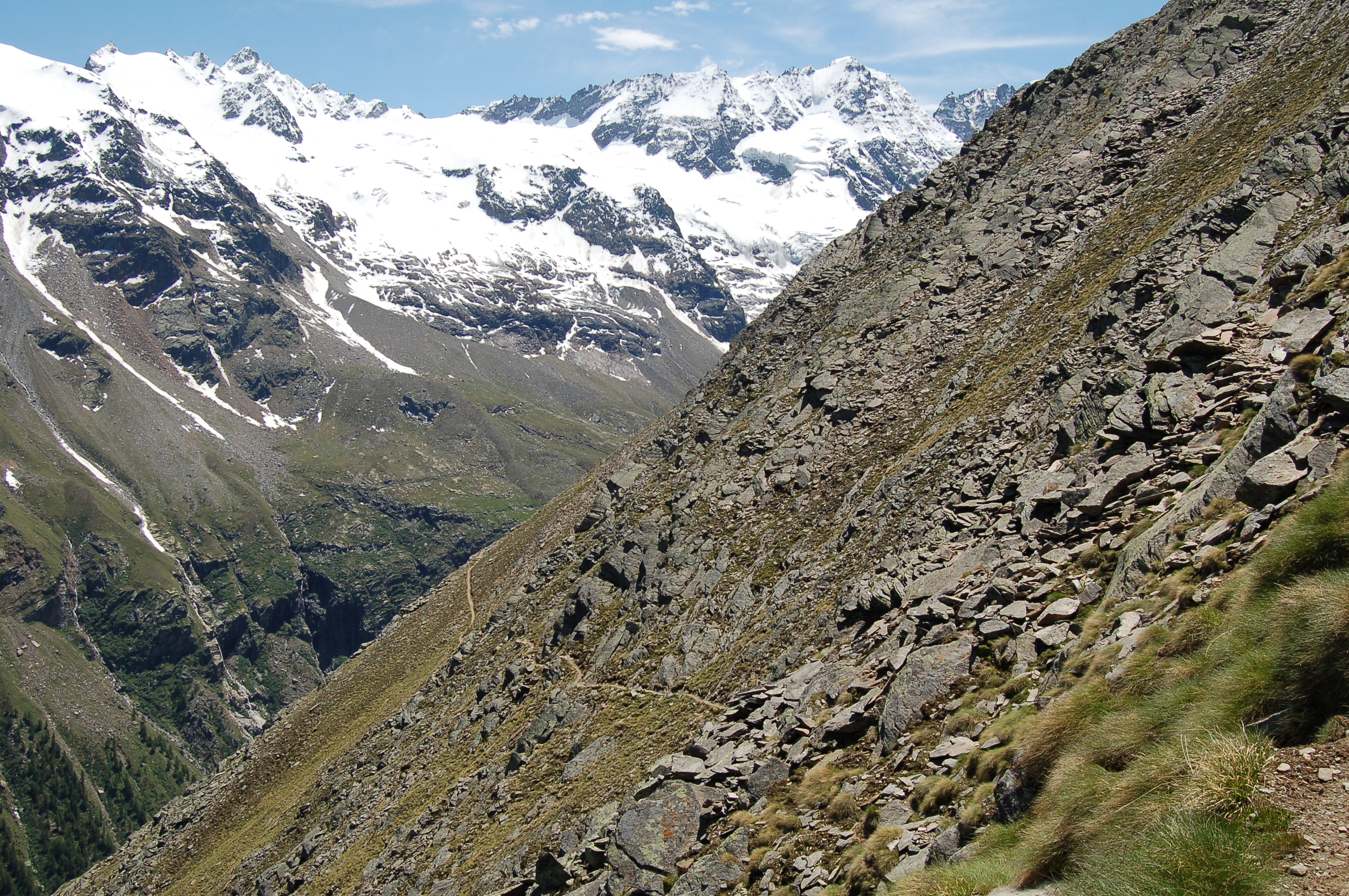
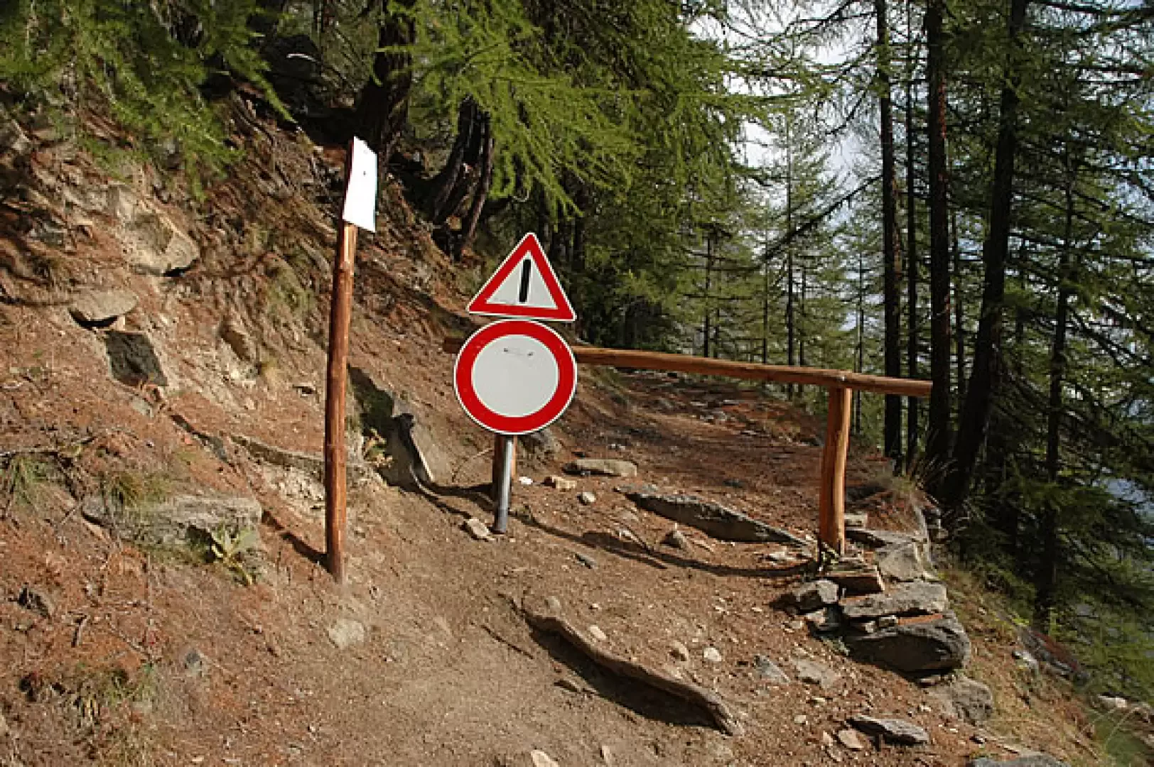
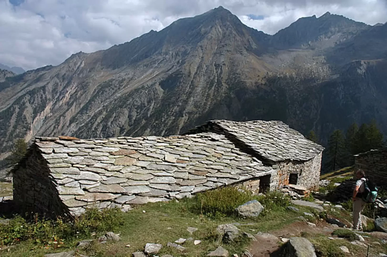
1h00' Neglect the continuation on the old royal road (closed to traffic due to the instability of the slope) and continue straight on until you come to a beautiful little stone bridge that allows you to cross the Torrent de Grand-Lauson. Now go up the orographic right-hand side of the valley and, after leaving the forest, continue on the meagre pastureland before the ruins of the small hamlet of Toules (2001m). After encountering a small drinking fountain 💧, continue the progression by following the twists and turns of the path that quickly lead to the southern edge of Pascieux (2224m).
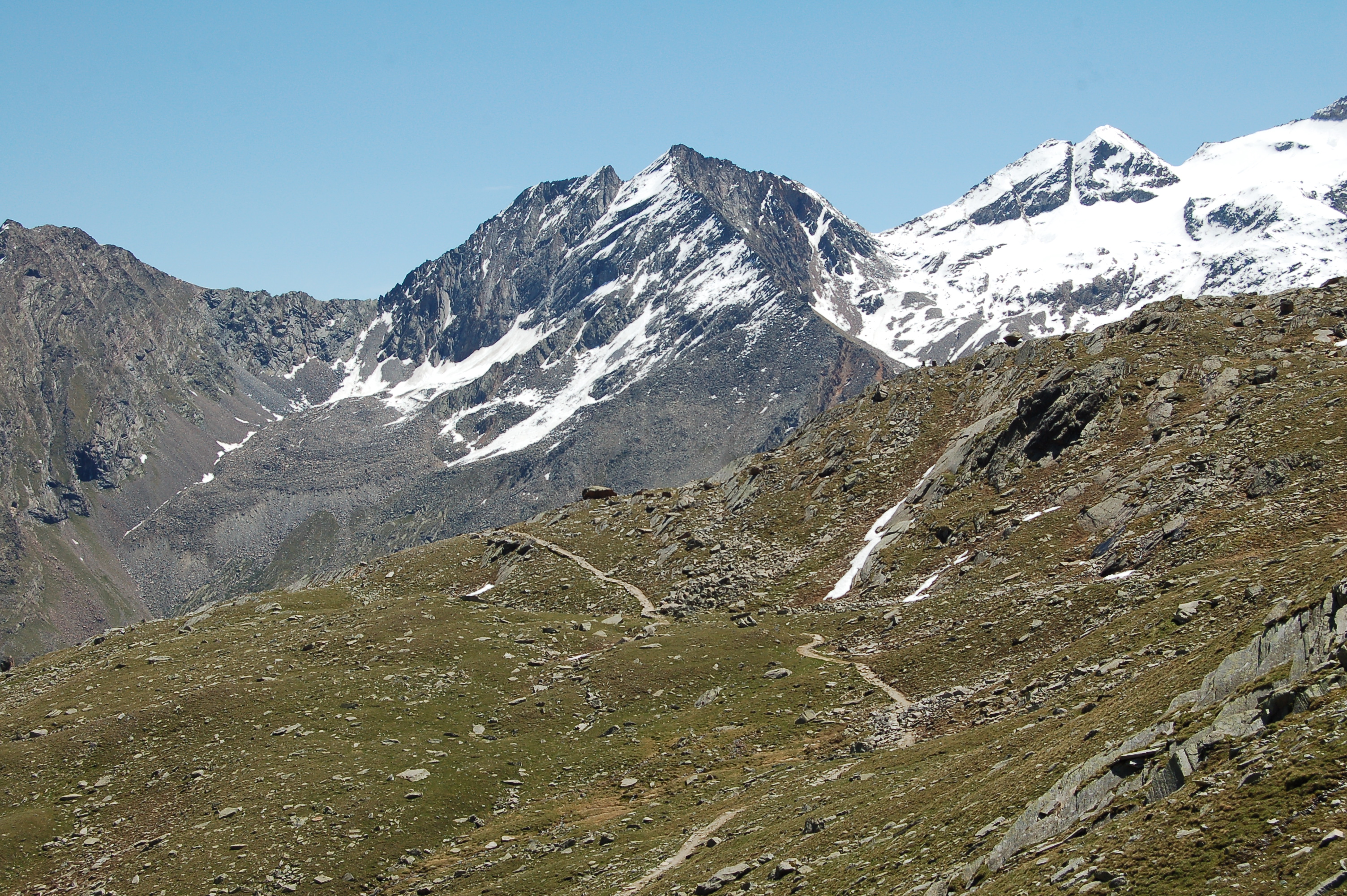
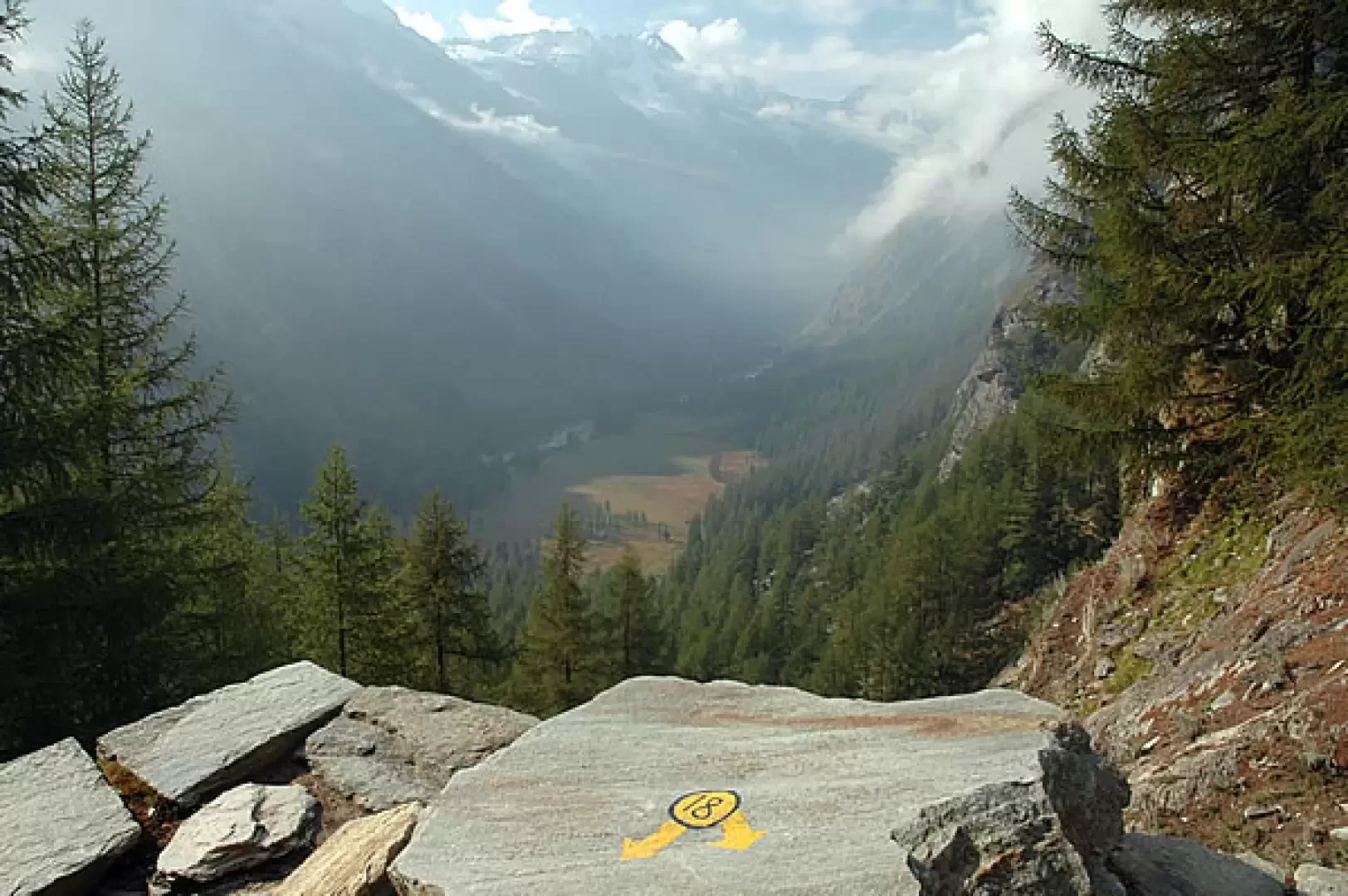
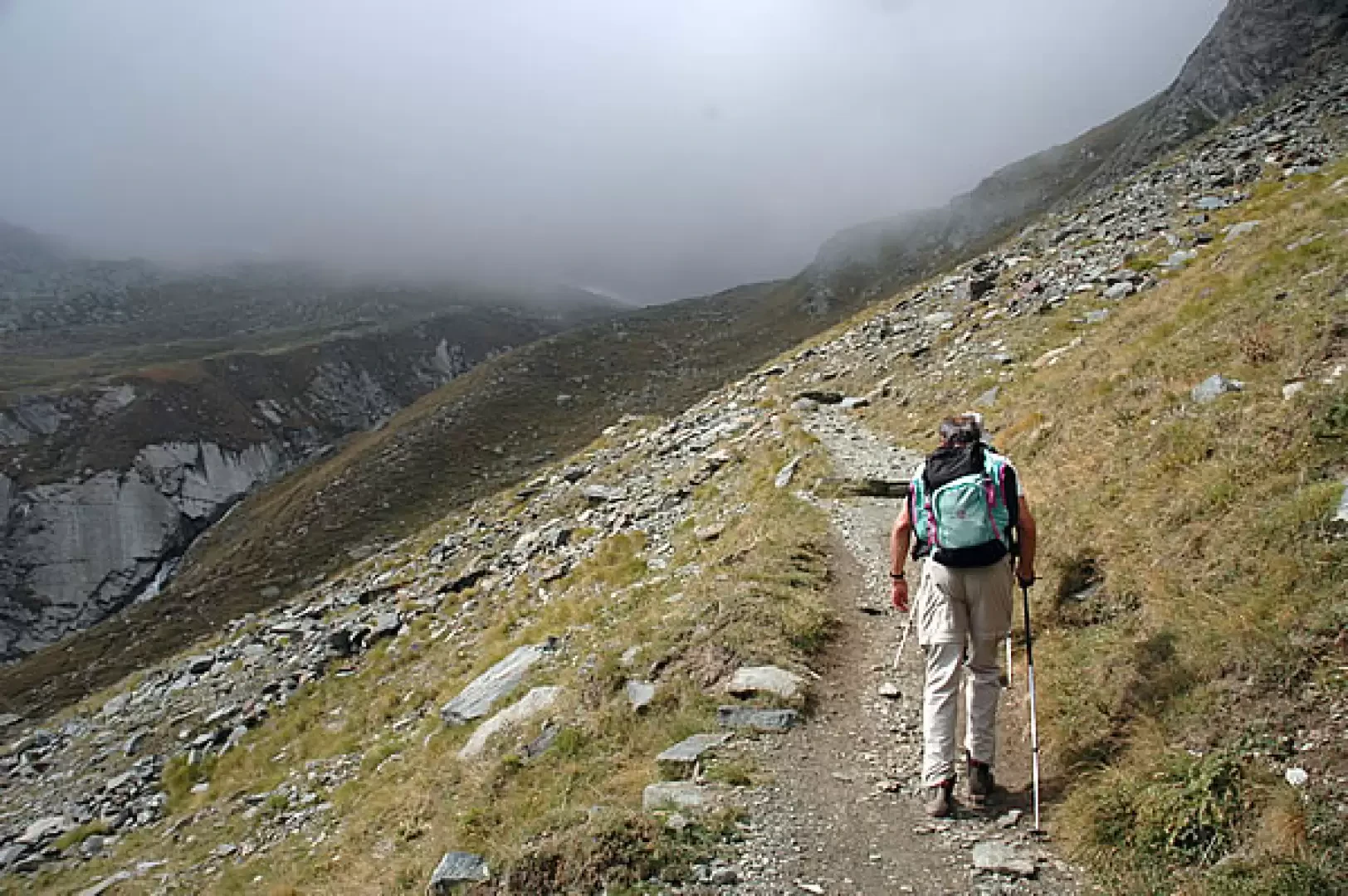
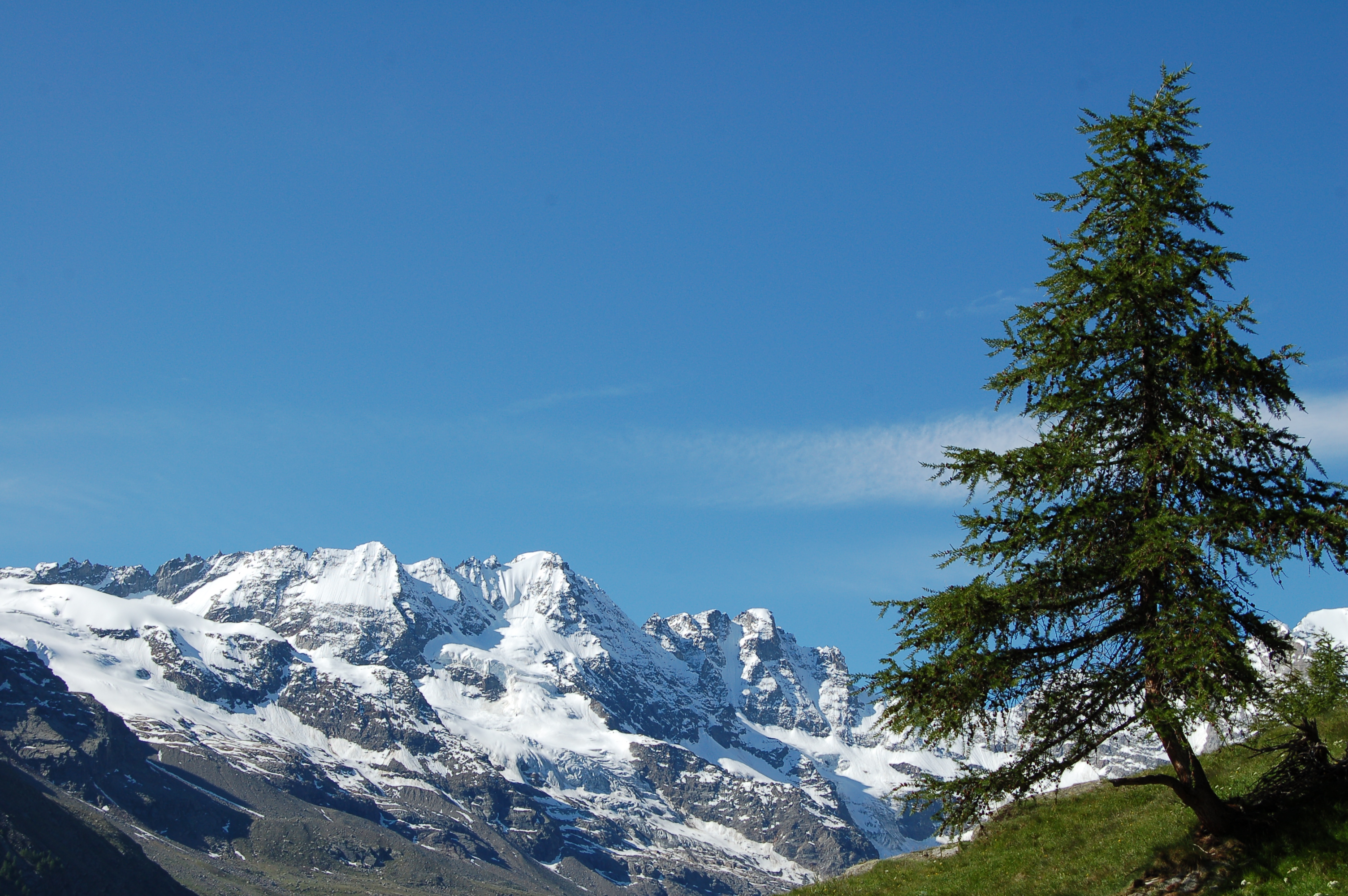
1h15' Climb the slope following the meagre larch forest until you again enter the surrounding pastureland and the view opens up to the not far away ruins of Petit Loson and the glaciers of Grand Croux and the Tribulation. The path veers to the right and after passing a section with steps, descends towards the Torrent de Grand-Lauson impluvium.
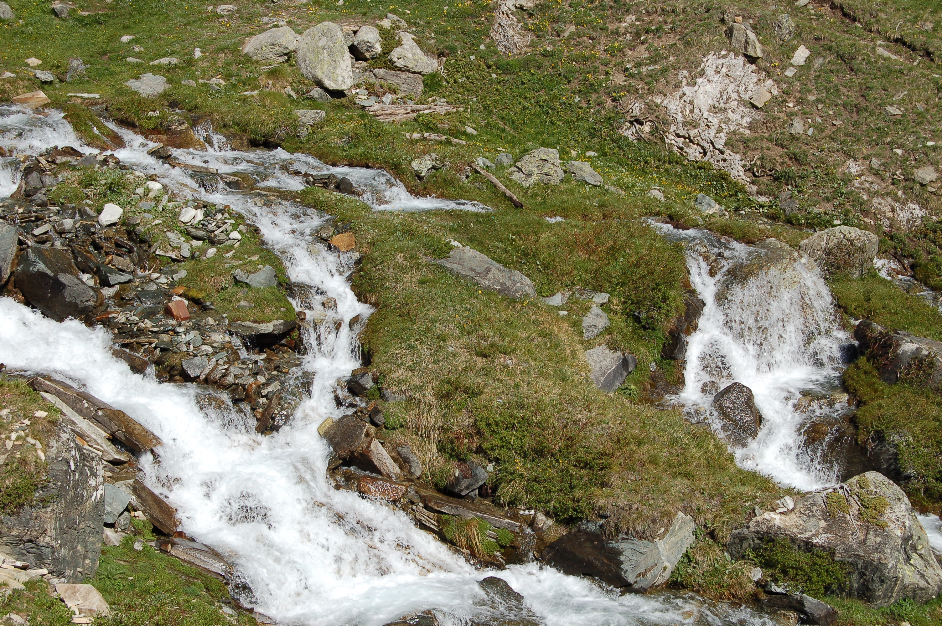
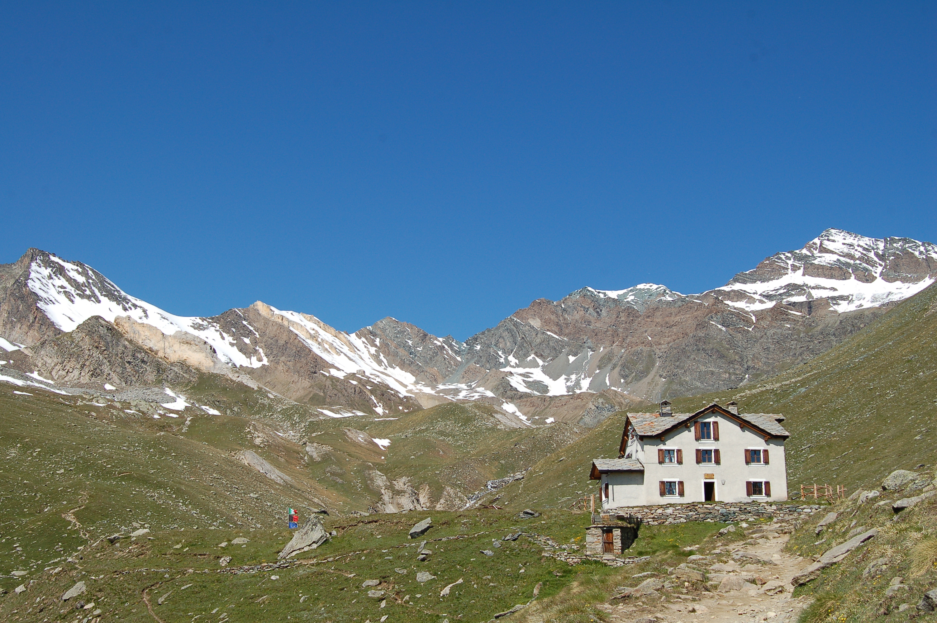
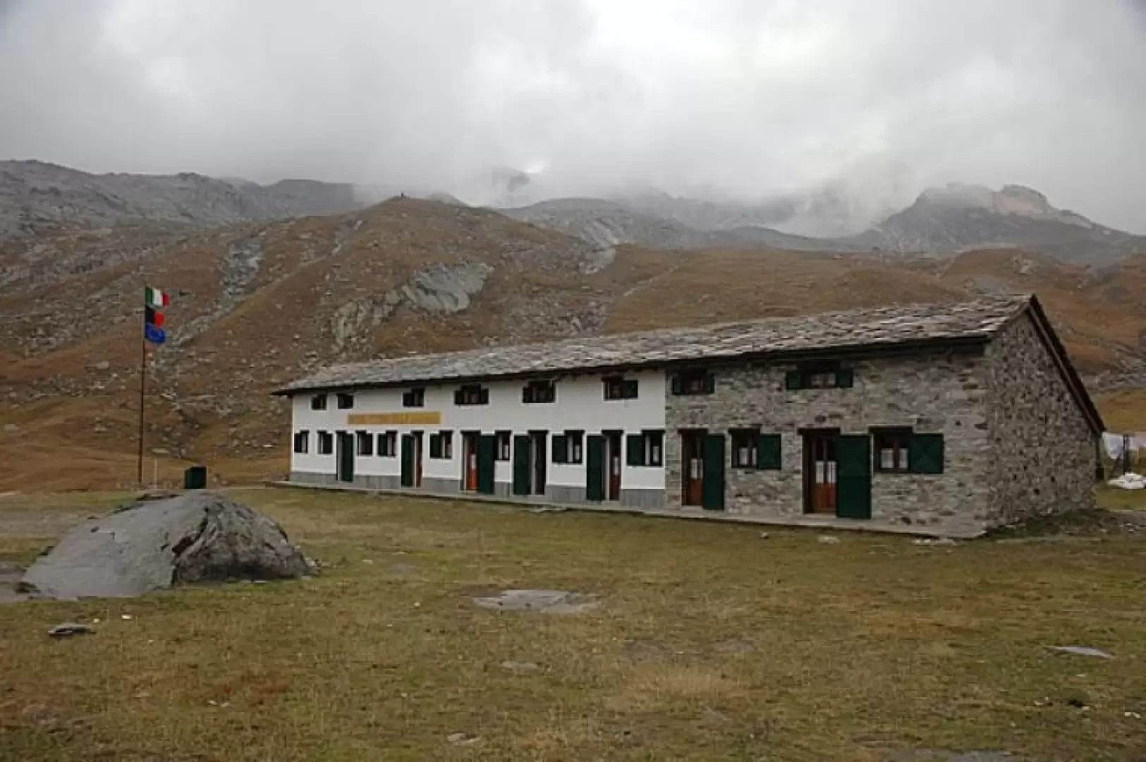
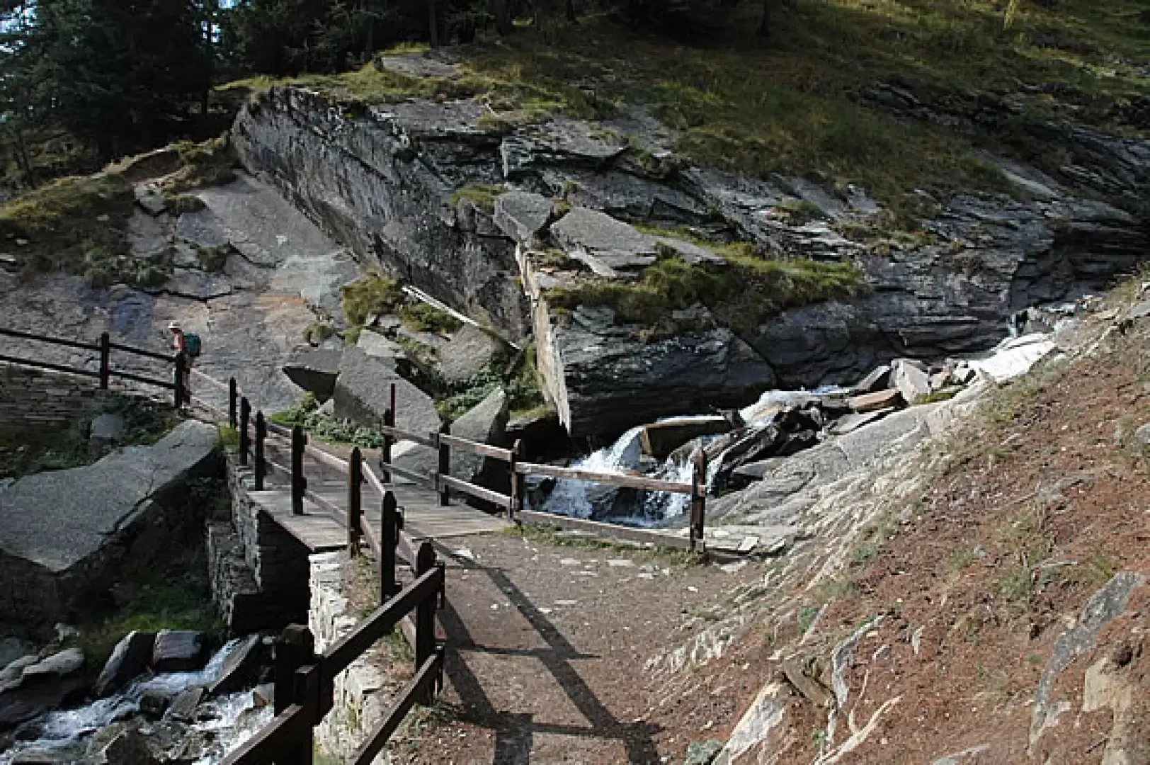
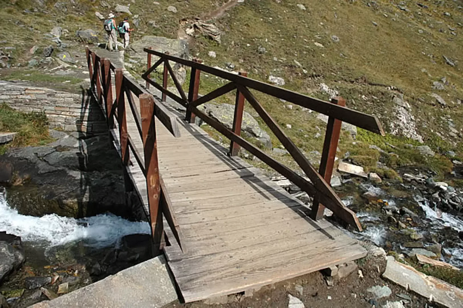
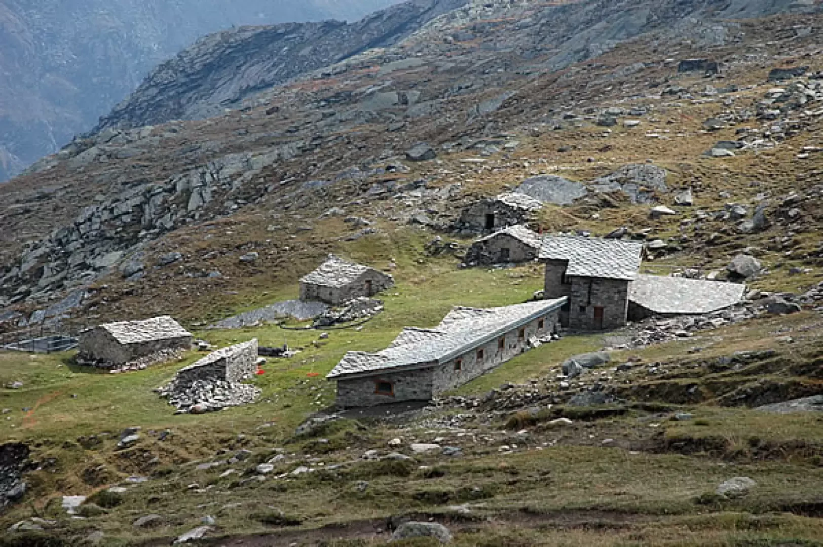
1h45' Cross the stream on the small wooden bridge and begin to climb up the left orographic slope, with a series of long, alternating traverses, until it joins the old royal hunting road again. The destination is approaching, continue by cutting across the steep grassy slopes descending from the Tête Tsaplane and then overcoming a decidedly steep section with a series of turns. Neglect the path to the alpine pastures of Grand Lauson (2506m) and proceed with a more moderate ascent until reaching the Park ranger's hut: here is the junction of the trail and the continuation of Alta Via 2. Descend briefly between the meadows until you reach the Vittorio Sella hut (2579m, 💧, 2h30').
The return is along the same route taken on the ascent 1h45'.
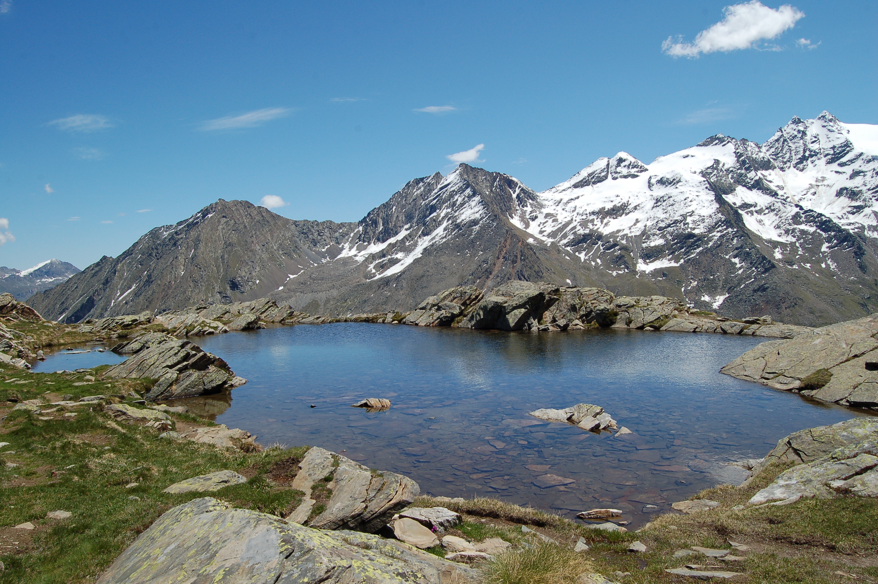
.Galleria fotografica
We have been there
Edited by:
Massimo Martini
Refuge Vittorio Sella
Introduction
La montée au Refuge Vittorio Sella est réputé une classique printanière dans le domaine du ski de randonné, mais peut bien etre considéré une superbe balade avec le raquettes à neige. La monté se divise en deux parties: au dèbut, dans le bois, on suit le remarquable chemin de chasse du Roi Victor Emmanuel II, montée douce avec la possibilité de rencontrer beaucoup de chamois; la deuxième partie, dés la sortie du bois, est une longue montée sur la pente raide qui précède le refuge. Dans l'ensemble la balade est fatiguante mais satisfaisante!Description

Edited by:
Ivo Giansetto
Rifugio Vittorio Sella
Giornata soleggiata e leggermente ventilata. Prestare attenzione al bivio che si incontra dopo circa un'ora di cammino. Il sentiero a destra non è percorribile nonostante non esista segnalazione appropriata. Il cartello di divieto di transito e l'ordinanza del sindaco sono stati rimossi, ma il divieto permane. Rimane ben segnalato il divieto quando si scende dal rifugio che obbliga gli escursionisti ad attraversare il torrente e a scendere dalla parte destra orografica del torrente Lauson.
Edited by:
UpTheHill
Rifugio Vittorio Sella da Cogne
Settimana di vacanza con cinque belle escursioni nella zona di Cogne, di cui questa è la prima. Partiamo da Cogne lungo la forestale che porta a Valnontey, da dove inizia la salita vera e propria, divista in tre fasi: la prima fino al ponte sulla testa della cascata che scende dal pianoro del rifugio Vittorio Sella, poi lungo un costone fino ad un secondo ponte che riporta sulla sx orografica, e la terza parte dopo il ponte fino al rifugio. Saliamo nel bosco del primo tratto, con il sentiero che zig-zagga lungo un cono di detriti, i tratti tra un tornante e l'altro sempre più brevi, per raggiungere il primo ponte. Da qui si esce dal bosco, per salire decisi su sentiero sasso-terroso. Il sentiero originario restava sulla sx, ma è franato e non è più stato sistemato. Dal secondo ponte il sentiero ridiventa un po' più agevole, passando un alpe ancora caricato, per spianare poi verso il "Casotto del Lausson" e portare infine al rifugio. Lo stesso è stato fatto costruire originariamente da Vittorio Emanuele II, che saliva quassu per la caccia allo stambecco. Attualmente è di proprietà del CAI di Biella, e dedicato a Vittorio Sella, pioniere della documentazione di montagna. Pranzo in rifugio, poi decidiamo per la discesa (avremmo voluto continuare fino al passo che dà la vista sulla valle di Valsavaranche a Q3200, ma la meteo instabile ce lo ha sconsigliato). Discesa senza storia fino a Valnontey, e rientro a Cogne. Descrizione completa con mappa, foto e testo.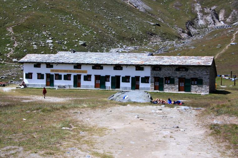
Edited by:
Ivo Giansetto
Rifugio Vittorio Sella
Giornata soleggiata e leggermente ventilata. Prestare attenzione al bivio che si incontra dopo circa un'ora di cammino. Il sentiero a destra non è percorribile nonostante non esista segnalazione appropriata. Il cartello di divieto di transito e l'ordinanza del sindaco sono stati rimossi, ma il divieto permane. Rimane ben segnalato il divieto quando si scende dal rifugio che obbliga gli escursionisti ad attraversare il torrente e a scendere dalla parte destra orografica del torrente Lauson.Giornata soleggiata e leggermente ventilata. Prestare attenzione al bivio che si incontra dopo circa un'ora di cammino. Il sentiero a destra non è percorribile nonostante non esista segnalazione appropriata. Il cartello di divieto di transito e l'ordinanza del sindaco sono stati rimossi, ma il divieto permane. Rimane ben segnalato il divieto quando si scende dal rifugio che obbliga gli escursionisti ad attraversare il torrente e a scendere dalla parte destra orografica del torrente Lauson.