The proposed itinerary is, for the first section, probably the most frequented in the La Thuile valley: one climbs near the main Rutor waterfalls, passes the bucolic Plan de la Lière, climbs the grassy slope before the Deffeyes hut and then traverses the entire Combe des Ussellettes. The proposed descent route requires some care when descending some rocky stretches and the ability to follow, in places, markings made only with stone cairns.
Description
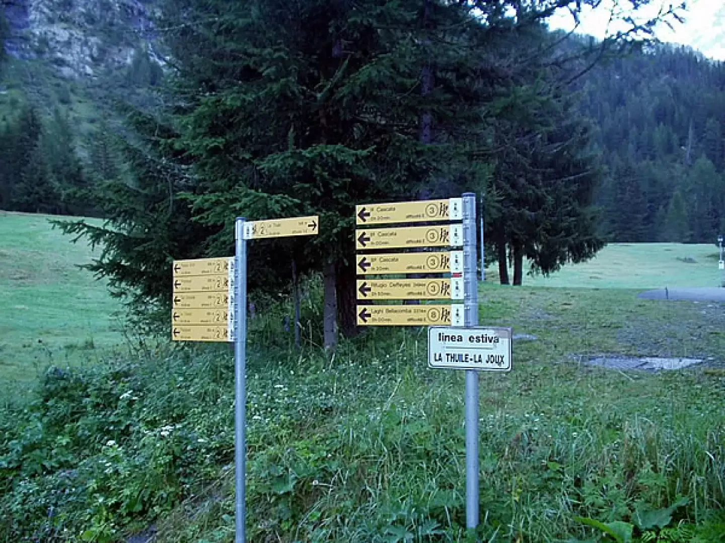
0h00' Before the car park of the restaurant-bar (1603m), on the left, the track, markers
and
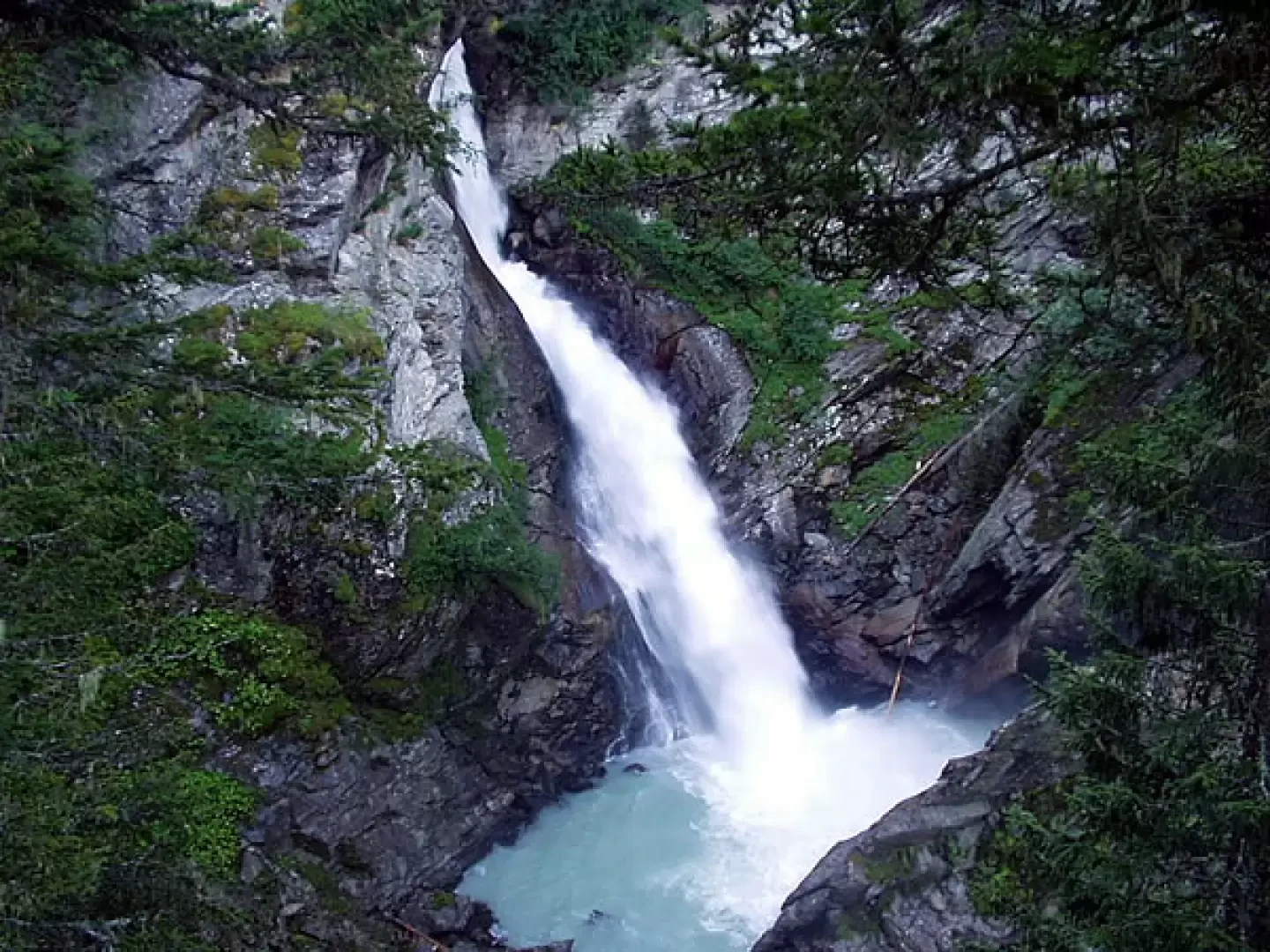
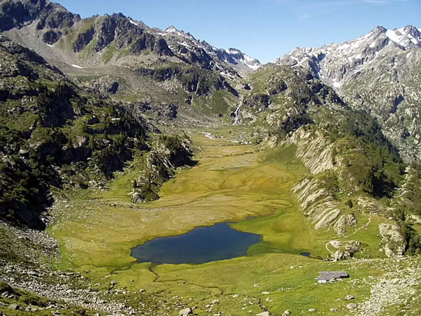
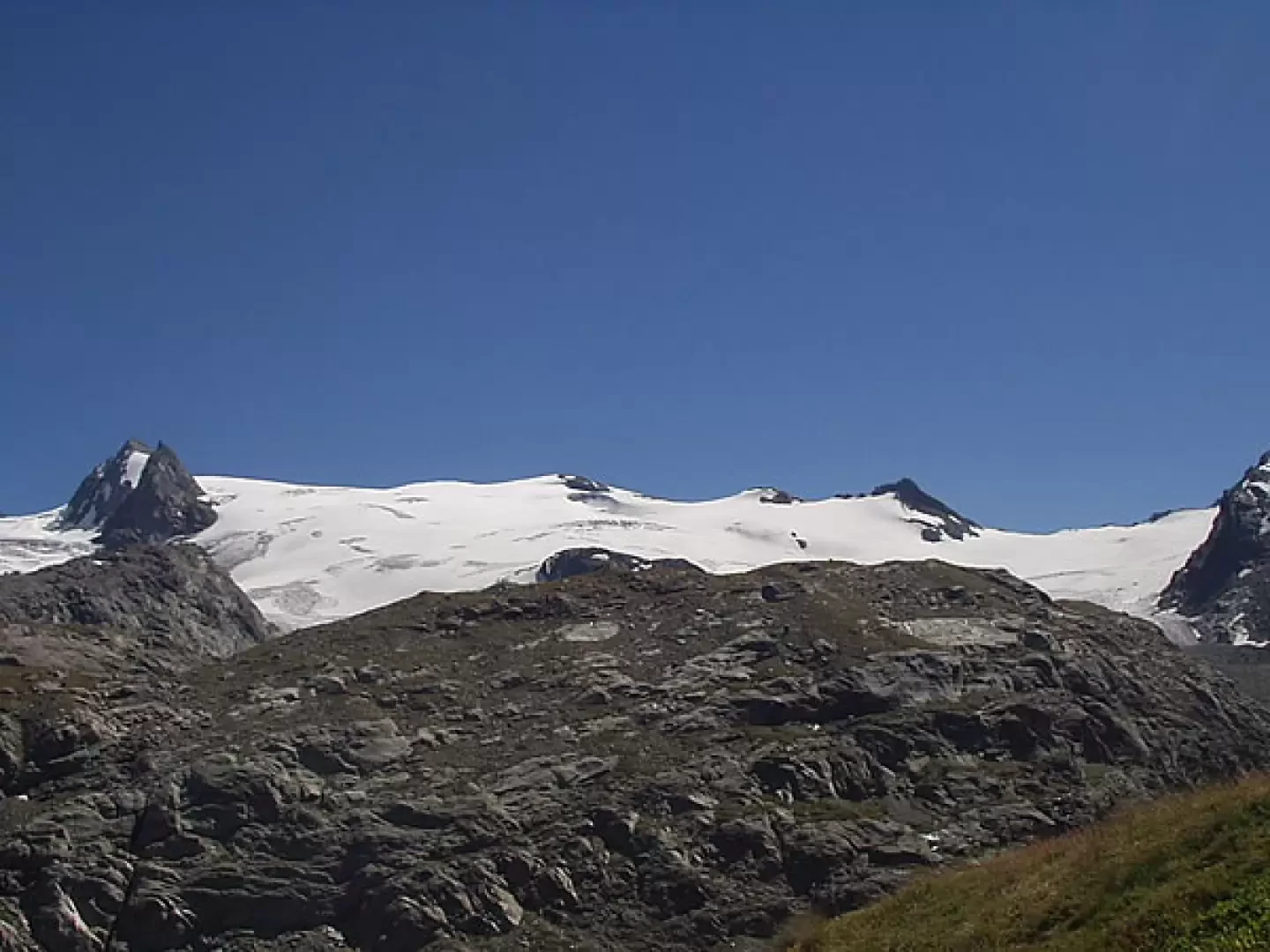
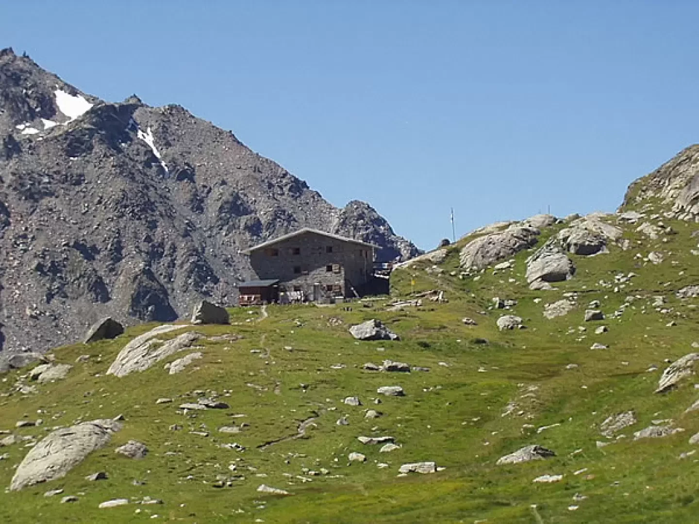
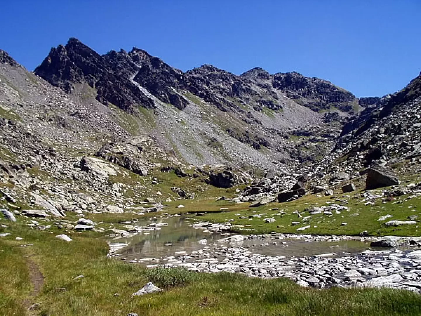
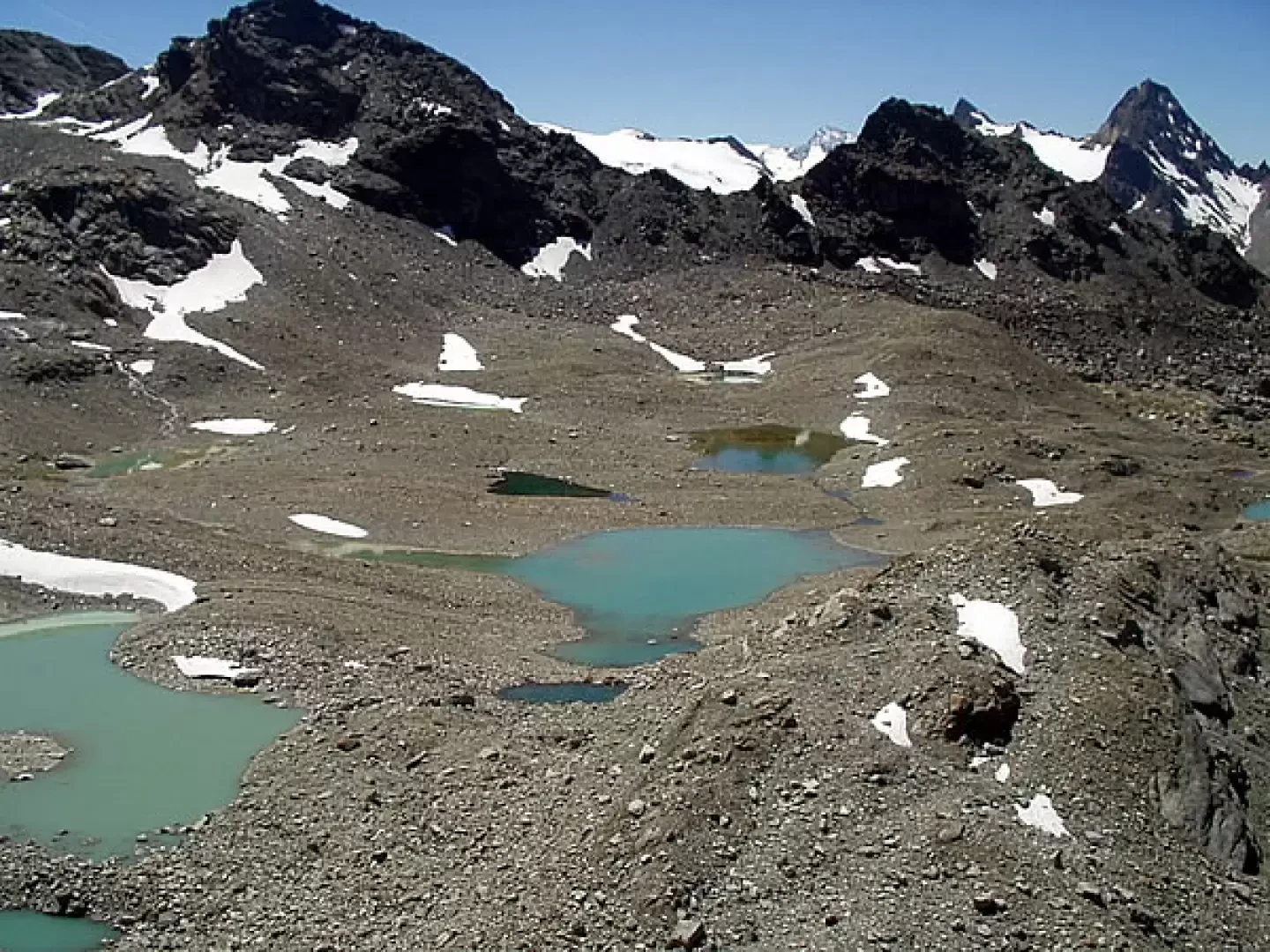
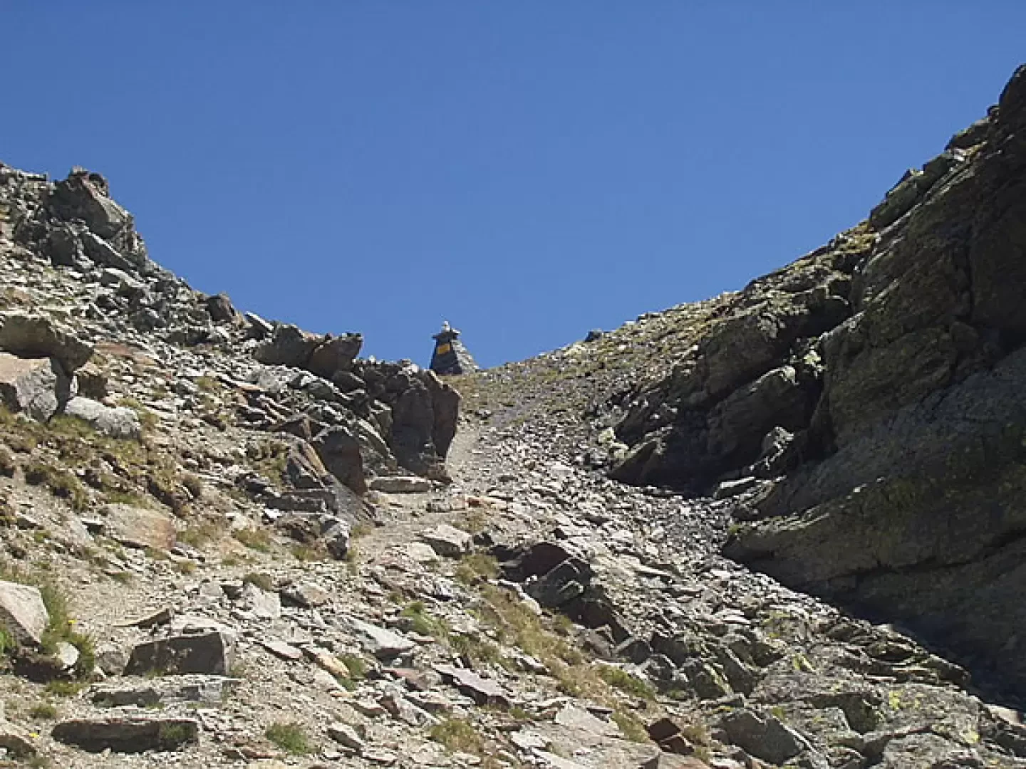
, starts to follow. Proceed for a short distance along the stream and cross over a bridge to the opposite bank. In the middle of the forest, climb up to the panoramic balcony on the first Rutor waterfall (1,700m, 0h15'). Continue along twists and turns in the forest, passing a characteristic boulder and coming out at Parcet. Now proceed on a gentler ascent, passing by another waterfall and reaching a bucolic plateau near the stream, close to a bridge. Continue uphill on the path, which is paved in places, until the short diversions, to the right, to the second waterfall. Continue uphill and in a few minutes you will reach the next turnoff for the third waterfall, which can be reached in 3-4 minutes (1996m, 1h10'). When visiting this waterfall, pay particular attention to the very slippery ground because it is constantly splashed with water. Retrace your steps to the junction with the marker (8) for the Belle Combe valley. Take the left, climb for a few minutes and then descend to the enchanting Plan de la Lière, near the Lac du Glacier (2140m, 1h45'), with great views of the Mont Blanc chain. After crossing the little bridge (dedicated to Sergeant Giulio Guedoz and built by the Aosta battalion in 1934), passing by the Alpage du Glacier, we ascend the grassy slope in twists and turns and then slope to the right to the saddle at the Alpage du Rutor, which precedes the Deffeyes hut (2494m, 2h45'). In front of the hut there is a magnificent panorama of the Rutor glacier. A few steps from the hut, a marker indicates the Alta Via 2 trail sign for Combe des Ussellettes and Passo Alto - Haut Pas. Descend through some wetlands to the orographic right of the stream and climb a first crag. Next, cross a wide ledge and, at first among rocks and grass and then over mounded rocks, gain the base of a debris barrier, beyond which, on the right, a view opens up over the numerous lakes of the Usselettes. The trail climbs to the left and then bends to the right to climb the last steep ascent to Passo Alto - Haut Pas (2860m, 4h15').
The return route is identical to the ascent: descend to the Deffeyes hut (2494m, 1h10') and reach the La Joux car park (1603m, 3h10').
Alternatively, with a route that requires more attention, from the Deffeyes hut continue in a south-westerly direction towards the characteristic chapel dedicated to San Grato and Santa Margherita. When you reach the little chapel, the path descends abruptly (beware of crossing a rocky strip) to the Lac du Rutor and the Lac des Seracs. Follow the cairns to reach a marker post and follow the signs to the right to reach an almost flat valley. The track now passes above the gorge carved out by the Rutor stream, descends a few more rocky sections (be careful) and, after passing by a waterfall, descends to Plan de la Lière (2197m, 2h10'). A short descent leads near the bridge to the Belle Combe valley. Taking the right in about ten minutes, you cross the ascent route. After passing the three waterfalls, return to the La Joux car park (1603m, 3h25').
Solitaria salita al Passo Alto: per noi era una prima volta! Ambiente solitario e sublime: una bella occasione per guardare da vicino alcune vette circostanti.Solitaria salita al Passo Alto: per noi era una prima volta! Ambiente solitario e sublime: una bella occasione per guardare da vicino alcune vette circostanti.


Comments (0)
Sign in to leave a comment