Reports Points of interest I have been there Magazine Webcam

Penne Nere bivouac, from the Valpelline sports area

Profile image

Edited by:

Last survey: 16/09/2010
Updated at: 02/11/2025
Difficulty
T2
Length
0.00 Km
Departure altitude
947 m
Recommended period

Access

Highway to Aosta, exit Aosta East. Follow the road to San Bernardo and exit after the tunnel following the signs for Valpelline. When you reach the village of Valpelline, turn right after the main square, at a petrol station, following the signs for Camping Grand Combin. you can park after the campsite on the right. From the car park continue along the road and cross the Buthier stream on the bridge by the bar/restaurant.

.

Description

WARNING from here, do not take the well-marked path on the left, which runs alongside the river and passes near a rock climbing wall unless you want to go up to Ronceaz by road, in which case turn right onto the road, pass a few hairpin bends and continue along the straight path to Ronceaz.(1095m) On our path, which is not very well marked, you must stay to the right after the restaurant until you come to a red ball indicating Plan de Ressa. From there we ascend through the forest to Ronceaz, turn right and on the wall there is an indication to continue to the left. Here we enter the forest, which, with a series of hairpin bends, climbs up to the track, which we follow for a couple of bends and a straight stretch. At the end of the straight stretch, after the bend, there is a faded sign on a stone indicating that we should continue through the forest on path no. 5. We pass over a small bridge. Enjoy it because it is the only flat section of the entire walk!!! After the bridge you start climbing again along the river. At the end of the forest (the path always runs alongside the river) you arrive at the ruins of Verney, where there are also signposts. (1730m) For path no. 5, it is advisable to stay to the right, passing by a drinking trough and over some stones until you find the path going up the meadows. If you follow the sign and climb closer to the trees, you run the risk of getting bogged down in streams half hidden by grass (the path is better marked downhill than uphill). When you reach the road, follow it as far as the Arpisson alpine pasture (1838m) and then start climbing again across the meadows to Porillon Alpe Neuve and from there up to Fouillou (2087m). The path now changes from meadows to rock and continues to climb to the beautiful Lake Arpisson (2482m). The ascent continues on a well-marked trail until reaching the Col de Viou, where trail 105 from Blavy also climbs. For the bivouac, you have to climb a little more and find it on the right at 2730m. The view from the col and the bivouac is exceptional. It still takes about 30 to 45 minutes to reach the Becca summit. It was a little late for us and we still had 1800m of descent to face. The Becca will be for another time, maybe starting from Blavy. Small note of disappointment: The trail, despite being long, offers great views, especially when you start climbing after Fouillou. The most travelled route is from Blavy, so going up from Valpelline you will find unspoilt landscapes ....... except, unfortunately, for some uncivilised person who left a can of Rio Mare near Lake Arpisson. Perhaps thinking that the 'famous alpine tuna' use the cans as a home to shelter from the cold????Access: Motorway to Aosta, exit Aosta Est. Follow the road to San Bernardo and exit after the tunnel following for Valpelline. Arriving in the village of Valpelline, turn right after the main square, at a petrol station, following signs for Camping Grand Combin. you can park after the campsite on the right. From the car park continue along the road and cross the Buthier stream on the bridge by the bar/restaurant. CAUTION: from here do not take the well-marked path on the left, which runs alongside the river and passes near a climbing wall unless you want to go up to Ronceaz by road, in which case turn right onto the road, pass a few hairpin bends and continue along the straight path to Ronceaz.(1095m) On our path, which is not very well marked, you should stay to the right after the restaurant until you reach a red ball indicating Plan de Ressa. From there we ascend through the forest to Ronceaz, turn right and on the wall there is an indication to continue to the left. Here we enter the forest, which, with a series of hairpin bends, climbs up to the track, which we follow for a couple of bends and a straight stretch. At the end of the straight stretch, after the bend, there is a faded sign on a stone indicating that we should continue through the forest on path no. 5. We pass over a small bridge. Enjoy it because it is the only flat section of the entire walk!!! After the bridge you start climbing again along the river. At the end of the forest (the path always runs alongside the river) you arrive at the ruins of Verney, where there are also signposts. (1730m) For path no. 5, it is advisable to stay to the right, passing by a drinking trough and over some stones until you find the path going up the meadows. If you follow the sign and climb closer to the trees, you run the risk of getting bogged down in streams half hidden by grass (the path is better marked downhill than uphill). When you reach the road, follow it as far as the Arpisson alpine pasture (1838m) and then start climbing again across the meadows to Porillon Alpe Neuve and from there up to Fouillou (2087m). The path now changes from meadows to rock and continues to climb to the beautiful Lake Arpisson (2482m). The ascent continues on a well-marked trail until reaching the Col de Viou, where trail 105 from Blavy also climbs. For the bivouac, you have to climb a little more and find it on the right at 2730m. The view from the col and the bivouac is exceptional. It still takes about 30 to 45 minutes to reach the Becca summit. It was a little late for us and we still had 1800m of descent to face. The Becca will be for another time, maybe starting from Blavy. Small note of disappointment: The trail, despite being long, offers great views, especially when you start climbing after Fouillou. The most travelled route is from Blavy, so going up from Valpelline you will find unspoilt landscapes ....... except, unfortunately, for some uncivilised person who left a can of Rio Mare near Lake Arpisson. Perhaps he thought that the 'famous alpine tuna' used the cans as a home to shelter from the cold????

.

Galleria fotografica

© 2023 - Anna Della Giovanna
We have been there
Profile image

Edited by:

Bivacco Penne Nere da Valpelline

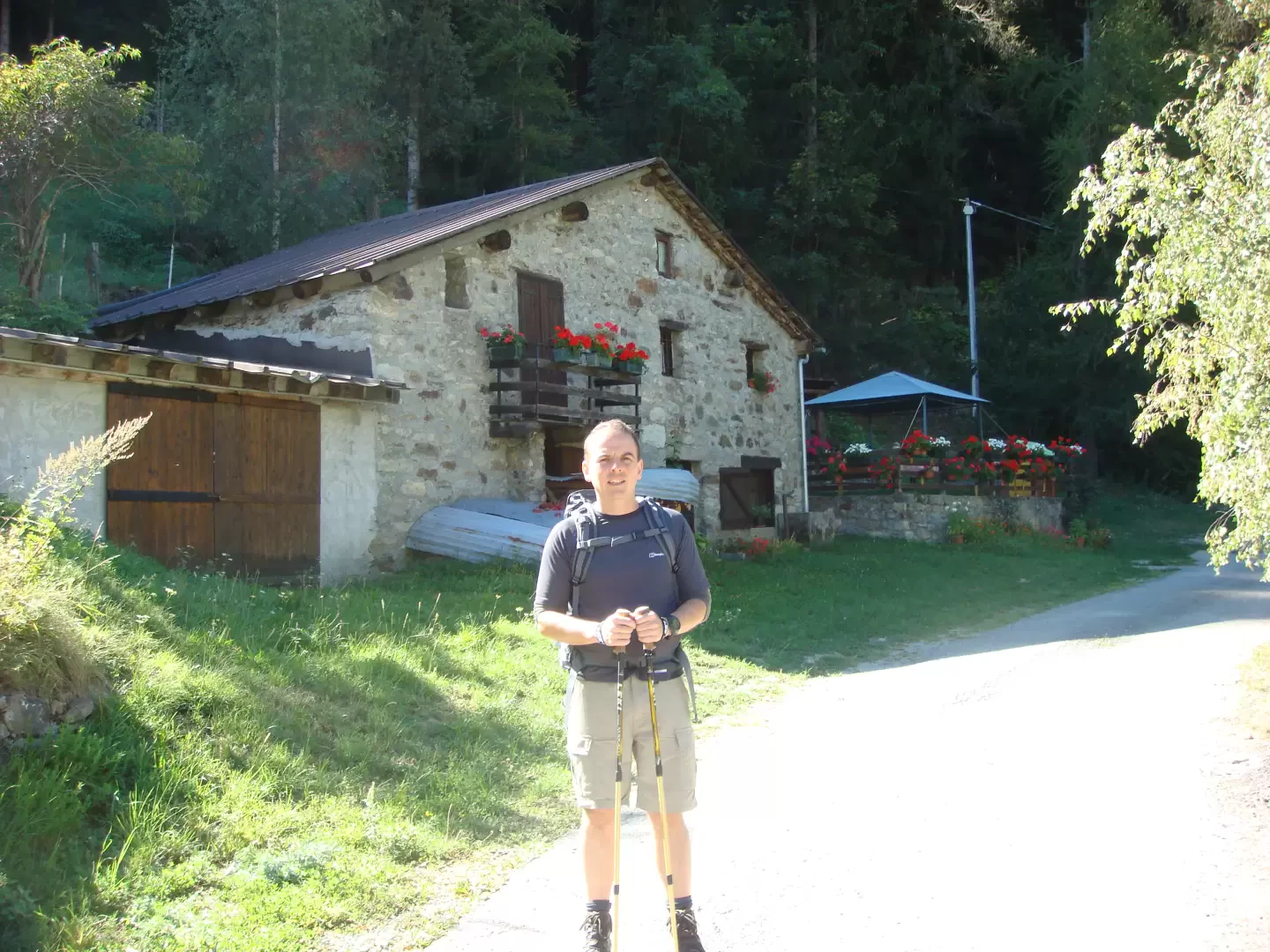
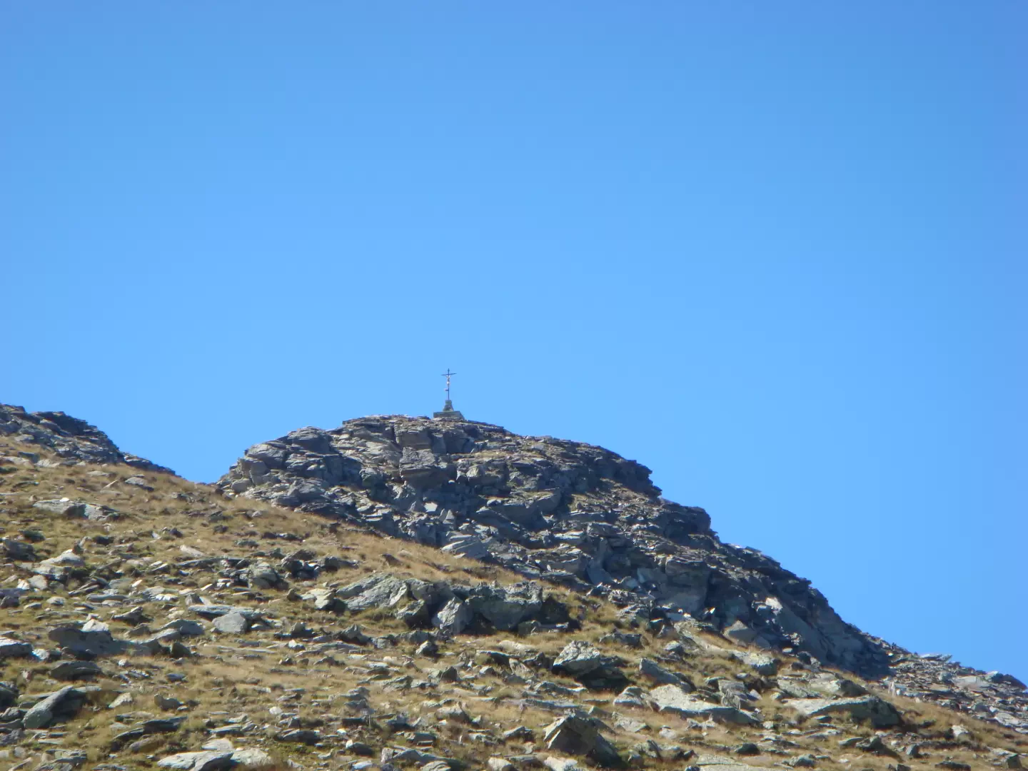
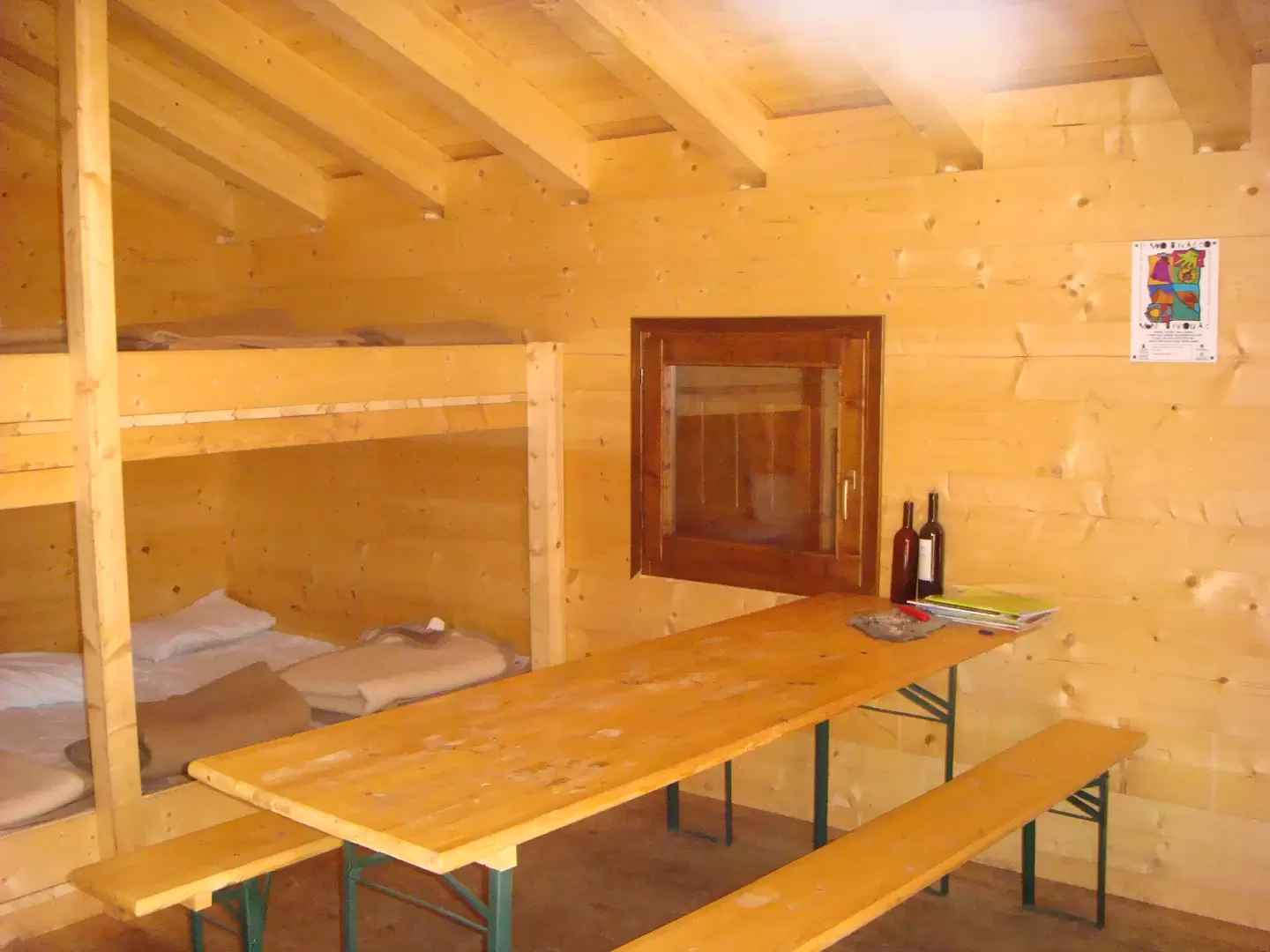
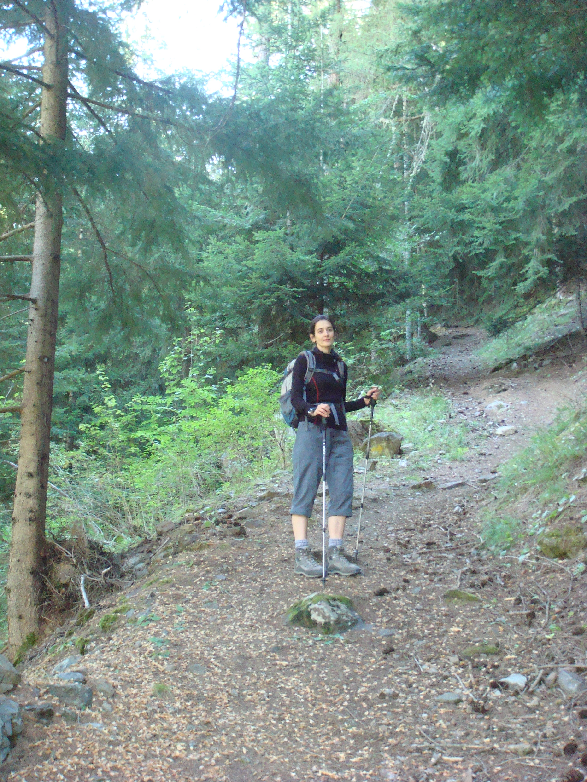
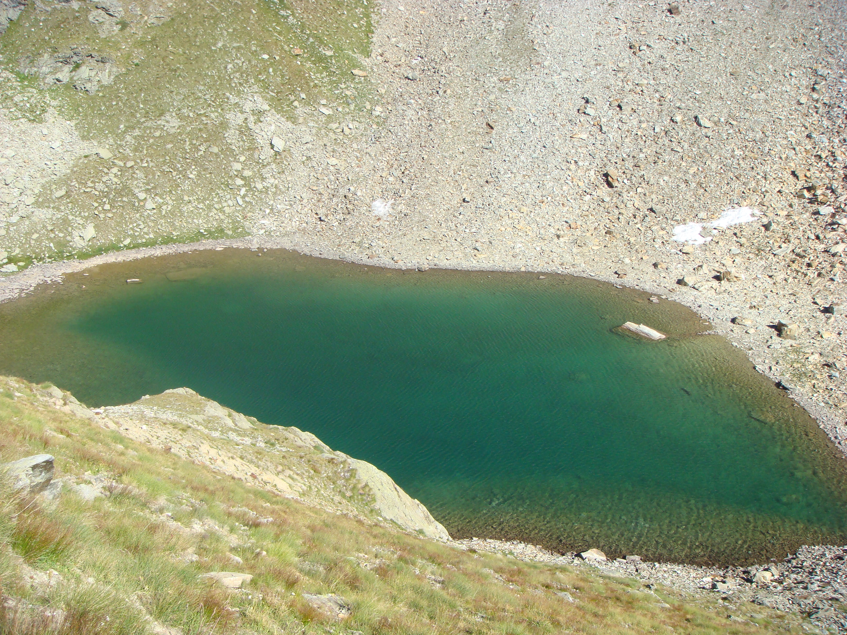
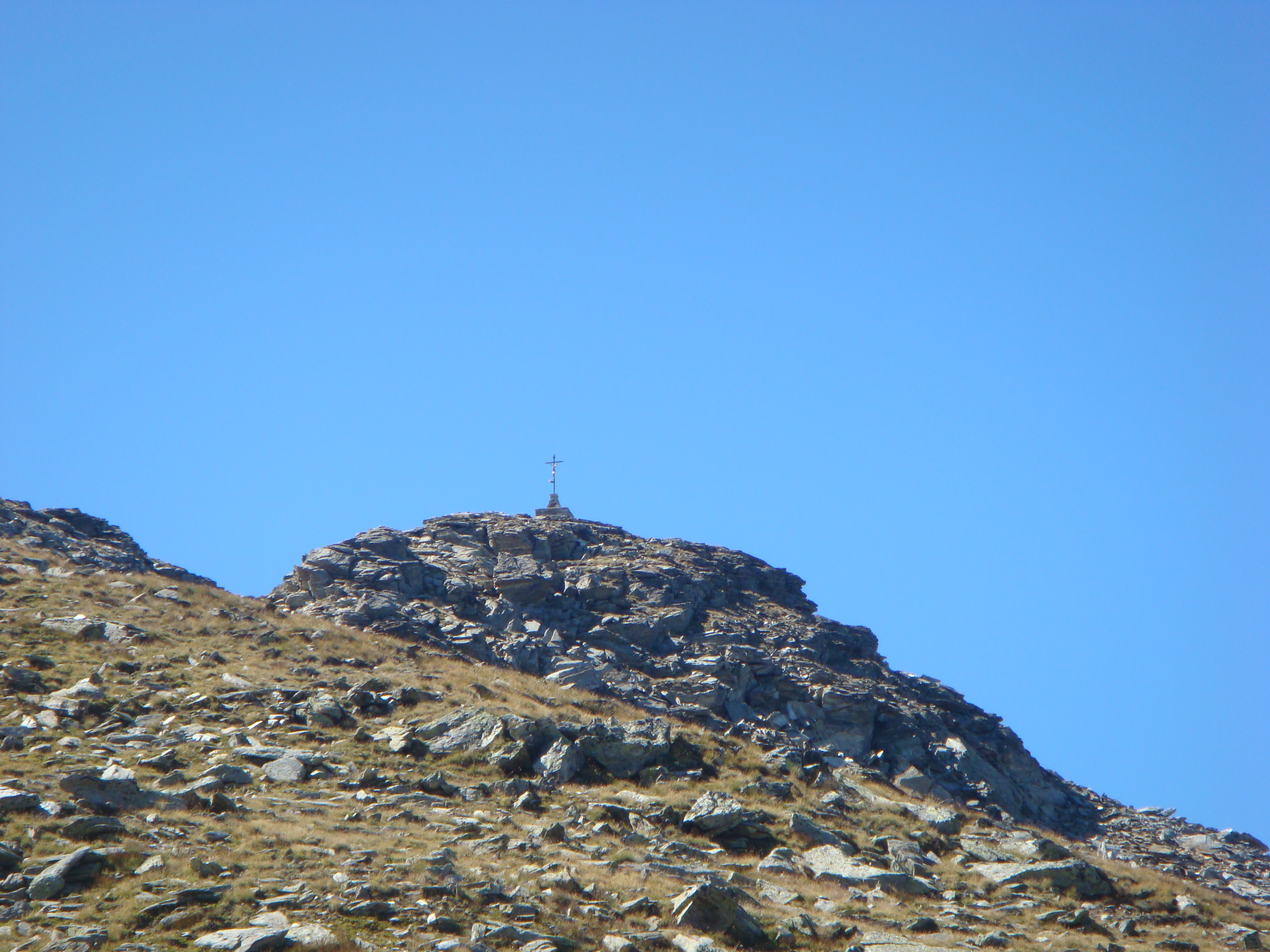
Accesso: Autostrada per Aosta, uscita Aosta Est. Seguire la Strada per il san Bernardo e uscire dopo la galleria seguendo per la Valpelline. Arrivati al paese di Valpelline girare a destra dopo la piazza principale, presso un distributore di benzina, seguendo le indicazioni per il Camping Grand Combin. si puo' parcheggiare dopo il campeggio sulla destra. Dal parcheggio si prosegue sulla strada e si attraversa il Torrente Buthier sul ponte presso il bar/ristorante. ATTENZIONE da qui non prendere il sentiero ben segnalato sulla sinistra, che costeggia il fiume e passa vicino ad una palestra di roccia a meno che non si voglia risalire fino a Ronceaz su strada, nel qual caso si gira a destra sulla strada, si passa qualche tornante e si prosegue sul rettilineo fino a Ronceaz.(1095m) Per in nostro sentiero, non molto ben marcato, si deve restare sulla destra dopo il ristorante fino ad arrivare ad una pallina rossa che indica Plan de Ressa. Da li si sale per il bosco fino a Ronceaz, si volta a destra e sul muro si trova l'indicazione di proseguire sulla sinistra. Qui ci inoltriamo nel bosco che, con una serie di tornanti, sale fino alla poderale che si segue per un paio di curve e un rettilineo. Alla fine del rettilineo, dopo il curvone, si ritrova un segnale sbiadito su sasso che ci indica di proseguire per il bosco per il sentiero nr 5. Si passa sopra un ponticello. Godetevelo perche' e' l'unico tratto in piano di tutta la passeggiata!!. Dopo il ponte si riprende a salire costeggiando il fiume. Alla fine del bosco (il sentiero costeggia sempre il fiume) si arriva ai ruderi di Verney dove sono anche poste palline segnaletiche. (1730m) Per il sentiero nr 5 si consiglia di stare sulla destra, passando di fianco ad un abbeveratoio e sopra delle pietre fino a ritrovare il sentiero che sale per i prati. Seguendo l'indicazione e salendo piu' vicino agli alberi si rischia di impantanarsi nei corsi d'acqua semi-nascosti dall'erba (il sentiero e' meglio marcato in discesa che in salita). Arrivati alla strada la si segue fino all'alpeggio di Arpisson (1838m) e poi si riprende a salire per i prati fino a Porillon Alpe Neuve e da li poderale fino a Fouillou (2087m). Ora il sentiero passa da prati a roccia e si continua a salire fino al bellissimo Lago di Arpisson (2482m). La salita continua su sentiero ben segnalato, sino ad arrivale al Colle di Viou dove sale anche il sentiero 105 proveniente da Blavy. Per il Bivacco si deve salire ancora un po' e lo si trova sulla destra a 2730m. La vista dal colle e dal bivacco e' eccezionale. Per arrivare alla vetta della Becca ci vogliono ancora circa 30/45 minuti. Per noi si faceva un po' tardi e avevamo ancora da affrontare 1800m di discesa. La becca sara' per un'altra volta, magari partendo da Blavy. Piccola NOTA di disappunto: Il sentiero, nonostante lungo, offre grandi panorami, soprattutto quando si inizia a salire dopo Fouillou. La via piu' battuta e' quella da Blavy, quindi salendo da Valpelline si trovano dei paesaggi incontaminati ....... tranne purtroppo, per qualche incivile che ha lasciato una lattina di Rio Mare vicino al Lago di Arpisson. Forse che pensasse che i "famosissimi tonni alpini" usino le lattine come casa per ripararsi dal freddo????
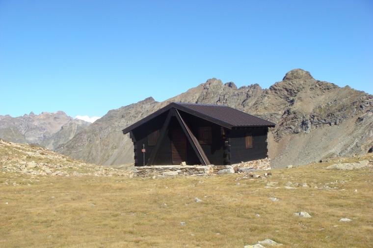
Login to post