Cima di Fraina, from Laveggiolo


Edited by:
Marco Bonati
Updated at: 03/09/2024
Access
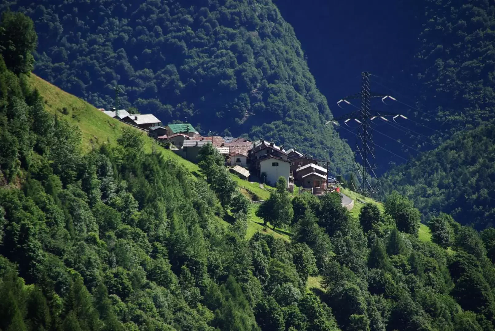
From Milan to Morbegno along state roads 36 and 38; at the roundabout at the entrance to the town turn right in the direction of Val Gerola; drive up the valley until just beyond the village of Gerola Alta. Near the new ice palace turn right in the direction of Laveggiolo: in the small hamlet the public road ends in a parking area.
Introduction
The peak we have to reach is never visible along the access route, except for the last few hundred metres; but its approach is most interesting for the presence - and use - of military logistical structures referable to the so-called Cadorna Line. The panorama towards the neighbouring Val Varrone (Premana - LC), the Ticino Pre-Alps and - in the background - Monte Rosa and Vallese is magnificent. The double descent is also very interesting.
.Description
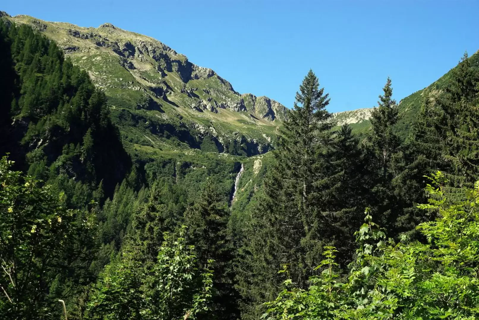
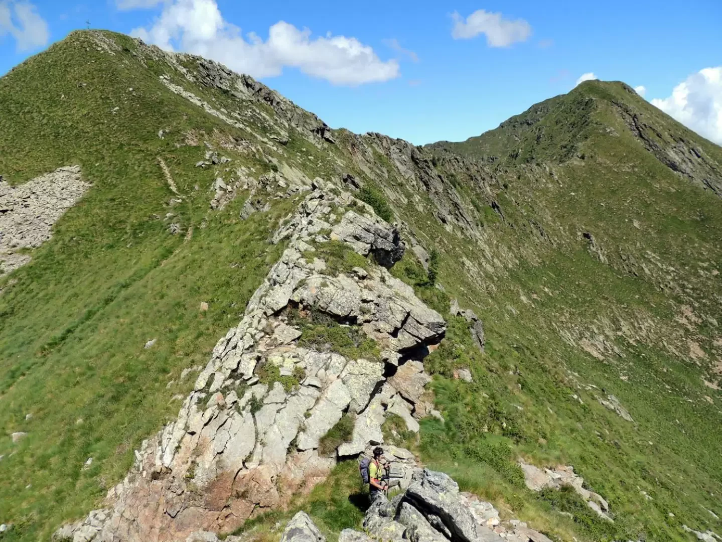
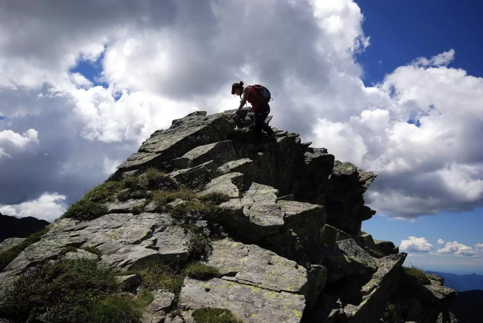
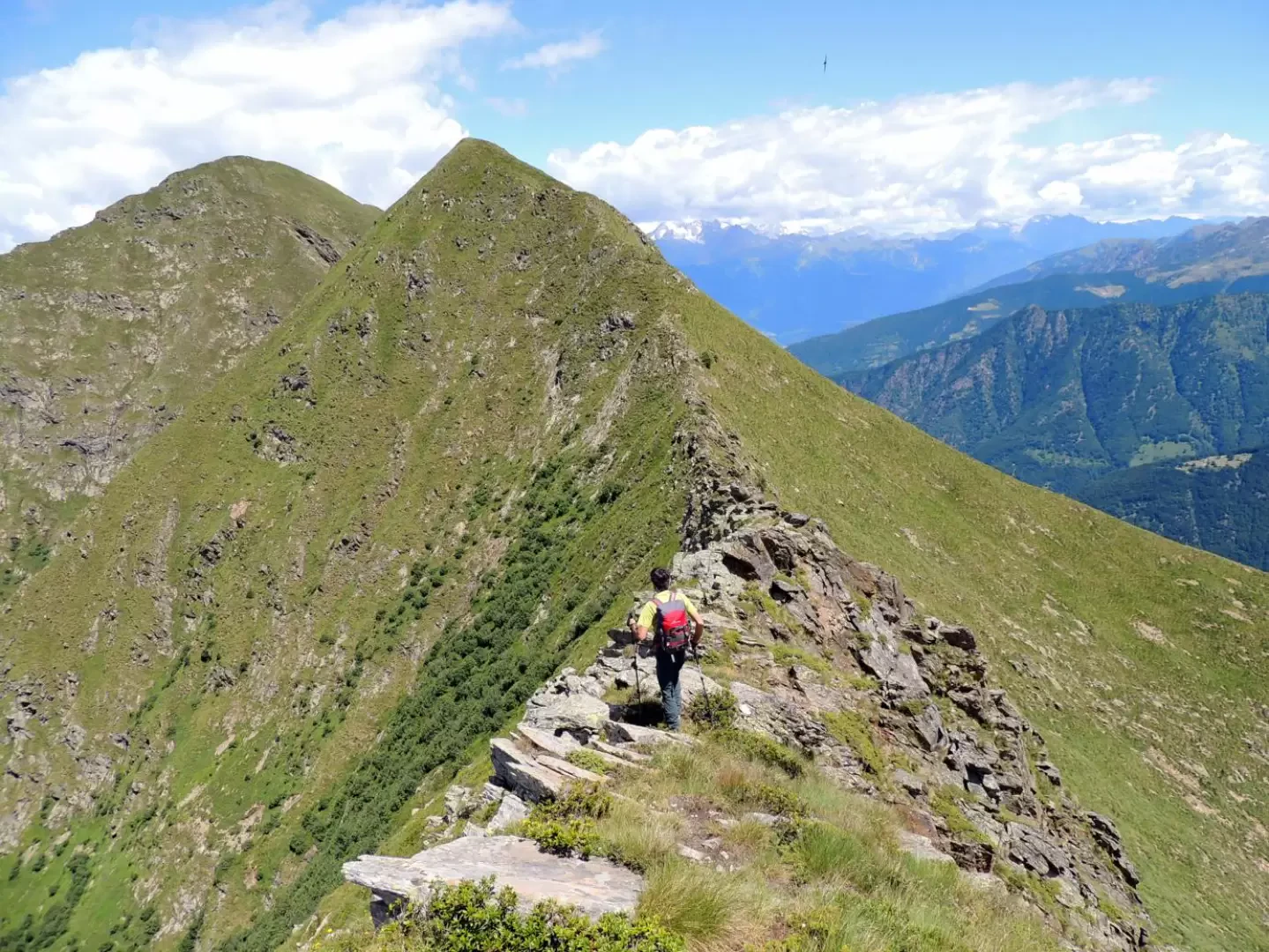
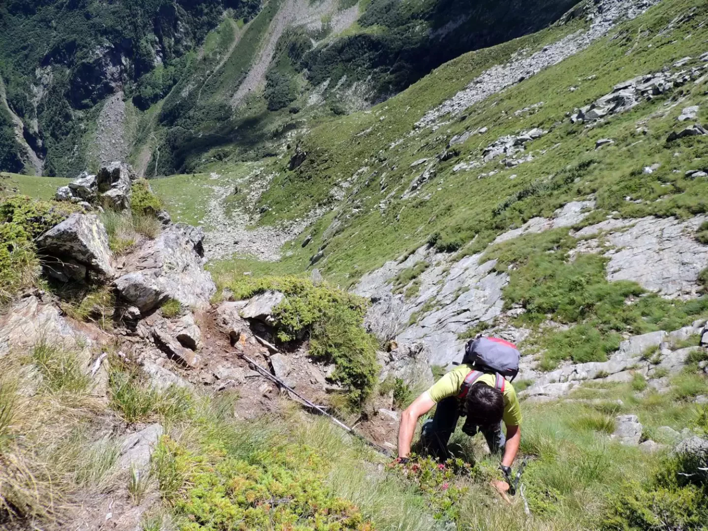
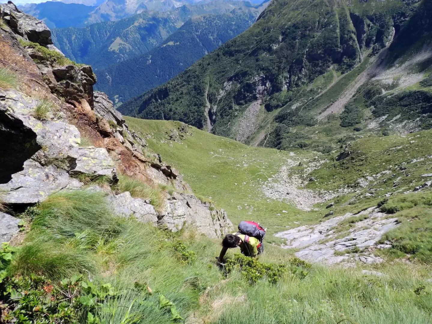
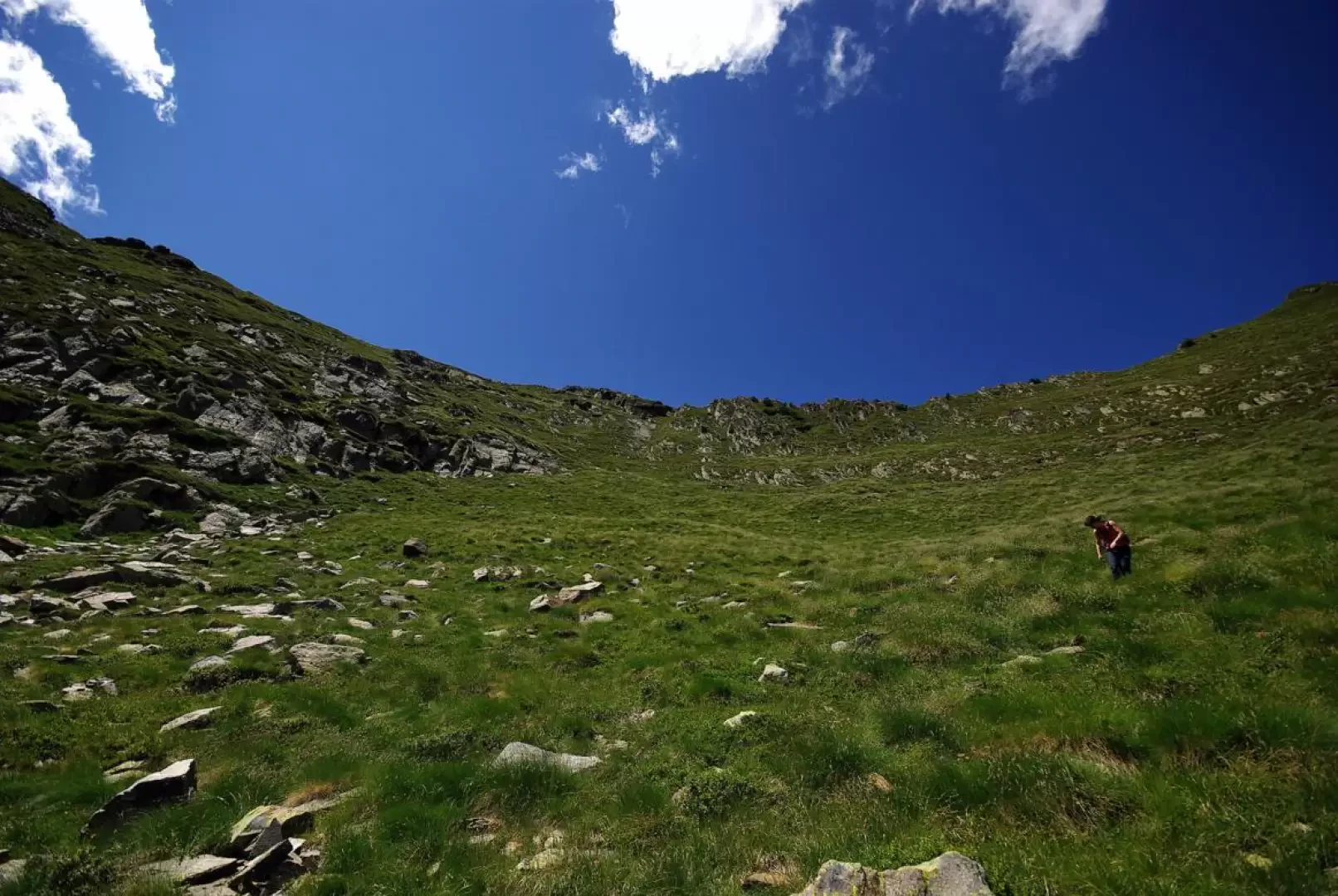
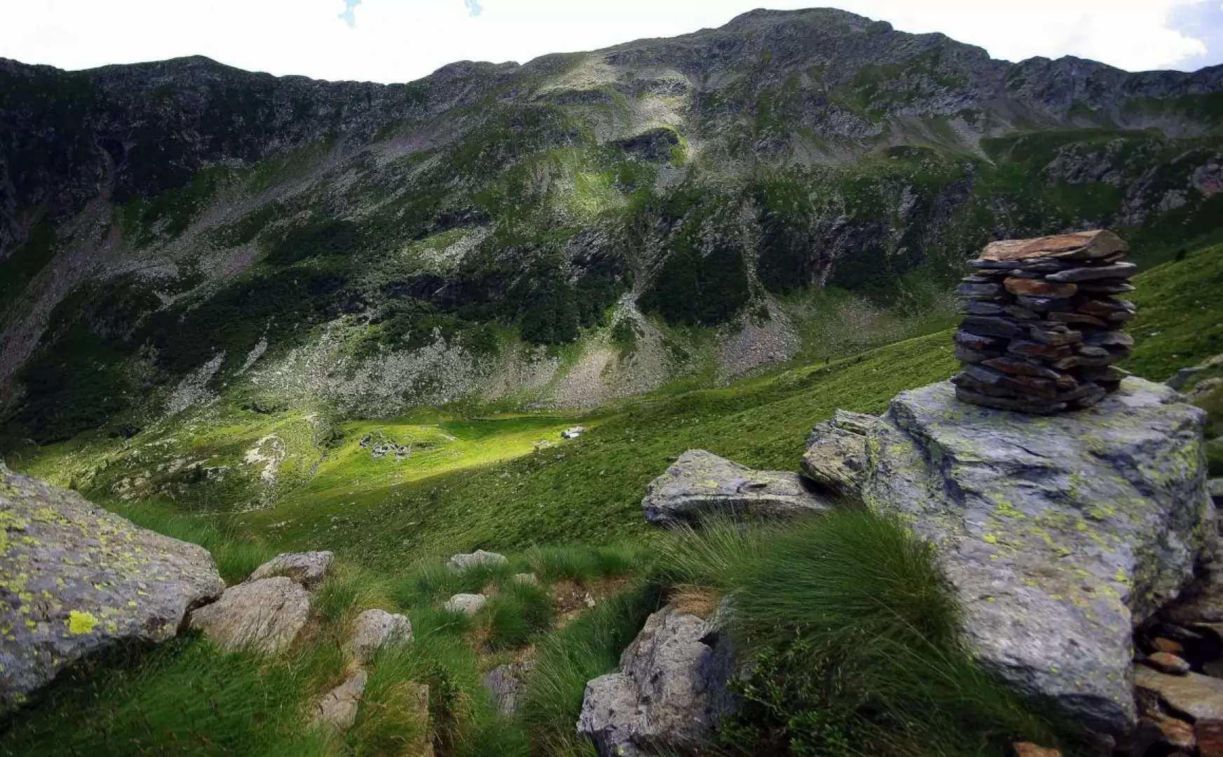
From the houses of Laveggiolo 1471m, continue along the forest track that is forbidden to the unauthorised and for a short stretch asphalted; ignore the lateral deviations and especially the widely signposted path to the left. In a constant gentle ascent, you reach the valley floor at the three Baite Grasso 1680m: you do not descend to cross the stream at the ford, but instead you flank it first along a secondary track and then along a barely visible path. The path, once again clearly visible, crosses the water and tends to ascend to the left with a few hairpin bends up a landslide cone that helps you cross the rocky threshold of the valley (Val Vedrano); having forded the stream again at a wide ledge carved into the rock, you reach the wide pastures of Alpe Colombana 1946m (indicated on maps as Alpe Vedrano, but locally unknown as such). Here the actual path ends and it is necessary to orient oneself by sight in order to continue: the alpe is dominated to the north-west by a rocky/grassy peak with a large cairn of stones on its summit; on the left side of this peak (actually the antecedent of our Cima di Fraina), a grassy opening is evident at the summit of a gully of steep pastureland. Climb this slope as best you can and, during the ascent, you will come across remains of ancient paths and traces of animal passage. When you reach Bocchetta di Colombana 2206m (which the maps place further north at Q2227), you realise that you are on a very unusual ridge: it is actually a panoramic grassy hollow enclosed between Pizzo della Càssera, Cima di Fraina and its antecima; to this hollow, on the Premana side, converge a number of military tracks - pedestrian and vehicular - due to the presence of the ruins of what must have been a small barracks and depots. We take the right-hand track that goes to the summit with a cairn, which turns out to be an observation post and the start of a ridge walkway joining a series of small trenches and gun emplacements. The ridge walk alternates between stretches of path and short, easy rock-climbing steps; at an artificial notch (protected walkway) the signs in paint of the easier descent route appear. Now well within sight of the summit cross, we climb the last few metres of slope, amidst grass and broken rocks, of Cima di Fraina 2288m; at the summit, an observation post and a shelter dug out under the summit rocks. The descent presents two possibilities of varying degrees of difficulty. The first consists of returning to the notch observed during the ascent of the last part of the ridge and following the stony path down the valley that passes at the base of a band of rocks at the base of the peak; you then descend to a grassy hollow with the remains of ancient cattle pens and, climbing over a ridge to the right, you take the beautiful path uphill to the Alpe Colombana huts, where you resume the outward route. The descent variant - completely without tracks - reaches the route already described at the hollow with fences. From Cima di Fraina, the north ridge is easily climbed in the direction of Q2325: about at the lowest point of the ridge, a very steep gully starts on the right, first rocky and then grassy; you take it and after a few steps on broken rocks you climb over a well gripped rib (steps of II+) to get under a jutting boulder in the form of a cave (the dark area in the centre of photo 23); From here one descends on very steep grasses enclosed between a smooth and impassable slab and a well gripped rocky wall; shortly the slope diminishes and, on a landslide pasture, one reaches the signs for the normal descent.
Photo gallery
Comments (0)
Sign in to leave a comment