The Cyclops Trail, from Filorera


Edited by:
Marco Bonati
Updated at: 13/07/2025
Access
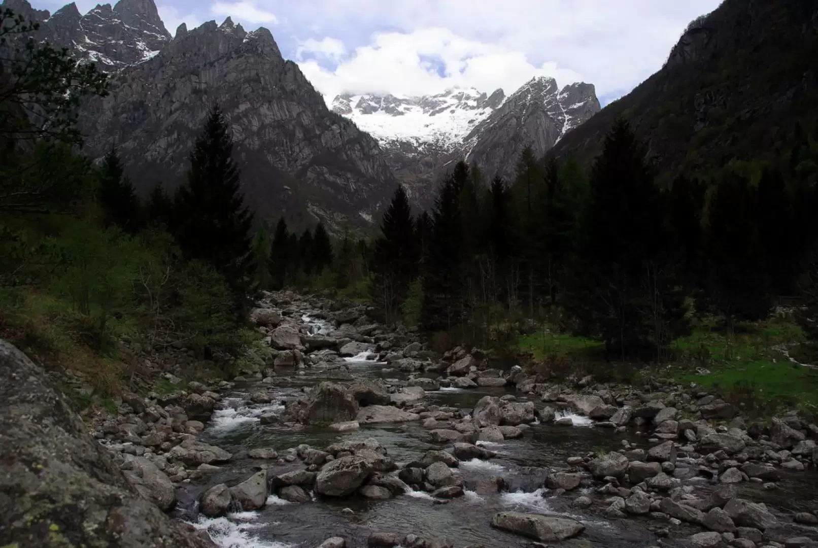
From Milan to Ardenno along state roads 36 and 38; just before the railway station turn left towards Val Masino. Climb up the valley to Filorera, where you can park near the Centro Polifunzionale della Montagna.
.Introduction
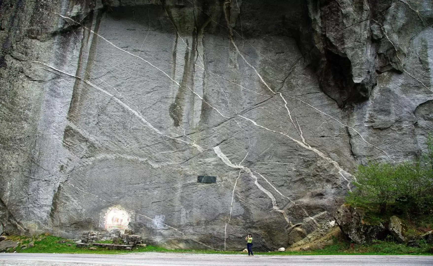
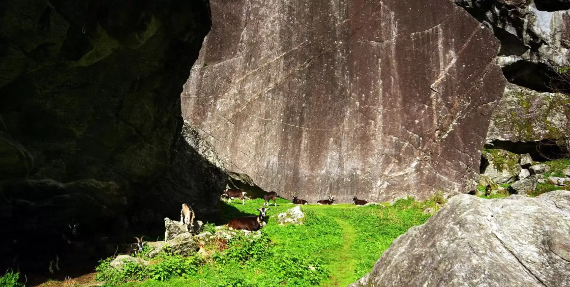
The Sasso Remenno area is well known in mountaineering circles as a climbing centre for several decades now (first practice routes of the Soccorso Alpino in the 1950s), but the real discovery for sports use dates back some 35 years. Initially, routes were also developed on many boulders scattered around the main one, but now many of these 'routes' are abandoned and almost completely engulfed by vegetation. A few years ago, the ERSAF (Ente Regionale per i Servizi all'Agricoltura e alle Foreste) restored, signposted and equipped a small path that circles the area of minor boulders surrounding Sasso Remenno. The path is still not very easy and must be searched carefully on the ground, without being confused by the tracks of the numerous goats.
Description
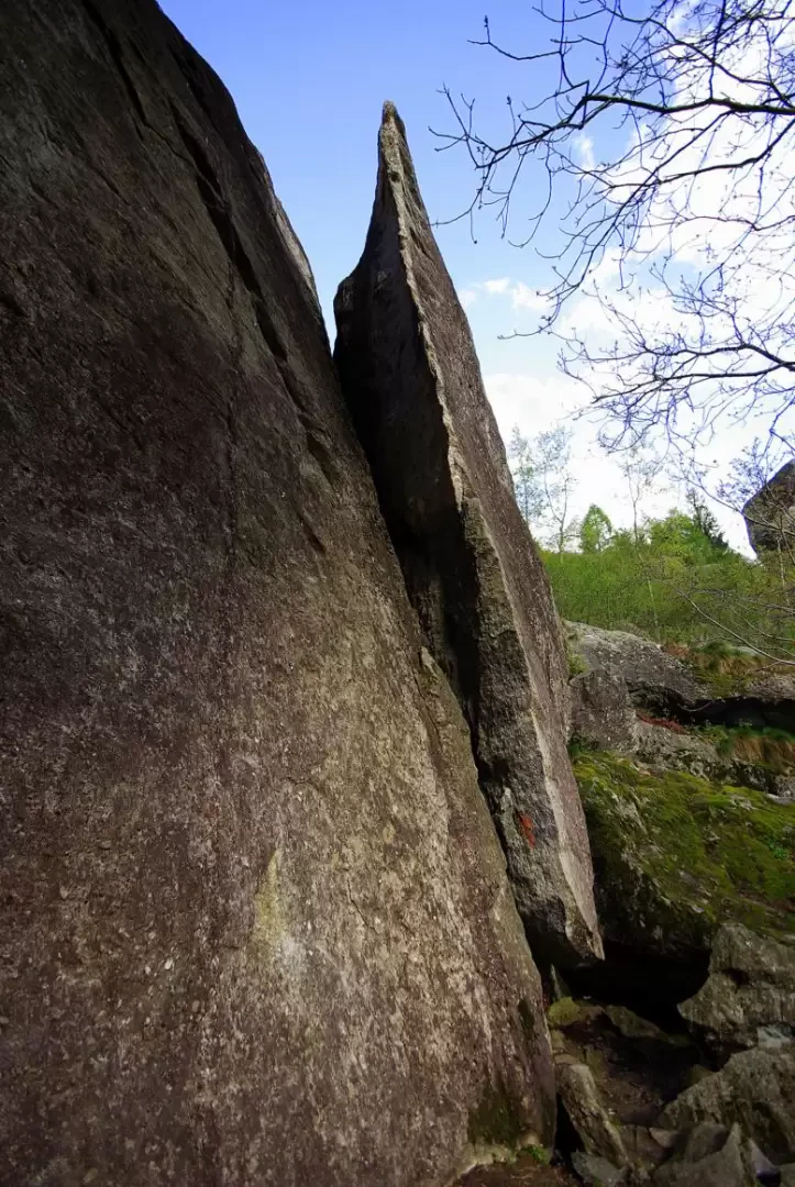
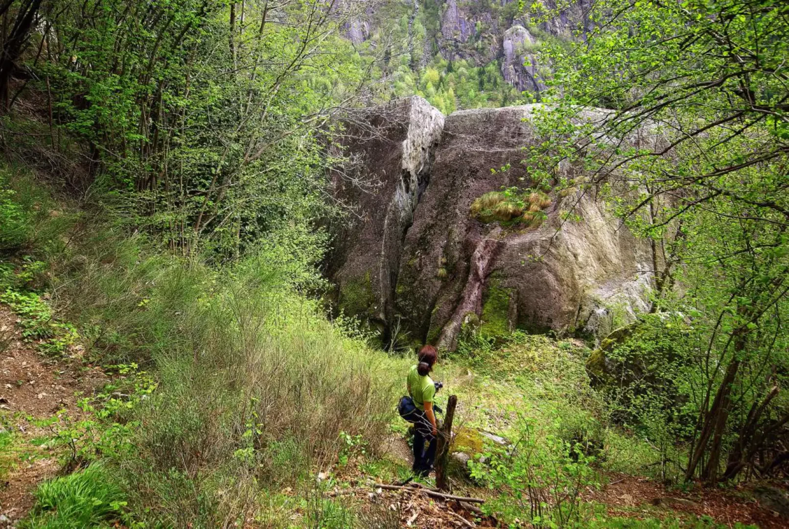
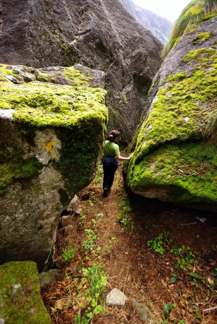
From the Centro Polifunzionale della Montagna (Multifunctional Mountain Centre), cross the Masino stream over the bridge by the Moss pond and turn left in the direction of Visido on the cycle/pedestrian path. After passing a granite quarry, some boulders frequented for bouldering, and the huts of the Visido district, you reach the Sasso Remenno campsite: along this stretch, you can observe some climbing areas of high difficulty. Cross back over the Masino on the access bridge to the campsite and reach the provincial road: follow it to the left, passing under the impressive north face of Sasso Remenno. Continue as far as the small car park on the right near an isolated cottage: the path begins (signpost with outline itinerary) on the left side of the square. You immediately head under the sharp blade of the Aperacheio boulder to a narrow passage under the Orologio del Tempo boulder; from here you approach - at the edge of a bushy pasture - the Sasso delle Crepe and the spectacular Scivolo. Zigzagging up between boulders and smaller blocks, one enters a cave where the passage, damp and slippery, is facilitated by a fixed rope. Continuing steeply into the wood and juggling over boulders, one reaches a fork in the road: one takes a left and, passing under the obelisk of the Tower, one soon reaches a small valley under the Sassi delle Capre, which - with ups and downs - preludes the impressive Antro di Polifemo. This gallery of stacked boulders leads to a basin-shaped meadow enclosed between the Sassi delle Capre and the looming Grande Grigio; on the left side of the meadow, the Canyon rift leads deep into the Sassi delle Capre: the damp, mossy corridor is divided into two sections by a jammed boulder, under which you creep to reach the bottom. [It is possible to climb to the top of the Sassi delle Capre by following - from the bottom of the Canyon - an oblique chimney, inclined and painful to climb, grade III on lichenous rock]. Back in the meadow, climb up to the base of Grande Grigio on a loose track and contour the rock to the right until you reach the not vast but flat summit: a great panorama of the boulders below, the mountains of Val di Mello and the entire Valmasino plain from San Martino to Cataeggio. Returning to the Antro di Polifemo, descend to pass under the Lama cave and traverse to the left on the level until you reach a clearing under the Tartaruga; turn right reaching and then circling the Ranocchio and, after a narrow passage between the boulders, arriving at the base of the Albero delle Lucciole (a popular boulder-gym). You slip under the wall and then turn left, descending between the boulders placed like huge steps until you come to a wide path: to the left, you reach the west face of Sasso Remenno and to the right, you descend to the meadow on the south face. Following the direction of the stream at the south face, you return to the road in the immediate vicinity of the car park at the start of the path; following the provincial road for a few hundred metres, you return to Filorera, behind the Centro Polifunzionale della Montagna.
Photo gallery

Comments (0)
Sign in to leave a comment