Tête du Mont, from Dublanc


Edited by:
Gian Mario Navillod
Updated at: 01/02/2026
Access
Leave the motorway junction at Pont-Saint-Martin and, after about 150 metres, turn left onto the road in the direction of Aosta. At the next roundabout, take the second exit and continue on the road for 2.2km (2.2km), passing through the village of Donnas until you reach another roundabout. Take the second exit still following the and continue for 3.0km (5.2km), bypassing the Fortress of Bard, until you reach another roundabout. At the roundabout, take the third exit and take the Valle di Champorcher regional road. Follow for 10.8km (16km), going up the valley and passing through the villages of Hône and Pontboset, until you reach the villages of Salleret and Dublanc. Continue for about 1km (17km) until you come to a small, free car park 🅿️ on the edge of the regional road in the locality of Dublanc, located just beyond the trailhead, used as the starting point of the itinerary.
Access by public transport
The starting point is served by the Verrès - Pont-Saint-Martin - Champorcher bus line, stopping at Salleret, two hairpin bends below the starting point. For timetables, please consult the website: www.vitagroup.it/linee-urbane-extra-vda
Distance and travel time
🕒 Travel time: 23 minutes
📏 Distance: 17 km
GPS navigation
📍 How to get there with Google Maps
📍 How to get there with Apple Maps
ℹ️ Important note
The directions given were verified on the date of the route survey. We recommend checking for possible changes in the route or road conditions before departure. Please consult Google Maps or Apple Maps for the latest information.
.Introduction
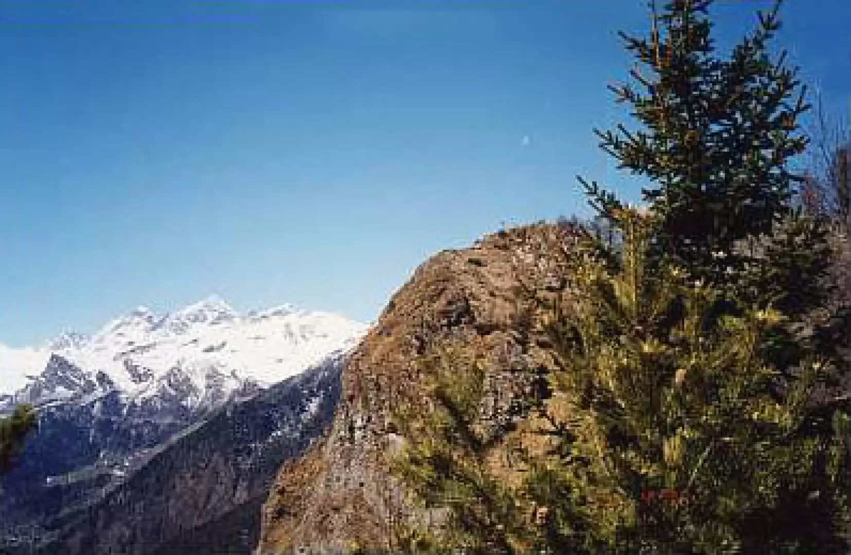
A splendid viewpoint over the Champorcher valley, passing through the uninhabited village of Barmelle. On arrival, a stunning view of the Matterhorn and Monte Rosa.
.Description
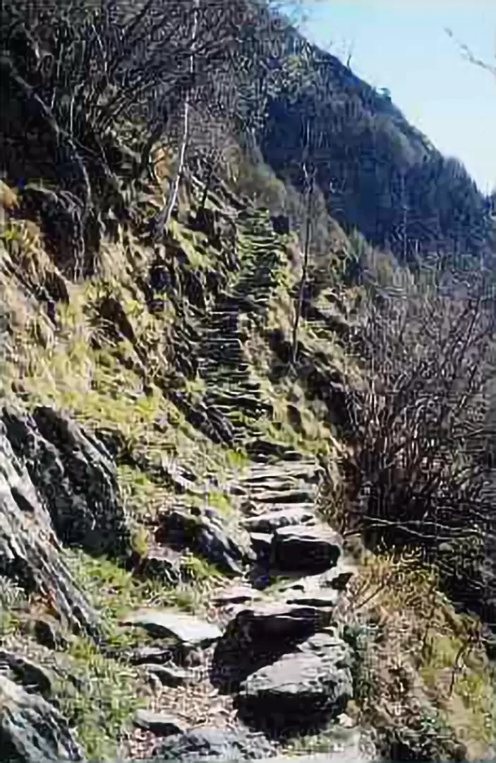
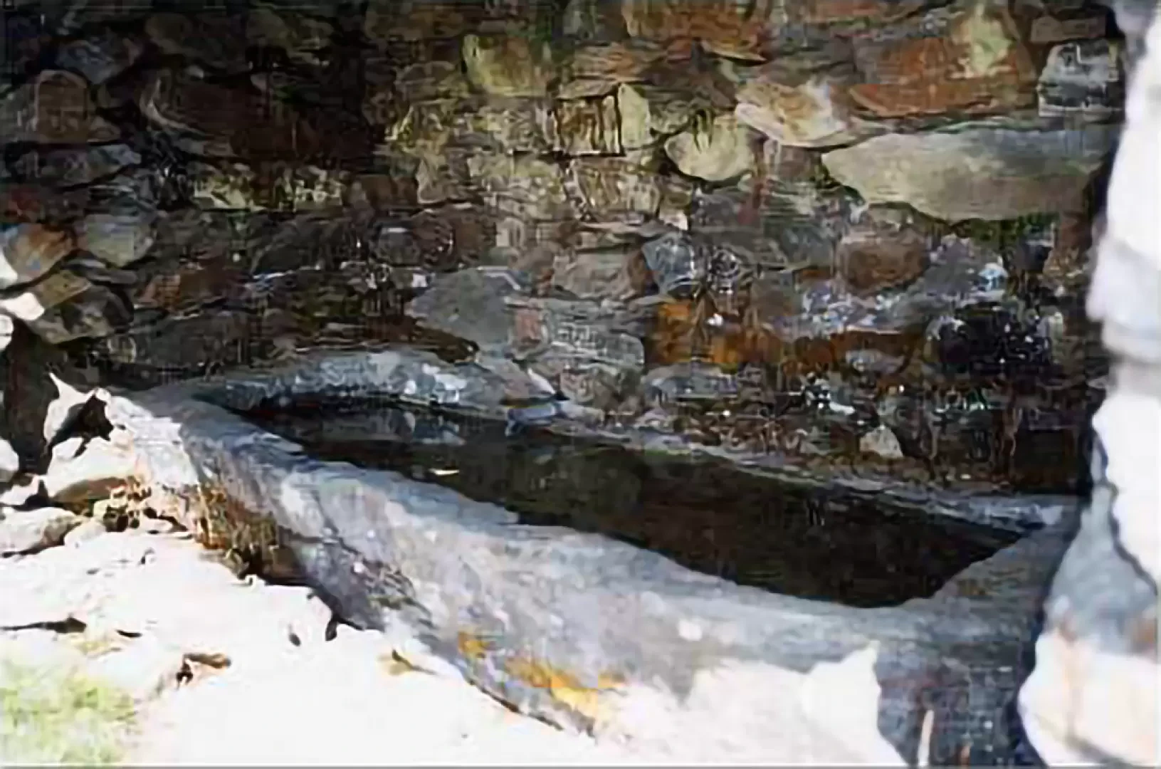
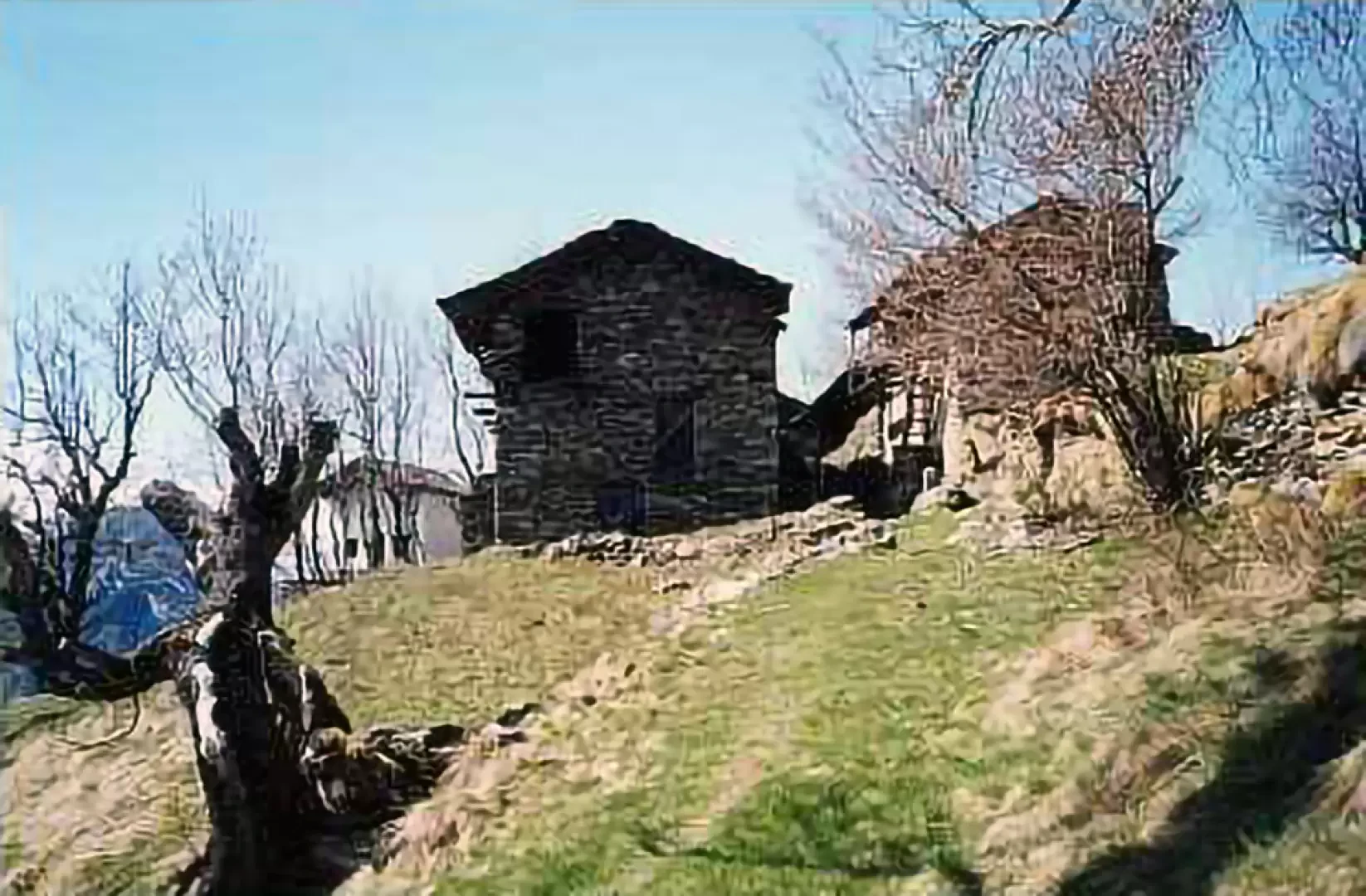
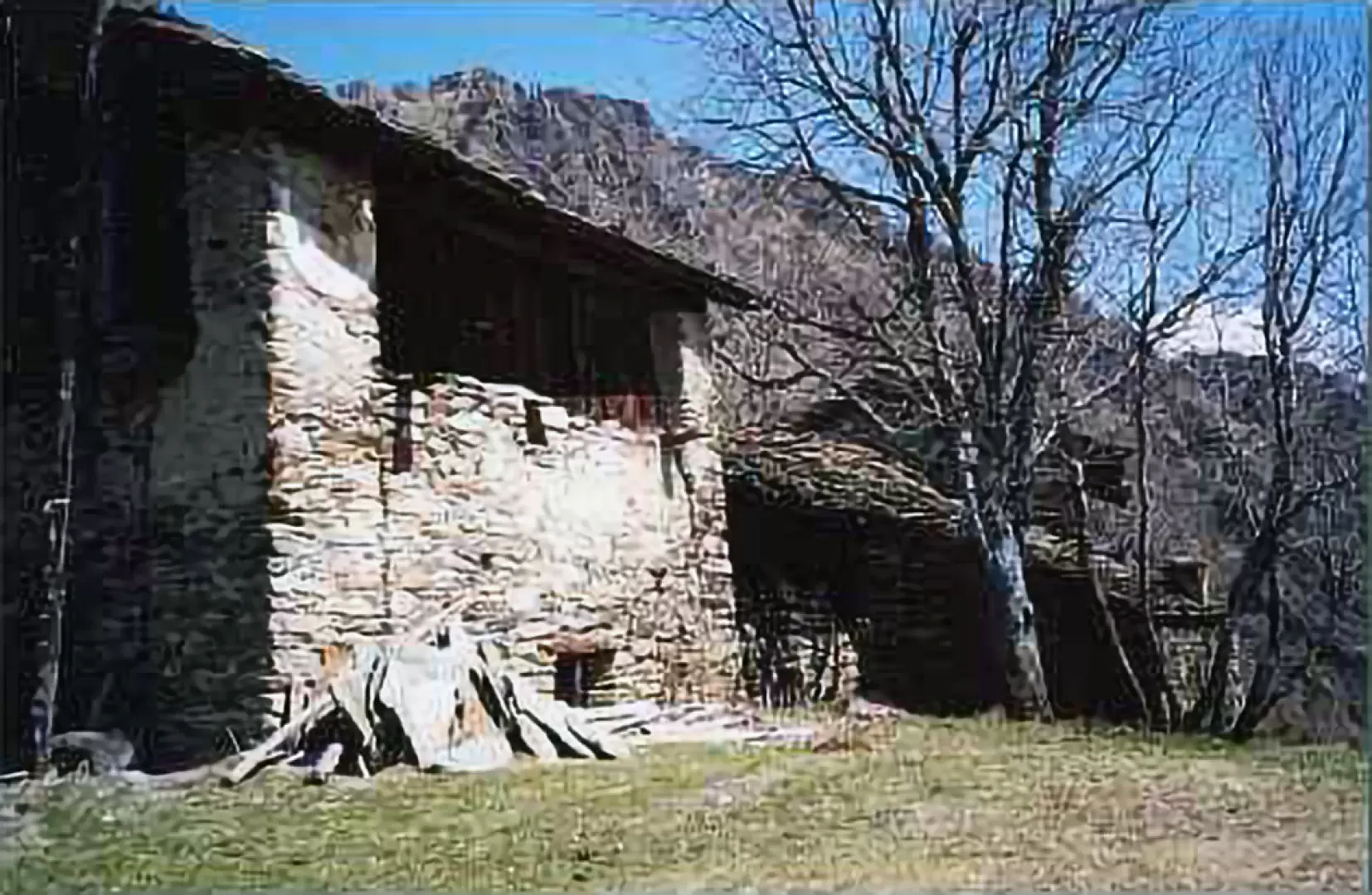
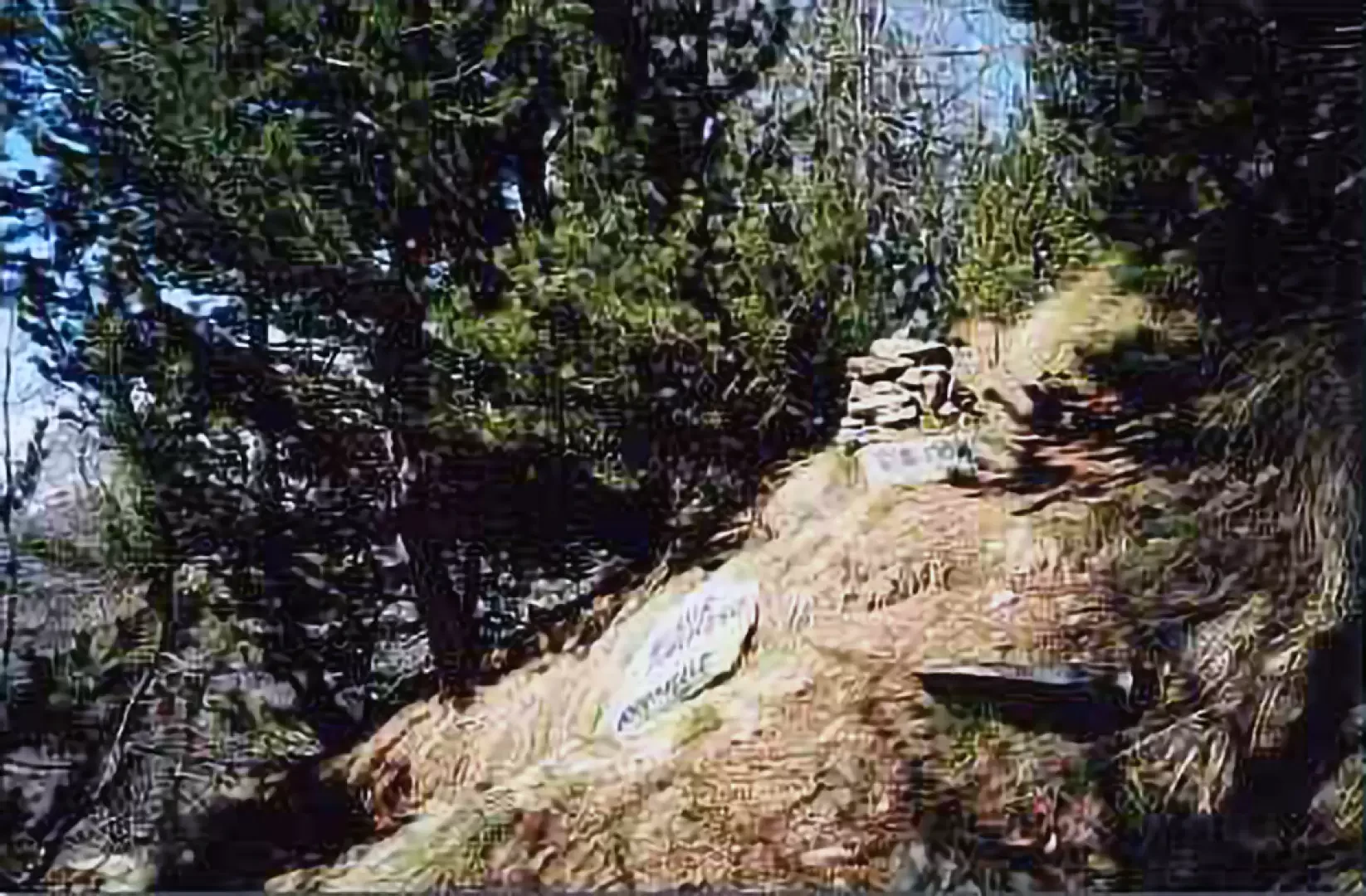
The first steps are taken along the asphalt road that leads to the large white apartment building. At the height of the building, take the path on the left that, after a few concrete steps, continues gently, passes the building and heads into the meadows, passing above a stable that houses a flock of goats. At the end of a slightly uphill section, the path narrows to pass between two large rocks, and shortly afterwards begins the first of several steps up the steep sides of the valley. At the end of the steps, you descend to cross a gully and climb up the other side into the coniferous forest until you come to a narrow passage where the path seems to be carved into the rock. Immediately afterwards, you come to a fork where you must follow the track to the left, which climbs steeply and almost immediately becomes a long stone staircase that, with a few narrow hairpin bends, quickly leads to the belvedere over the lower Champorcher valley. Cross a small valley crossed by a rivulet and after a few dozen steps, the village of Pontboset can be seen at the bottom of the valley. Continue along the steps until reaching a level section where the path heads eastwards until reaching the pastures below the village of Barmelle. The slope becomes less steep and after a few hairpin bends, you reach the beautiful fountain built downstream of the hamlet. Surrounded on three sides by a dry-stone wall that supports the roof made of slab tiles, the basin was carved out of a single block of rock patiently chiselled inside; unfortunately, there is no reference to the date of construction. It takes less than five minutes to reach the abandoned village, cross it on the way to the recently restored little church and from here, passing under the cables of the cableway used to transport materials, climb the slope northwards for a few minutes until you reach the foot of a large ash tree. Here, the uncertain track that ascends between the meadows resumes the dignity of a path and climbs steadily up the slope, crosses a scree slope and then reaches a forest of majestic larches. These dot the mountainside at a respectable distance from each other, tall and massive, stretching their long branches almost to the point of touching. The path then creeps between the dense rows of reforestation conifers that follow the contour lines in an orderly fashion until we reach the fork where we leave the left-hand branch that descends towards the village of Rosier and continue the ascent to the right. The path becomes less and less steep as it approaches the ridge, and you soon come in sight of the cross that marks the summit of La Tête du Mont and shortly afterwards cross the pass, passing on the north side of the mountain. Follow the path that descends the ridge heading west until you meet the track on the left that leads to the summit with a steep but short ascent. From here you can enjoy an exceptional panorama over the entire Champorcher valley, turning north, beyond Mount Barbeston, you can see the unmistakable silhouette of the Matterhorn in the distance and the Monte Rosa massif to your right.
Riferimenti Bibliografici
- Il Parco Nazionale del Gran Paradiso, vol .2 - Berutto Giulio - IGC Torino, 2000
Galleria fotografica
We have been there

Edited by:
Massimo Martini
Tête du Mont, da Dublanc
Bella escursione nella Valle di Champorcher. L'itinerario che abbiamo effettuato tocca il caratteristico villaggio di Barmelle, la Tête du Mont per poi rientrare con un lungo anello a Grand Rosier e Petit Rosier ed infine rientro al punto di partenza con il sentiero . Unico problema la discesa con il spesso interrotto da grossi alberi in terra. Ci sono stato!