Sasso Canale, from San Bartolomeo


Edited by:
Marco Bonati
Updated at: 21/09/2024
Access
From Milan or Como, one reaches Sòrico at the northern end of the Lario; at the bridge over a stream, one ascends in the direction of Montemezzo and then Bugiallo. The road ends at a grassy square near the church of San Bartolomeo (recognisable only by an inscription on the wall).
Introduction
The Sasso Canale is that peak overlooking Lake Como, Valchiavenna and Valtellina, easily recognisable by the presence of two repeater panels. Its position makes it a vantage point comparable only to the contrasting Monte Legnone: splendid sunset with reflections on the lake. The entire route (except the descent variant) is perfectly signposted in paint and coincides with the start of the first stage of the impervious Alta Via del Lario.
Description
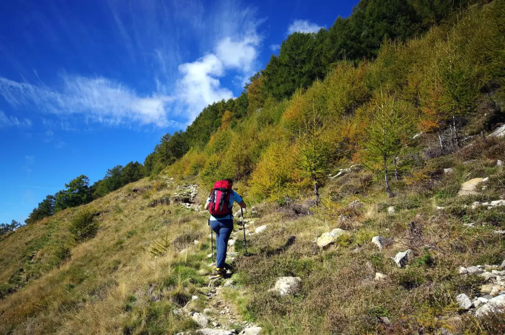
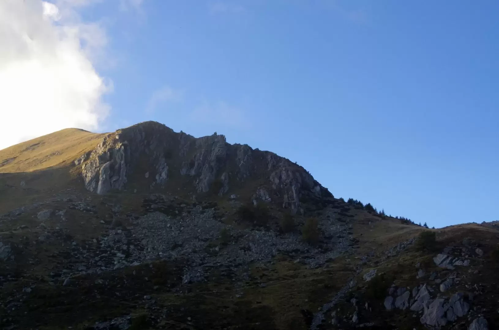
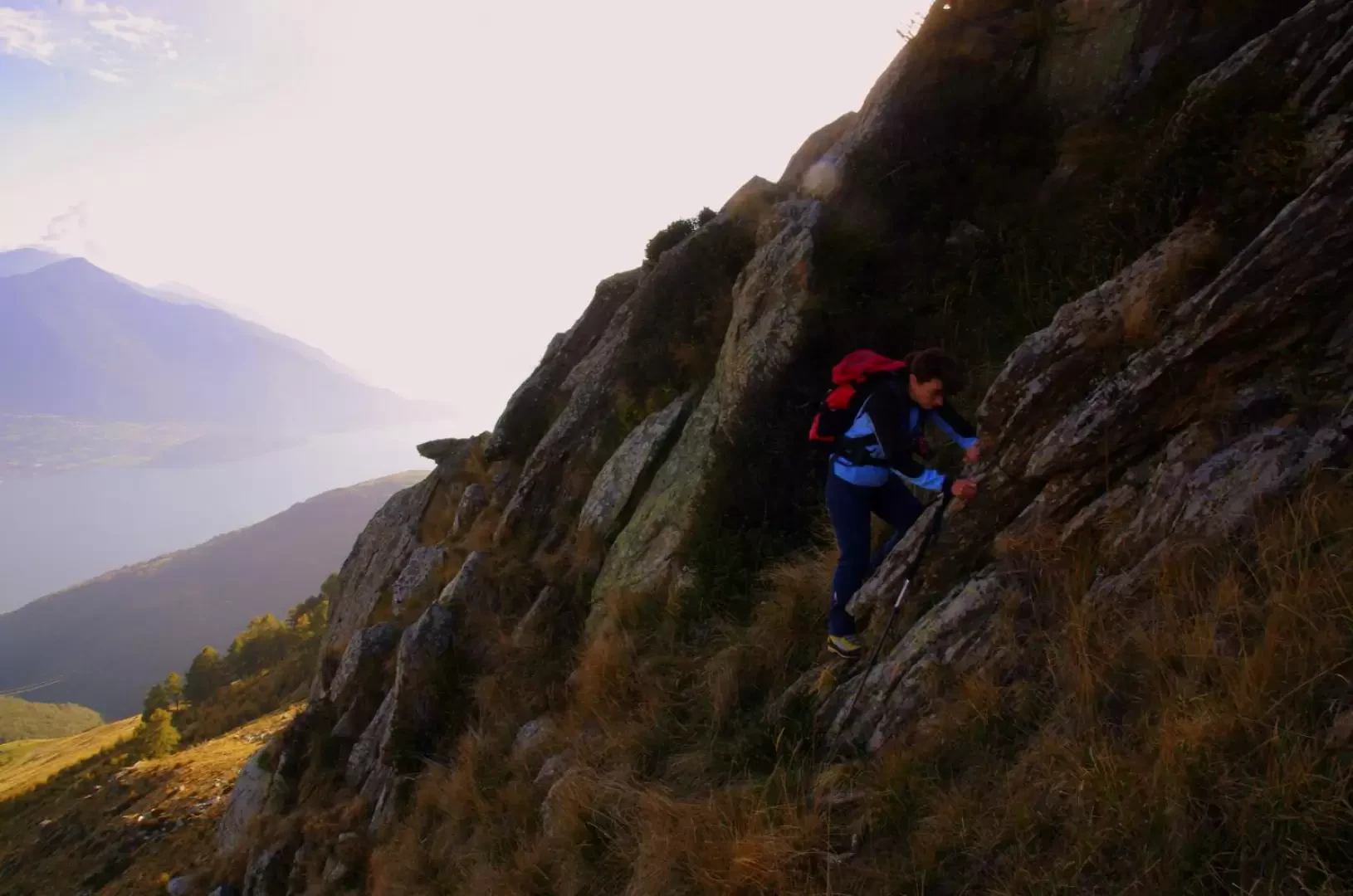
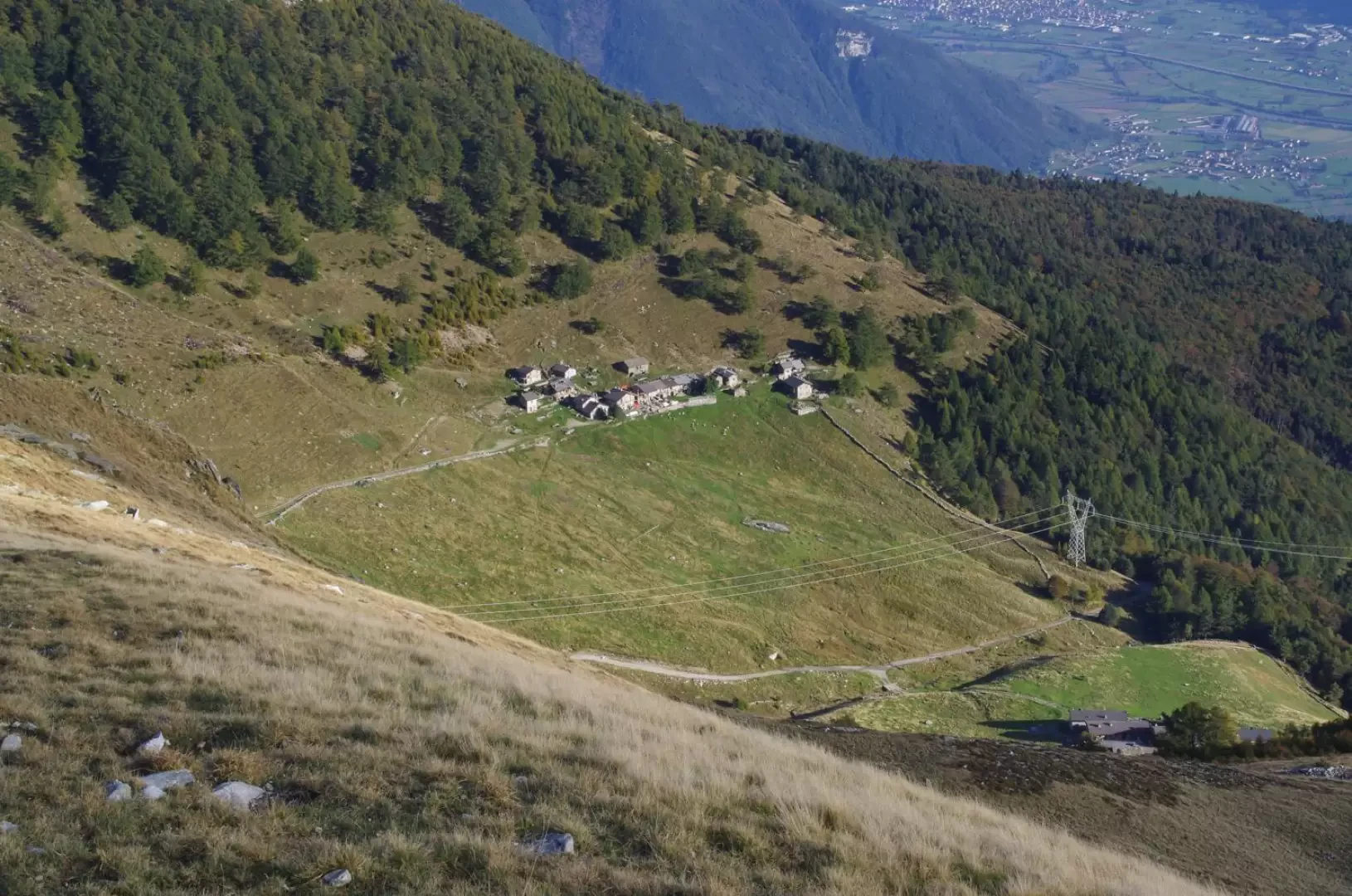
From San Bartolomeo (1204m), go up immediately into the pine forest where the path skirts a few small houses and continues with an ascending traverse that reaches a forest track; follow it at length until the vast pastures of Alpe Pescedo 1559m. Leaving the latter to the right (passage of the descent variant), turn left and climb up to the huts of Alpe di Mezzo (1536m): the path skirts the houses on the right and reaches a small chapel in the pastureland. From here, continuing on a good ascent, you pass through a dense thicket of small larches and come down onto the high pastures of Alpe Gigiai (1630m) characterised by the long wall of the "Terminone", the dividing wall of land ownership. When you reach the cairn at the top of the wall, you look out onto the dark Chiavenna side, traversed by gullies and precipitous rocks alternating with damp thickets; continue along the wide, increasingly rocky ridge, gradually taking you under the wall at the base of the first repeater. The final traverse - steep and landslide-like - leads to an equally rocky slope that converges into a rocky gully: which, in a few easy steps of climbing, opens out into a wide gravelly shoulder just a few steps from the Sasso Canale summit, Q 2397m, occupied in its entirety by the repeater panel. Continuing along the edge of the summit ridge - a short section of simple but exposed downhill climbing - you reach the artificial terrace with the second panel; from here you climb the short and well gripped terminal wall, reaching the narrow summit of Sasso Canale (2411m).
Return along the outward route.
Variant
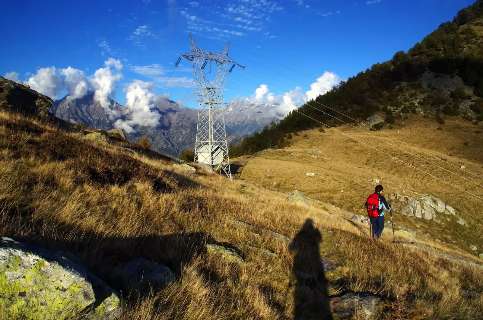
Beginning from the little cairn of the "Terminone", a slightly more challenging descent variant is possible. Continue along the panoramic meadow ridge to the rounded ridge at its end; from here, descend the wide eastern ridge until it becomes narrow and rocky, apparently impassable. On the left, however, a small goat track begins, descending by exploiting the weak points of the ridge - a few passages with the use of hands - to a small grassy esplanade crossed by an evident path. Continue along this track, which crosses the entire basin between Pescedo and Alpe di Mezzo; descend to Bocchetta Chiaro 1666m (characterised by the passage of a power line), and continue first on the level and then slightly downhill to Pescedo: after crossing its marshy pastures, you will find yourself back on the initial forest track, which you follow - as on the way up - as far as San Bartolomeo.
Photo gallery
Comments (0)
Sign in to leave a comment