Leave the motorway at the Aosta Ovest junction and turn right onto the regional road for the Cogne valley. After 400m (0.4km) at the roundabout take the second exit onto the national road , which you should follow for 32.4km (32.8km), passing through and alongside the villages of Saint-Pierre, Villeneuve, Arvier, Avise, Derby, La Salle, Morgex and Courmayeur, until you reach the exit for Larzey - Entrèves on the . Turn right and take the road for 4.0km (36.8km) to Entrèves. Continue on Strada la Palud for 11.1km (47.9km), passing La Palud, Planpincieux and Lavachey, until the end of the road near Arp Nouvaz.
Parking
At the end of the road, after crossing the Dora di Ferret on a small wooden bridge, you will find the 🅿️ car park at Arp Nouvaz at the end of the wooded scrub. During the summer period (July and August), access is regulated: it is normally allowed before 8:00 a.m. until the available spaces are saturated; after that time, a shuttle service is available departing from La Palud. For up-to-date information, please consult the special section of the Courmayeur municipality website.
Access by public transport
To reach the starting point of the itinerary, a private vehicle is necessary. During the summer period there is a shuttle service 🚌 from La Palud; check timetables and availability on the Courmayeur municipality website.
The information provided has been verified as of the date of the survey of the itinerary. Before departure, it is recommended to check possible changes in the route or road conditions. Please consult Google Maps or Apple Maps for the latest information.
.
Introduction
A walk suitable for everyone, including children. It is advisable not to do this hike in the middle of August, as the road through the beautiful Val Ferret is used by off-road vehicles that accompany guests to the hut.
This itinerary provides a perfect view of the Pré de Bard glacier: inside the hut there is a poster with various photos of the glacier, so you can see how it has retreated over the years.
Description
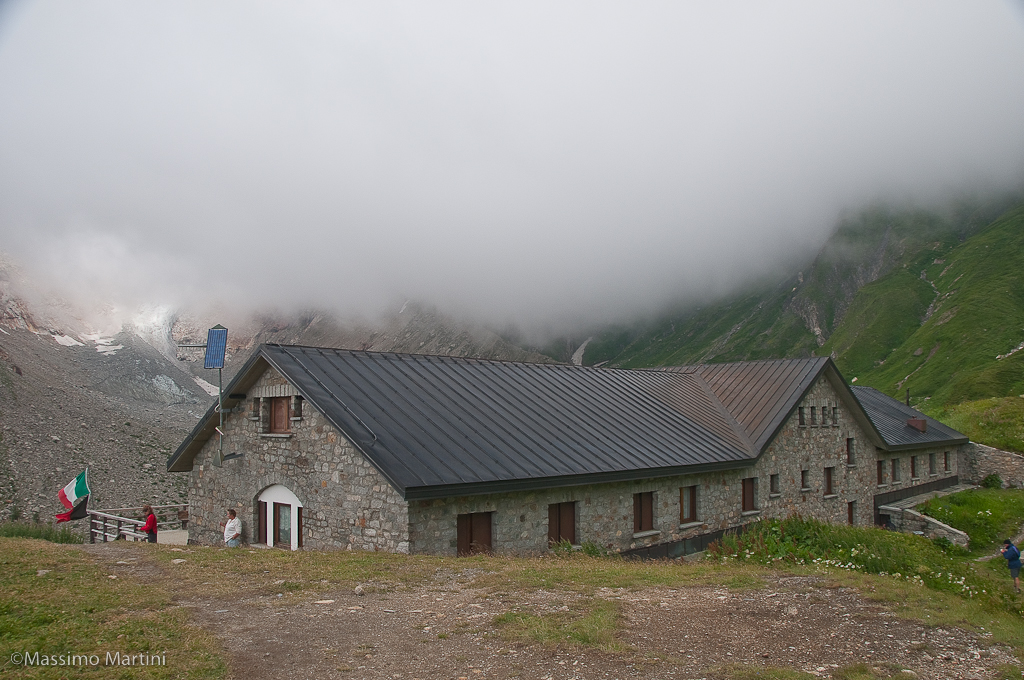
You park at Arp Nouvaz (1769m) just before the Val Ferret shuttle bus terminus (if the Val Ferret road is closed to traffic, you can reach Arnouva by shuttle bus). Leaving the car park, cross a small wooden bridge and start walking along a practically level farm road. After a few minutes, a signpost indicates the direction to take. Proceed for a short stretch on the level until you reach the crossroads for the Bivacco Comino (1785m, 0h10'): ignore the path and proceed along the road, which begins to climb. A splendid view of the Triolet glacier slowly opens up. The trail briefly skirts a branch of the Doire de Ferret until, at a hairpin bend, it reaches the start of the path to the Dalmazzi refuge (1857m, 0h15'). A couple of hairpin bends take you slightly upwards, continuing halfway up the hillside, passing under a sloping rock. After passing a couple of small hairpin bends, continue straight ahead again, heading towards a moraine tongue descending from the Pré de Bard glacier. Three long hairpin bends are reached, from which the hut can already be glimpsed: at the end of the last one there is a junction for the Fiorio bivouacs (2038m, 0h40') after which it continues slightly uphill, crossing a few small streams, until it meets, on the left, the start of the path for the Tête de Ferret. The itinerary is now finished, and after a few metres you reach the Elena refuge (2061m, 0h45'). The return is made by descending along path
.


Comments (0)
Sign in to leave a comment