Punta Fradusta, from Rifugio Rosetta


Edited by:
Massimo Martini
Updated at: 02/09/2025
Introduction
Extremely interesting and scenic excursion, the ascent to Punta Fradusta provides an in-depth insight into the particular environment, solitary and hermetic, of the Pale di San Martino group.
Description
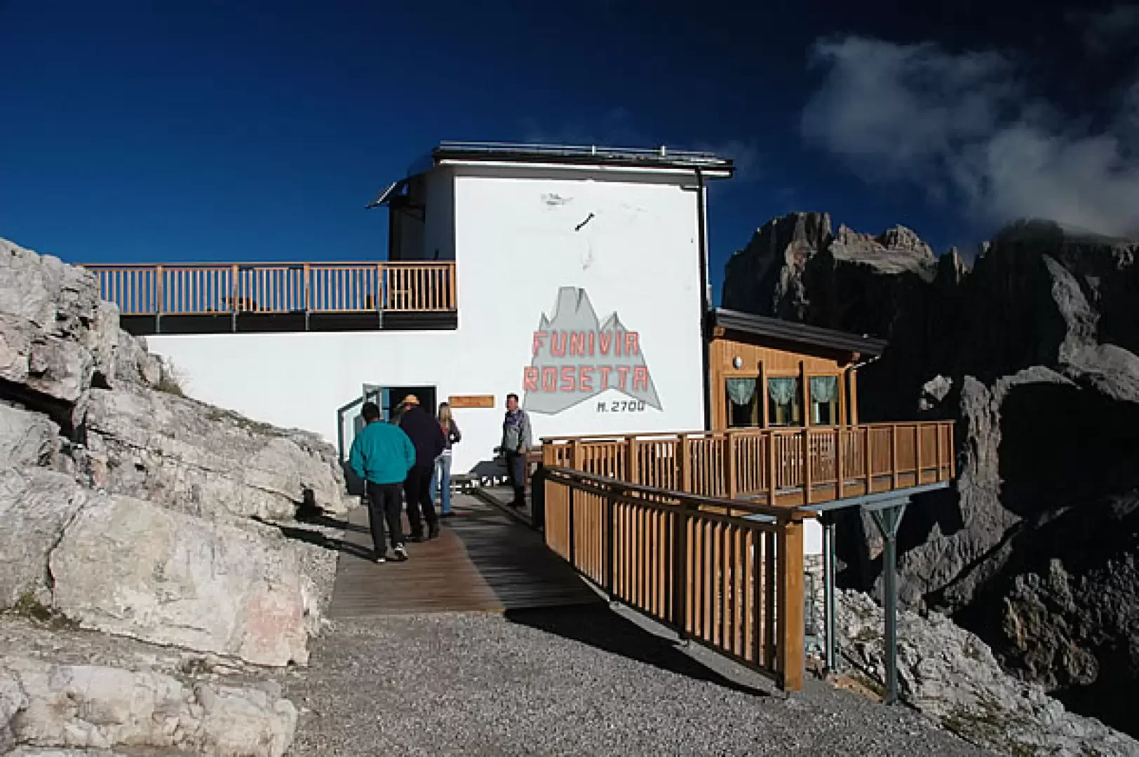
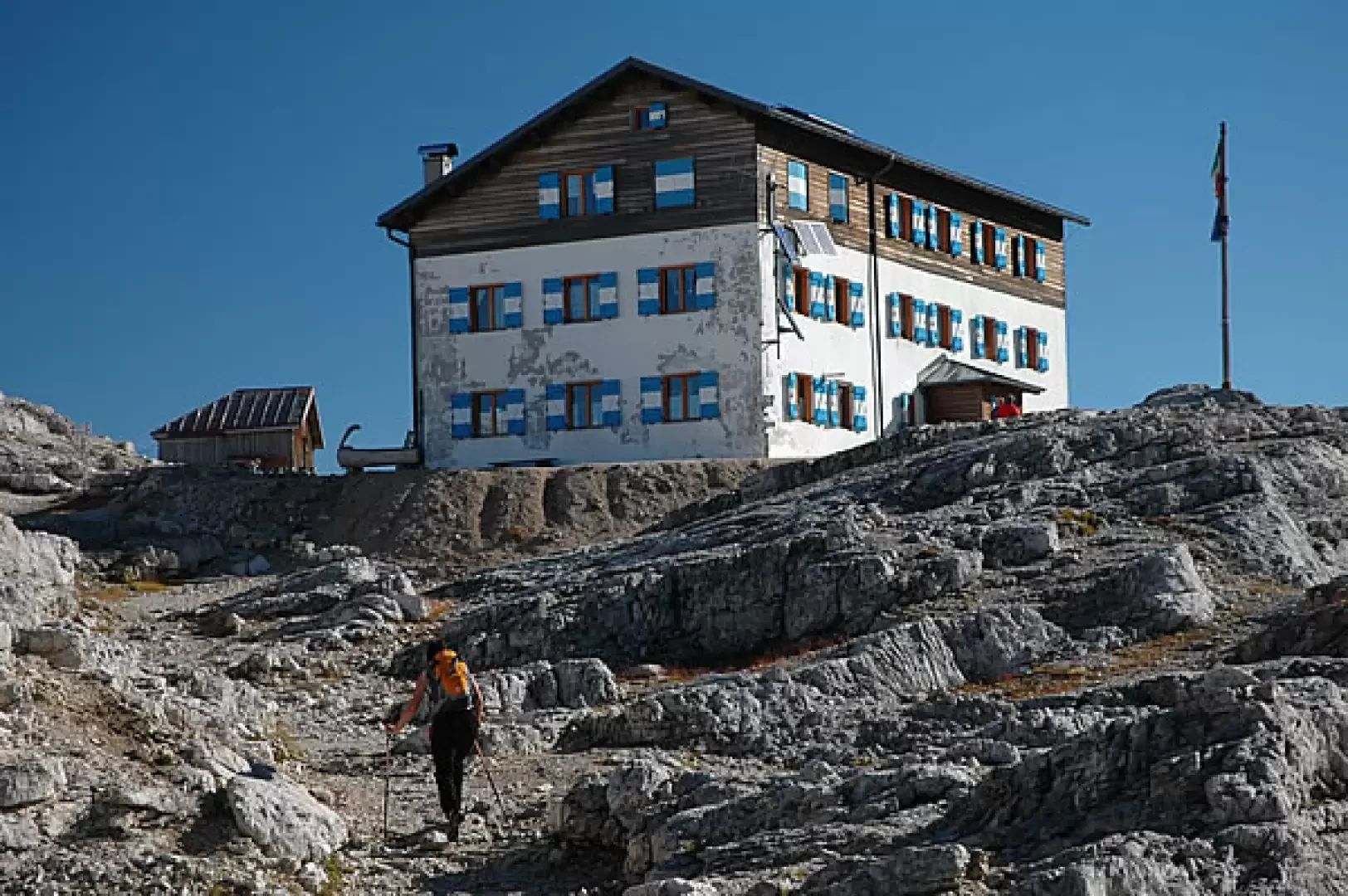
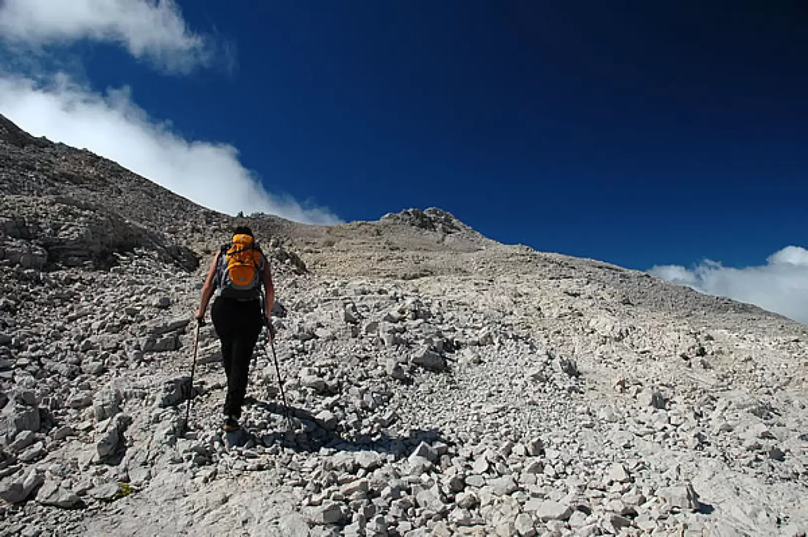
Leaving the Rosetta cable car (2,700 m), descend the wide path that leads to the Rosetta Pass (2,572 m, 0h10') and the junction with path no. 701 coming from San Martino di Castrozza. Continue to the right, slightly uphill, until you reach the Rifugio Rosetta "Giovanni Pedrotti" (2851 m, 0h15').
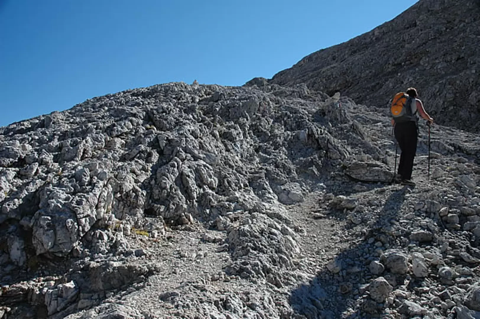
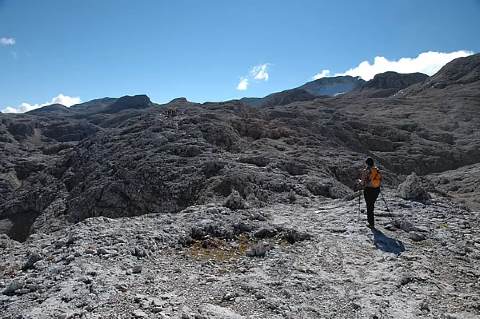
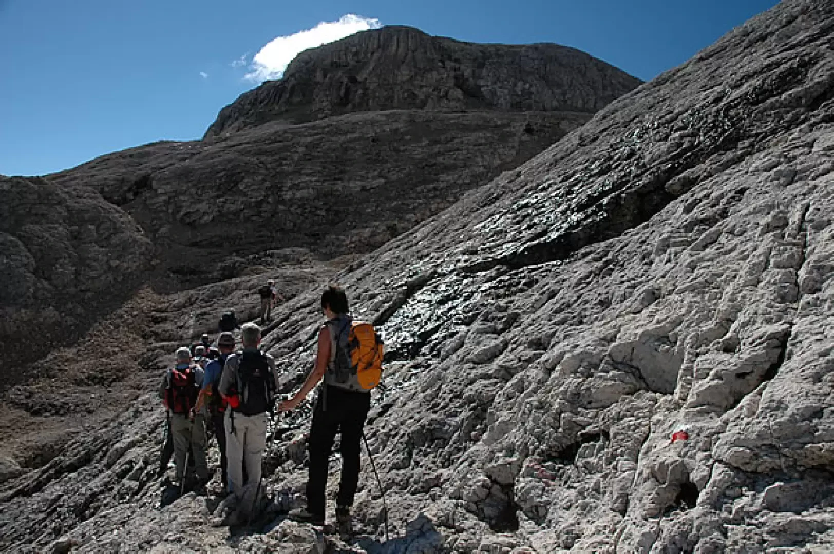
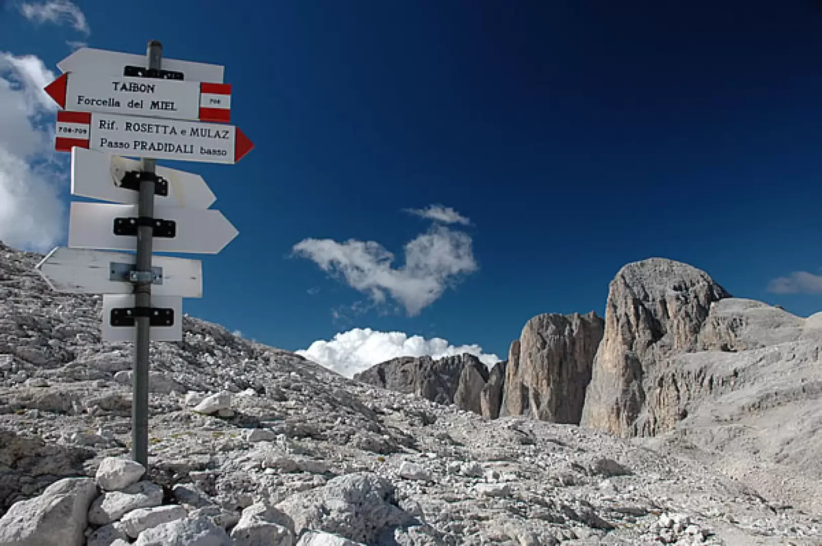
From the refuge, proceed on the flat until you come to a fork: turn right following the signs for Sentiero N° 707-Sentiero N° 709 and begin to walk through the unique environment of the Altipiano delle Pale. After a short descent, climb up a wide notch between corrugated rocks, witnesses of great geological variations. We reach a small collar where the boundless expanse of the Altipiano appears: here the emotions conveyed between the lines of Dino Buzzati's 'Desert of the Tartars' come true! In the distance, Punta Fradusta appears for the first time and the path still to be bridged to reach it. The path, which is always evident and well signposted, emerges in the lunar environment amidst suggestive mountain conformations. We follow a few ups and downs until we reach the bifurcation between Path No. 707 and Path No. 709: we continue to the right, on Path No. 709 skirting the arid slopes of Cima di Scarpe. One enters a small rocky valley and then comes out onto a plateau; one proceeds on a few slight ups and downs until one ascends a short sloping slope which leads near Colle Pradidali Alto: one reaches the crossroads for the pass (2710 m, 1h15'), one overlooks it, and continues straight on, letting oneself be lulled by the splendid silhouettes of the peaks which surround the upper Pradidali valley.
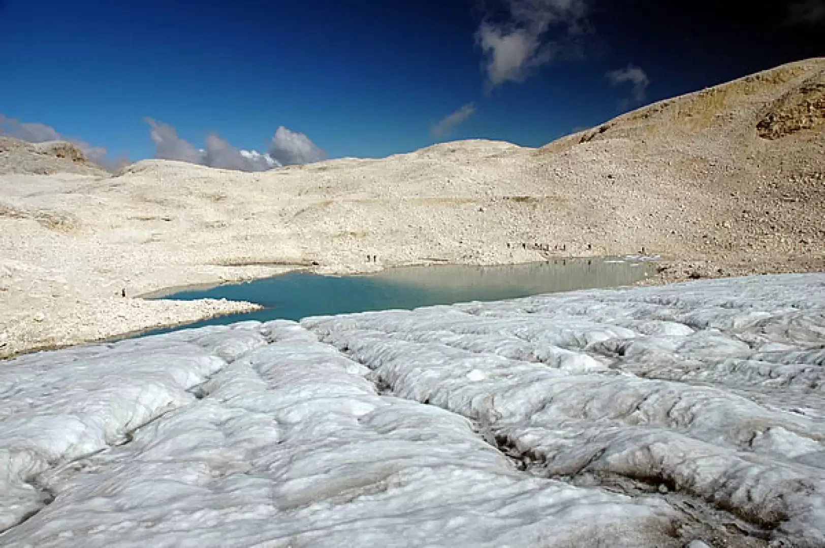
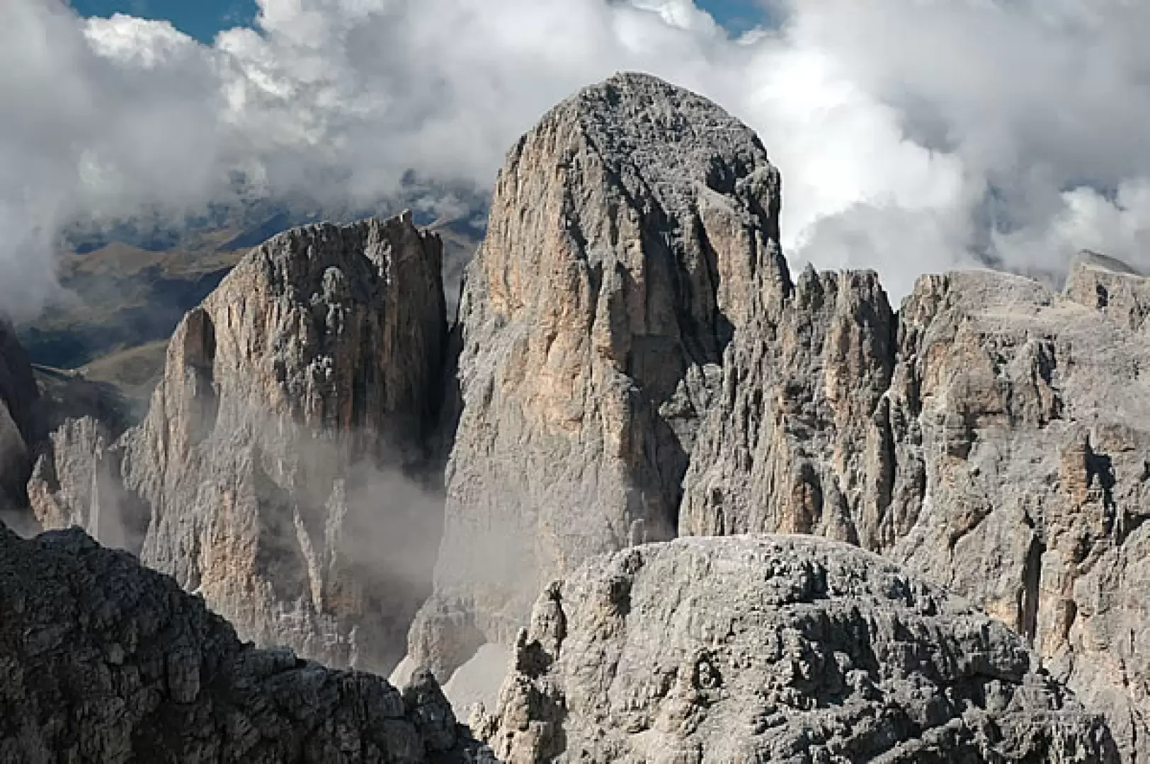
We continue around the ridge of Cima Tomè (2748 m) until we reach the lower Pradidali Pass (2658 m, 1h25'). Neglect the descent to the right and continue straight on, slightly uphill, until you reach the wide catchment area of the Fradusta glacier: at the junction of Col Fradusta (2680 m, 1h35') continue to the left, descending to the edge of the small lake of the same name, and then begin the ascent, keeping the glacier on your right until you reach a col (2750 m, 2h20'). Now turn right and follow the path that climbs towards the summit; after a sustained climb, the slope descends until reaching the final crest: one last effort and you finally reach Punta Fradusta (2939 m, 2h45').
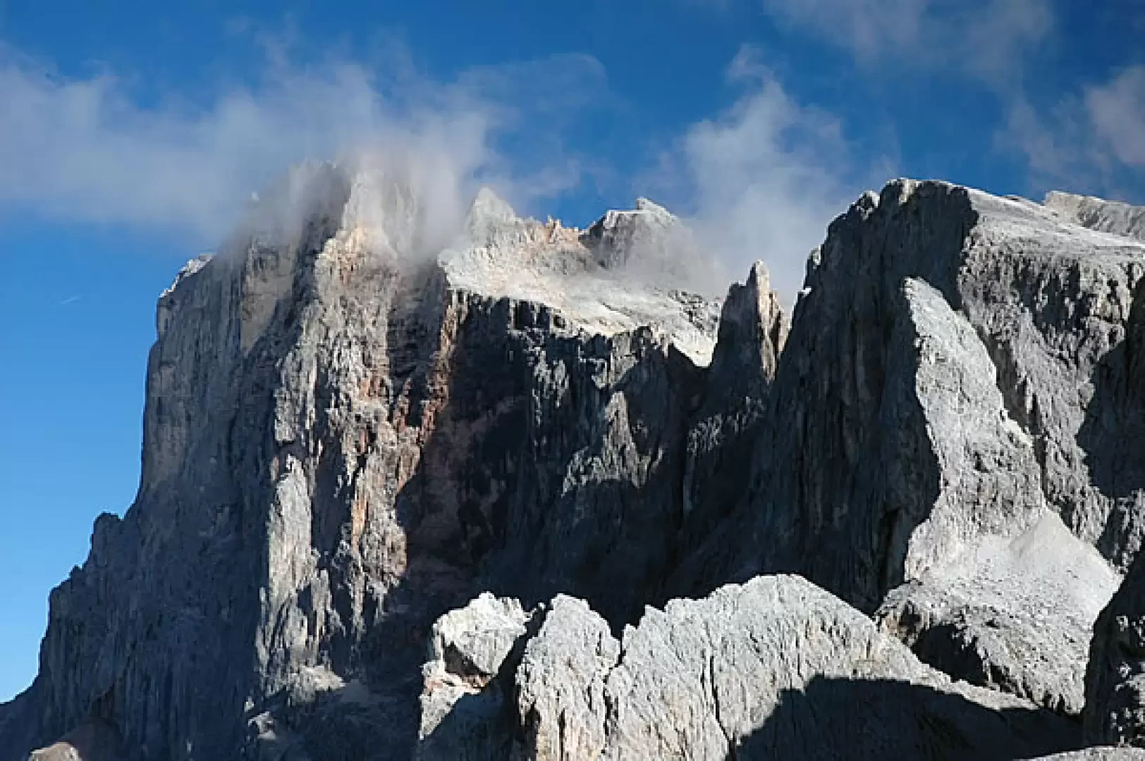
From the summit the panorama is nothing short of exceptional: in the foreground the Pala di San Martino and the Immik and Pradidali peaks; in the background, however, the majestic "skyline" of the Cimon della Pala and the Cima di Vezzana, an experience not to be missed!
Bibliographic references
- Tabacco, Pale di San Martino, sheet 22, scale 1:25,000, Udine
Photo gallery
Comments (0)
Sign in to leave a comment