Cima Eyenhorn and Monte Massone, from Alpe Cortevecchio


Edited by:
Marco Bonati
Updated at: 03/09/2024
Access
From Milan, take the A8 autostrada dei Laghi and then, at Sesto Calende, continue along the A26 in a northerly direction to its end. Without any detours, continue on the motorway to Domodossola until the Ornavasso exit. Drive through the village, and immediately after the bridge over the only stream, turn left uphill towards the Sanctuary of the Madonna del Boden. Just before the Sanctuary - signposted - you leave the main track and turn right following the sign "Rifugio". From here, the road, still asphalted, becomes very narrow and steep: follow it without too much difficulty until Cortemezzo 1300 m approx. From here, non-off-road vehicles may have difficulty: the last 3 km are very bumpy. Park in a small square in Corte Vecchio.
.Introduction
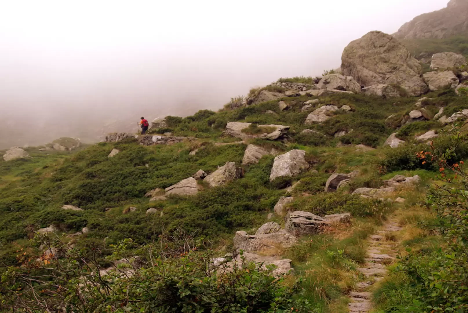
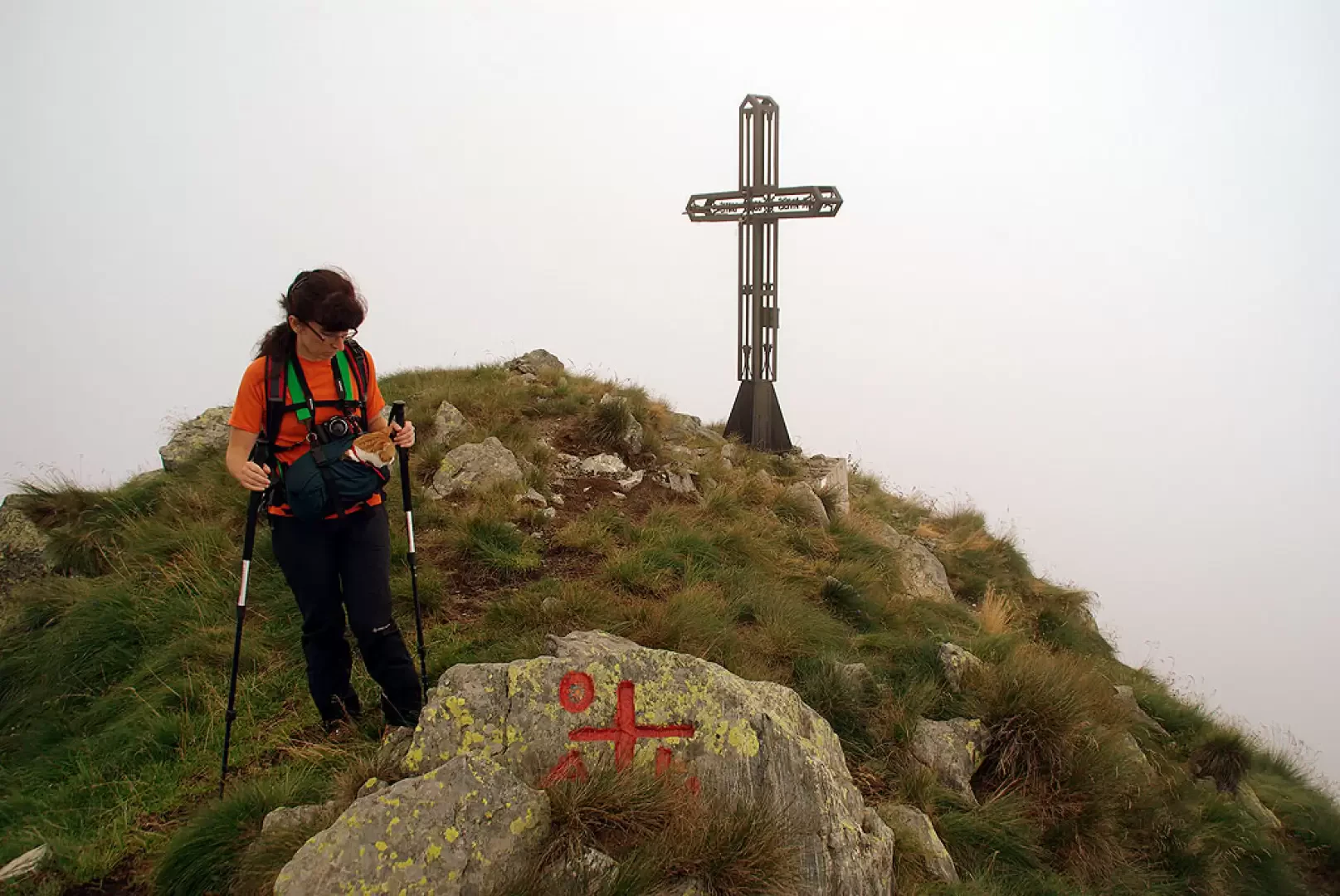
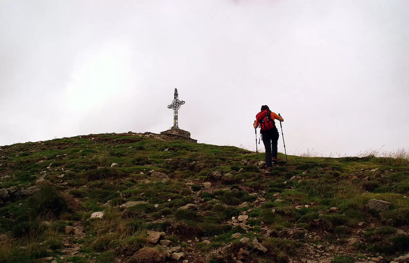
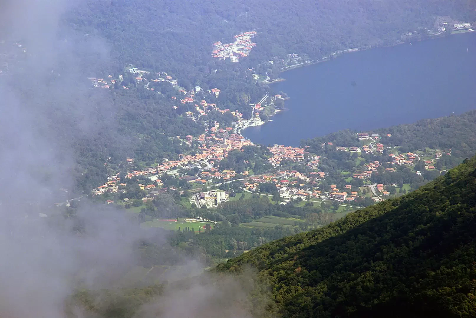
Interesting excursion for the views (in summer, likely fog and clouds from Lake Maggiore) and a visit to the military structures of the Cadorna Line. On reaching the summit of Monte Massone, it is traditional to ring the bell located at the top of the summit cross. If you do not arrive at Corte Vecchio by car, the route is about an hour longer.
Description
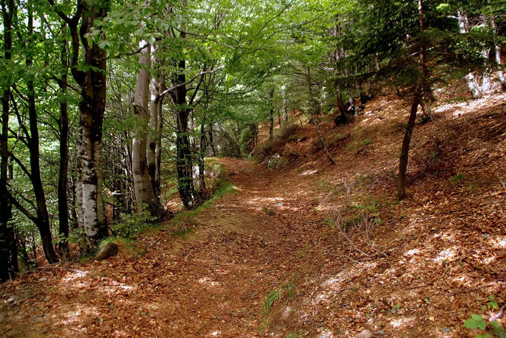
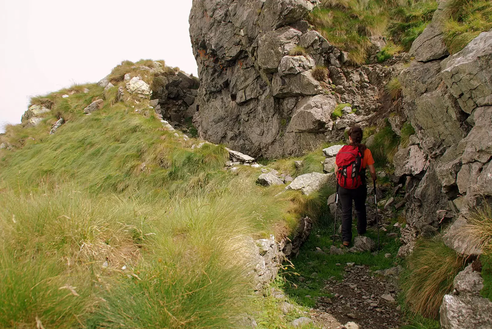
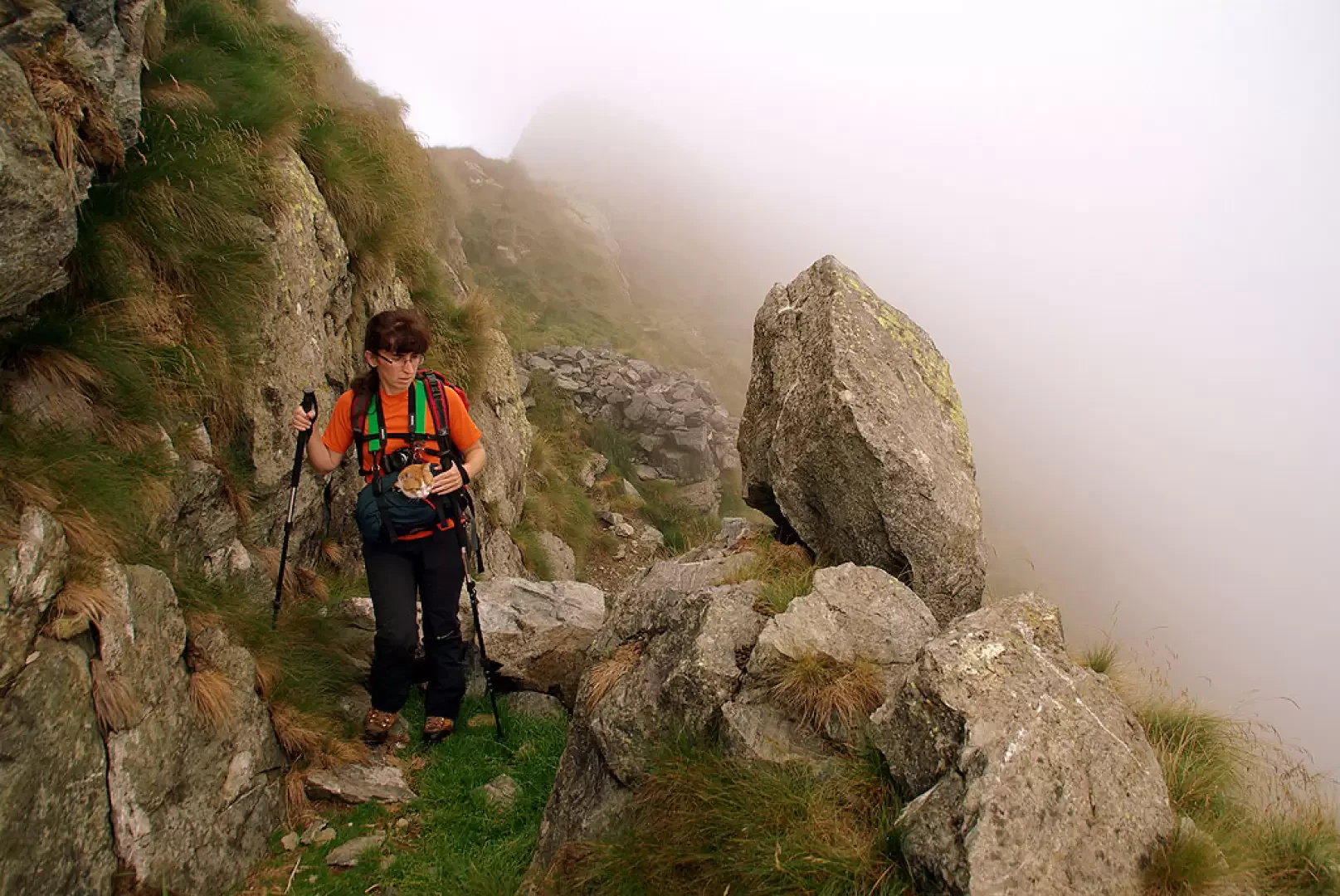
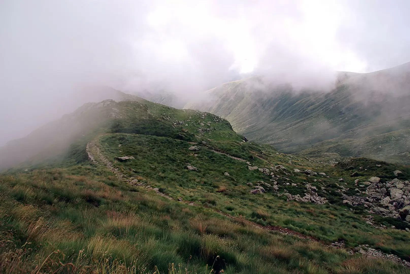
From the alpine pastureland of Cortevecchio 1535m (huts restored to holiday homes), continue briefly on a cart track closed to unauthorised traffic as far as the Gravellona Toce Refuge; from here the route - which has become a path - enters a luminous beech forest on the flat and leads into a small valley, which is climbed in narrow bends, covered on each side with dense rhododendrons. After the first ascent, the path widens out and allows us to recognise the typical structures of the military road: the traverses become longer, the hairpin bends are widened with retaining walls, the depressions are levelled almost like short viaducts. In this way we arrive at Bocchetta 1904m - signposted - and continue on abandoned pastureland to the right, in view of the peaks to be reached; a signposted junction shows us the rough route to Cima Eyehorn 2131m, which is reached on sight and with a few makeshift cairns. Cima Eyehorn is actually a high point at the low end of the crest of rocks and grass that forms the border between the Ossola and Strona Valleys. The route resumes towards Monte Massone, juggling carefully between sheep tracks and sharp boulders on the edge of the ridge; often leaning on the southern slope, until you come across paths from the valley leading to the trenches and emplacements dug (but left unused) in the hypothetical defence of the Ossola Valley in 1915/16. Once the path softens, along the wide stony ridge, in about 50 minutes you reach the summit cross of Monte Massone. On a clear day, the view encompasses the basin of Lake Maggiore, the whole of Lake Orta, the peaks of the Valgrande National Park and nearby Monte Rosa on the Macugnaga side. For the descent, it is unnecessary to retrace the ridge trail of the outward journey, but you reach the junction before the Cima Eyehorn by a parallel, lower path. From here to Corte Vecchio on the same route as the ascent.
Bibliographical references
- Paolo Crosa Lenz, Valle Strona - sentieri nella storia e nella natura, Alberti Libraio Editore, Verbania, 2000
- Omegna - Varallo - Lago d'Orta, Carta escursioni e sci alpinismo foglio 97, 1:50000, Kompass
Photo gallery
Comments (0)
Sign in to leave a comment