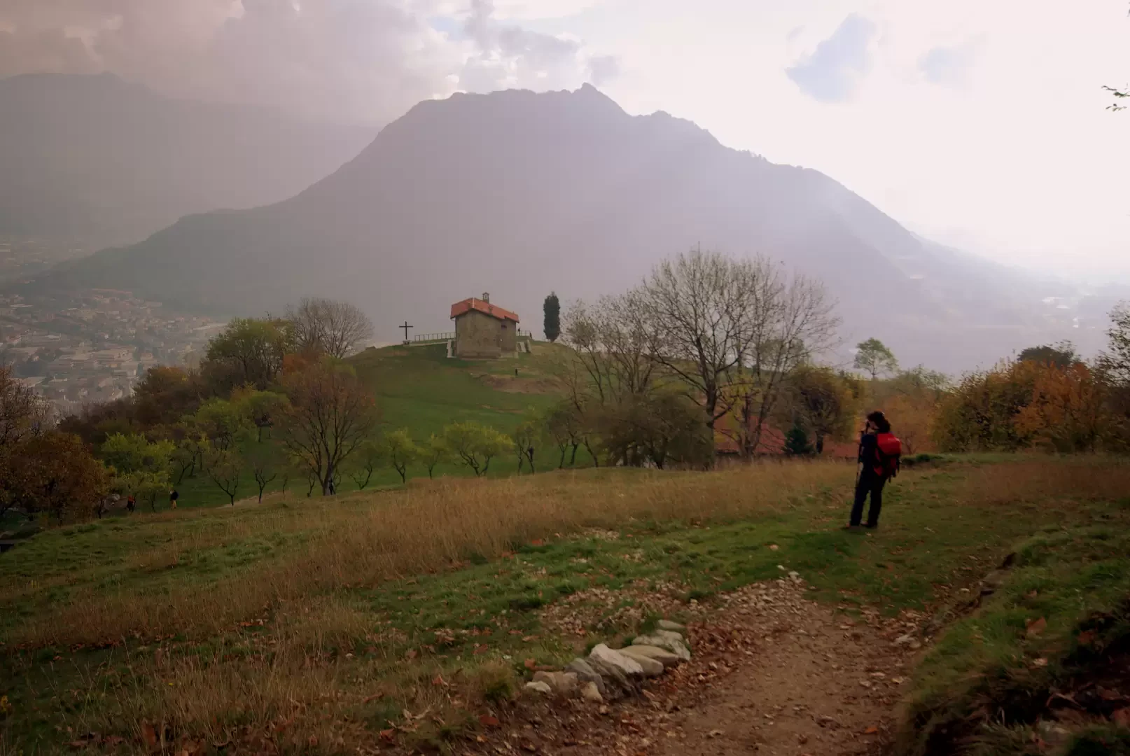
Corno di Canzo orientale, from the Sanctuary of San Martino


Edited by:
Marco Bonati
Updated at: 04/05/2025
Access
From Milan to Valmadrera along the state highway ; from the exit junction, follow the signs for the cemetery, where the large squares are also organised for walkers with a special path and signposts.
How to get there with GMaps
How to get there with Apple Maps
Introduction
The area of the Corni di Canzo is a classic destination for hikes of every taste and difficulty: from the didactic trail, to via ferratas, to alpine climbing. The combination of routes described leads from the plain to the summit of the Corno minore in the most direct and challenging way. There are many sections equipped with chains for progression only, even very exposed or at risk of 'bathing'. Signposts are plentiful and all forks are signposted with poles; non 'canonical' paths are ignored and cause doubt (there are many and still used by locals); on the ground, there are too many signs in paint and of all colours (every hiking society and mountain race organiser has left its brush strokes).
Description
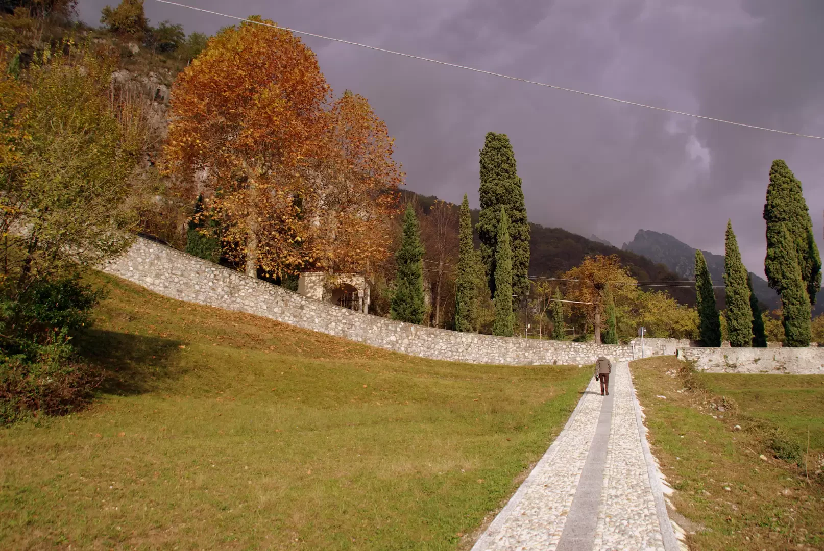
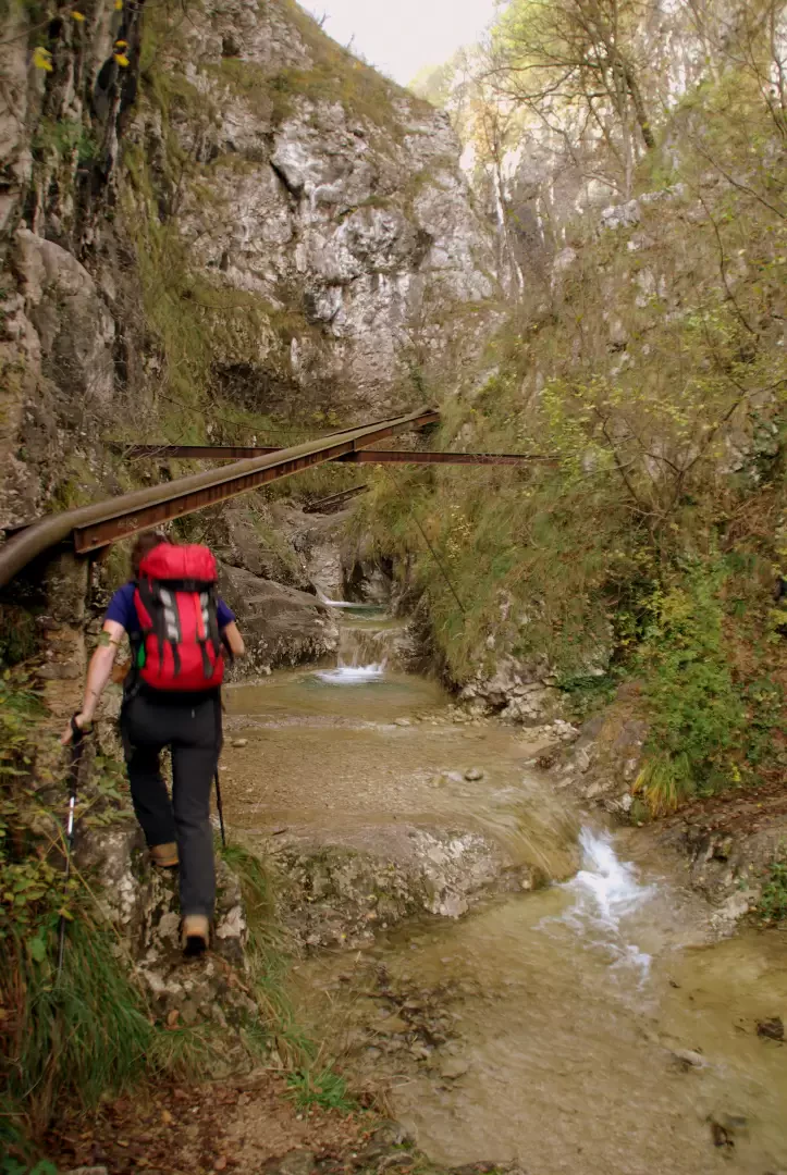
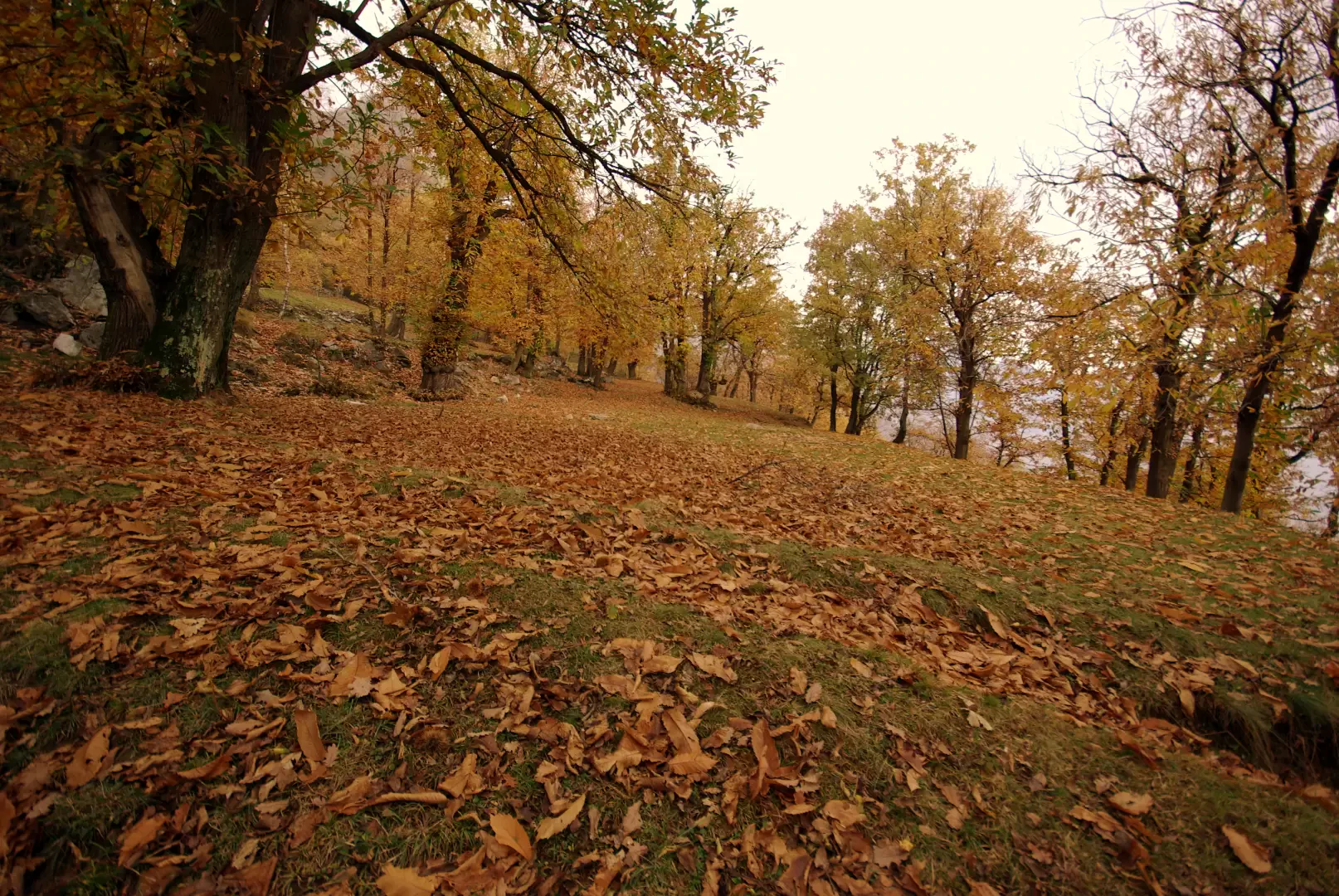
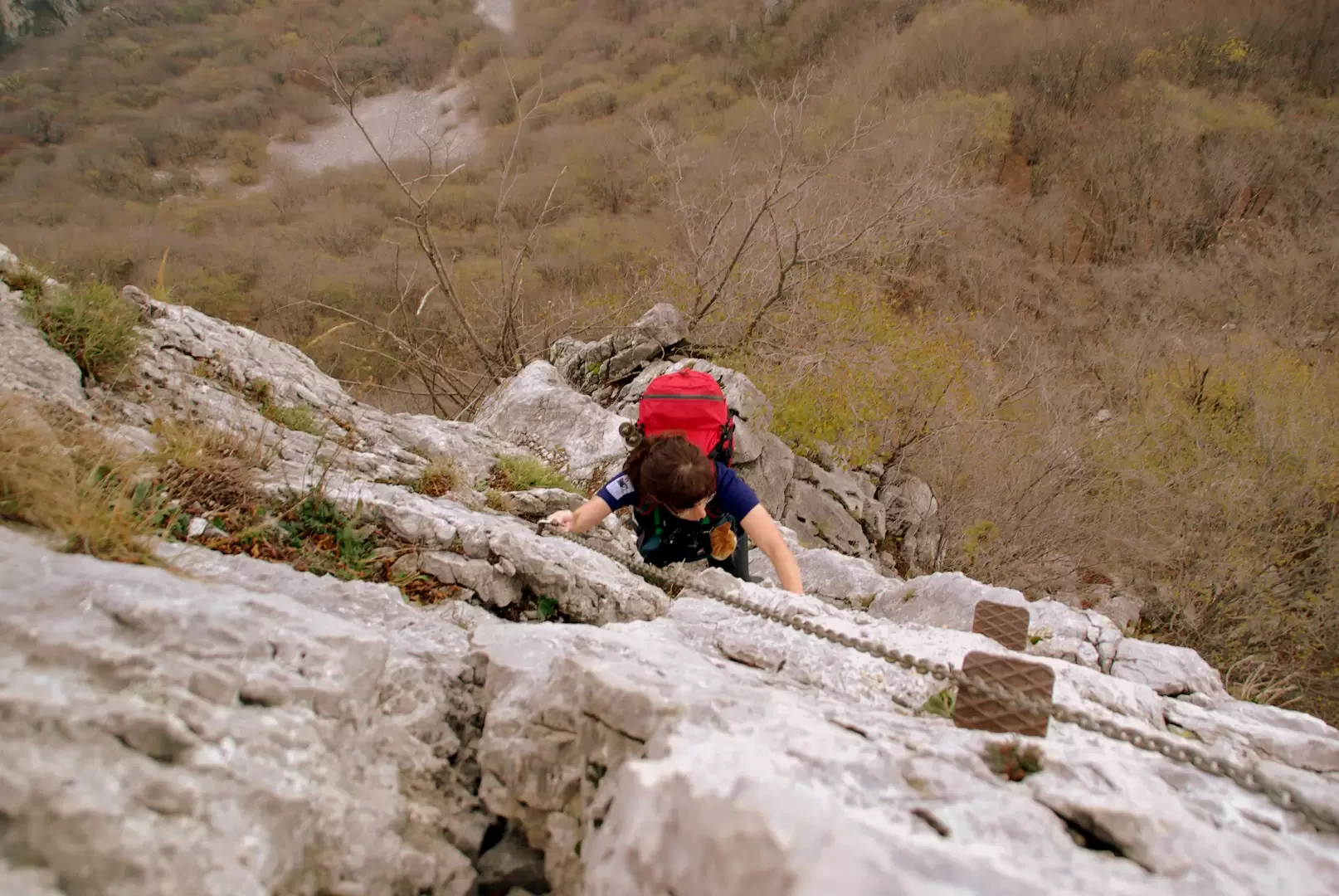
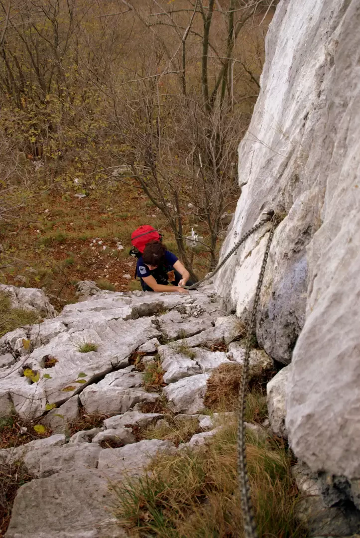
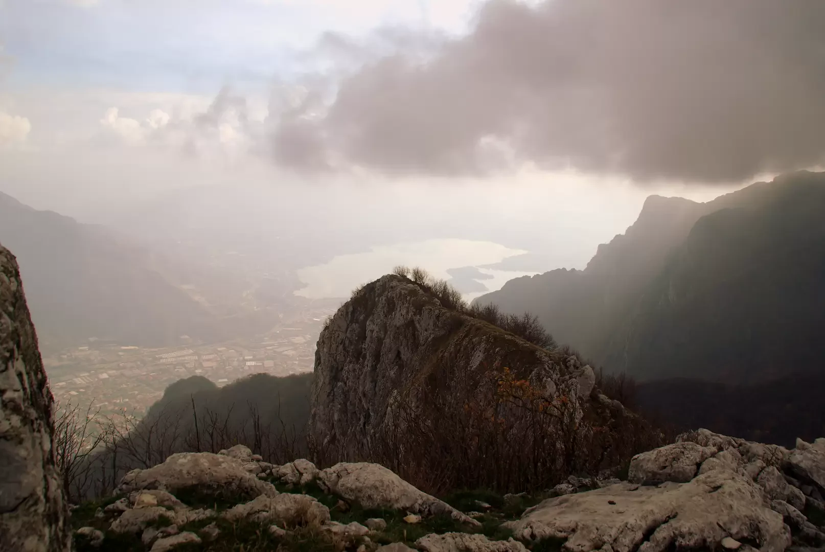
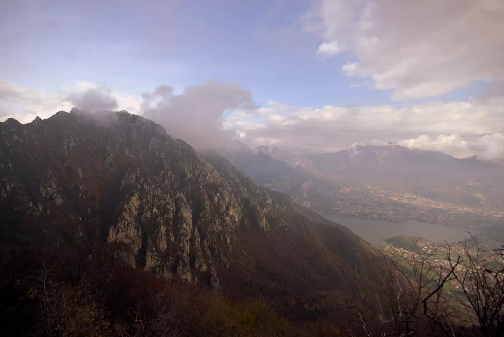
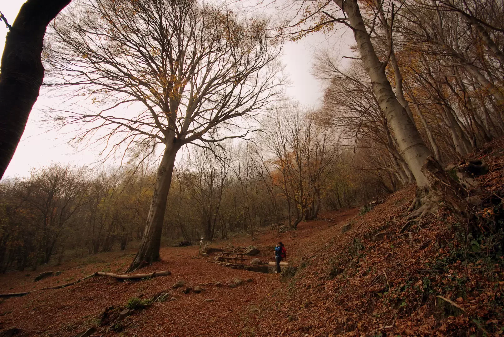
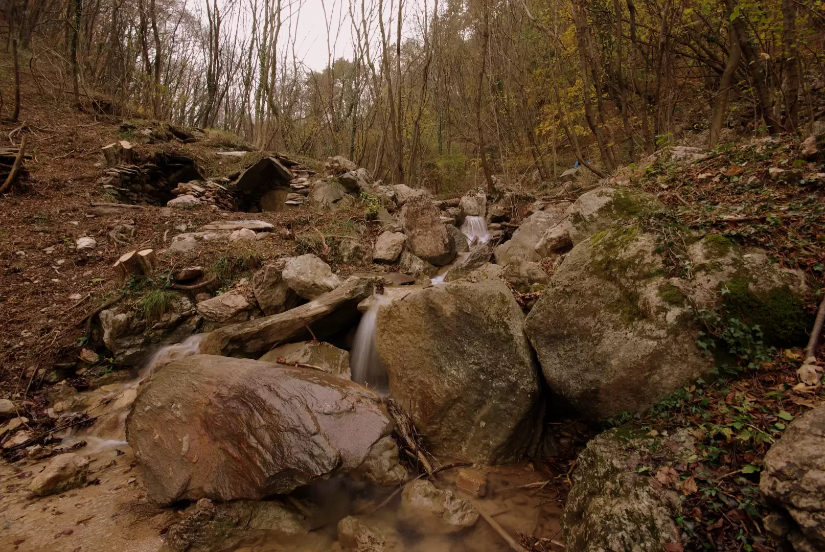
From the highest square of the cemetery 288 metres above sea level, we take the recent cobbled path leading to the avenue-viacrucis of the sanctuary of the Madonna di San Martino. Behind the first chapel we encounter on our way up to the left, we find the little path that immediately enters the ravine of the Molinata Valley, which is crossed by the Inferno stream. The track, to be followed carefully, avoids the bottom of the riverbed with traverses on the banks where the use of hands is indispensable for progression. At times, an old penstock approaches, taking water from a small dam upstream: in the sections suspended in the void, it is neither solid nor reliable. The path continues up the torrent along the edges of beautiful pools and natural pools, with intermediate waterfalls that force one to exit into the forest to gain the corresponding difference in altitude. The passage of the 'cascada de la scaléta' is remarkable, with steps carved into a rather vertical and always wet wall. In the event of excessive flow in the riverbed, escape routes can always be found among the bushes on the eastern bank. When the route has overcome most of the difference in altitude, one heads into the bush to reach a marked track to the right. (You are at Tajasass 623m, so called because of the exploitation as granite of ancient erratic boulders deposited here by glaciers from the Adda valley). The route continues on level ground to the beautiful and very popular locality of San Tomaso 580m; having passed the open-air tables of the refreshment area, we turn immediately left and, amidst beautiful chestnut woods, climb up the western slope of Corno Rat. We approach two recently restored milk sheds 700m and, with an increase in gradient, reach the ridge above Corno Rat (Colle del Gatton 900m approx.) near the exit of the ferrata. From here, we begin to follow the southern shoulder of the eastern Corno di Canzo, which alternates between the forest and rocky ridges equipped with chains. These are all very articulated walls (the chains, which are very loose, are mainly of psychological value) and each has a side escape path. The real difficulty is the last surge - of about 15 metres - on vertical slabs with few artificial holds. At the end of the difficulty, on broken rocks, you come out onto the summit meadow. There is a beautiful panorama of Monte Moregallo, Lecco, Monte Barro and the Brianza lakes.
For the descent, you go to the nearby Bocchetta di Luera 1200m approx. and, following the steep path , you reach the "Acqua del Fò" spring 1000m (monumental beech); the track continues in the valley, barely visible among the foliage, and reaches the uphill path near the Corno Rat saddle. If the path is lost, it is useless to waste time looking for it: in this case, it is better to continue leftwards in a gentle descent following the slopes of the luminous beech wood; a clearing with marshy ground anticipates an increase in the gradient towards the rivulet at the bottom of the valley; continue tending slightly towards the confluence with the watercourse and you will find yourself on a wide, stony mule track that has fallen into disuse: in a few dozen metres, you will come out above the Luera milk huts. From here you return to San Tomaso on the same route as the ascent. Alongside the row of almond trees (the only ones in the province of Lecco, it seems) you come to the edge of the terrace of meadows and spot a bifid track that descends to the valley: take the one on the right and with numerous hairpin bends through the woods you reach the hamlet of Ceppo di Valmadrera. Cross the Inferno stream over a modern bridge and climb up the other bank via a flight of steps: you find yourself on the via crucis, just downstream from the initial cobbled path.
Objective Danger: Rocks moved by mouflon
Exposed Sections: Sections with only chain
Photo gallery
Comments (0)
Sign in to leave a comment