On the Resegone paths

Edited by:
Rita Tarussello
Introduction
The Resegone rises with its dolomite walls east of Lecco, marking the border between the provinces of Lecco and Bergamo. Its spires, all between 1600 and 1875 metres, are arranged from north to south almost as if to form a saw (resega, in Lombard dialect), hence the name. Punta Cermenati (1875 m) is the highest peak and is placed in an almost central position in relation to the other peaks. The western, Lecco side has steep walls and deep gullies. The ascent routes are generally steep and demanding. In addition to numerous climbing routes, this slope is also home to four via ferratas of varying degrees of difficulty, one of which is considered among the most difficult in the Lombard Pre-Alps. The Bergamo side, the eastern side on the Imagna Valley, is conversely gentle and wooded almost to the summit and is much frequented in winter by ski mountaineers. The itinerary illustrated here completes a loop starting from Erve (596 m) on the Lecco side, climbs directly to Punta Cermenati touching the Capanna Alpinisti Monzesi and ascending the Val Nigra gully, then descends on the Bergamo side to intercept the Resegone and DOL (Dorsale Orobica Lecchese) loop. It then continues in a southerly direction to Passo della Porta and from here returns to the western slope, descending to Passata. Returning to the Lecco side, the trail finally descends to Erve passing the Sorgente San Carlo.
Description
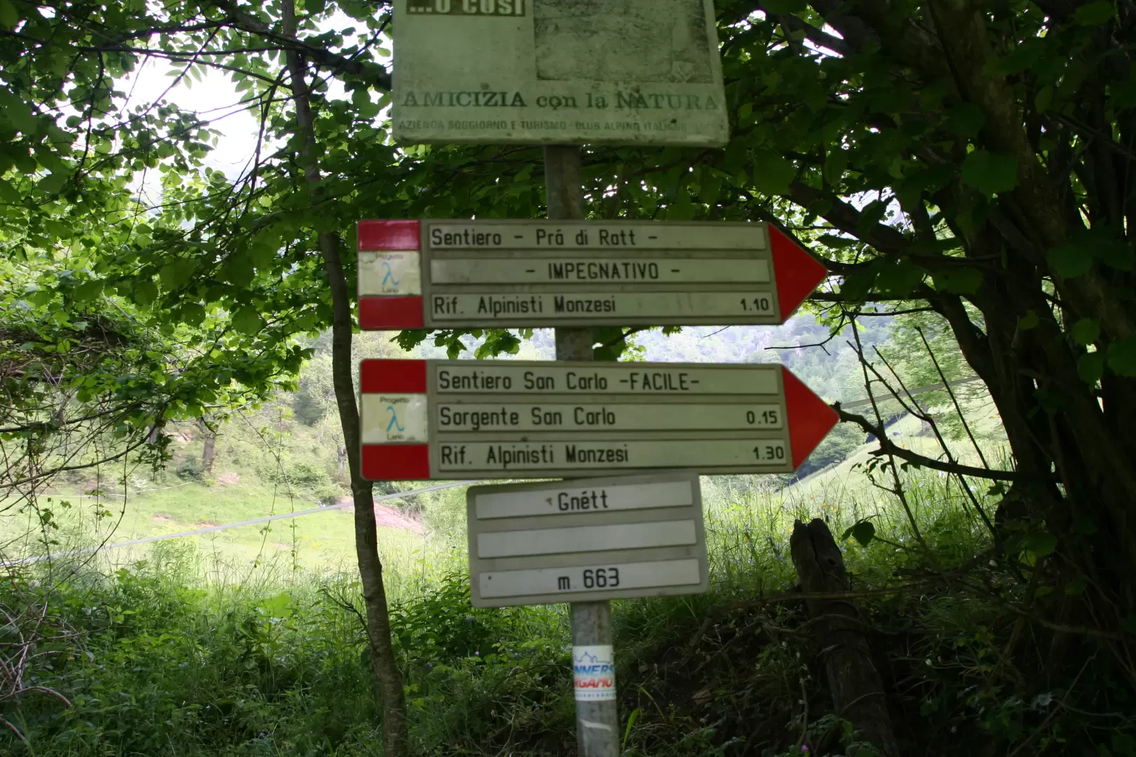
Leaving the car at the Erve car park, continue along the road along the Gallavesa stream on an easy dirt track, which is cemented in places. Once in the locality of Gnètt, a system of small wooden bridges allows the stream to be crossed. Immediately afterwards, a path through the trees is visible on the right that forks in a few minutes (25'). A marker indicates on the left the variant of the no. 11 or Pra di Ratt path, which, at times with narrow serpentines and at times for the steepest gradient, climbs into the forest until it reaches a beautiful panoramic traverse with a view of the Creste Sud. The route is now almost flat for a short stretch, but soon begins to climb steeply again. We then reach a crucifix and a crossroads (arrival of the path to the San Carlo spring). Go past a fountain with a basin and climb up to the Capanna Alpinisti Monzesi (1173 m, h 1:40').
The path starts off again immediately behind the hut with an initially moderate gradient and shortly afterwards meets the junction for the Sentiero dei Solitari path, which heads to the Creste Sud. Continue straight ahead for a steeper section through the trees. You will then reach another fork and the signpost for the Val Nigra gully on the left (h2:15').
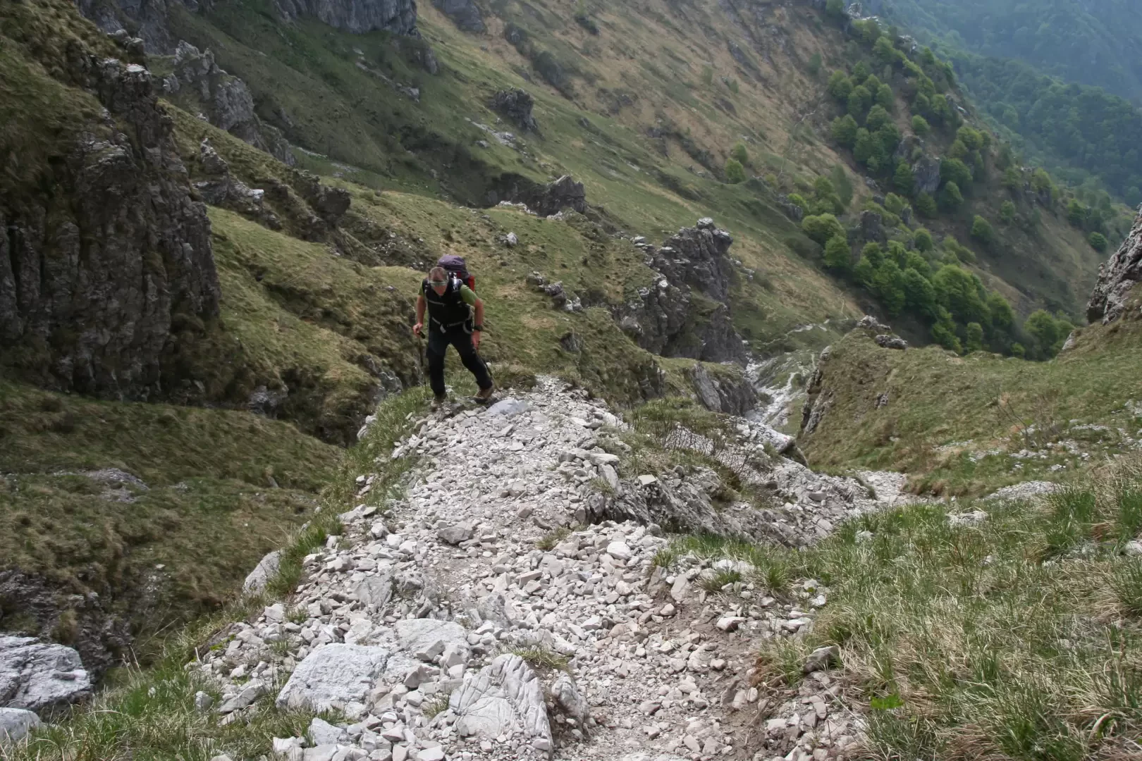
You then leave the shady area by taking a traverse between rocks and boulders, and then climb steeply up a rib with grass and stones, following the marks that lead directly into the gully, which becomes steeper and narrower. This takes you into the gorge below the Azzoni refuge, which is visible for much of the strenuous climb.
At a slightly more severe bottleneck, you have to look for the best route (on the right), after which you can see the trace of path no. 1, the normal route to the Azzoni refuge on the Lecco side, at the top left.
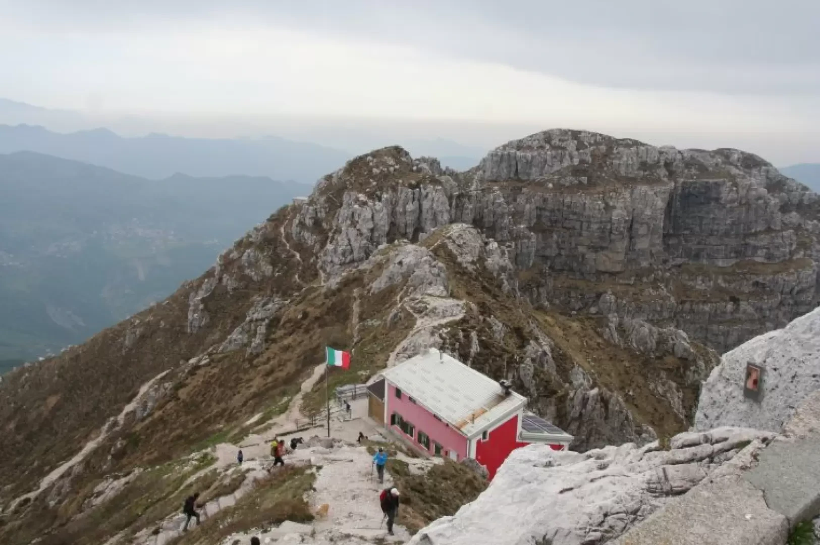
Reaching the junction with path no. 1 and passing more easy rocks, you can find the path to the right. 1 and overcome other easy rocks, you finally set foot on the terrace of the refuge (1860 m, h 3:25'), from which, with a last short effort, you reach the summit cross (1875 m, h 3:35').
After a well-deserved break to admire the panorama over the plain and lakes, the Grigne and the mountains of Valtellina and Bergamo, we descend to the Orobic side, taking the path to Brumano (no. 571-17) which descends in many stony rivulets to the beautiful beech woods. The slope is now much gentler and the pace relaxed. Pay attention to the signs, however, so as not to take the wrong path.
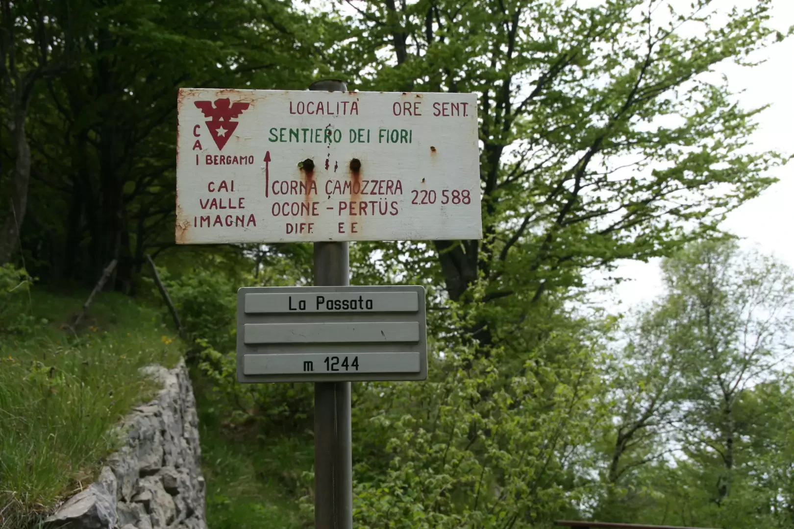
We then come to and take path no. 576 or Anello del Resegone on the right, which winds its way through beech woods with a long up-and-down traverse (panoramic view of the Costa del Palio and the soft horizons of the Imagna Valley). Continue following the signs for La Passata; ignore the track that goes up to the Solitari and continue above the Zucchero huts and, still with small ups and downs in the beech wood, you reach the Passo Porta (1123 m, h 5:45'). From here, other markers indicate to the right the path that climbs more than a hundred metres in height and finally reaches the Passata (1248 m, h 6:15'), the point where the Lecco side of the mountain comes down. At the pass, there are signposts for the various itineraries, including that of the Via delle Creste, and that for the Alpinisti Monzesi hut. An ancient boundary stone between the Duchy of Milan and the Republic of Venice is also clearly visible. Immediately afterwards, on the path to the Alpinisti Monzesi hut, the remains of the old mines can be seen.
The path back to the Alpinisti Monzesi hut is a continuation of the Resegone ring, which, like the eastern part, unravels inside the woods with gentle ups and downs. From the hut, descend to the crucifix encountered on the way up and take the easy path to Erve, passing the Sorgente San Carlo. The path descends into the woods with a steeper gradient, taking you now to the left and now to the right of the Gallavesa stream until you reach a spring at an altitude of 774 m (Sorgente San Carlo) in an equipped lay-by (h 8:00).
With no further difficulties you descend to the locality Gnètt and, having crossed the stream for the last time on the wooden spike, you take the nice dirt track back to Erve. Total time h 8:35 including stops.
General information
Signposts: (6), s.n. and (1)
Type of route:circular
Recommended period:March, April, May, June, July, August, September, October, November
Objective hazard: take care with some passages over rocks in case of wet ground
Sun exposure:southeast
Exposed sections:
Galleria fotografica
We have been there

Edited by:
Ermanno Panara
sui sentieri del Resegone
bella gita, caratterizzata da una prima parte impegnativa ed un lungo ritorno turistico. Il cielo velato ci ha indubbiamente aiutato nella salita del Canalone di Valnigra, altrimenti torrido. In vetta un vento gelido ci ha fatto rimanere solo pochi minuti, e una leggera pioggia ci ha accompagnato per gli ultimi tratti del ritorno. Molto bello il gruppo di camosci in muta, nel Canalone di Valnigra, per nulla intimoriti della nostra presenza. Avvistamenti faunistici: Rupicapra rupicapra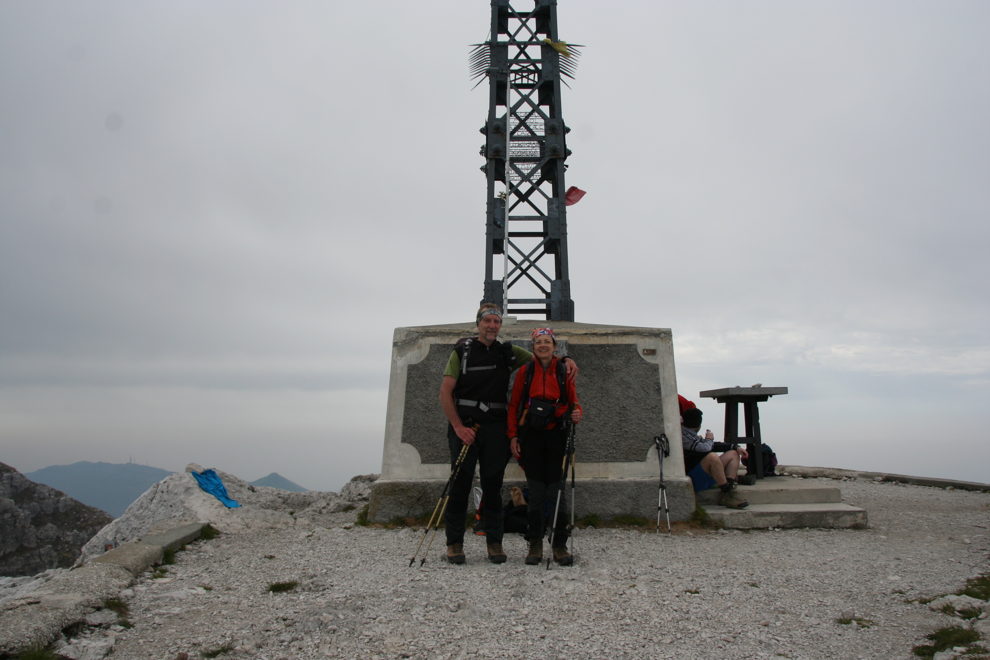
Edited by:
Ermanno Panara
sui sentieri del Resegone
bella gita, caratterizzata da una prima parte impegnativa ed un lungo ritorno turistico. Il cielo velato ci ha indubbiamente aiutato nella salita del Canalone di Valnigra, altrimenti torrido. In vetta un vento gelido ci ha fatto rimanere solo pochi minuti, e una leggera pioggia ci ha accompagnato per gli ultimi tratti del ritorno. Molto bello il gruppo di camosci in muta, nel Canalone di Valnigra, per nulla intimoriti della nostra presenza. Avvistamenti faunistici: Rupicapra rupicaprabella gita, caratterizzata da una prima parte impegnativa ed un lungo ritorno turistico. Il cielo velato ci ha indubbiamente aiutato nella salita del Canalone di Valnigra, altrimenti torrido. In vetta un vento gelido ci ha fatto rimanere solo pochi minuti, e una leggera pioggia ci ha accompagnato per gli ultimi tratti del ritorno. Molto bello il gruppo di camosci in muta, nel Canalone di Valnigra, per nulla intimoriti della nostra presenza. Avvistamenti faunistici: Rupicapra rupicapra