Moregallo is a peak in the Larian Triangle that is not very high but interesting because its very panoramic position overlooking the lake and the plain, as well as its limestone conformation, offer the hiker routes that are always challenging and of significant height difference. The route to Canalone Belasa, rated as a ferrata, is rather a low-altitude mountaineering route, very demanding and with difficulties of various kinds: climbing steps without belaying, overcoming landslide sections, jumps equipped with chains but only in the most demanding situations. Last but not least, not to be underestimated, is the climb up a very steep meadow that becomes slippery in wet weather. Ferrata equipment is mostly unnecessary, as the equipped jumps are rather short. Better, if necessary, to use a rope to belay those who find themselves in difficulty. To be tackled in any case with due experience and training.
Description
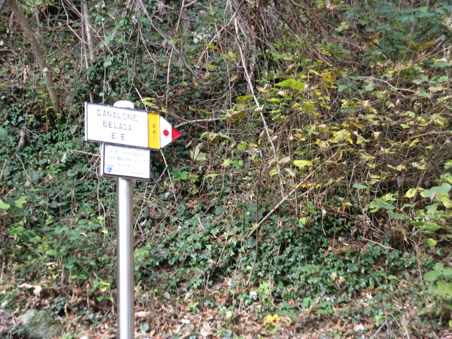
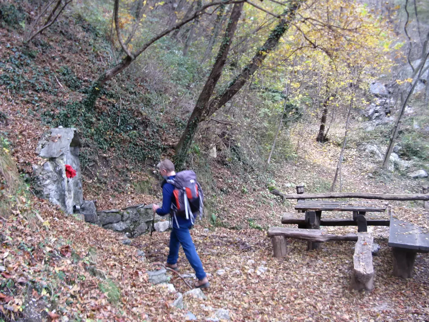
Leave the car and continue along the cobbled path which, after two hairpin bends, reaches the small VARS chapel. A marker indicates, among others, path no. 7 to Sambrosera. Climb up into the forest in a north-north-westerly direction with a constant, moderate slope until, after about an hour, you reach the crossroads at the Sambrosera spring and the Canalone Belasa signpost. One enters the canal among pebbles, stones and shrubs. The route is marked with red marks that at times need to be looked for carefully because they are not very evident. One proceeds among the vegetation and rocks with a sustained slope, alternating easy climbing stretches with sections of landslide path. The first equipped wall is now encountered, which presents no difficulty, followed by a section of small rocks and debris, then the second compact rock jump equipped with a chain. One continues in easy climbing on small rocks for a fairly long stretch; at times one has to face somewhat more challenging passages. The third equipped jump is a chimney that is not very long but rather problematic in its upper part due to the difficulty in finding holds. Once past this passage, continue along rocks until you find another jump where the chain is very useful in overcoming the rock that is poor in holds. Just a little further on you come to another equipped passage that can be climbed to the right with the indispensable help of the chain, or to the left, using the more grippy edge. The gully is now narrower, but the altitude reached allows a nice view of the lakes and the plain. In front, the Moregallo ridge is getting closer and closer. There are two equipped jumps to be climbed, less demanding but still tiring, after which you have to climb 'on all fours' up the very steep meadows below the Cresta Ovest. Use great care not to slip. After crossing and ignoring a level path, continue climbing up through the grass until you come to a second path that cuts across the meadow. From here, you can either ascend until you reach the chains placed below the summit, or continue to the right on a very exposed half-hike that, after about a quarter of an hour, leads to the Bocchetta di Sambrosera, a panoramic viewpoint over Lake Como and the Lombardy Pre-Alps. All that remains now is to ascend to the left the short ridge that leads to the wide summit plateau, with its cross and madonnina. For the return journey, you can choose between the various path alternatives to the east or west of the summit. We have already reported on the descent to the West Ridge, made in April 2010. On this excursion, we opted for the Tavoulera path, heading west under the ridge. A few metres after the cross, you immediately spot a chain that plunges into a rocky drop below the summit. The first passage is the most challenging, but the chain is a comfort on the steep descent. We proceed among exposed rocks and jumps until we come to a fork in the path, which to the right leads to the Cresta Ovest and to the left descends without further difficulty to the Bocchetta di Moregge. On the way, you can observe from above the Belasa gully, which sinks into the forest in a severe environment of pinnacles and steep meadows. In front are the Corni di Canzo with the SEV Pianezzo refuge. When you reach the Bocchetta di Moregge, descend to the left along path no. 7 which, inside a beech and birch wood, leads to the Sorgente di Sambrosera spring. Having finally closed the loop, we return, still on path no. 7, to the Belvedere di Valmadrera.
Dove andare a cercar rogne in un sabato di novembre con il meteo a rischio e la promessa di sicura perturbazione per la domenica?
Poca la voglia di fare lunghi percorsi in auto, pochissima quella di alzarsi presto.
La Grigna è a due passi, ma ormai per quest'anno basta. Le gite sul Triangolo Lariano sono ormai trite e ritrite. A meno che .....
Il Moregallo, subito dietro Valmadrera, può essere raggiunto per la via diretta: il Canalone Belasa. Mai stati. Le informazioni su internet lo danno come ferrata. Beh, vedremo.
In effetti ferrata non è, sentiero nemmeno, è un canalone e di quelli tosti. Da Sambrosera tira dritto come segnato con il compasso tra pietre, boscaglia, qualche salto con catene, molti salti senza niente. Pinnacoli sulla testa e di lato, sudore, fatica.
E quando credi di esserne fuori ti aspetta il più bello: un prato così in piedi che di più potrebbe solo strapiombare. Sali con le unghie e con i denti. Finito il prato un bel sentierino, talmente stretto che una cengia darebbe più sicurezza, e infine sei alla croce e pensi: meno male, adesso si scende sul sentiero facile.
E mentre, speranzoso, compi i primi passi di discesa trovi una catena che ti toglie il sorriso. Il sentiero facile in effetti c'è: là in fondo, sic!
Alla fine, come ogni cosa sulla terra, anche questa finisce.
Da domenica prossima solo gite "T"!!!!


Comments (0)
Sign in to leave a comment