Monte Melma


Edited by:
Marco Bonati
Updated at: 11/05/2026
Access
From Milan to Lecco along state road 36; take the 'Lecco centro' exit and head towards the old Valsassina provincial road. After a few bends, at a T-junction, turn right in the direction of "Casa del Clero - Villa Aldè": find parking in the area.
Introduction
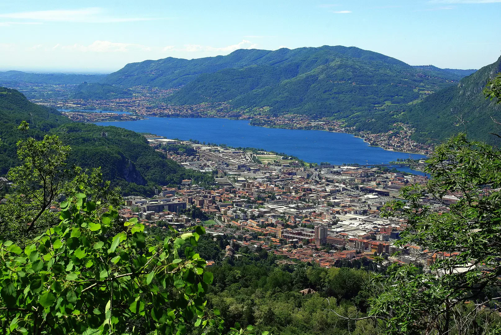
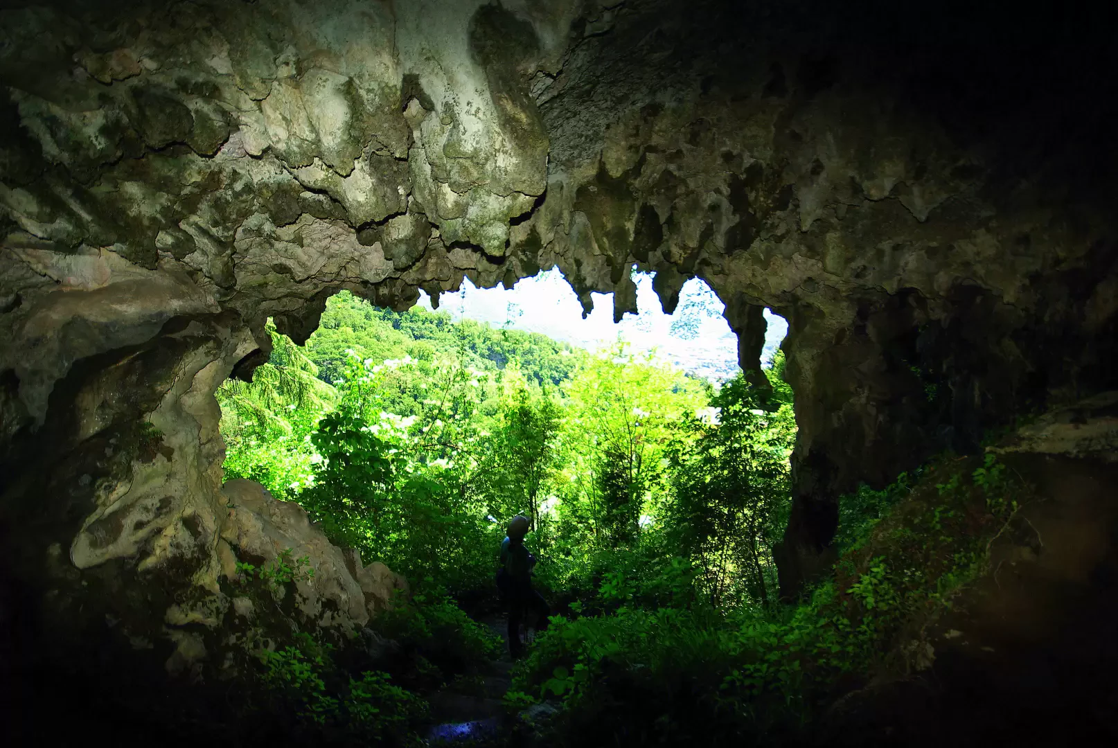
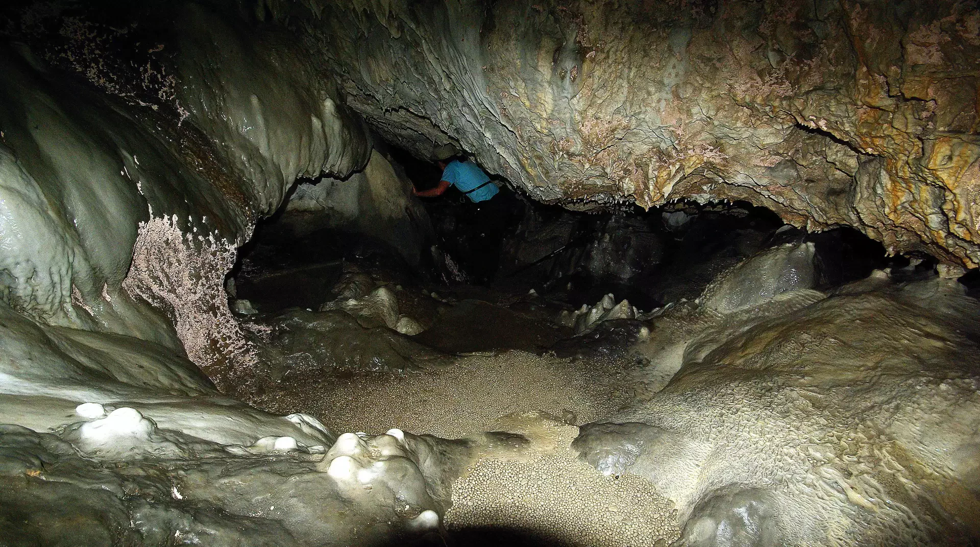
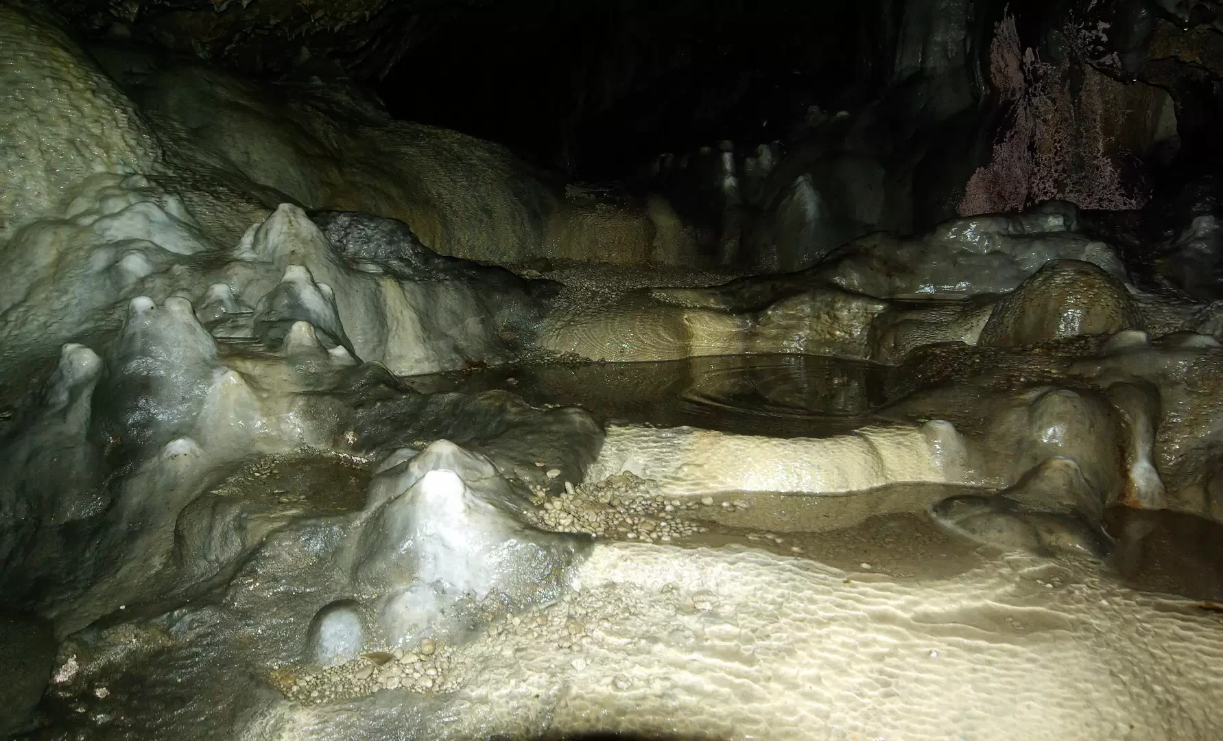
Little-known but very pleasant excursion to occupy a free half-day: advisable clear weather for the grandiose panorama over Lecco, its mountains and the plain. Monte Melma rises above the city, isolated between the courses of the two streams that descend from the Valsassina towards the lake: Gerenzone and Grigna. On the way back it is interesting to make a diversion to Laorca (the last district of Lecco on the way to Valsassina) to visit a geological peculiarity: the Grotta di S.Giovanni. It is an easy cavity excavated by erosion in the highly cemented material of an ancient landslide, rich in concretions and cascading pools: the water collected here was believed to be miraculous for silkworm breeding!
Description
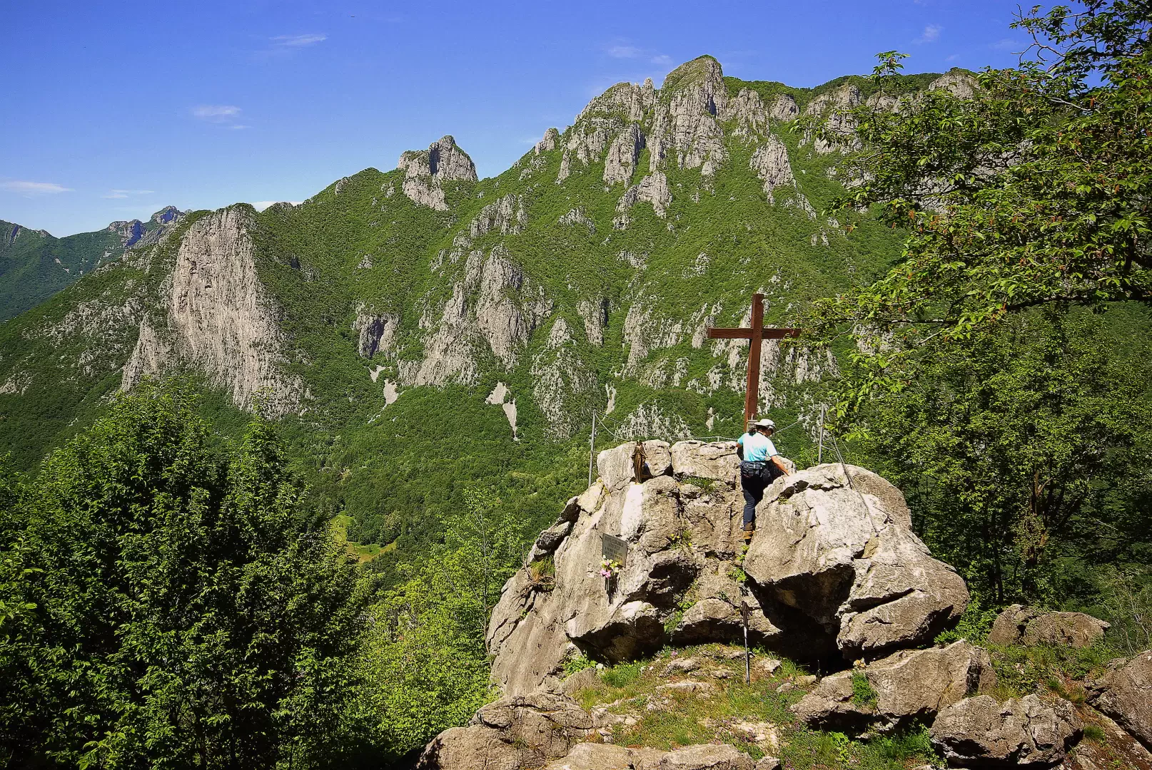
From the 330-metre car park, return to the former provincial road and walk up it for a few dozen metres: just in front of a bus shelter, a narrow cobbled street branches off at an angle. One follows it for a long time, at first between the walls of the parks of stately villas, then between more recent houses, often on the line of the steepest slope. In the area of the Cereda district, you cross a carriage road, but soon return to the cobbled road, which gradually leads into an agricultural and then wooded area: along the ascent, you come alongside a forest track (it is worth following it for a stretch, as far as a bend to the right), and then return to the beautiful mule track as far as the Montalbano clearing 575 m (a very popular trattoria). Near the pylon of a repeater tower, climb up a cemented track for a few metres, immediately abandoning it for a steep and stony mule track to the left; go up the forest to a fork and continue to the left. The vegetation becomes sparser, affording sweeping views of Lake Lecco; you come to a new fork (return route) and continue uphill on increasingly steep and rocky terrain. In a short time, you arrive at the saddle characterised by the viewpoint known as Sass Quader 887 m: this is not the highest point, but it is certainly the most panoramic. To reach the summit of Monte Melma 914 m (unfortunately occupied by a cumbersome repeater), continue along the path between a few small rocks in the steep forest, to the summit esplanade. The panorama is more limited due to the vegetation, but allows views of the Val Boazzo and its spectacular road to Resegone. Beware of the precipice of over 300 metres that opens up on the east side of the summit! For the return journey, go back as far as the last signposted junction: take the little path to the right, which, with a gentle traverse, leads to a beautiful wood that is descended in comfortable hairpin bends to the bottom of the valley (halfway down, you intercept the track that leads from Ballabio to Montalbano). You cross the Torrente Gerenzone between old metallurgical factories (generally wire mills), which in the past drew motive power from the appropriately channelled waters, then climb back up to the old provincial road: just opposite, between the houses on the other side, a narrow road opens up to the church and the nearby cemetery. Note that the oldest part - on the right - is housed in a shallow grotto ('Crota di mort'). From the left-hand edge of the balcony that leads to the artificial Grotta della Madonna, one can barely notice a trace among the thorns and nettles that leads just above, inside a second grotto ("Crota de San Giuan"): entering on steps carved into the concretions, one arrives at a descending hall, whose floor is a succession of concretionary basins sloping towards the landslide at the bottom. Turning back out into the open and all the way to the provincial road, to return to the car park it is convenient to follow the inner lanes of Laorca (intuitive direction) as far as the district of Malavedo. A few hundred metres, unfortunately on the provincial road, lead back to the starting point.
General Information
Recommended period:January, February, March, April, May, June, July, August, September, October, November, December
Objective hazard: very slippery path in case of rain
Equipment:headlamp
Sun exposure: south-east
Photo gallery
Comments (0)
Sign in to leave a comment