Monte Marmontana, from the Giovo Pass


Edited by:
Marco Bonati
Updated at: 09/12/2025
Access
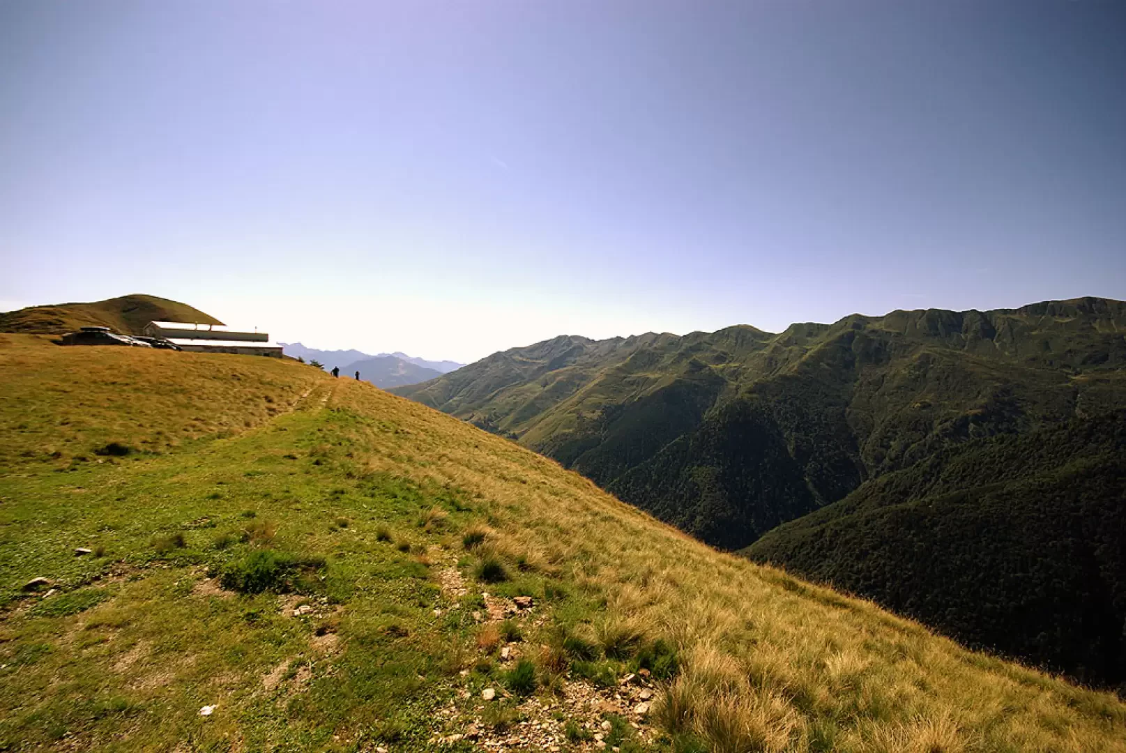
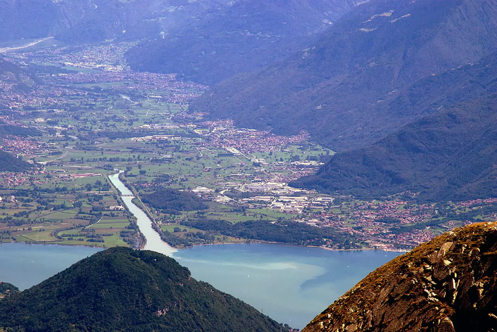
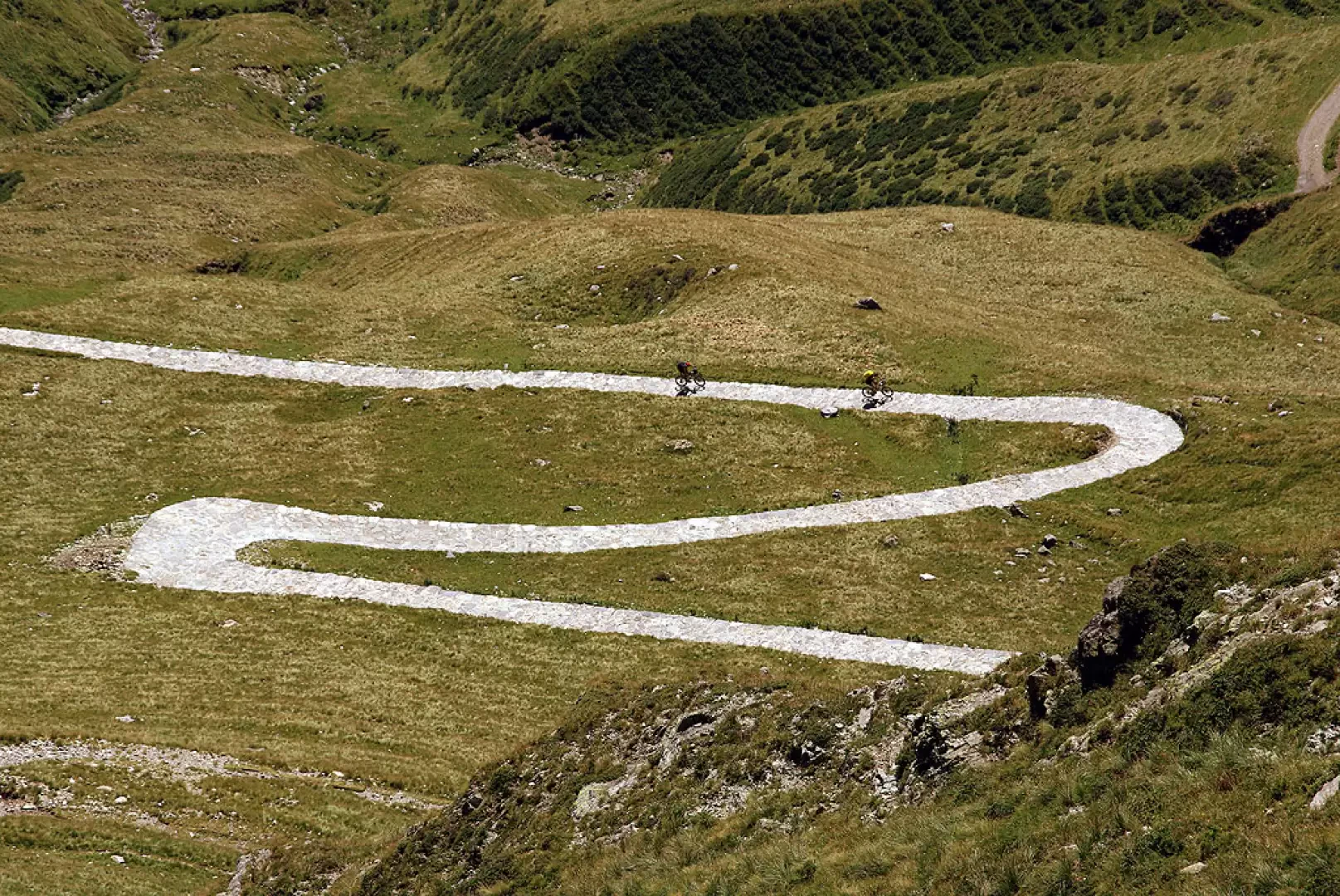
From Como to Dongo along the statale "Regina". At the centre of the village, follow the signs upstream for Stazzona, Germasino and Garzeno. From Garzeno, just beyond a curious monument to the Alpini, you turn right with a narrow hairpin bend and begin to follow a long asphalted climb through the woods towards a barely perceptible pass that leads into a parallel valley. The ground becomes unpaved, but practicable with great caution by all vehicles. The track climbs up the slopes of Monte Cortafon and Motto Paraone, amidst beech forests and little-visited alpine pastures; after a few hairpin bends and a landslide section, you reach "Il Giovo" 1706 m, an expanse of pastureland between the Valle Albano and the Valle di S.Jorio. At the car park there is a refuge, a former G.d.F. barracks.
.Introduction
A hike that in a wide loop along the Swiss border joins three refuges (all former G.d.F. barracks) and two very scenic summits. There are hardly any painted markings on the chosen route: you continue on sight and therefore good visibility is required. The presence of snow in the late season advises against this route, and the presence of numerous memorial stones in memory of G d F soldiers swept away by avalanches testifies to this.
Description
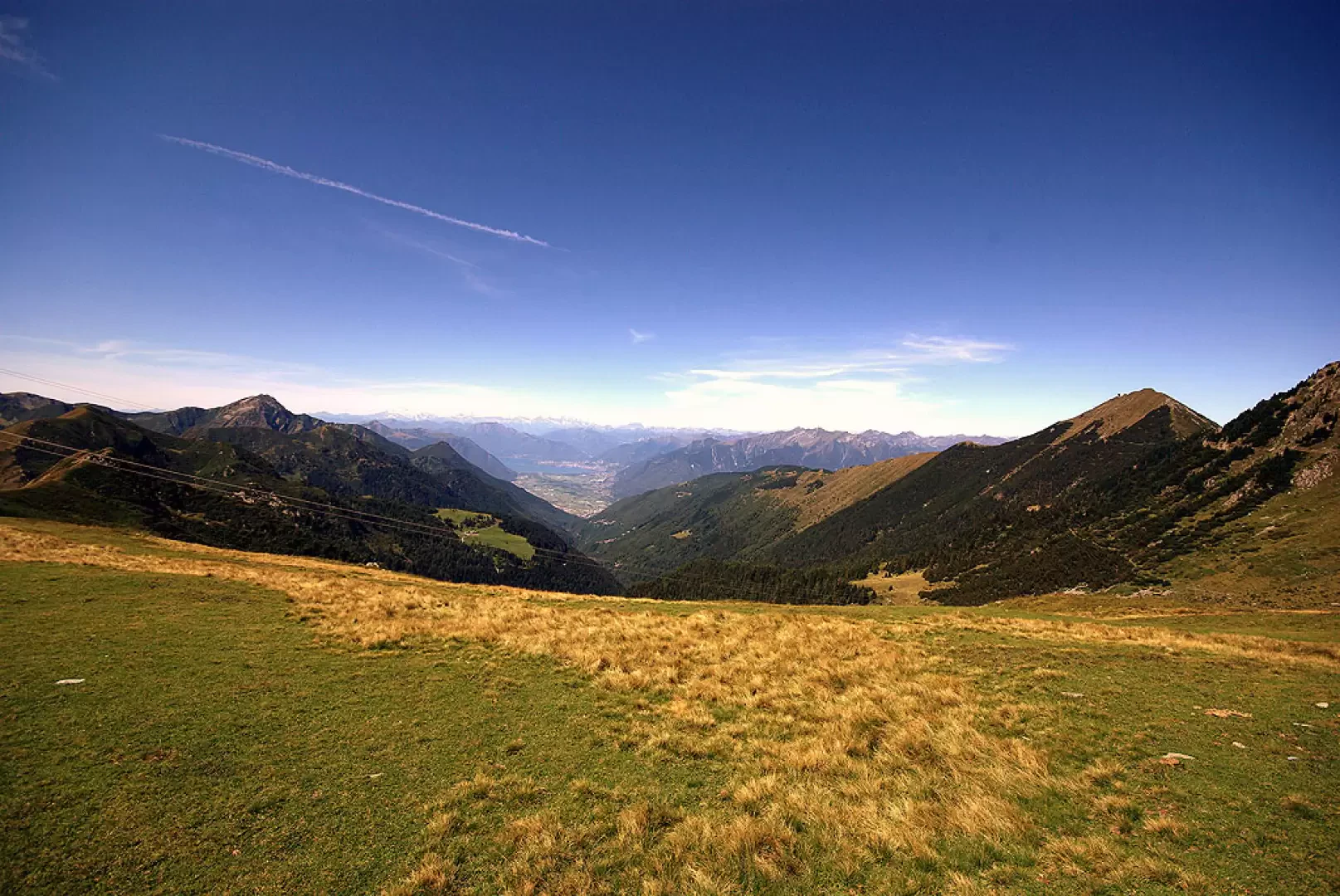
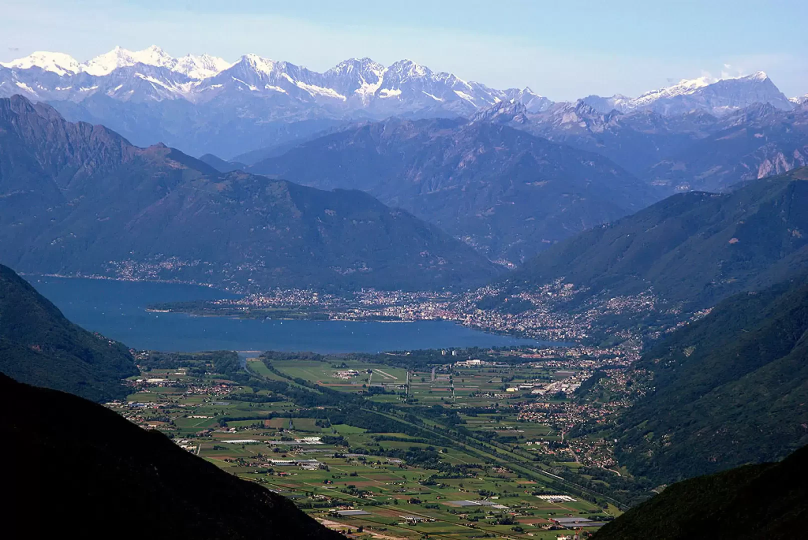
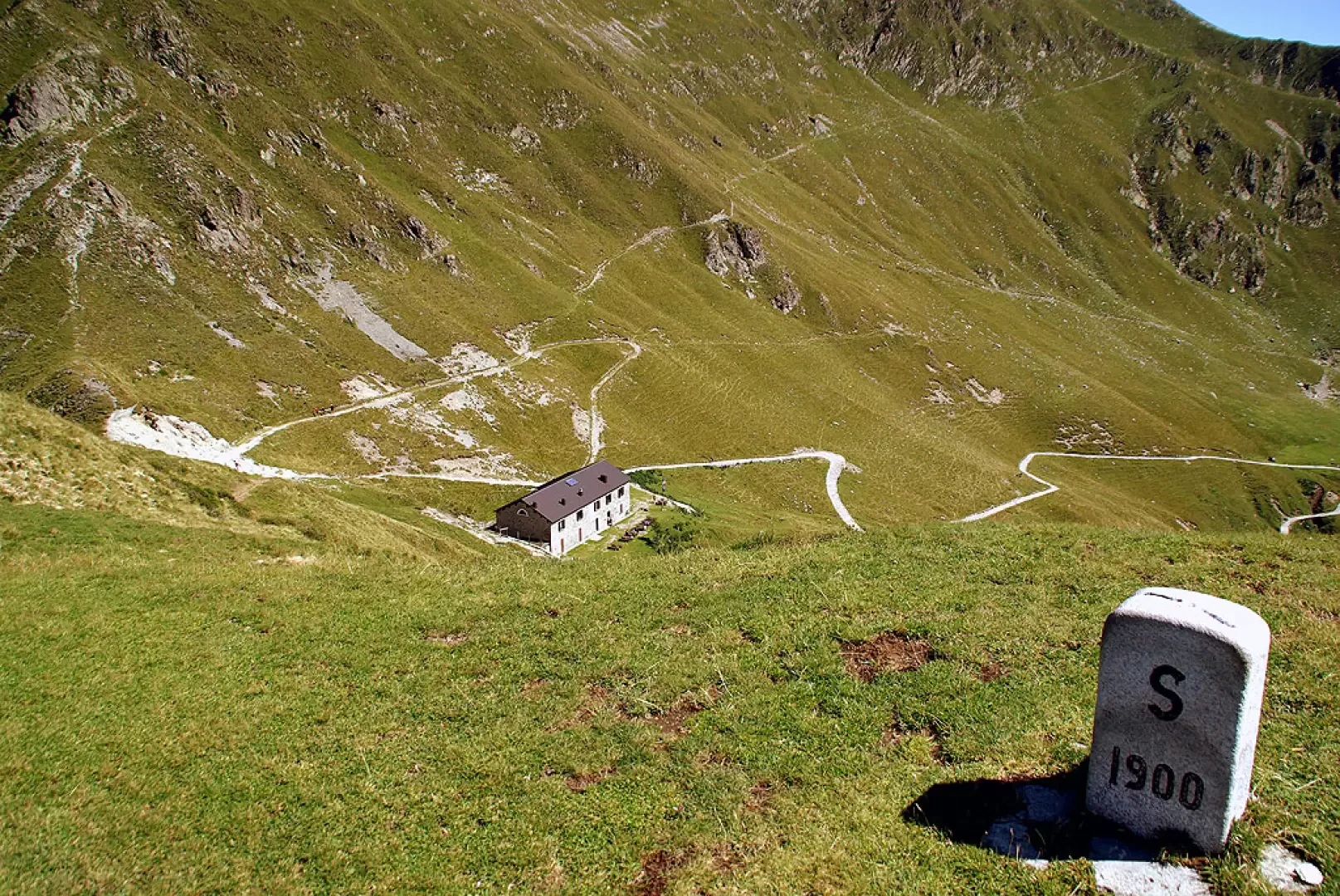
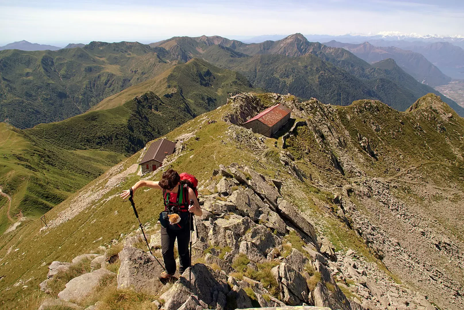
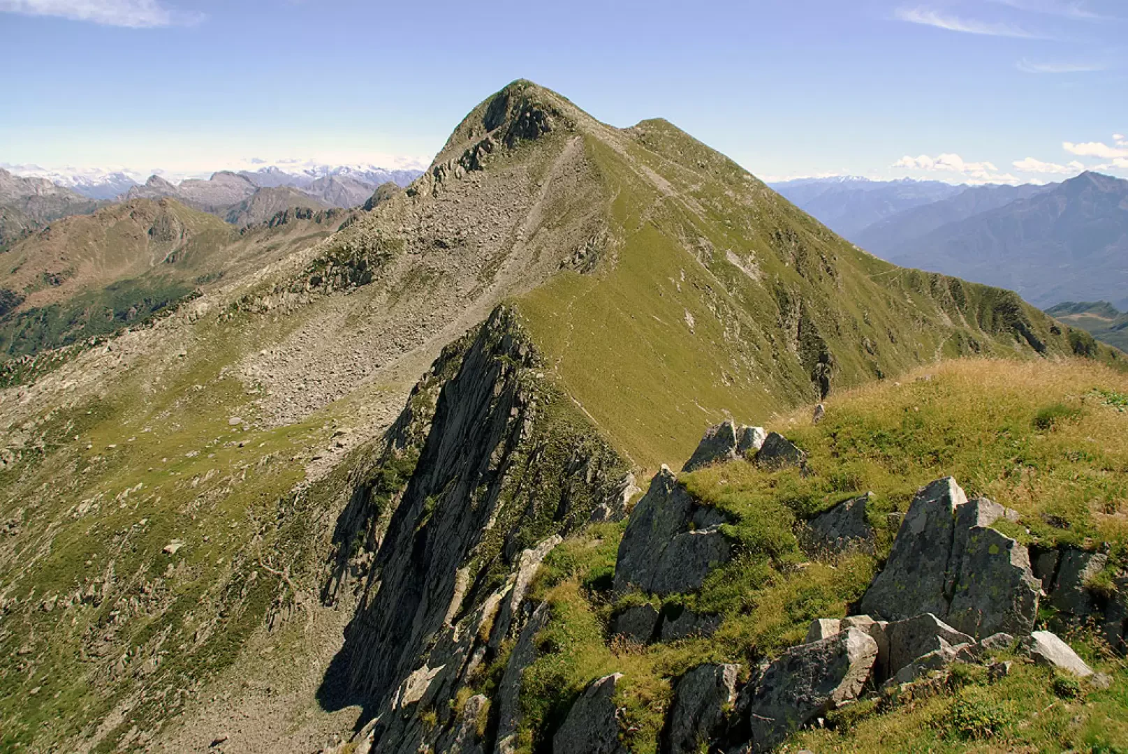
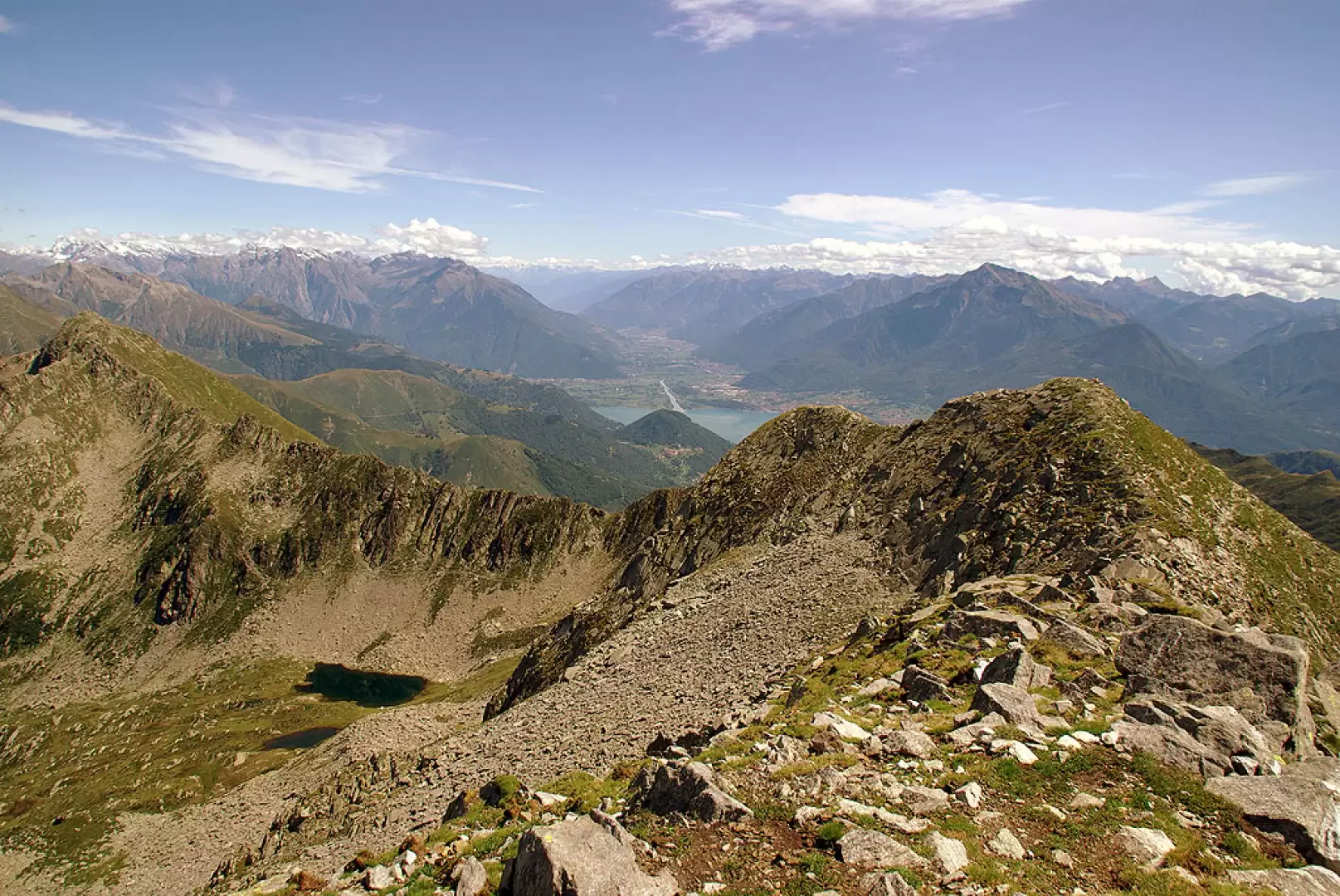
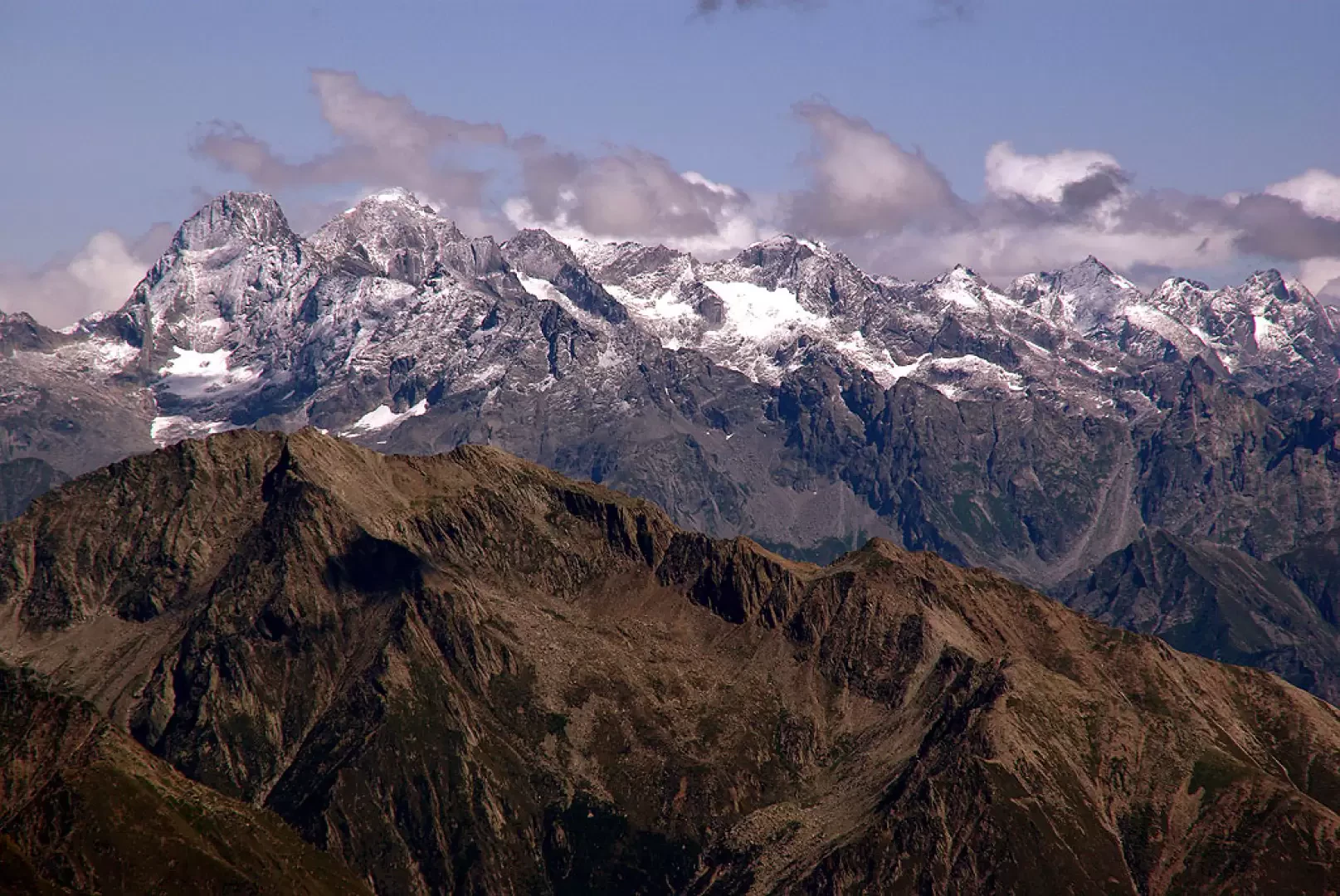
From the esplanade of "Il Giovo", ignoring the numerous signposts, we take a track through the pastureland that, on the steepest line, climbs up the rounded ridge parallel to a power line. Having reached the wide ridge, which coincides with the state border - a few milestones - we follow it northwards with a less accentuated ascent until we come in sight of a small church. This is San Jorio, located just above the pass of the same name (2014m): on the Italian side, a few metres downstream, we see the San Jorio hut; while on the Swiss side, a wooded valley opens up with a few alpine pastures. Having descended to the pass - a stony, landslide-ridden pass with signposts pointing towards Swiss itineraries - we immediately ascend to the opposite side along a barely visible track, very steep, rocky and with many loose blocks: the path, which is not very intuitable, is nevertheless very effective in avoiding major difficulties on decidedly treacherous terrain. A last gravelly traverse sloping down into the valley in Italian territory leads us to a niche esplanade in the ridge that houses a (private!) refuge located practically on the border. A few metres behind the former Italian barracks stands, even closer to the border, the equivalent Swiss construction, apparently still functioning as a logistics warehouse. You return to the ridge line and, amidst stacked blocks, you reach Cima di Cugn (2237m): this is the point of convergence between Italy, Canton Ticino and Canton Grisons. From here, the panorama sweeps from Lake Maggiore with the Monte Rosa group to the little-known peaks of the Mesolcina and the Màsino-Bregaglia mountains. The next destination, Monte Marmontana (2316m) - three peaks, culminating in the central peak - can be reached by following the ridge between confused traces of grazing animals and piled up boulders. Be careful on the Swiss side because it plummets down into the vertical void for about 200m (unpublished climbing routes reported). The summit of Monte Marmontana, while maintaining the views mentioned, also opens up the panorama towards the upper Lake Como and Valtellina. For the descent, it is best to follow the very steep pastureland of the eastern summit without a track until you are just above the height of the San Jorio hut: here there is a stony but marked path that leads to the paved track of normal access to the hut. Follow it for a long time along the hillside in the direction of the visible Rifugio Il Giovo, right at the car park.
Photo gallery
Comments (0)
Sign in to leave a comment