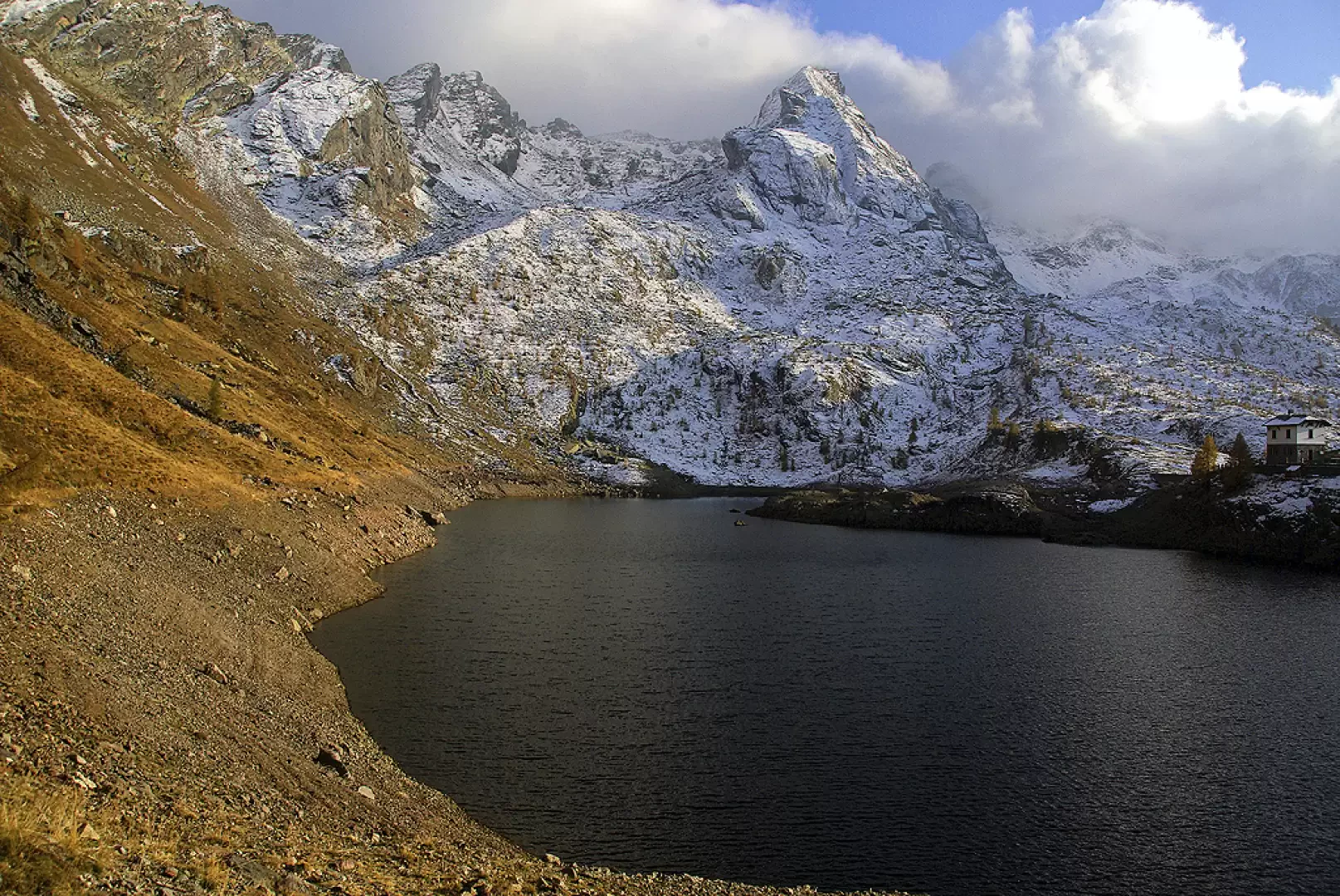
Ponteranica Lakes, from Pescegallo


Edited by:
Marco Bonati
Updated at: 03/09/2024
Access
From Milan to Morbegno along state roads 36 and 38; at the roundabout at the entrance to the town turn right towards Valgerola. Follow the provincial road for the entire valley until you reach the parking areas of the Pescegallo ski facilities.
Introduction
A hike mostly on Bergamo territory with an ascent and descent on the Valtellina side. The two pleasant little lakes that are the destination of this excursion are reached via a beautiful half-hill path through the high pastures of the Piani d'Avaro, at the apex of the Valbrembana. The descent route is a little more technical, following a steep and landslide gully. Dramatically opposing views on both sides and the possibility of encounters with wild ungulates. Incompleteness, confusions and errors in the available cartography.
.Description
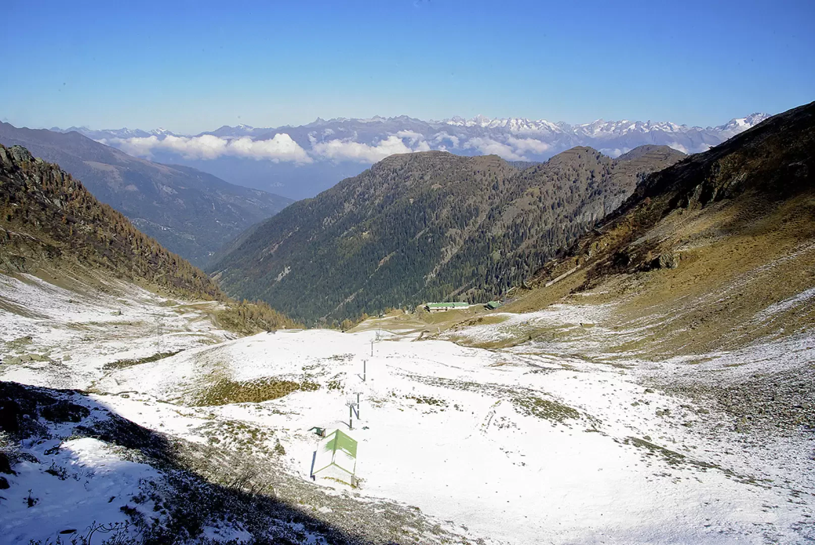
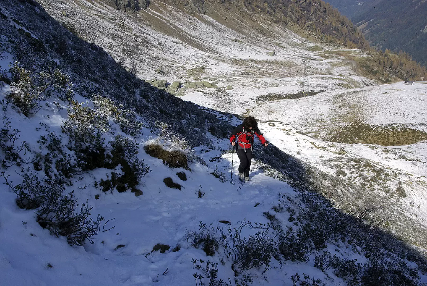
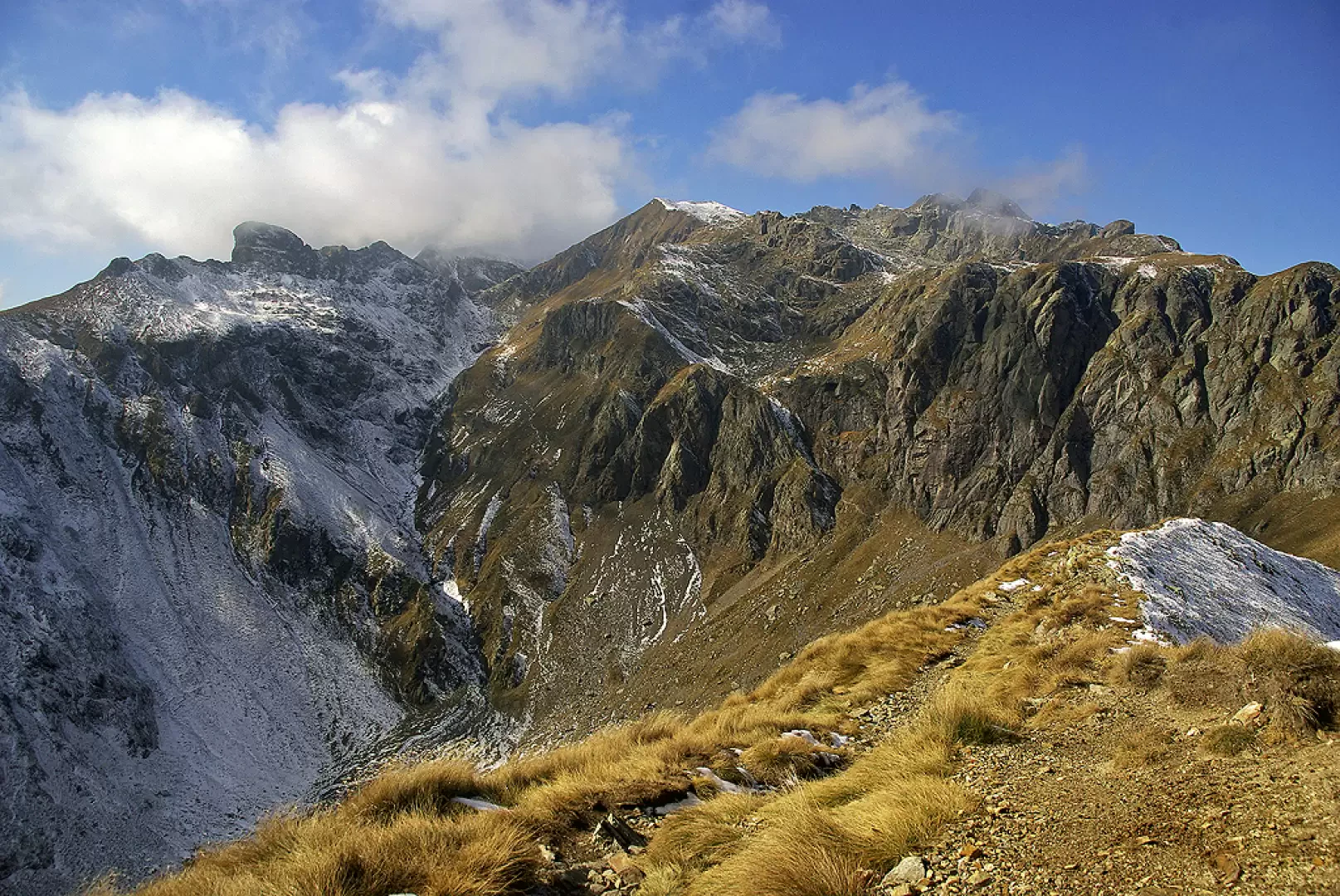
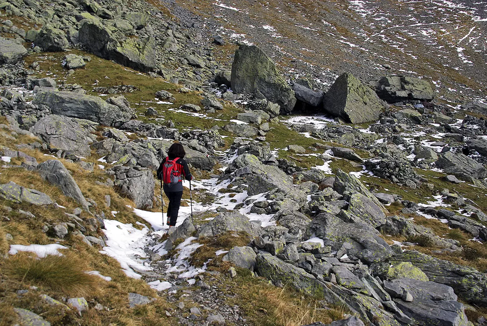
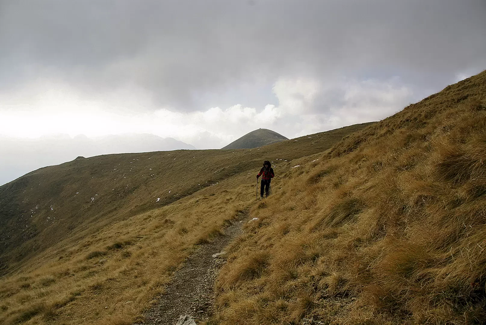
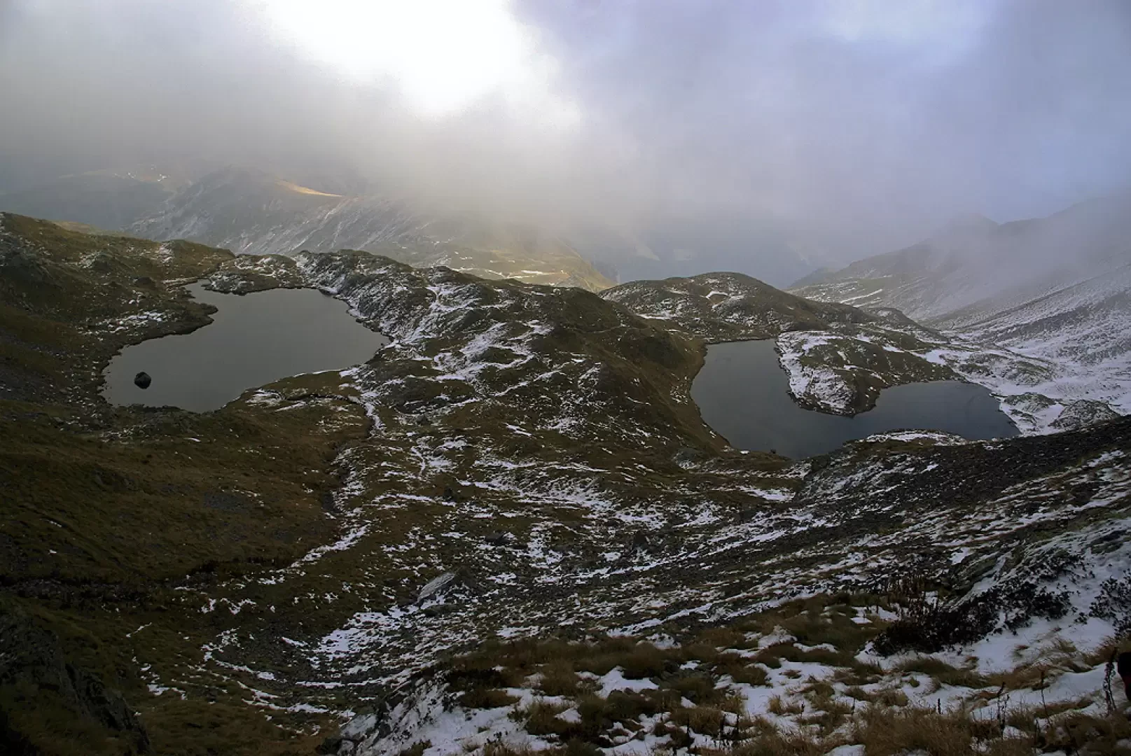
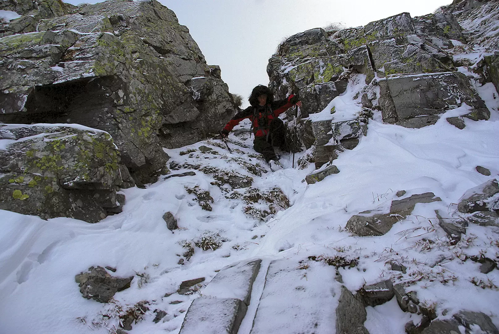
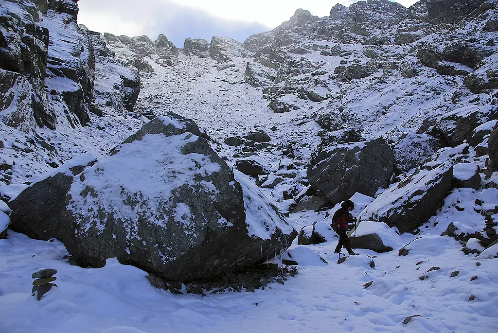
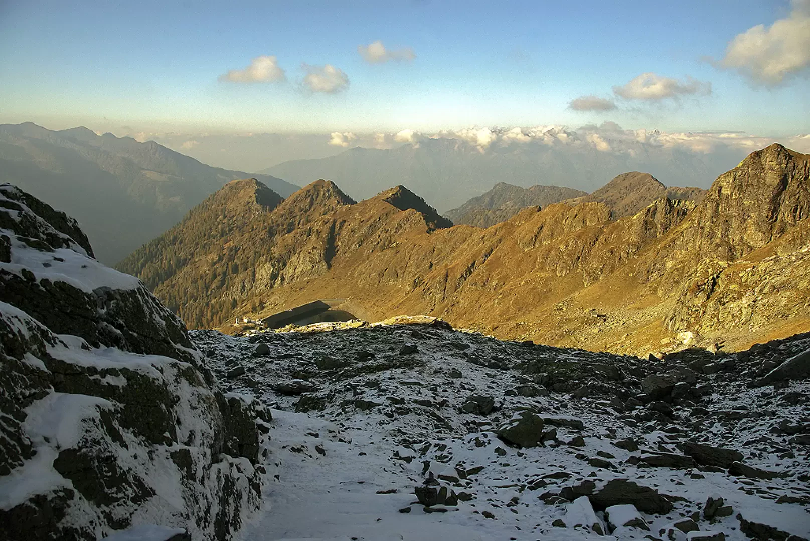
From the Pescegallo chair lift forecourt 1454m, follow the ski lift service track (or its signposted shortcuts) to Rifugio Salmurano alle Foppe di Pescegallo 1848m; continue through the pastureland along the line of the ski lift to its end. Behind the arrival building, the path climbs for a few dozen metres before forking: choose the left-hand branch which, after a few bends and a traverse, reaches Passo d'Avaro 2099m (or Passo Salmurano Orientale). The pass is a short trench in the ridge line that joins the path connecting Rifugio Benigni to Cà San Marco (n. 101). Continue eastwards with a level traverse that takes you to a grassy shoulder (with a fine view of the Vallone di Salmurano, Rifugio Benigni, the Piazzotti group and, further away, the Mezzaluna ridge), where the path loses a hundred metres in altitude. A second level traverse enters a valley at the base of Monte Valletto, which becomes increasingly stony until you reach the bottom near some boulders used as shelters for grazing animals. The next section recovers the height difference to a pastureland plateau with a small lake 1997m near the grassy summit of Monte Avaro 2088m. Disregard the signs for path 109A, which turn upwards. The traverse, continuing eastwards, is reached from the valley by a path coming from the visible Piani d'Avaro; when you reach a crest with signs, leave the path towards Cà San Marco and ascend the ridge until you reach the two adjoining basins of Laghi di Ponteranica 2105m. The path back to Valgerola follows a less marked but still clearly visible track (a few rare remnants of faded paint markings): with the right choice of ascent among scree, steep streams and rocky outcrops, the path tends to a grassy saddle to the right of a voluminous cairn of stones. The ridge - which cannot be climbed in this section - must be followed to the right and, past a second cairn, with a short, exposed descent, reaches a narrow notch: a few delicate steps and the summit scree of the gully between the Pizzi di Ponteranica (western 2353m and eastern 2378m) is reached. Dominated on the left by the rocky towers of Monte Valletto, descend the large, very mobile debris following a series of precarious cairns to the bottom of the gully. The track, meandering now among large boulders, comes in sight of the artificial reservoir of Pescegallo 1865 m: you reach an isolated hut and, a little further on, the marked path coming from above Forcellino (a pass linking Valgerola and Val Bomino). Follow it towards the valley as far as the dam wall: beyond the crossing proceed on the service track as far as Casera Pescegallo Lago 1778 m, where a stony and steep mule track starts (just to the side of the track) which soon descends to the parking areas.
Photo gallery
Comments (0)
Sign in to leave a comment