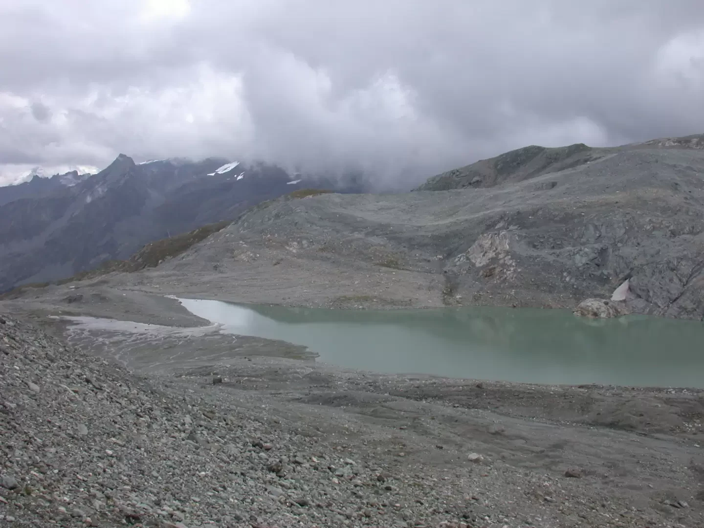
Lake Goletta, from Thumel


Edited by:
Massimo Martini
Updated at: 25/08/2025
Access
Lasciare l'autostrada allo svincolo di Aosta Ovest e proseguire fino all’innesto con la strada statale . Svoltare a sinistra al semaforo e procedere in direzione Courmayeur. Superati gli abitati di Saint-Pierre e Villeneuve, dopo 6,6 chilometri imboccare sulla destra la strada regionale della Valsavarenche, che attraversa rapidamente Introd e, dopo altri 4,7 chilometri, si dirama diventando la strada regionale della Valle di Rhêmes. Risalire la vallata per 14,9 chilometri, oltrepassando Rhêmes-Saint-Georges, fino a raggiungere Bruil, capoluogo del comune di Rhêmes-Notre-Dame. La strada si inoltra nel fondovalle, supera il piccolo villaggio di Pellaud e prosegue ancora per qualche minuto, fino a raggiungere l’ampio parcheggio 🅿️ a pagamento di Thumel, situato all’inizio dei principali sentieri della zona.
La tariffa è di 50 centesimi per la prima ora e di 15 centesimi per ogni ora successiva.
Distanza e tempo di percorrenza
🕒 Tempo di percorrenza: 39 minuti
📏 Distanza: 29,6 km
Navigazione GPS
📍 Come arrivare con Google Maps
📍 Come arrivare con Apple Maps
ℹ️ Nota importante
Le indicazioni fornite sono state verificate alla data del rilievo dell’itinerario. Prima della partenza, è consigliabile verificare eventuali variazioni del percorso. Per ottenere indicazioni aggiornate e dettagliate, si consiglia l’uso di Google Maps o Apple Maps.
Introduction
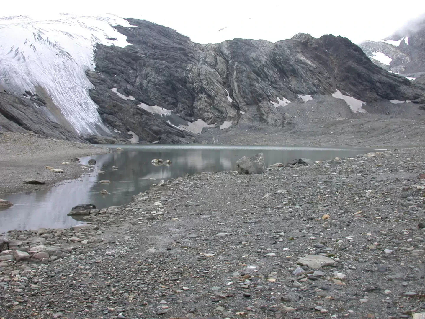
Immersed in a semi-glacial environment, Lake Goletta is a very interesting destination from a landscape point of view, in fact, the fact that it has the peculiarity of receiving in its basin a tongue of the glacier of the same name.
Description
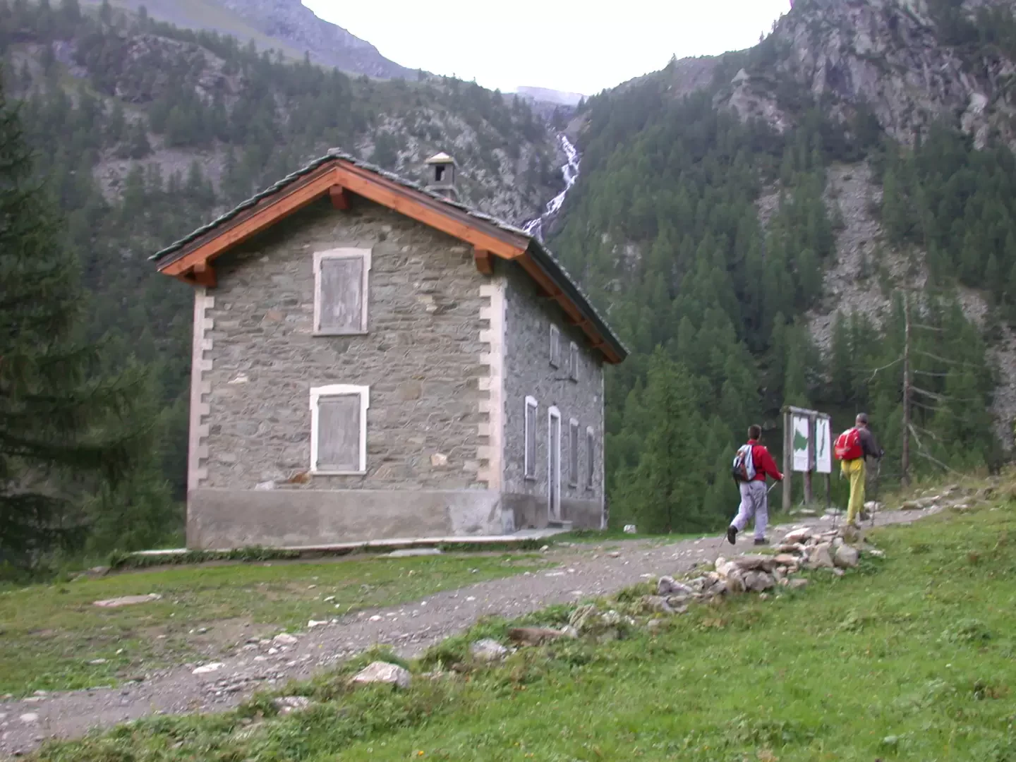
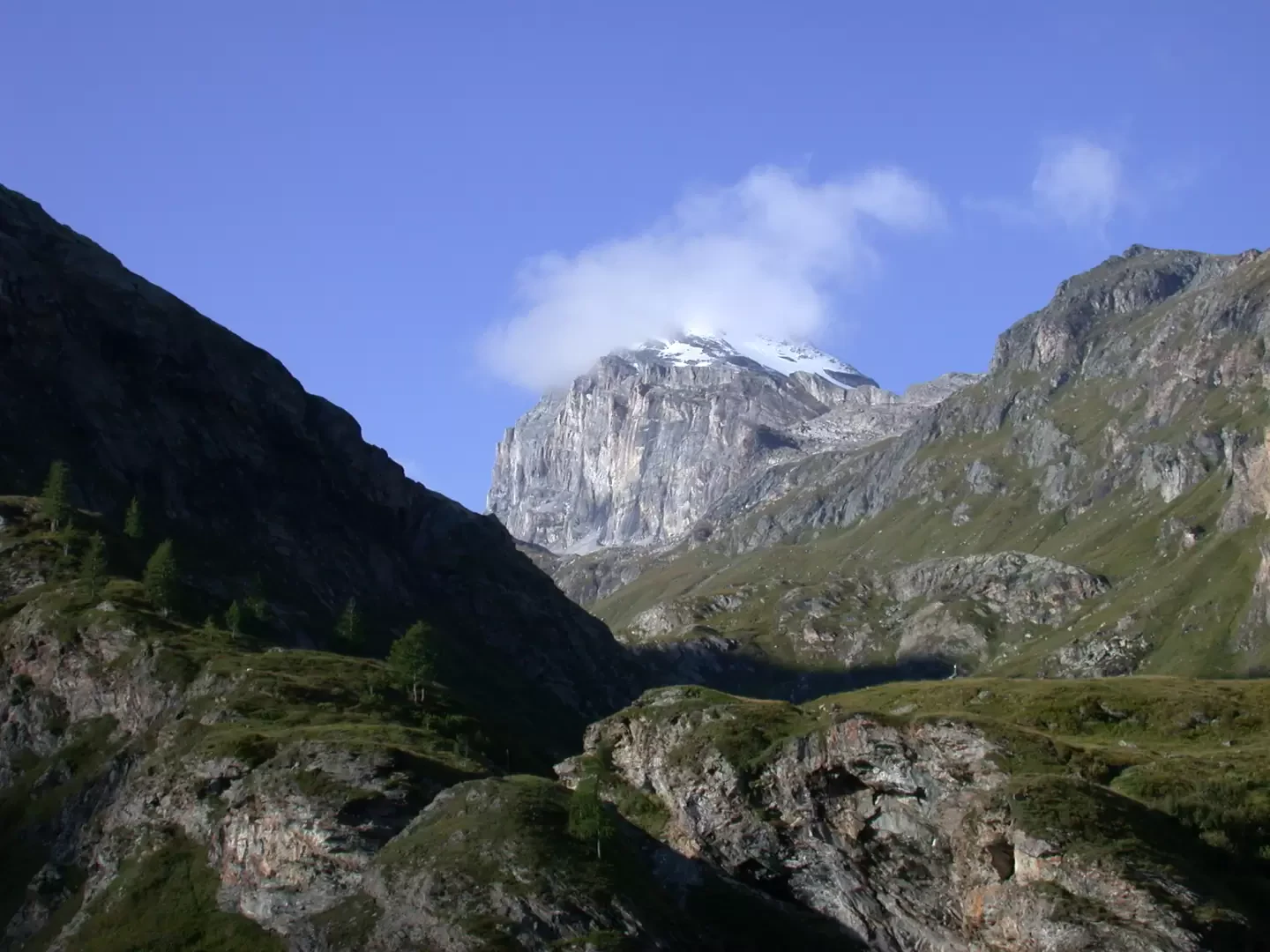
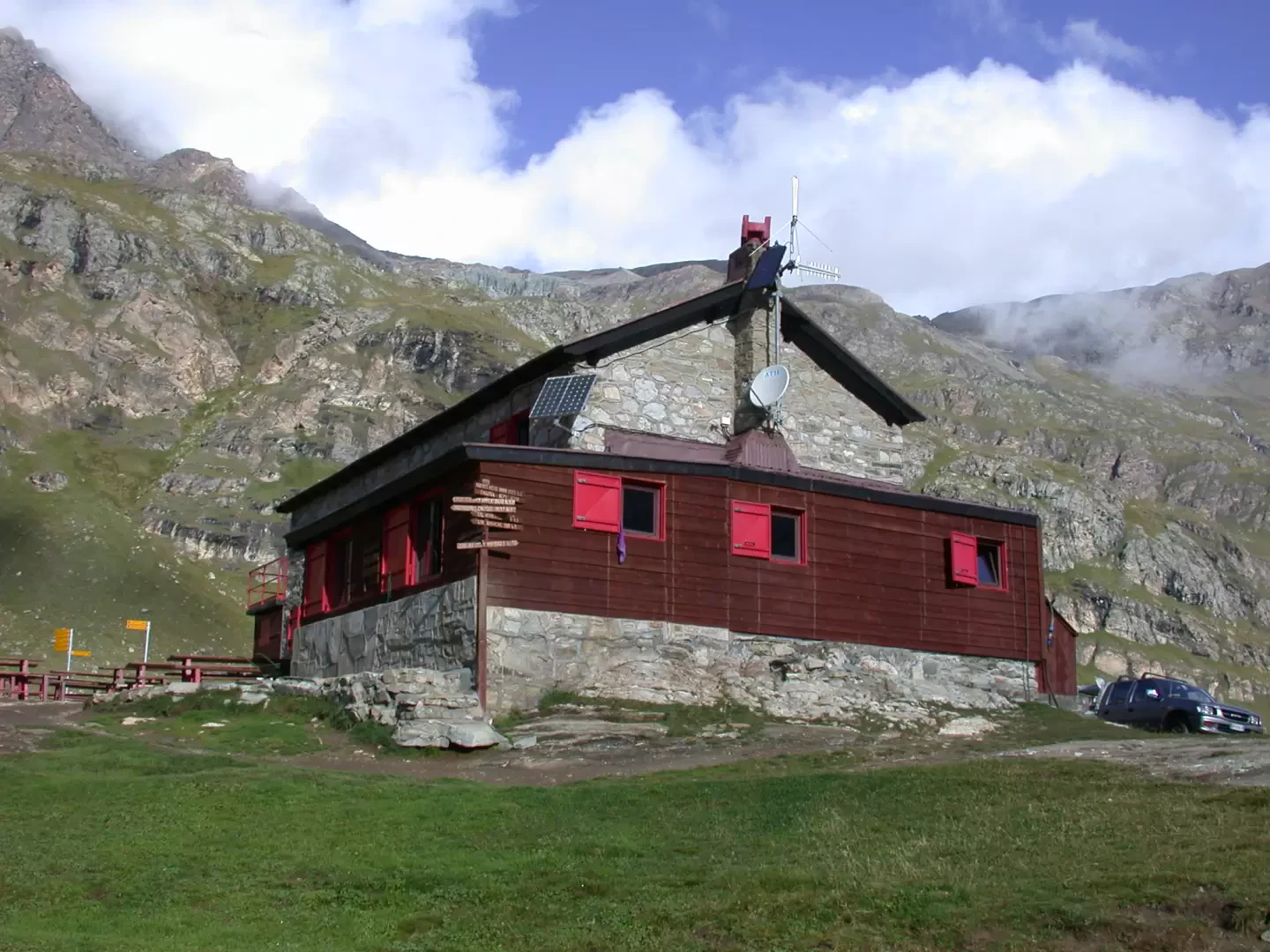
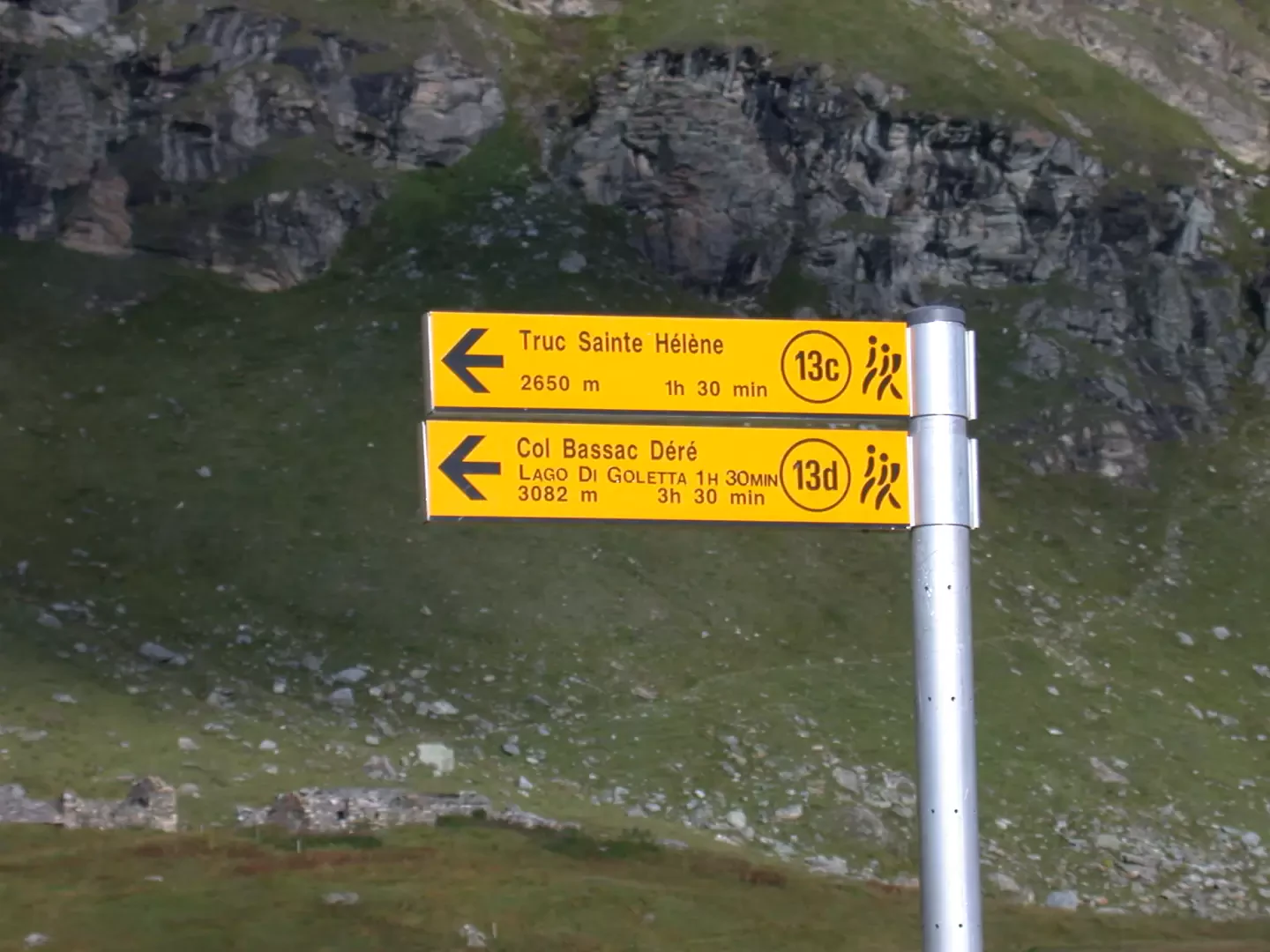
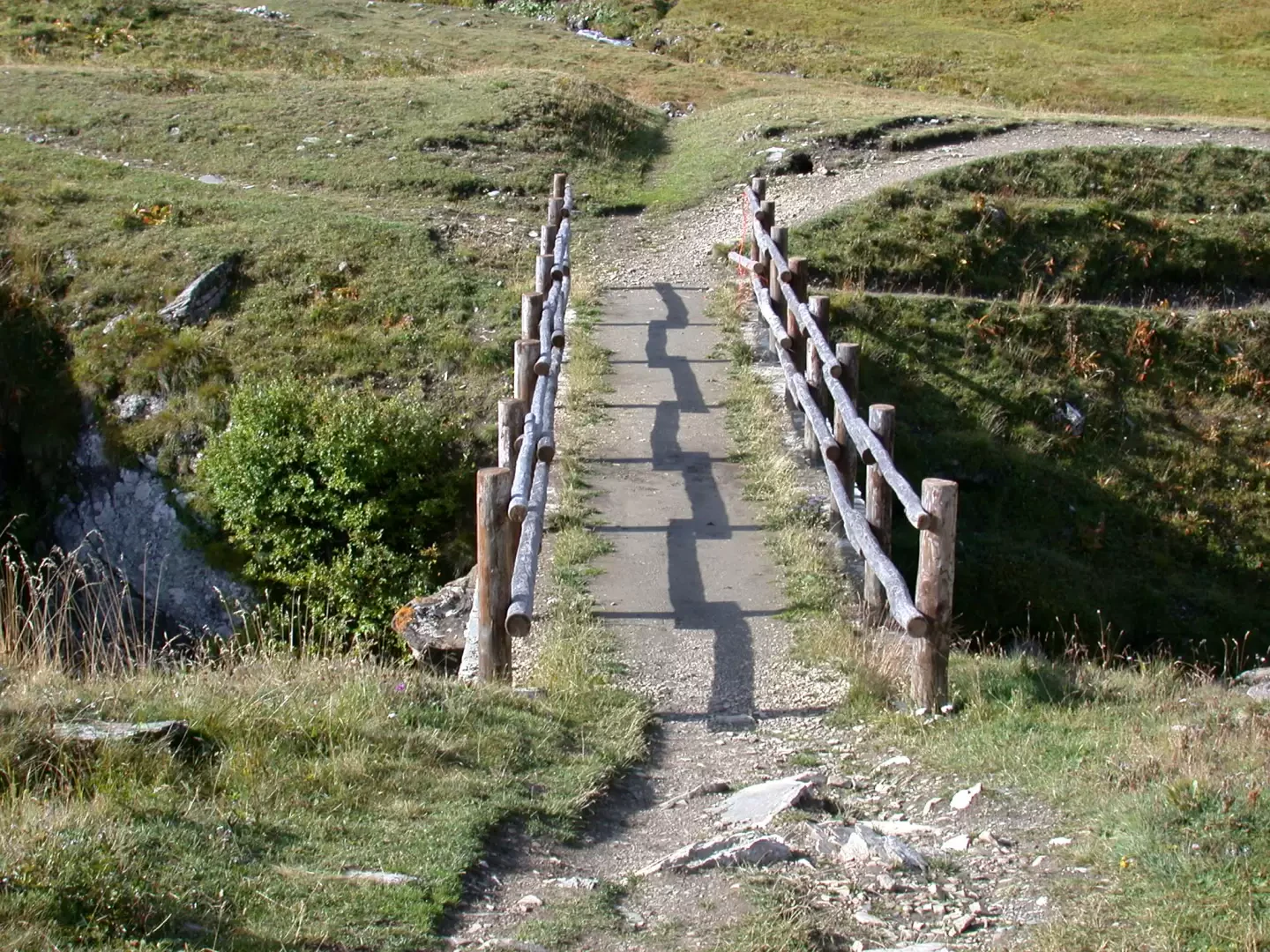
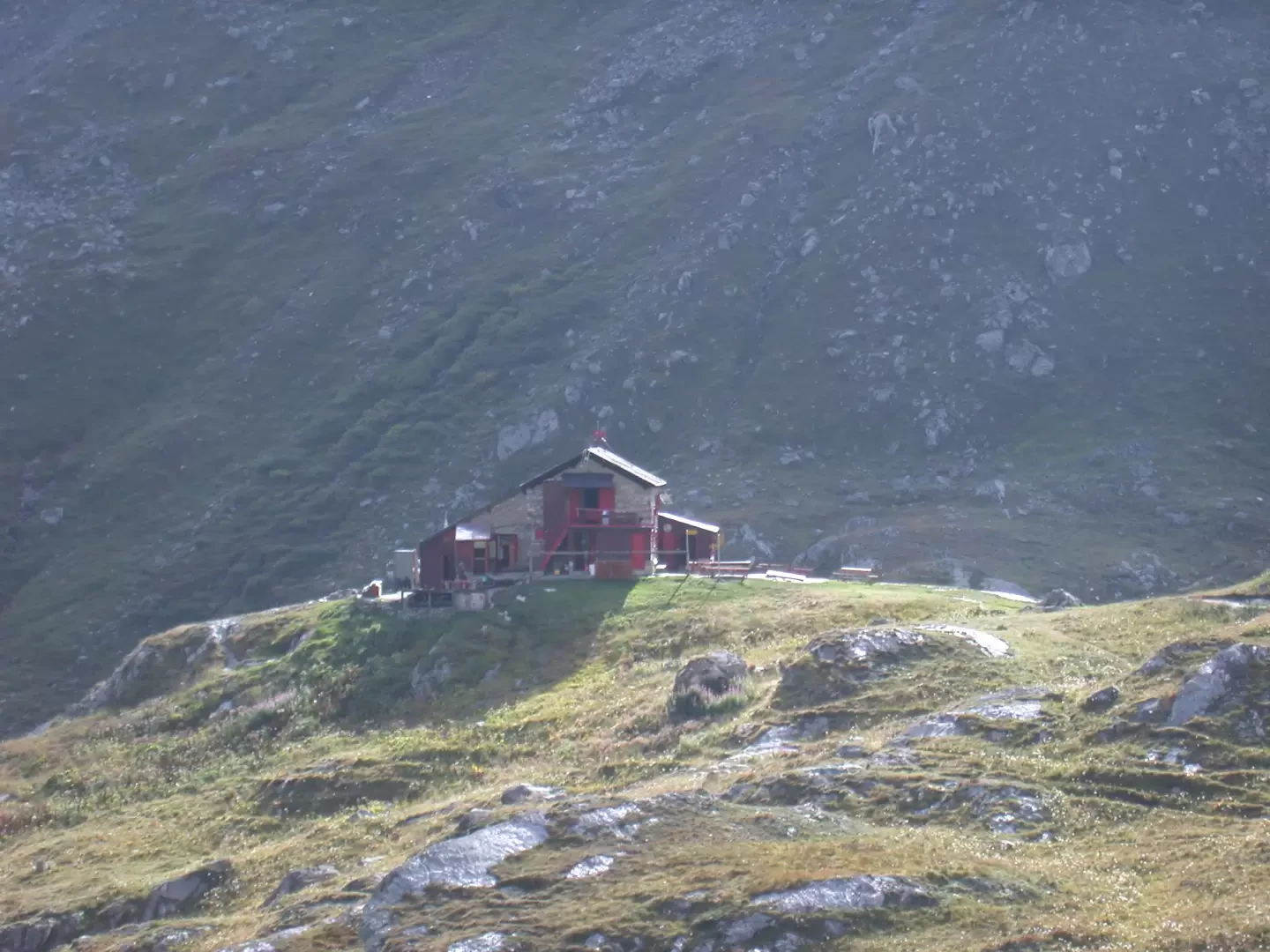
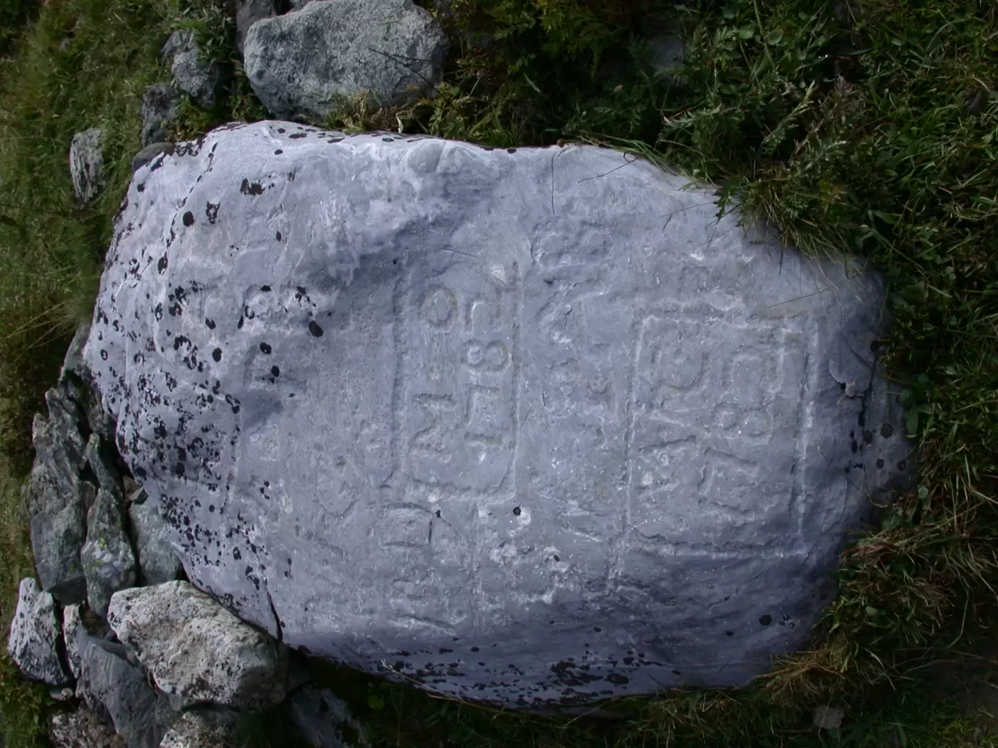
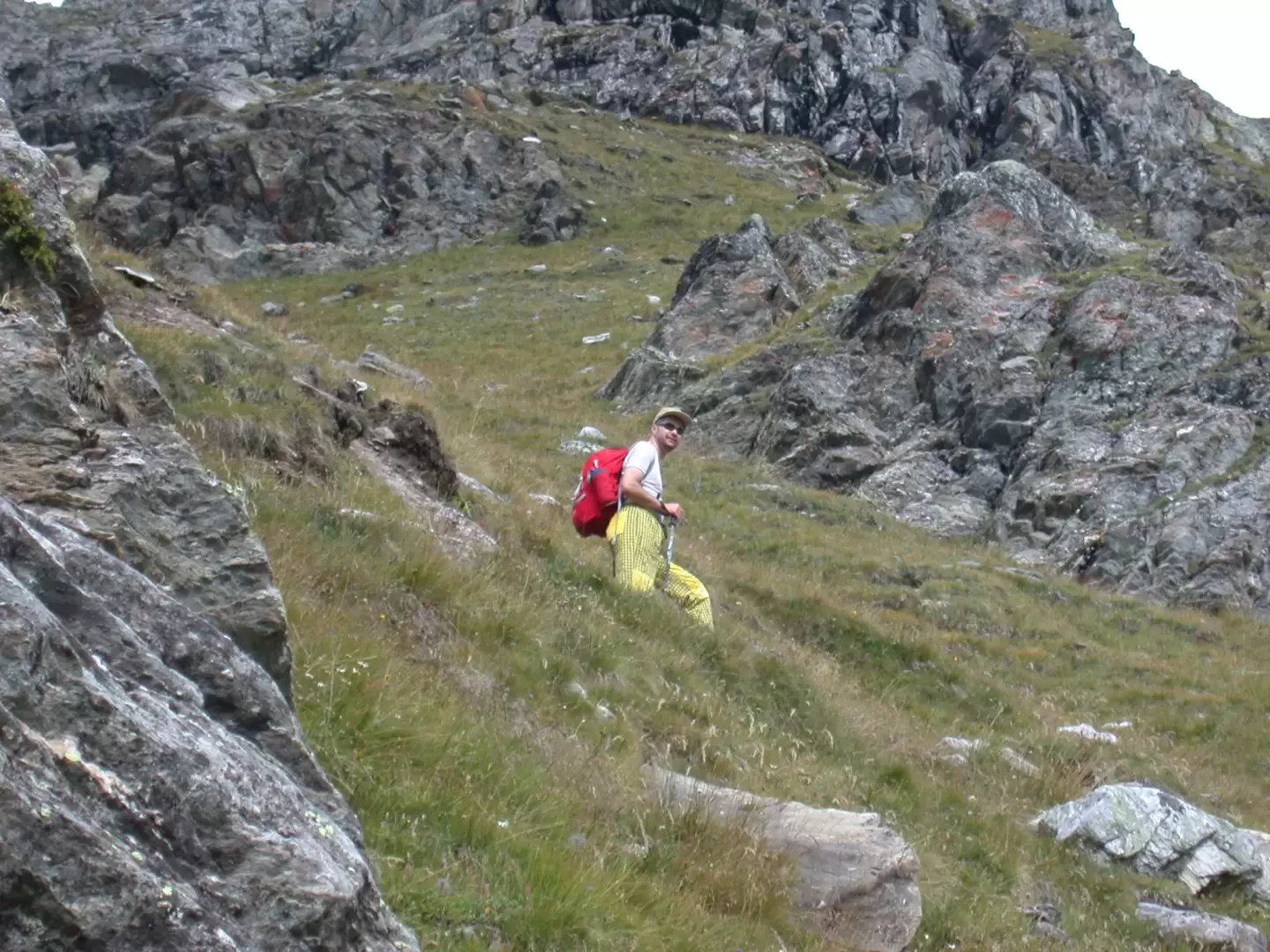
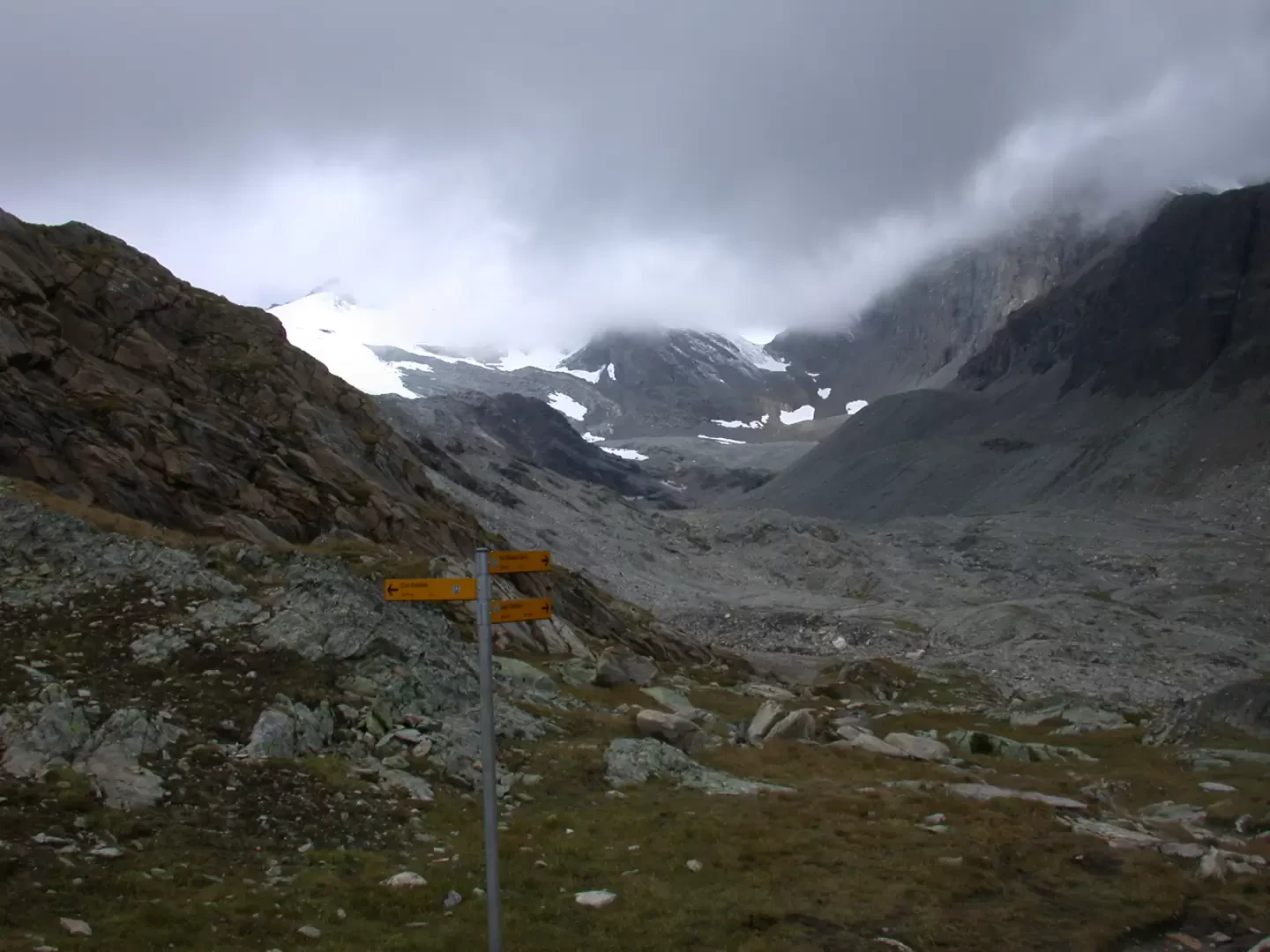
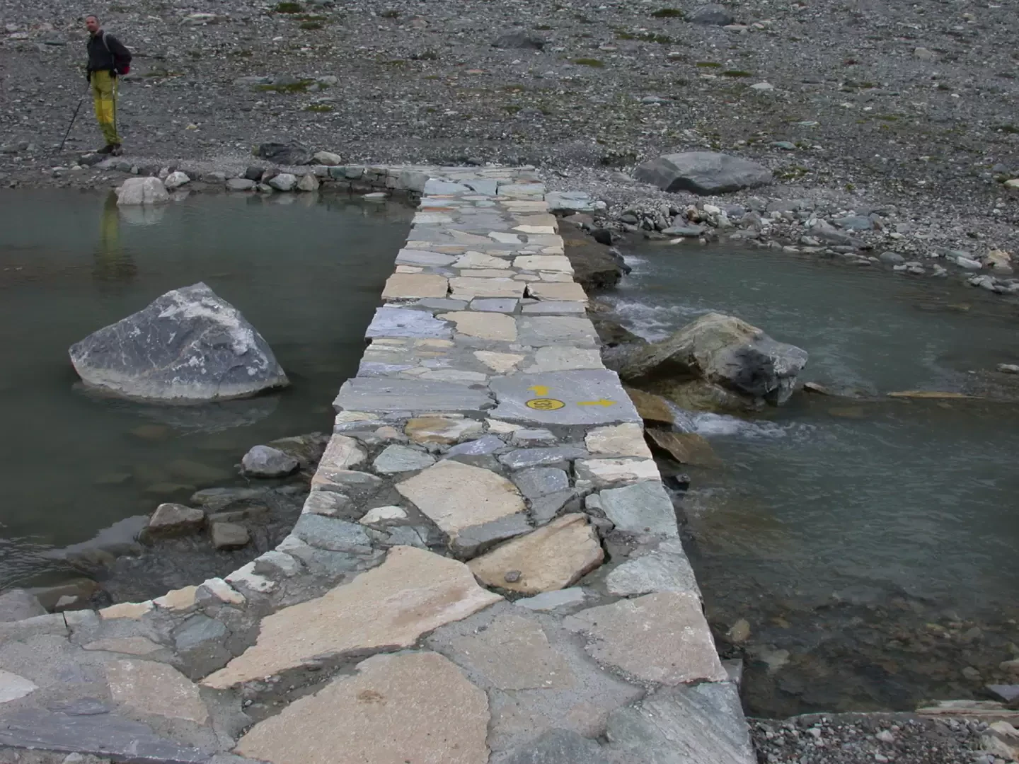
From the car park, continue along the tarmac road until you reach the panel bearing the name of the village of Thumel (1879m, 0h05'); leave it on your left and continue straight on, leaving a modern alpine pastureland on your right. Having passed the alpine pasture, the path (13) begins. We begin to climb the wide mule track that crosses a stretch of larch woodland; after about ten minutes we reach the Casotto dei Guardia Parco (there are explanatory panels in front of it). The path flattens out slightly and narrows: on our left we can observe the small waterfalls generated by the waters flowing down from the Vaudalettaz valley, while on the right (above the path) we can see a small chapel with a bell gable. The itinerary develops on terraces on the orographic left of the Dora di Rhêmes; after about 20 minutes we leave a track on our right that leads to an alpine pasture. From here we begin to catch a glimpse of the valley floor and in particular the Grande Traversière (3496m). The trail then descends slightly into the bed of a stream, which is crossed by means of a convenient little bridge equipped with chains. Once over the bridge, leave path no. 12 on the left, which crosses the Grande Vaudala valley and leads to Col Rosset, and continue to the right: a wooden panel indicates the way to the hut. The paved mule track continues up the valley, alternating between flat and slightly uphill stretches, leaving some alpine pasture ruins on our right. After walking for about 30 minutes, we reach the junction for Col Bassac, marker (14) after which we pass under a rock with black streaks under which we also find the remains of an old alpine pasture. From this point you can begin to admire the stupendous east face of the Granta Parei. After a short descent, the path crosses a stream on a rudimentary little bridge made of wooden planks, then skirts the gorges formed by the Dora di Rhêmes. After briefly ascending a panettone that skirts the gorges, the path descends again among some alders to a marshy plain where the path remains less evident and then becomes broad and well-marked again. After about 50 minutes of walking, we begin to catch a glimpse of the refuge in the distance, while on our right we can admire an impressive waterfall coming from the La Combassa gorge above. After crossing a small wooden ladder bridge and another small stream on a plank, we reach the farm road after 55 minutes. When you reach the farm road, turn left and follow it for about 200 metres until you cross a metal-framed bridge. After this, climb up the path on the right, cutting across two hairpin bends in the farm road and finally reaching a large stone wall supporting the road. Continue along a stretch of the farm road until you reach the Lavassey alpine pastures: here, turn right onto a wide mule track that wedges into a gully of light-coloured rocks (slippery in the rain but avoidable with a small path to the side). Finally, after 1h 15' you reach the hut. Leave the refuge by following the signpost indicating the path (13D). Having passed a small hump, the path forks: we follow the right-hand direction to the Goletta lake. From the fork, the path descends slightly until it reaches a small wooden bridge that crosses the Dora di Rhêmes. We then cross a second small bridge and begin the ascent on an evident and marked path that crosses the pastures below the Des Sauches mountain pasture. During the ascent, you will come across an engraved stone dated 1782 on the right-hand side of the trail and shortly afterwards reach the Des Sauches alpine pasture (2,313 m, 1h 30'). Shortly after the alpine pasture, the trail veers to the left, climbing up towards the valley floor, and reaches the junction for Col de Rhêmes. Still on an excellent path, proceed up a steep slope that quickly takes us to the Comba di Goletta. Neglecting a little path on the right, which leads to Alpe Goletta, go up the valley, proceeding slightly uphill until reaching the small dam that forms the lower edge of the lake (2699m, 2h45'). The descent follows the same route as the ascent (2h00').
.Photo gallery
Comments (0)
Sign in to leave a comment