Lasciare l’autostrada allo svincolo di Aosta Ovest e immettersi a destra sulla strada regionale per la valle di Cogne. Dopo 400m (0,4km) alla rotonda prendere la seconda uscita entrando nella strada statale , da seguire per 32,4km (32,8km), attraversando e costeggiando gli abitati di Saint-Pierre, Villeneuve, Arvier, Avise, Derby, La Salle, Morgex e Courmayeur, sino a raggiungere l’uscita per Larzey – Entrèves. Svoltare a destra su Strada Larzey – Entrèves e percorrerla per 450m (33,25km). Proseguire su Strada la Palud per 2,1km (35,35km). Continuare su Strada della Val Ferret per 850m (36,2km). Percorrere la strada per la località Planpincieux per 375m (36,6km) e svoltare a sinistra per raggiungere il piazzale del parcheggio dopo ulteriori 75m (36,7km).
Parcheggio
In località Planpincieux si trova il piazzale del parcheggio 🅿️ a pagamento, punto di partenza di numerosi itinerari in Val Ferret. L’accesso alla Val Ferret è regolato da un varco con sbarra automatica posizionato a La Palud: l’ingresso è consentito fino alla saturazione degli stalli disponibili. La sosta è a pagamento nella fascia oraria dalle ore 9:00 alle ore 19:00 in base alle tariffe stagionali approvate dal comune di Courmayeur. Per informazioni aggiornate su tariffe e modalità di accesso consultare il sito del comune di Courmayeur.
Accesso con mezzi pubblici
La Val Ferret è raggiungibile con le navette Arriva Valle d’Aosta 🚌 che collegano Courmayeur a Planpincieux e, in stagione estiva, proseguono fino a Lavachey. Verificare orari e frequenze su aosta.arriva.it.
Le indicazioni fornite sono state verificate alla data del rilievo dell’itinerario. Prima della partenza si consiglia di verificare possibili variazioni del percorso o delle condizioni stradali. Per informazioni aggiornate si raccomanda di consultare Google Maps o Apple Maps.
Introduction
Not a very long, but intense hike, reaching the base for the attack on the Grandi Jorasses.
Description
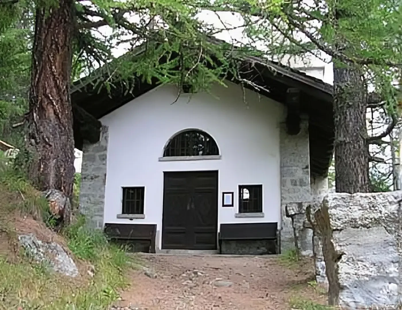
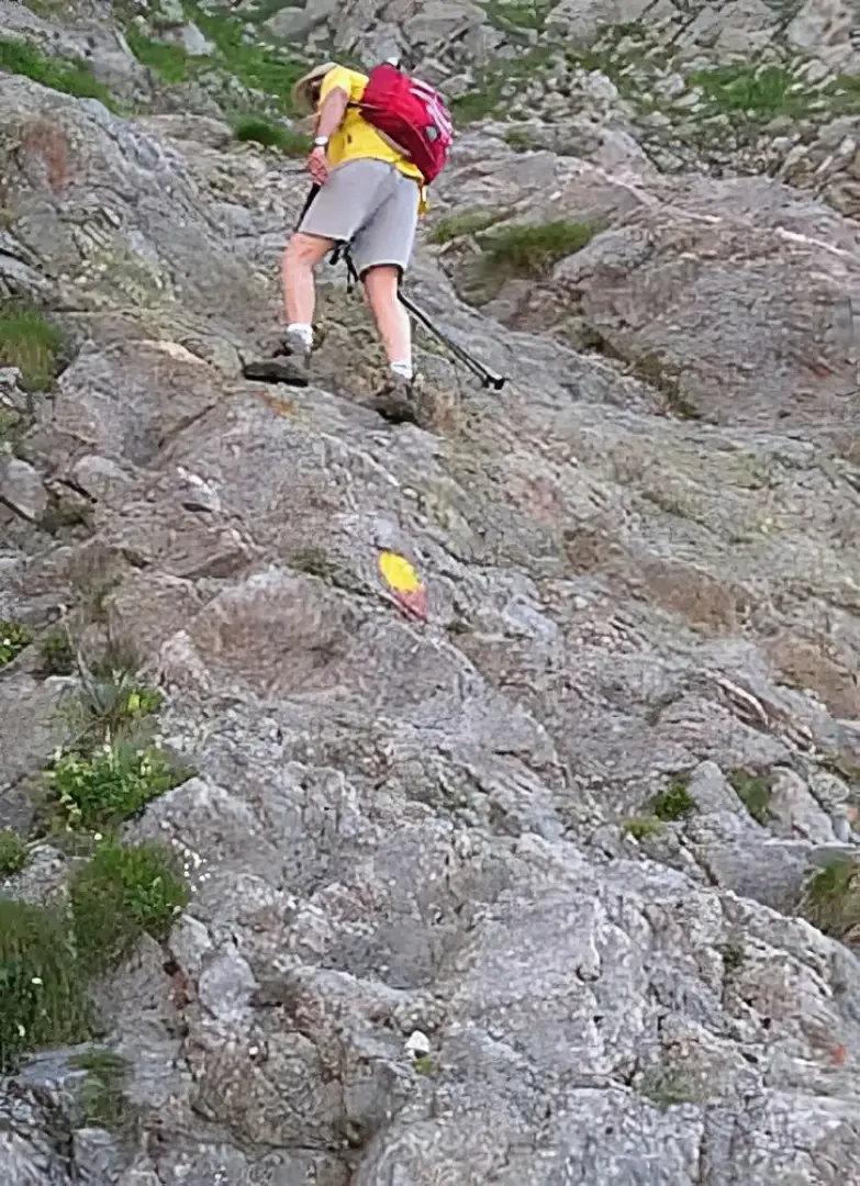
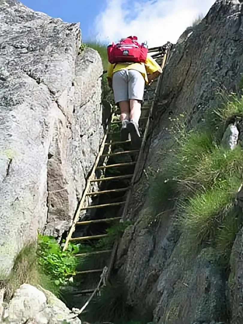
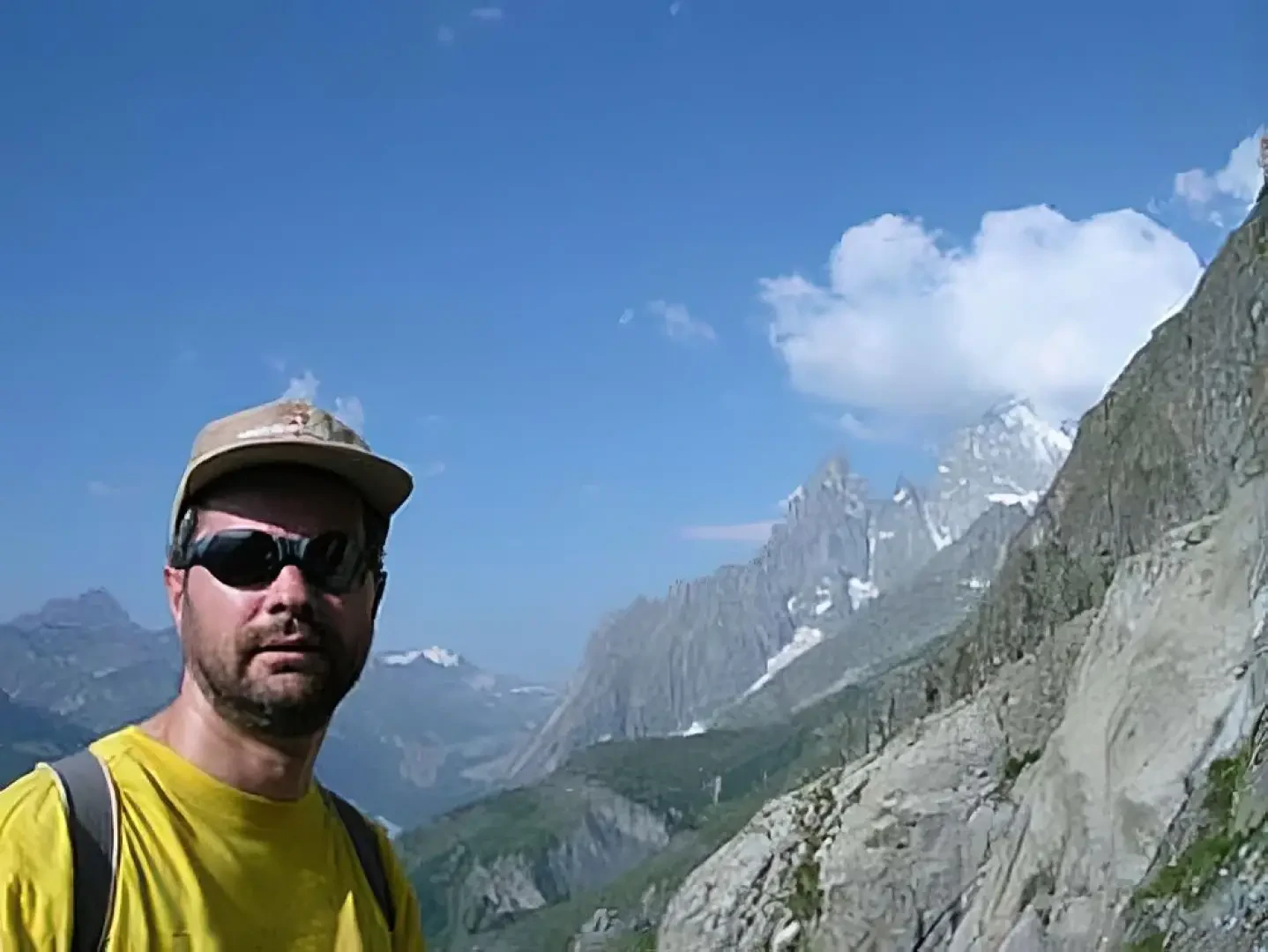
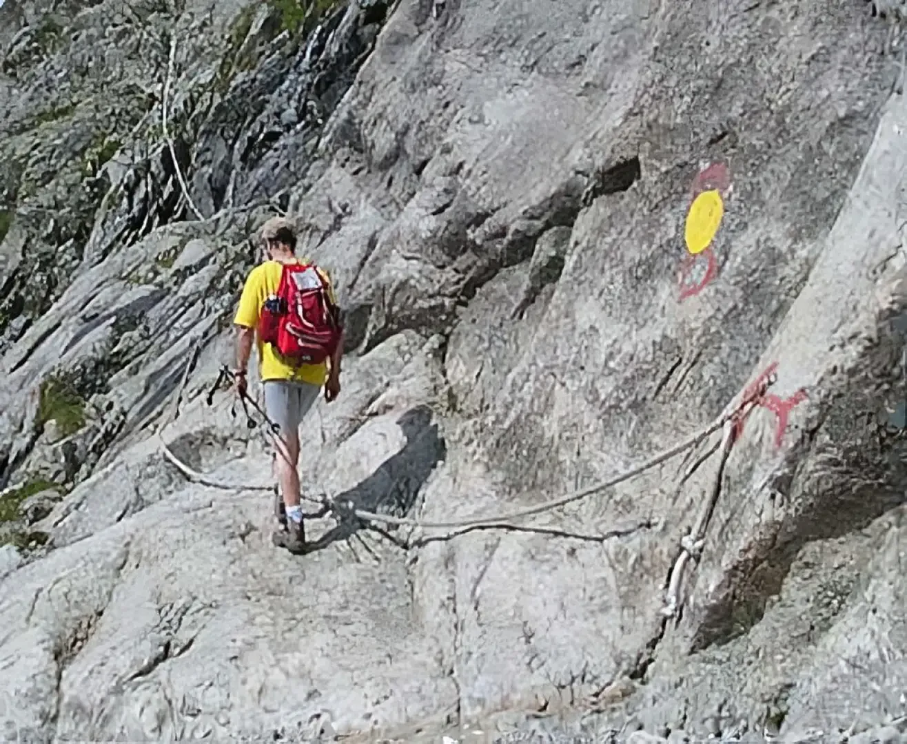
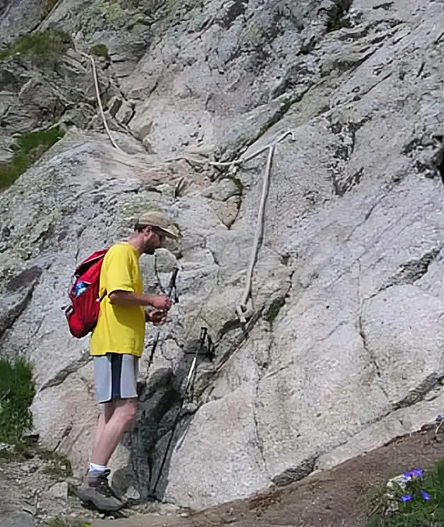
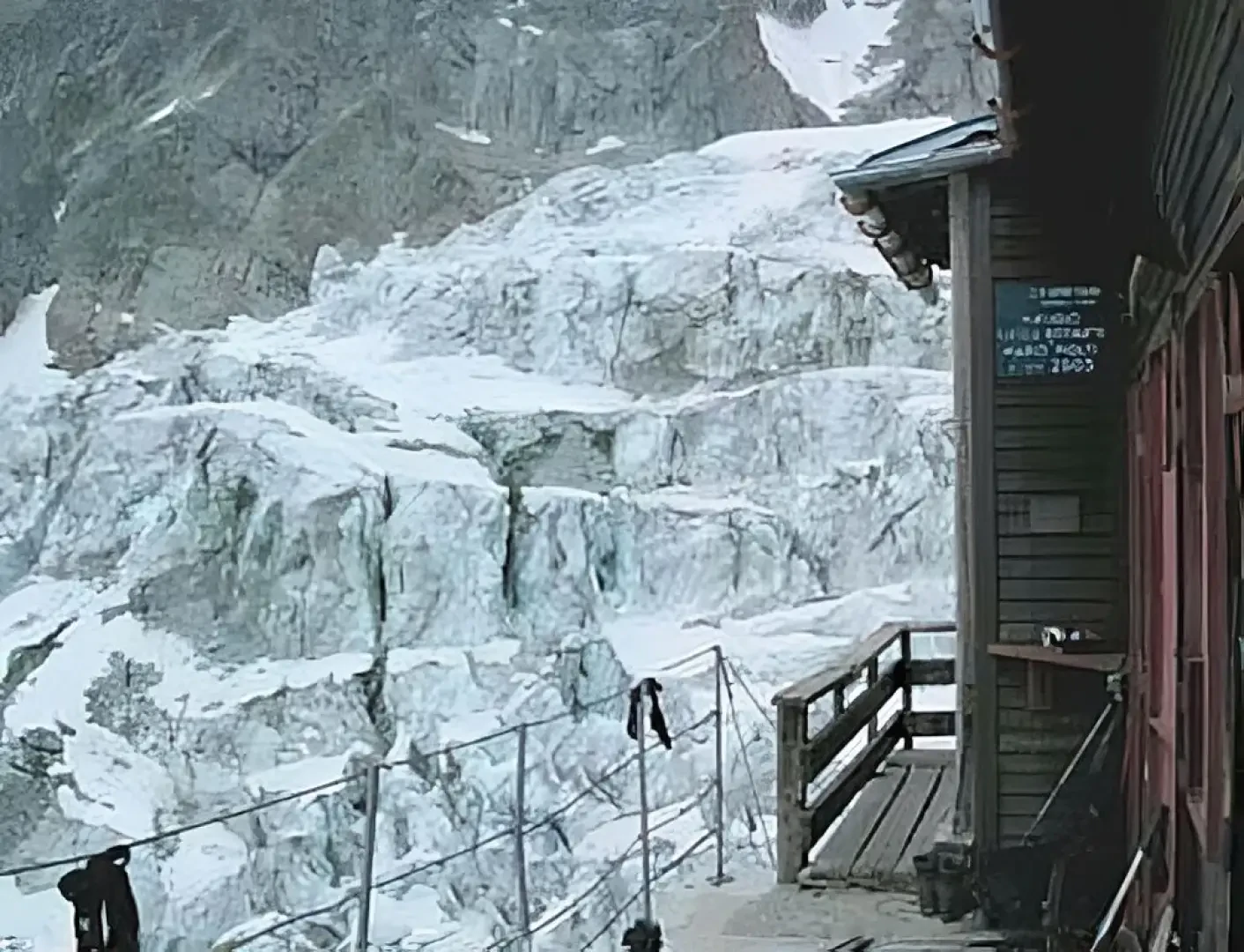
Leave the car at the car park and head towards the old village houses. Near the fountain (water) you will find the old signpost. The path leads out of the village, passing by the chapel and climbing first through a forest, then across the last meadows. The slope is steep, but not excessive. There is no doubt as to which path to follow, because no other uphill paths cross. After 50', you arrive at the end of the meadows and at a double ford of a stream, and then climb first along the banks of the second one, then on a very steep plateau, along which you will sometimes have to rest your hands to ensure your balance. Be very careful on wet ground. The end of this demanding section is symbolised, after 1h 30', by an iron ladder (about twenty steps), which is necessary to overcome a rock jump. The path continues steeply along a moraine ridge. The destination is increasingly visible above, but the advance is slow due to the steep path and the countless zig-zags. About an hour later, we turn left to cross a snowfield and the stream that forms there. Large blocks of ice precipitated from the glacier above suggest that we should not linger on this section of the trail, at least until we reach the base of the rocky island on which the hut is located. The path now becomes a simple rock path, facilitated by the presence of large fixed ropes. A little attention and a final anaerobic effort and you quickly reach the tiny terrace of the refuge. The more willing can continue a little further, still following the fixed ropes, and reach the top of the rocky island to enjoy a better view. Return along the same route.


Comments (0)
Sign in to leave a comment