Cardinello Gorge


Edited by:
Marco Bonati
Updated at: 30/11/2025
Access
From Milan to Chiavenna and Campodolcino along the state road . Next to the car parks of the funicular for the Madesimo-Motta slopes, take the provincial road to Isola; park in a widening at the artificial reservoir.
How to get there with GMaps
How to get there with Apple Maps
Introduction
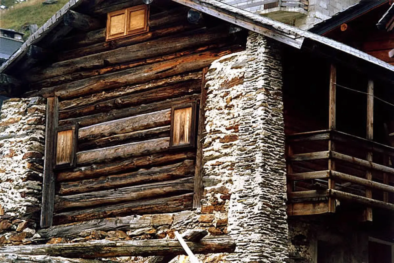
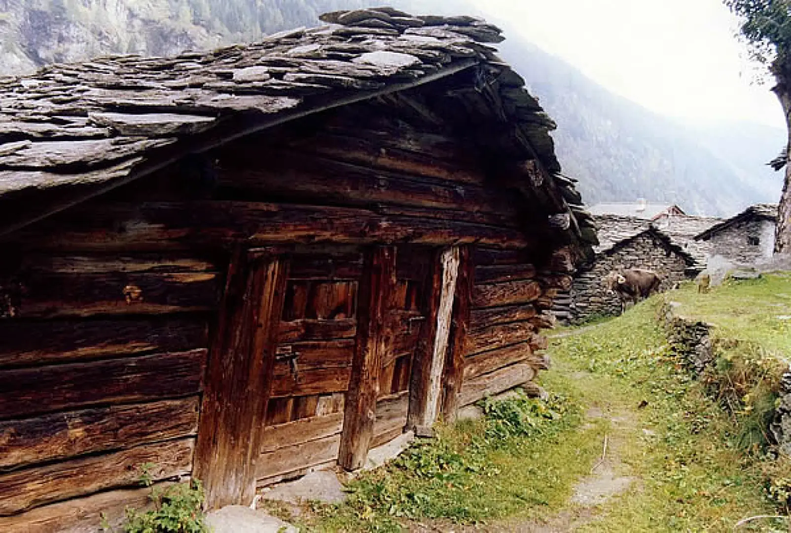
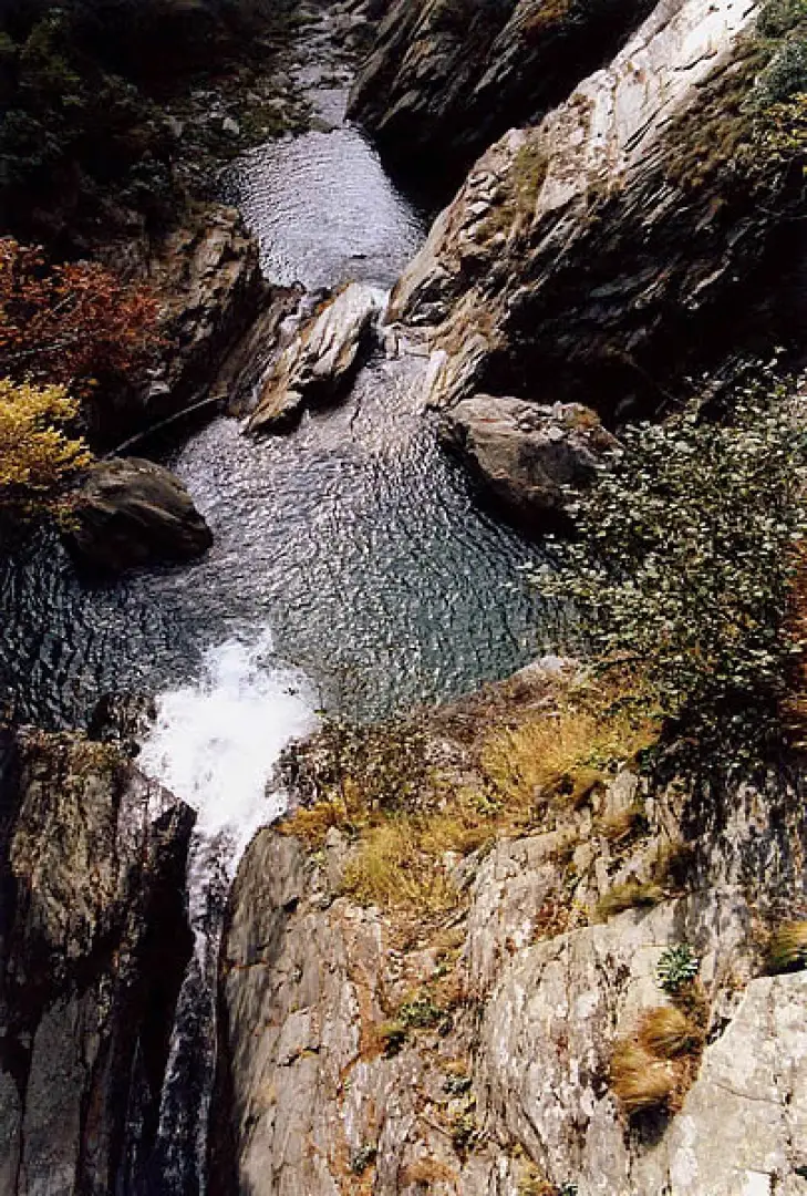
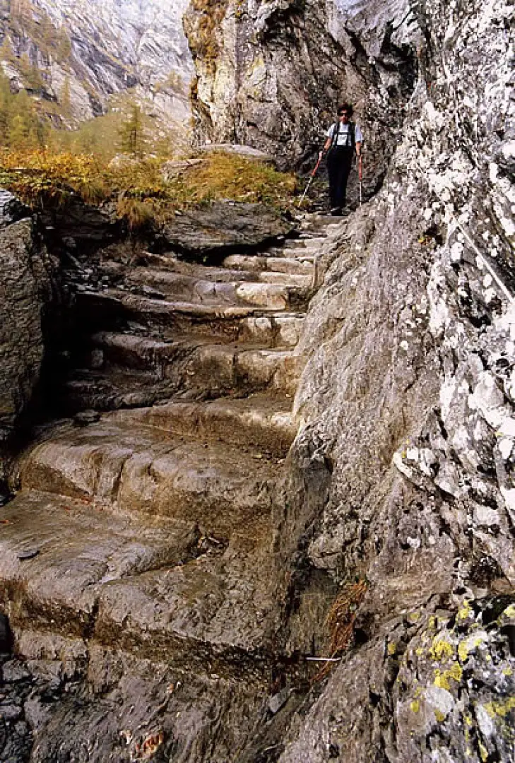
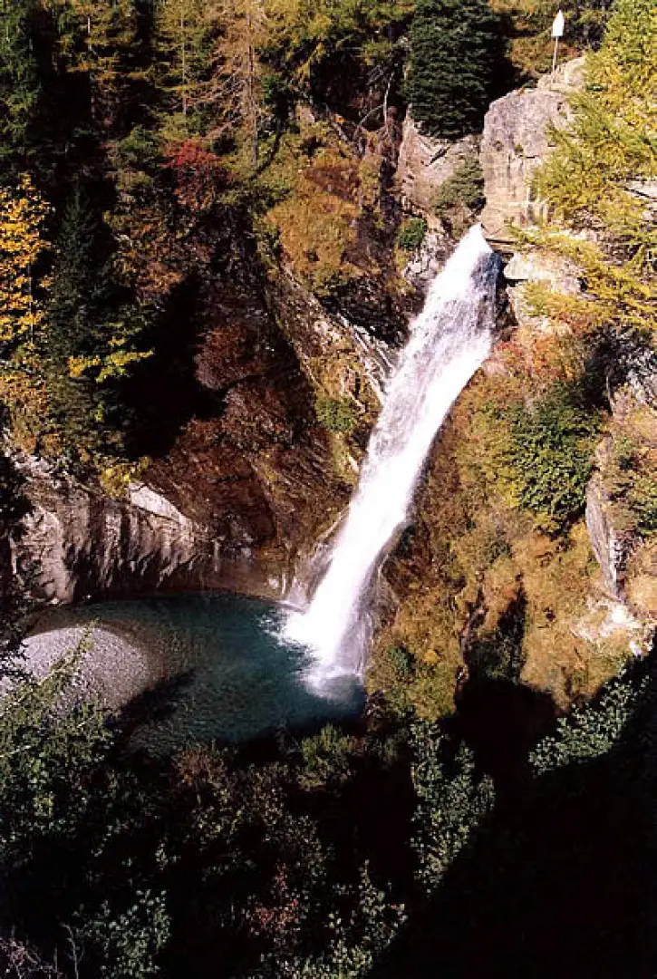
This excursion is interesting in several respects: historical, because it follows a route that has existed with minimal variations since prehistoric times; ethnographic, because it crosses rural nuclei with centuries-old constructions; and scenic, because despite the absence of wide horizons, it allows the observation of waterfalls and pools formed by the Liro river. The historical-tourist texts list a stratification of eleven itineraries belonging to various epochs: from prehistoric times to the mid-1800s; few traces remain or are barely recognisable, except in the obligatory passages carved into the sheer rock. The panorama widens in the circumnavigation of Lake Montespluga, which concludes the ascent. This route should be avoided altogether in the presence of snow; it can be done with great caution - and crampons! - in the presence of ice. The descent by mountain bike after climbing up the state road to the Montespluga dam is interesting.
.Description
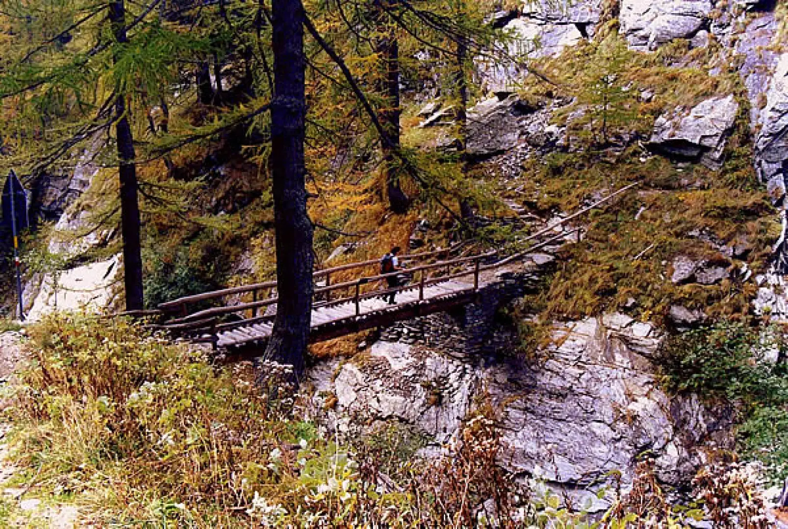
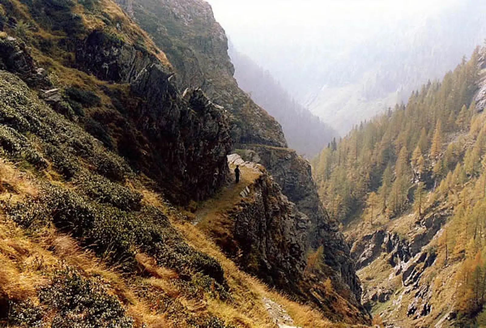
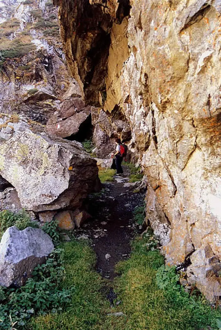
From the car park, cross the bridge over the Liro and then, alongside the power station, follow the track that runs alongside the river amidst the bushes of vegetation that has grown back on the track of the Reno methane pipeline buried here in 1980. After crossing the small hamlet of Torni (1360m), the track continues for a few hundred metres until it abruptly changes direction from the river, where it becomes a mule track on a route dating back to the 18th century. At the height of the Ponte degli Svizzeri bridge (built in 1990 by a platoon of Swiss infantrymen as part of a supranational project to upgrade historic routes) the mule track enters the spectacular section, alternating steep mule tracks with stepped trenches and semi-galleries. Here and there, in the rock, one can distinguish perforations intended to support - in the past - wooden parapets or avalanche barriers; some inscription or date or symbol engraved in the rock face probably reminds one of the many misfortunes that have occurred along this stretch.
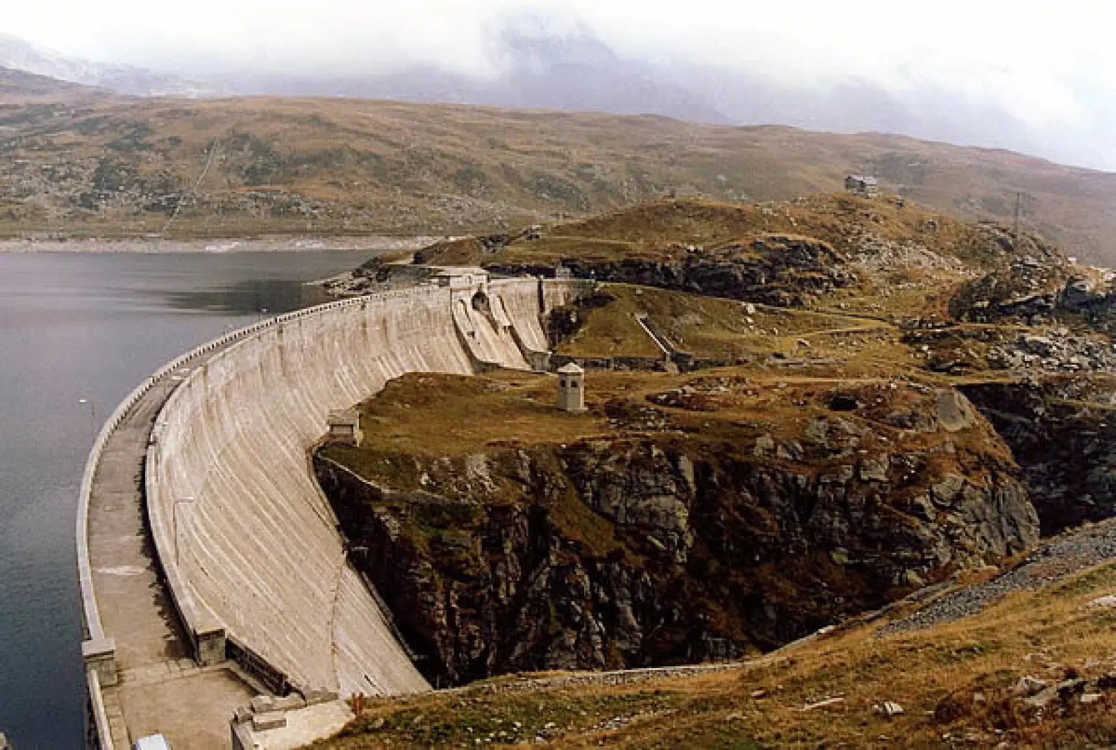
(One for all: in the autumn of 1800, an avalanche threw at least a hundred soldiers on horseback - plus horses - of a Napoleonic military column into the abyss). After a few more recent hairpin bends, we climb up the paved road (certainly not Roman, as a sign would indicate) to the height of the dam of Lake Montespluga.
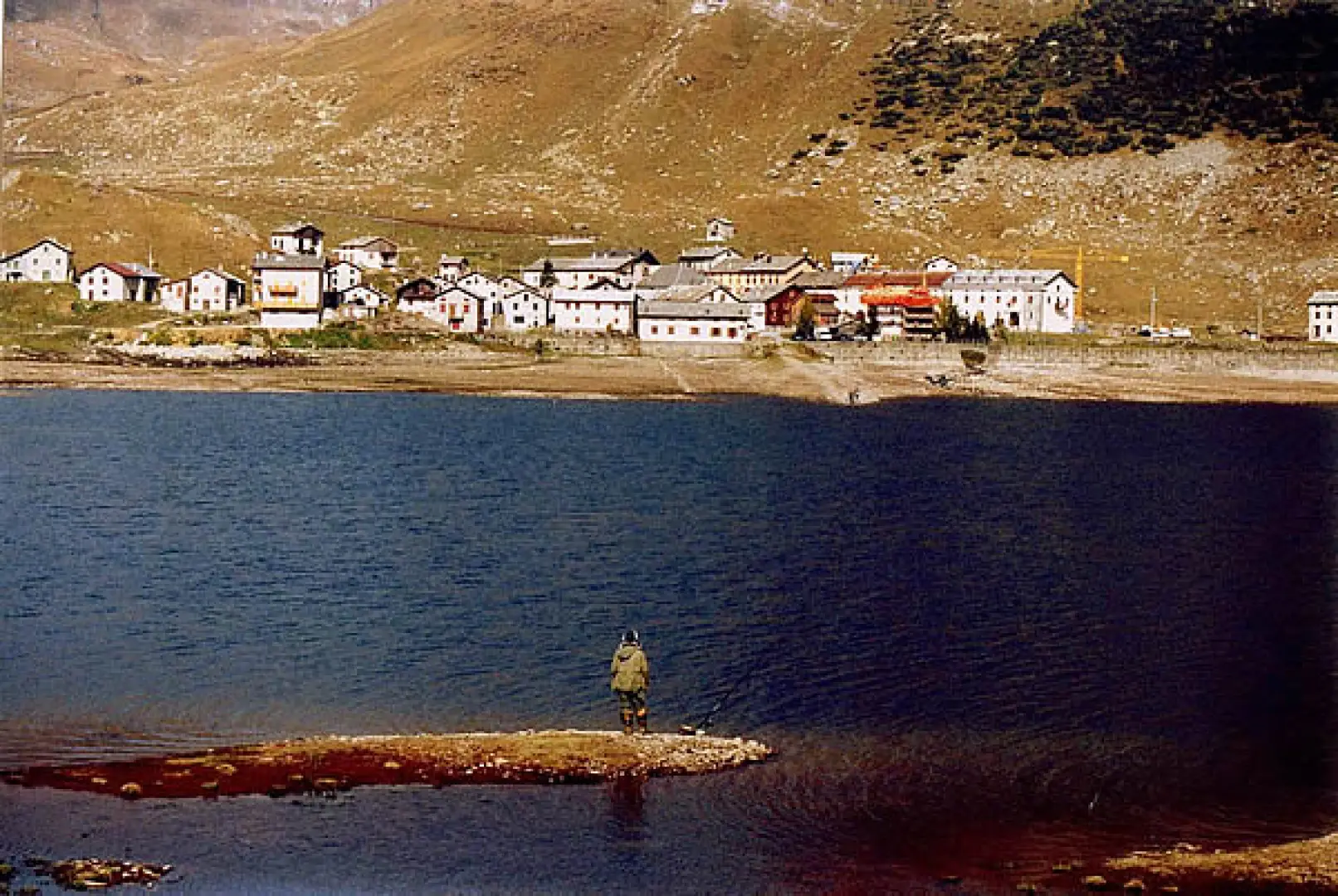
After the outlet of the Schisarolo Valley, we follow the flat path that skirts the western side of the lake. By now within sight of the village of Montespluga 1912m, cross the Val Loga on marshy terrain to reach the village. For the return trip, it is best to follow the eastern side of the lake, keeping below the state road as far as the dam, which you cross passing by the Castellaccio hut, and then retrace your steps as far as Ponte degli Svizzeri, where you cross to the opposite side. Immediately you are at Soste 1597m, amidst the donkeys of a large herd, then continue through the pastures to the 'carden' huts of the Rasdeglia 1499m and Mottaletta 1346m villages. (Contacts with Walser populations from the upper Mesolcina and Rheinwald are documented). The road has become asphalted and soon leads back to Isola. (Note the construction of the Cardinello Inn in 1722).
General Information
Path:from Isola
Signposts: -
Type of route:circular
Recommended period:April, May, June, July, August, September, October
Sun exposure: south
Photo gallery
Comments (0)
Sign in to leave a comment