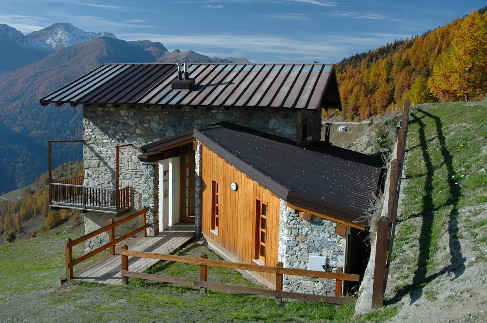
Dortoir Baravex, ring from La Ville

Access
Leave the motorway at the Aosta Est junction. Take the state road - in the direction of the Gran San Bernardo tunnel. Continue uphill, pass the municipality of Gignod and continue until you come to the crossroads with the regional road for Allein. Turn right and take the road. Descend towards the valley floor until crossing the Artanavaz stream, then climb up the opposite slope in a series of hairpin bends. Reach the main town of Allein and continue uphill for a few more kilometres until reaching the village of La Ville (altitude 1,405m), located about 7km from the junction with the . Leave your car in the car park 🅿️ located in front of the Agriturismo Lo Ratelé.
Distance and travel time
🕒Travel time: 26 minutes
📏 Distance: 21.1 km
GPS navigation
📍 How to get there Google Maps
📍 How to get there with Apple Maps
ℹ️ Important note
The directions given were verified on the date of the route survey. Before departure, it is advisable to check for any changes to the route. For up-to-date and detailed directions, we recommend the use of Google Maps or Apple Maps.
Introduction
Interesting loop to discover a little-known place in the Aosta Valley. The destination of this little tour is the Dortoir Baravex: this stopping point is very useful for those who, during the Tour des Combins, wish to keep lower and bypass the Col de Champillon. In this itinerary, on the other hand, we propose it as the destination of a beautiful circular route on the slopes of Mont Saron through enchanting pastures and forests.
Description
0h00' 0.00km From the car park of the Lo Ratelé holiday farm, turn left onto a small road that crosses through the village of Ville; go past a small clearing, then turn first right, then left and right again until you come to a small asphalt road that runs along the upper edge of the village. We turn right and begin to climb the wide slopes descending from Mont Saron along a small asphalted road. Along the way, there are interesting views of the not-too-distant Mont Fallère and Grande Rochère and the Mont Saron above. One climbs up the pastures, often with one's eyes peeled! passing a series of hairpin bends until you reach the crossroads near the Comba alpine pastures: here continue straight on, now meeting the no-trespassing sign (1666m).
0h50' 0.00km ()The road now becomes a dirt track and, after a wide bend to the left, you pass below the ruins of Pied du Plan (1722m): the destination of the itinerary is now clearly visible. Continue on and, after a hairpin bend to the right, you reach the cottages of Baravex dèsot and, shortly afterwards, Baravex de Meiten (middle).
1h05' Having left the little road for the latter (1825m), one enters the beautiful Bois de Baravex composed mainly of spruce (Abies picea) and speckled with larch (Larix decidua), which accentuates its colouring in the autumn period. After passing a hairpin bend in the forest, turn left and you will soon reach the renovated alpine pasture of Baravex Damon (1925m, 1h25'). After passing the alpine pasture, descend a couple of short hairpin bends and finally reach the new Dortoir Baravex (1910m).
1h30' The descent can be made along the same route as on the outward journey, but it is advisable to proceed downhill along the Sentiero
path that descends the slopes of Mont Saron.
Follow the itinerary back to the Baravex Damon mountain pasture, turn left here and go back up the little dirt road. Neglecting the fork to the left for Orgières, continue straight on until reaching a practically level stretch that cuts across the ridge descending from Mont Saron. Re-enter the forest and soon reach the Parc mountain pasture (2014m) and its very long watering hole: from here, descend in a southerly direction following the yellow markings of the trail (not very evident at first).
1h40' Now continue downhill following a small valley and soon reach the pastures above the Fontaines mountain pasture (1892m).
1h50' Continue in a westerly direction, entering the forest on an almost level path until a turn to the left: from here, begin the descent into the forest along the slope above Echevennoz. After meeting the dirt track (1724m), continue downhill again following the path that starts out just below flanked by a wooden railing.
2h00' You descend for a short distance then turn left (be careful, it is not very well signposted!) and continue your descent until you reach a small panoramic spot with rudimentary wooden benches. The descent continues until you come to a second small road coming from the Bossolaz pasture: here, turn left and head back towards the starting point. Shortly afterwards you will come to a fork: turn right and descend to Bruson (1479 m, 2h15'); here you will come to a post indicating that you should descend, turning right.
2h15' After following a first bend to the right, you make a wide curve to the left, leaving the asphalt road behind, which becomes a farm track and then a path. When you reach a small stream, climb up until you come to the ruins of an old mill; just above it, cross the stream/torrentello: the path again becomes an agricultural track and then a tarmac road when you reach Ville. Passing the first houses, you come to the small chapel of La Ville, dedicated to Saint Stephen, and soon reach the starting point (1415 m) 2h30'.
Punti di interesse
- La Ville
- Baravex dessus
- Dortoir Baravex
- Fontaines dessous
- Berruard
Collections
- escursioni con partenza da La Ville - sulla mappa
- escursioni ad Allein - sulla mappa
- escursioni nella Coumba Freida - sulla mappa
- escursioni ai bivacchi della Valle d'Aosta - sulla mappa