Motta Ridge


Edited by:
Marco Bonati
Updated at: 03/09/2024
Access
From Milan to Morbegno along state roads 36 and 38; at the roundabout at the entrance to the town, turn right towards Val Gerola. Drive up the valley to the village of Gerola Alta: some limited parking areas are available.
Introduction
A hike that is locally known but generally little frequented in its entirety.
Great panoramic interest on all the peaks of the Val Gerola: an orographic complex frequented only on a few well-known peaks and completely neglected in the majority of its extension. The complexity is also underlined by the absence of accurate, precise or at least credible cartography.
Description
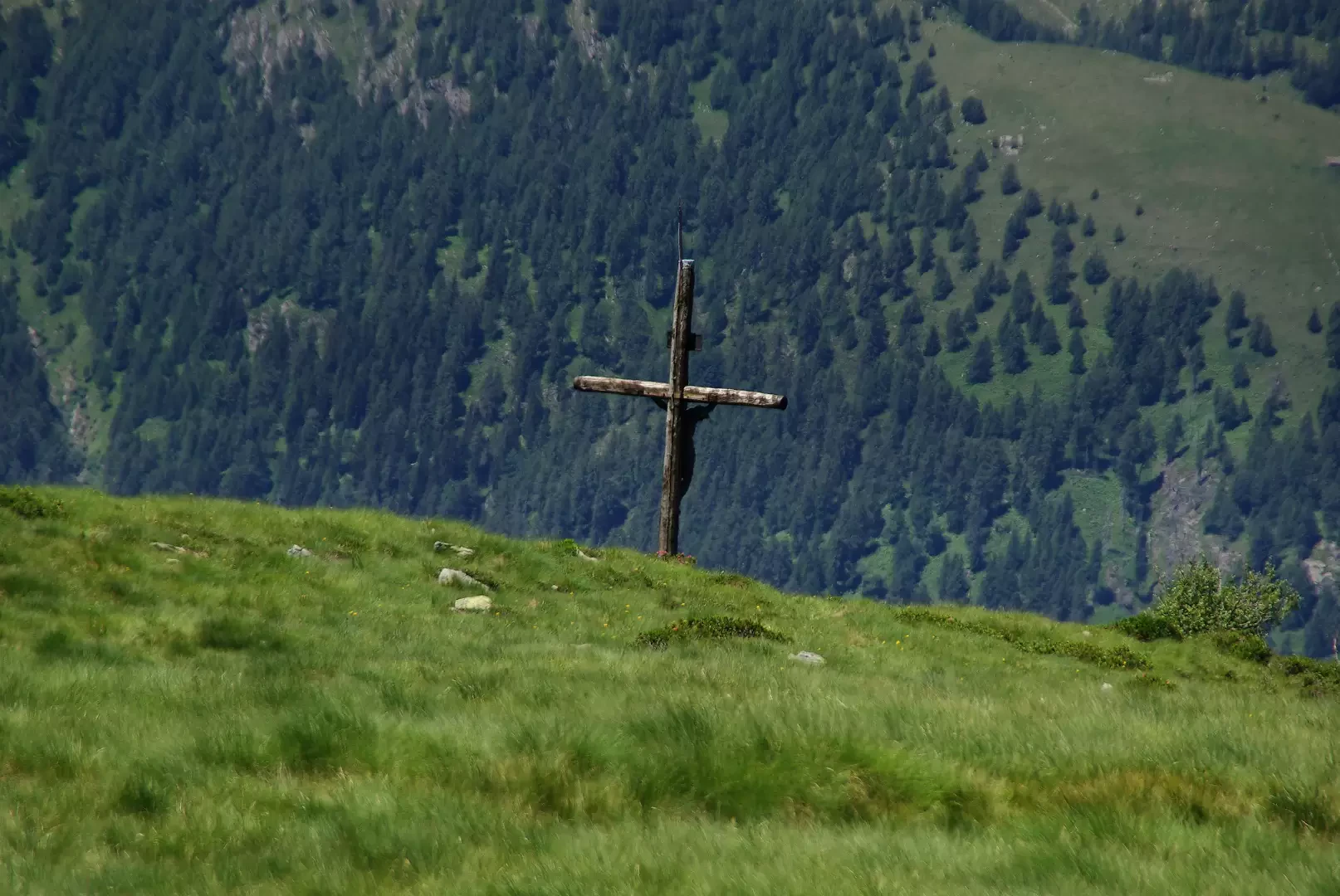
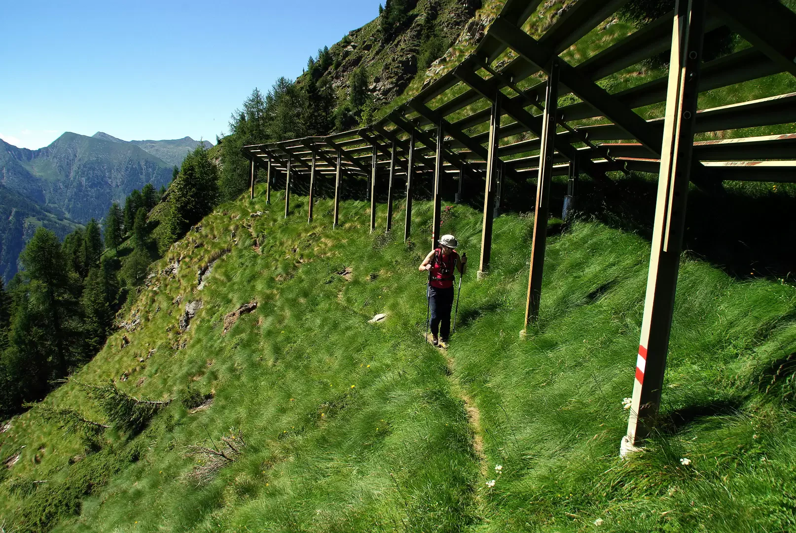
From the car park, cross the Bitto stream over the bridge in front of the Albergo Tre Signori: from here, on the left, a beautiful mule track begins, which climbs in a long wooded diagonal all the way up the slope at the base of the last offshoots of Monte Motta. As you leave the beech forest, you reach the first clearings of the Bominallo alpine pastureland 1357 m: vast prairies dotted with sparse huts surrounded by beautiful fir trees. The path, barely visible in the grass, follows the painted markings on the huts, always keeping to the edge of the forest in a SOUTHERN direction. You walk along a long, splendid stretch with lush undergrowth of bilberry and rhododendron; at "Pantano" (presence of a seasonal pond) you leave the junction for "Rundanit" on the right and continue until you come to the pastureland of the "i Piaz" hut, about 1600 m. The track tends to disappear, but from the hut, a dense signpost (three red dots) leads in a sometimes steep traverse to the "Piä da la Gianzana" pasture. From here, the last very steep stretch to the summit is visible: amidst alder bushes, a narrow serpentine bypasses some ancient avalanche barriers to the summit meadows of Monte Motta 1971 m. A valuable wooden crucifix is placed at the northern edge of the shelf in a dominant position over the valley. A well-marked path climbs up to the highest point of the Motta ridge 2004 m and then descends to an unlisted pass: from here, descend through numerous rows of avalanche barriers through sparse woodland to a couple of huts with a fork in the road. Take the ascending traverse to the left and you will soon reach the Bocchetta di Scioch 1950 m approx. (communication with the high alpine huts of Bomino Vaga); continue along an exposed traverse, at times rocky and landslide-prone, to a rocky ridge with a beautiful view of Lake Pescegallo and the peaks of the Ponteranica group. A grassy little valley leads to the crossing of the Pescegallo dam 1865 m; on the other side, follow the service track to the Casera Pescegallo Lago 1778 m, where a stony and steep mule track starts (just to the side of the track) that quickly descends to the car parks of the tourist resort of Pescegallo 1454 m. Passing to the right of the chairlift station, a track can be found in the meadows beside the stream (signs of a 'life trail'): follow it at length to the locality of Fenile 1238 m, where it returns to the provincial road for a short distance. To the left, near a hydroelectric water intake, begins the old mule track in the valley, which quickly leads to Gerola Alta, right near the initial bridge.
Objective Danger: presence of slippery grasses
Mountaineering Grade: I
Exposure to Sun:South-West
Exposed Tracts:long traverse
Photo gallery
Comments (0)
Sign in to leave a comment