Crepaccio di Paderno, from Paderno d'Adda


Edited by:
Marco Bonati
Updated at: 03/09/2024
Access
From Milan, take the Tangenziale Est (Eastern Bypass) all the way to its end, where you continue in the direction of Lecco as far as the traffic lights at Cernusco Lombardone; turn right and continue as far as the traffic lights just before the bridge over the Adda at Paderno. Do NOT cross the river, but take the road opposite the traffic lights, which enters the fields after an isolated farmstead. Few parking spaces immediately after the farmstead.
.Introduction
Curious speleological destination in an area of complete plain that is certainly not karstic. The Adda flows in a rocky gorge about 100 metres from the level of the surrounding countryside: the structure is a conglomerate of pebbles welded together by an arenaceous matrix ('stump'). The cave opens into the wall following a fracture line of probable tectonic origin. The route is free of objective dangers and does not require any specific technical knowledge. Caution is advised and care should be taken not to pollute the environment in any way.
Description
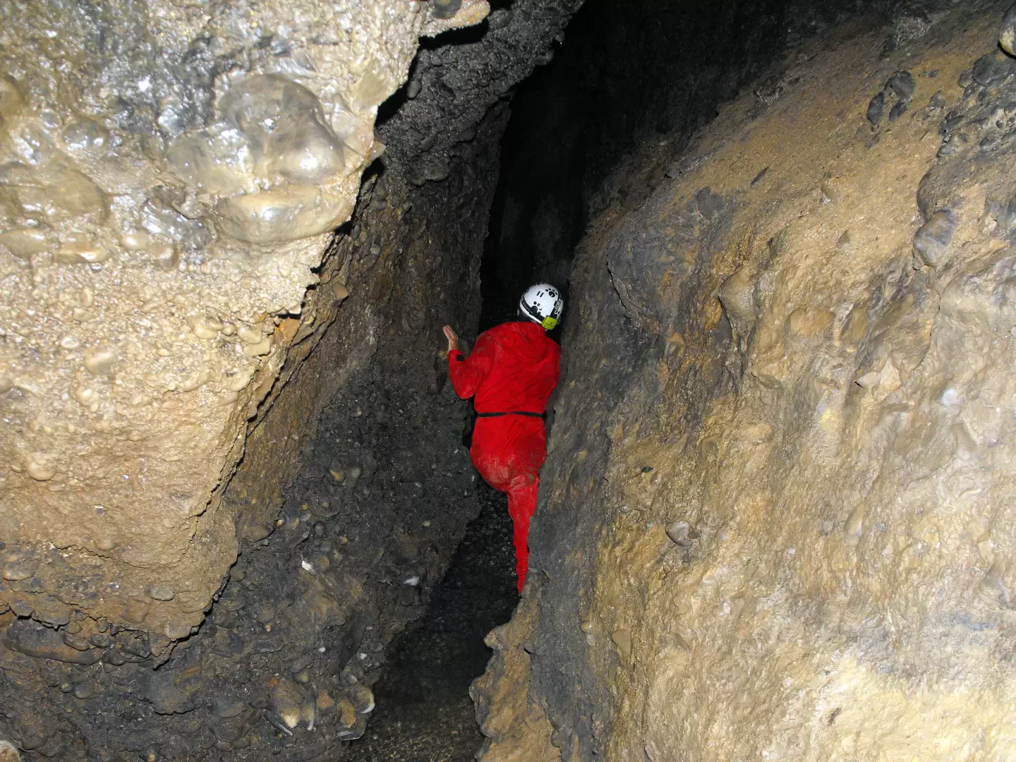
From the 284 m car park, take the cobbled track steeply downhill towards the river towpath. At the third hairpin bend, leave it and, to the right, follow a flat dirt track for about 350 metres to a vague widening (a small path branches off to the left). Here the track tends to climb: about 60/70 metres from the widening, it approaches the rock face; a very steep landslide track leads in a few metres to a cleft in the rock between the trees. One ascends it and a natural arch precedes a grassy terrace where the 210 m cave opens up. Initially, a steep slope of loam and plant debris is faintly illuminated by a thread of light coming from above; then the path - still about 50 to 150 centimetres wide - becomes stony and a little damp. Unravelling among some jammed boulders and very short climbs, one reaches a first limpid pond (in reality, a deep fissure to the right side of the floor flooded by clear groundwater). To the left, the route continues with similar characteristics and a single delicate passage: a loose rock flake allows passage over a floor sinking. A fork represents the end of the trip (-25 m from the entrance): to the right a flooded corridor closes after about ten metres, to the left an artificial footbridge (two large branches side by side) over a deep pond leads to a narrow passage that also closes after a few metres.
Return by the outward route.
Route Type: A/R
Difficulty: EE
Mountaineering Grade: II-
Equipment: good light source
Recommended Period: all year round
Total Time 1h30'
Departure altitude: 284 m
Arrival altitude: 185 m
Height difference: 99 m
Objective Hazard: caving environment
Exposed sections: delicate passages on wet rock
Photo gallery
Comments (0)
Sign in to leave a comment