Corna Mara, from Alpe Mara

Edited by:
Marco Bonati
Updated at: 03/09/2024
Access
From Milan to Sondrio along State roads 36 and 38; at the roundabout at the entrance to the town turn right and follow the old ring road until the traffic lights at the building housing the Civica Scuola di Musica and the Provveditorato agli Studi (on the right). Turn left and follow the signs for "Montagna" and "Strada Panoramica dei Castelli". The route crosses Sondrio and then begins to climb up the slope with a few steep bends; once at Montagna, continue until the sign for "Municipio" and turn left. From here, passing several bivouacs, and always following the signs for "Alpe Mara", go up the wooded slope for several kilometres. In the last stretch, the road surface becomes unpaved, but still fairly well travelled. We park in a limited lay-by near a ford of a stream, where the movement of unauthorised persons is prohibited.
.Introduction
A classic panoramic climb, traditionally frequented by the people of Sondrio since the early years of tourist mountaineering. The climb is advisable with excellent visibility during the autumn season to avoid the frequent mists at the bottom of the valley; not advisable, on the contrary, with fog due to the extreme difficulty of orientation and with snow due to the slope of the summit pastures.
Description
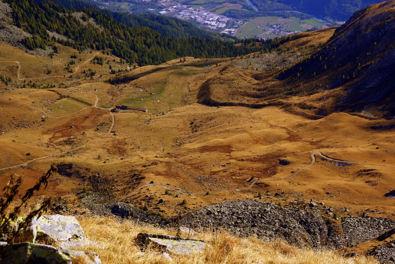
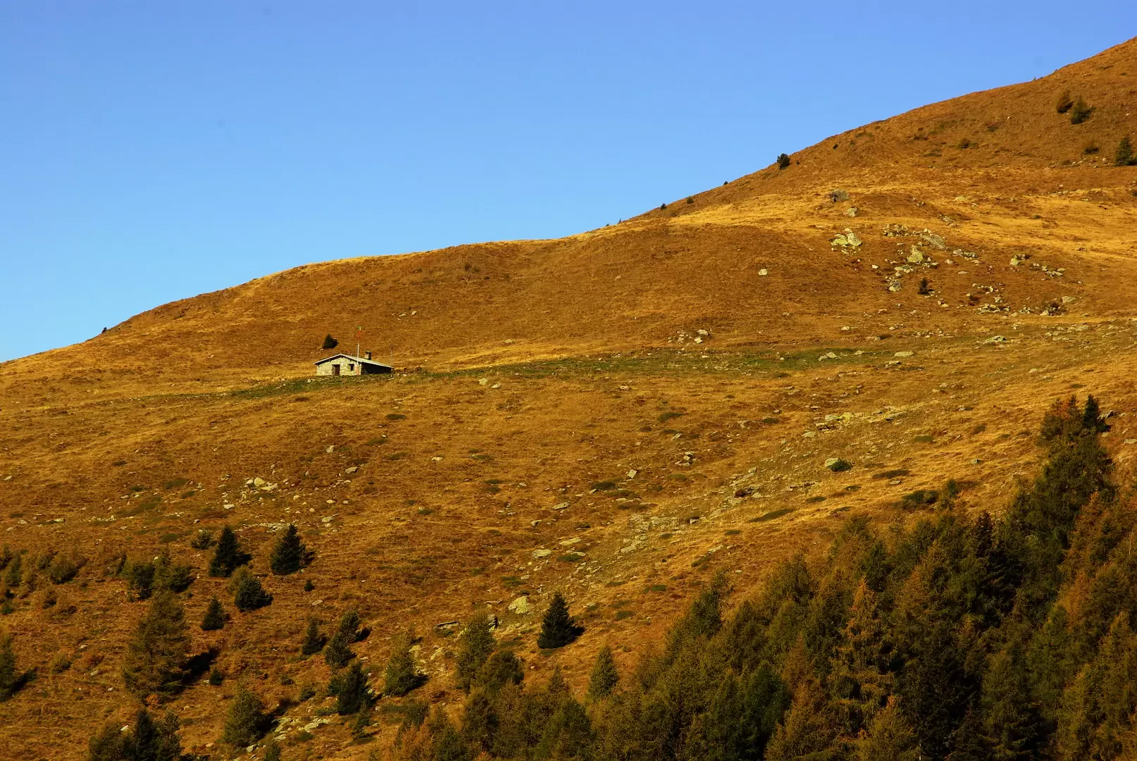
From the widening in correspondence of the Davaglione stream crossing (Alpe Mara 1749m), following the indications on the post, take the forest track for the entire length of the Rifugio Gugiatti-Sertorelli 2138m [it is convenient to use the old mule track that cuts the hairpin bends of the cart track as a shortcut].
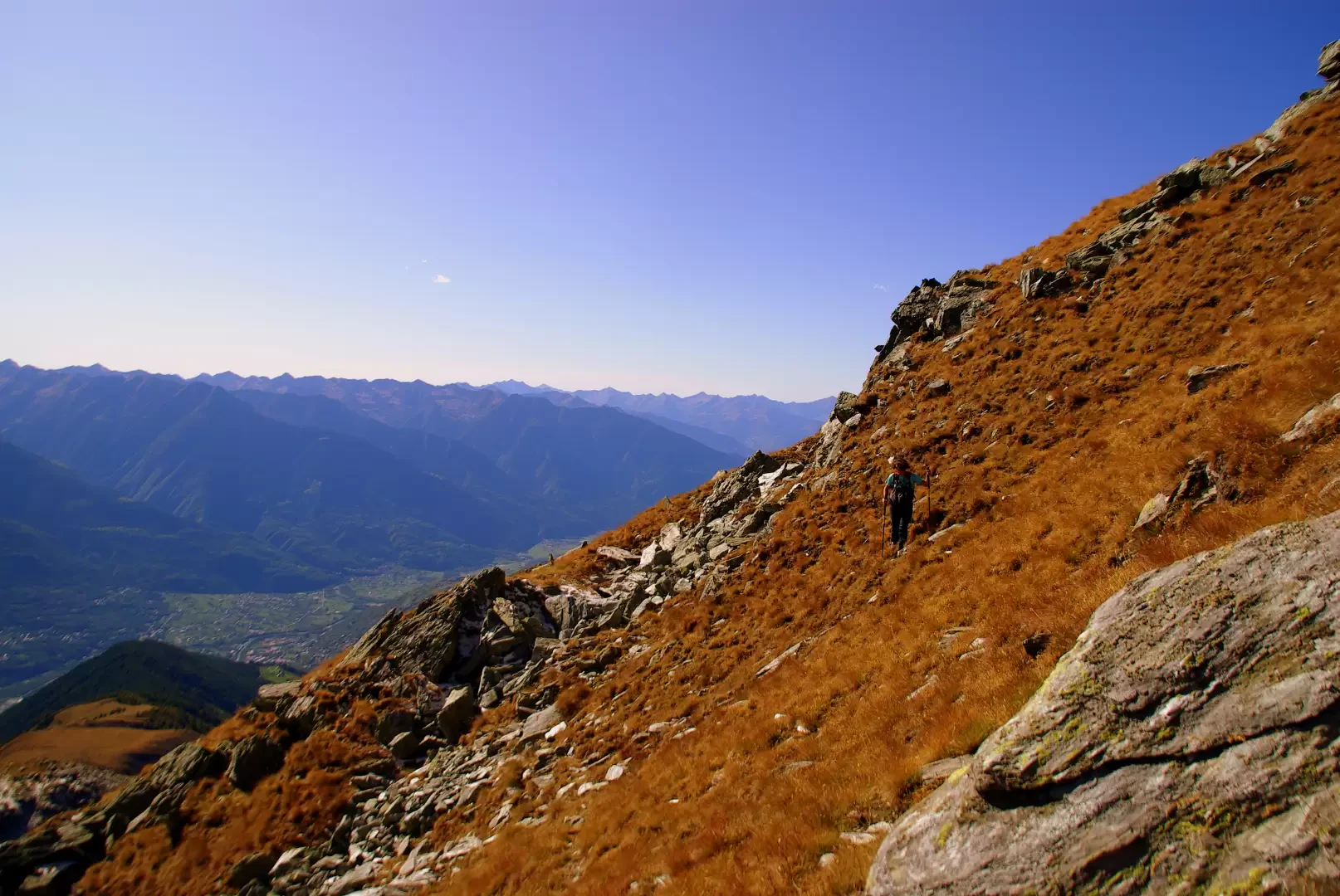
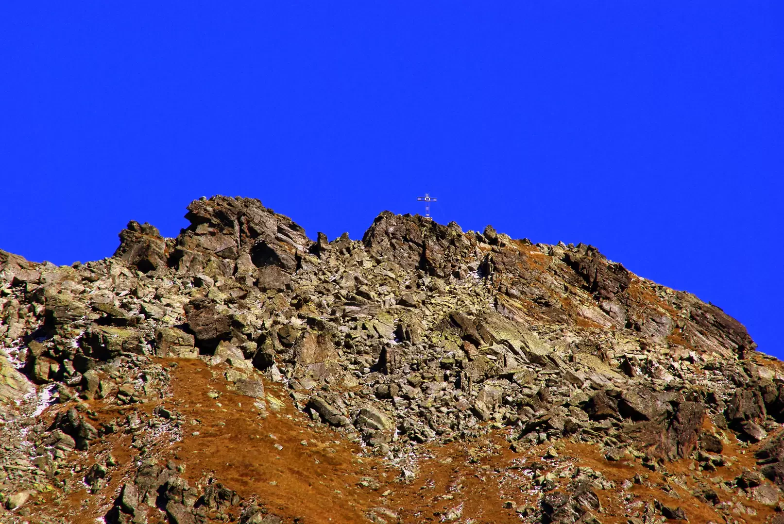
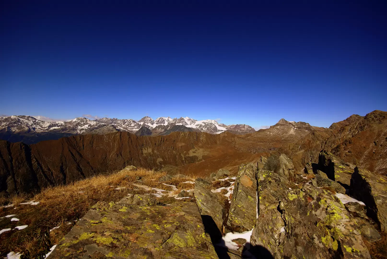
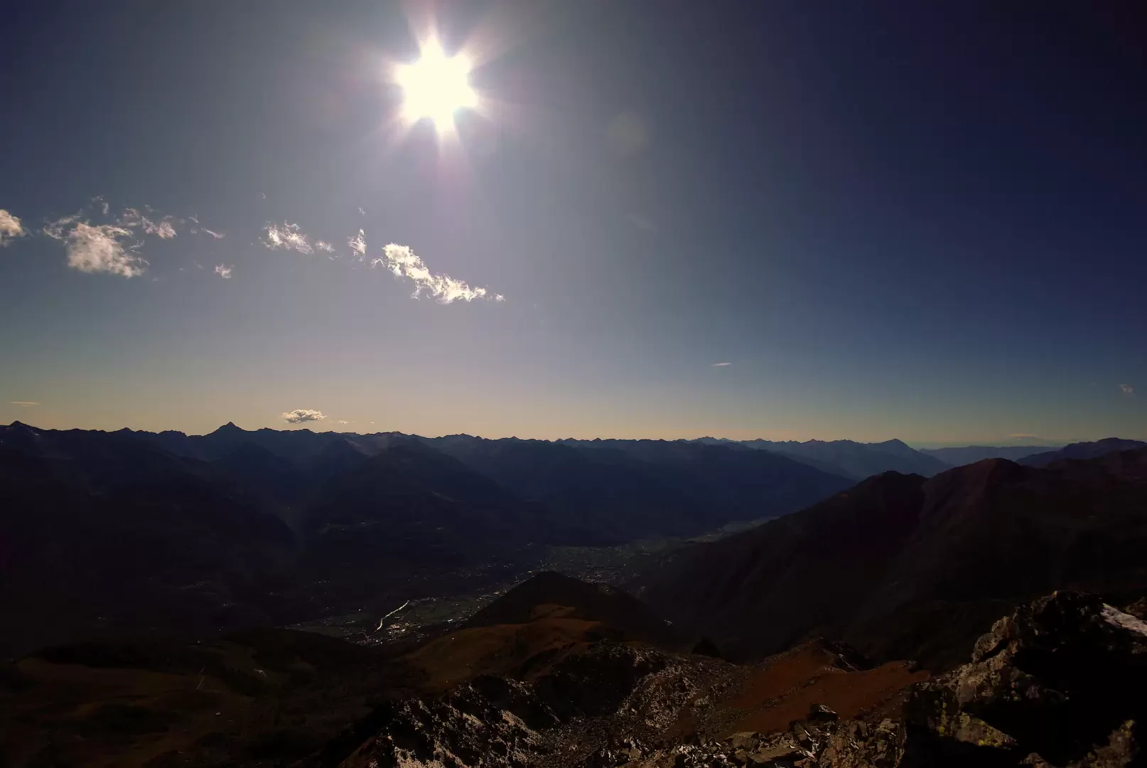
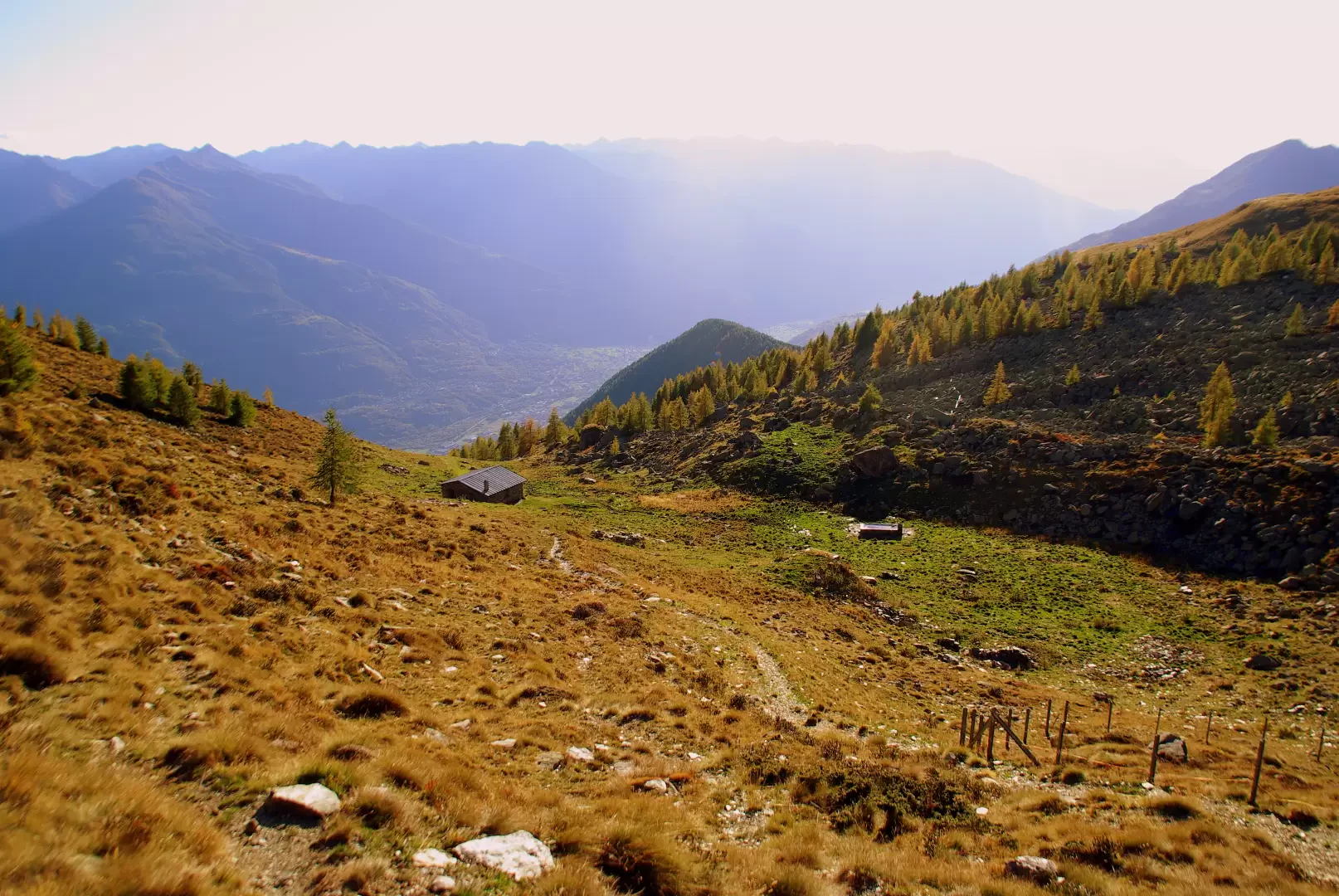
About a hundred metres before the hut, we detach from the track to look to the right for a small path that, with a few short traverses, climbs the grassy shoulder 2289m. Continue along the south-west ridge on a steep track between pastureland and rocks: great views over the lower part of Valmalenco and Val Torreggio as far as Monte Disgrazia. Having reached the summit of this section 2585 m, an unexpected wide basin opens up on the left, invisible from below. Having crossed the bottom occupied by boulders, the track becomes totally lost and to continue it is necessary to climb the very steep pasture until near the west-south-west ridge: here there are signs of passage and a few stretches of paint. One continues in a gentle upward traverse among slippery grasses and unstable boulders: the track heads for a kind of wide gully - more like a hollow in the slope - of enormous stacked blocks. Juggling the boulders, you traverse below the very close summit and reach the south-east ridge: on goat tracks you reach the summit cross of Corna Mara 2807m. [Some guides classify this last section with mountaineering difficulty F]. Very open panorama on all sides, between Monte Rosa and Adamello, but particularly complete on Bernina and Orobie.
For the return trip, it is entirely convenient to continue with the crossing of the summit: descend to Bocchetta di Torresello 2580m, initially along an unstable scree slope and finally along a comfortable pastureland slope. From the Bocchetta, descend southwards on a very faint, essentially grassy track, bypassing some bumps, until reaching a forest track near Alpe Rogneda 2186m: the track lies between a marshy area and a cumbersome intake structure of the Tresivio aqueduct. [This entire section is clearly visible from the summit of the Corna Mara]. Continue along the track to the right - some shortcuts are useful - until you reach Bocchetta di Mara 2342 m. On the other side, a good track descends gently to Baita Zocche 2150m (once again in view of Rif. Gugiatti-Sertorelli). From here a farm track goes to reach, near an aqueduct tollgate, the access road to the refuge, already taken on the outward journey: follow it downhill to return to the Alpe Mara car park.
Objective Danger: slippery grasses
Exposed Sections: traverse path before terminal rocks
Galleria fotografica