Col Pinter, from Tschemenoal


Edited by:
Massimo Martini
Updated at: 09/04/2026
Access
Leave the motorway at the Pont-Saint-Martin exit. After about 100 metres, turn right, pass a traffic light and continue for about 600 metres until the crossroads for Gressoney. Enter the village of Pont-Saint-Martin and, after 1.2 kilometres, turn right onto the regional road in the direction of Valle di Gressoney. Follow up the entire valley for about 30 kilometres, passing through the villages of Lillianes, Fontainemore, Issime, Gaby and Gressoney-Saint-Jean . Once past the latter, continue for a few more minutes until you reach the village of Tschemenoal, where there is a free car park (🅿️) just beyond the hamlet, on the side of the road.
The place is served by public transport; to consult up-to-date timetables and lines, visit the aosta.arriva.it.
Distance and travel time
🕒 Travel time: 40 minutes
📏 Distance: 30.2 km
GPS navigation
📍 How to get there with Google Maps
📍 How to get there with Apple Maps
ℹ️ Important note
The information provided has been verified as of the date of the route survey. Before departure, it is advisable to check for any changes to the route. For up-to-date and detailed directions, we recommend the use of Google Maps or Apple Maps.
.Introduction
The Col Pinter is one of those passes that can unite two worlds: it connects the Gressoney Valley to the Val d'Ayas through a wide pastureland basin nestled between the slopes of the Corno Vitello and Testa Grigia. The excursion from Tschemenoal winds its way along a richly evocative route through larch forests, ancient Walser villages and wide alpine pastures still in use, until it reaches the high altitude where the landscape opens up to the peaks of Monte Rosa. It is an itinerary with an Alpine feel, alternating between the quiet of the meadows and the majesty of the mountains, with the Alpenzù Refuge as an ideal stop-off point for a rest or for those wishing to continue towards Testa Grigia or the watershed ridge. From the Col Pinter saddle, at 2,777 metres, the view sweeps unobstructed over the peaks of the Val d'Ayas and the glacial walls of the Monte Rosa massif, while behind it stretches the entire Gressoney basin, furrowed by the Lys torrent.
.Description
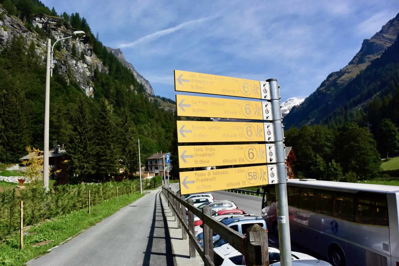
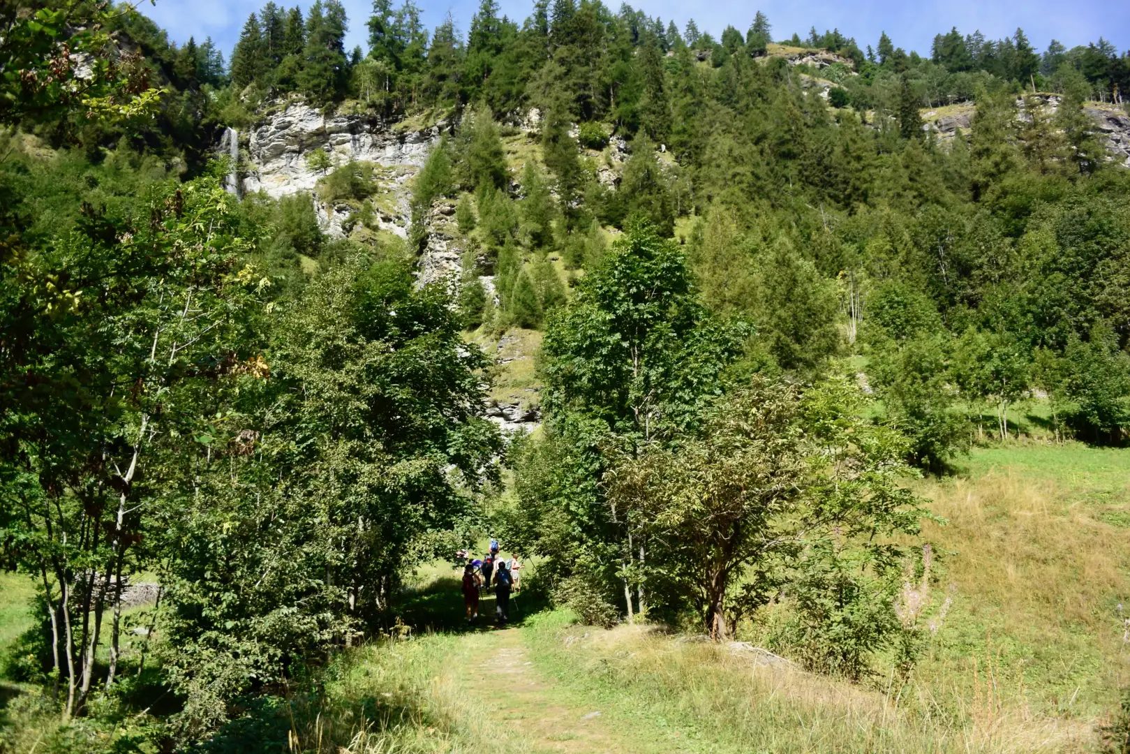
0h00' 0.00km Proceed along the tarmac road above the car park and reach the signpost indicating the start of the itinerary. Turn right in the direction of the waterfall visible opposite; after a short flat section, turn right again to take the wide mule track of Alta Via 1. Climb the steep slope through a series of hairpin bends that quickly gain altitude, entering a forest dominated by larch (Larix decidua), with sporadic presences of maple (Acer pseudoplatanus). After a long traverse to the right, continue climbing with short turns until reaching some panoramic benches at an altitude of 1,526m. Pass the benches and turn left along a section protected by a railing: here the forest thins out, offering a wide view of the Gressoney-Saint-Jean basin. Continue until you reach a well-preserved stadel and, a little further on, a small oratory, situated near a fork in the road (1,592m).
0h25' 0.54km Ignore the path on the left and continue along the mule track, flanked by ancient dry stone walls. Gradually leave the forest and meet the ruins of the Tschòké mountain pasture (1,655m), protected by a large rock. Cross the alpine pasture, skirt a small stream and negotiate a few wide bends, at the end of which the picturesque little village church appears above your heads. Cross a short wooded strip and enter the pastures that extend below the village. Pass a second oratory (1,702m) and continue across the meadows until reaching the old mule track. Turn right: the characteristic Walser settlements and the charming St. Anne's chapel appear in front of you. Continue for a few more minutes to reach the village of Alpenzù (💧) and the hut of the same name, located within it (1,779m).
0h45' 1.17km From the Alpenzù hut, take the path that climbs up through the pastures in a north-westerly direction until you reach an alpine pasture at an altitude of 1,914m, where the trail bends to the right until it reaches some ruins. Walk along the meadowy ridge to the crossroads in front of Alpe Ondermontel (2,007m), where you take the path uphill.
1h25' 2.16km This moves to the left and, with wide bends in the larch wood, reaches the ridge above. Climb over the ridge, first to the side, then over a rocky crag protected by fences. Reach a ledge, from where the climb continues in hairpin bends to the turnoff for Alpe Obermontel (2,220m). Continue ascending towards the centre of the valley, leaving a very primitive pastureland to the right, until reaching the Alpe Loaôche buildings, equipped with a fountain (💧). Pass a couple of small streams and another mountain pasture located near the impluvium of the Montil stream (Mòntélbach), which runs through the centre of the wide valley. Next, ascend the slope to a panoramic terrace, where the ruins of the Pinter (💧) alpine pastureland (2,465m) are located. Continue between open spaces, climbing up a crag in the valley, which gradually narrows. Cross a false plain and lean to the right, to cross the scree gully below the slopes of Mont Pinter, and tackle the final ramp keeping to the right, at the point of maximum depression until reaching Col Pinter (2.777m), a marked crag between two very scenic and representative peaks, the Corno Vitello to the south and the Testa Grigia to the north 3h30' 5.75km .
The return is made by following the route back along the same path to the Tschemenoal car park 2h30' 5.75km .
Points of interest
- Tschemenoal
- Grosso Alpenzù
- Grosso Alpenzù Refuge
- Cappella di Grosso Alpenzù
- Gressoney-Saint-Jean
Collections
Riferimenti Bibliografici
- Alte Vie della Valle d'Aosta - Martini Massimo e Zavatta Luca -
Photo gallery
Comments (0)
Sign in to leave a comment