Leaving the [A5] motorway at the Saint-Pierre (Aosta West) exit, continue in the direction of Courmayeur. After passing Saint-Pierre you reach Villeneuve, where you meet the junction for Val di Rhêmes. Continue along the Val di Rhêmes regional road, passing the municipalities of Introd, Rhêmes-Saint-Georges and Rhêmes-Notre-Dame until reaching the last village in the valley: Thumel. Shortly before the end of the road there is a large car park.
You must leave your car at the existing car park on the left a few hundred metres before the hamlet of Thumel. As of this year, however, there is a new parking fee, but it should be noted that the fee is not at all high: €0.10 per hour and €1.00 for the whole day, and you avoid a fine! However, hikers, mountaineers and tourists who wish to use it must be equipped with coins because the ticket machine does not accept banknotes and does not give change. Those who go to the mountains park their cars early in the morning, but if they are without change they risk having their plans compromised while waiting for someone to arrive who can exchange notes for coins......
Introduction
Beautiful excursion that develops almost entirely within the Gran Paradiso Park, traversing different territorial peculiarities: forest, alpine pasture, meadow, moraine scree, glacier.
Description
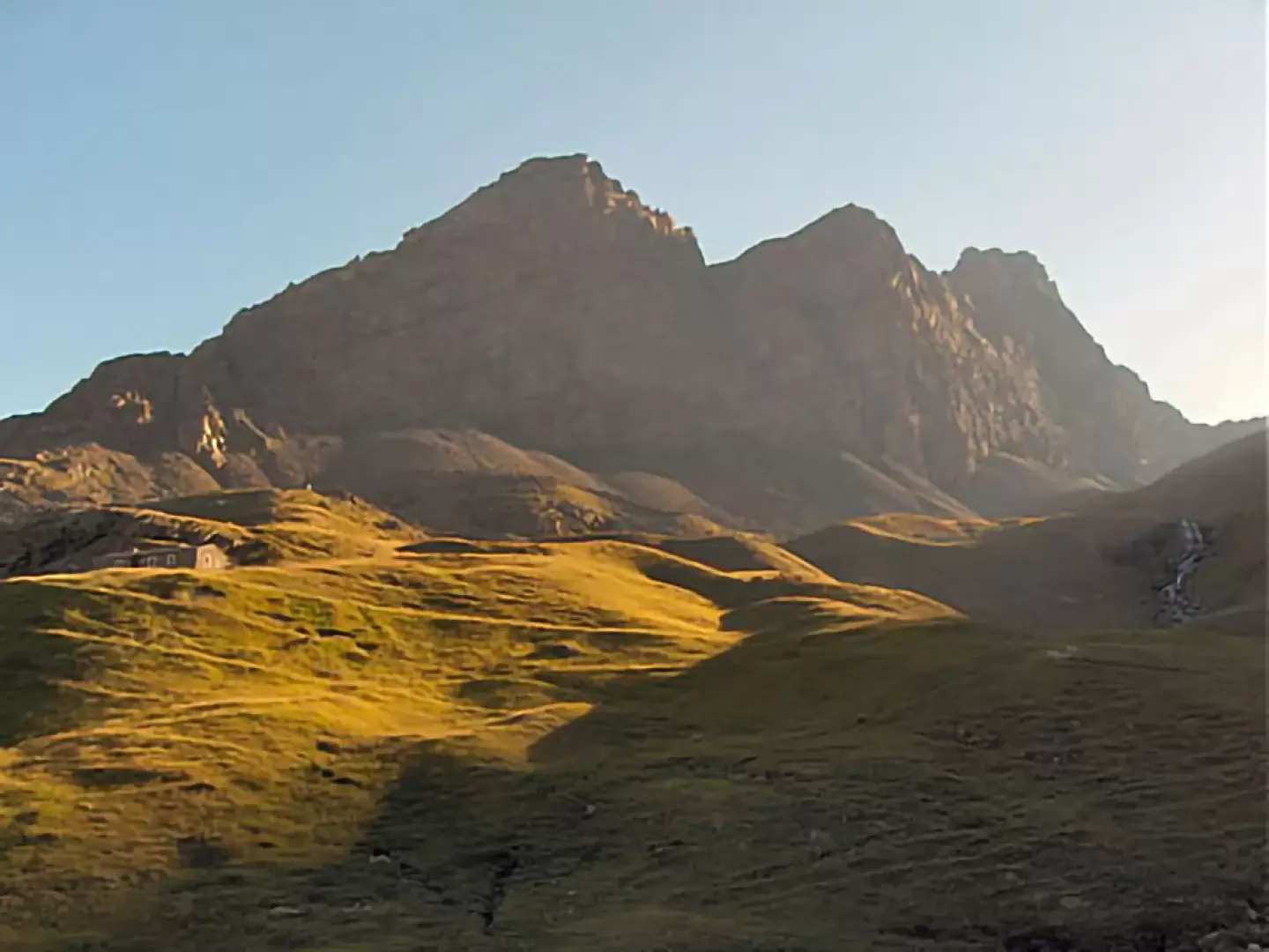
In about ten minutes you will arrive at the marker post on the left-hand side of the road, then descend to the left towards the village of Thumel, skirting it on the right; a small wooden bridge will allow you to cross the Dora di Rhêmes and reach its orographic right bank.
Here you immediately enter the forest and the territory of the Gran Paradiso Park and after a few minutes you will find a sign with the following wording "Welcome to those who study, protect and respect nature": during the continuation of the excursion you will have time and opportunity to reflect on these words...
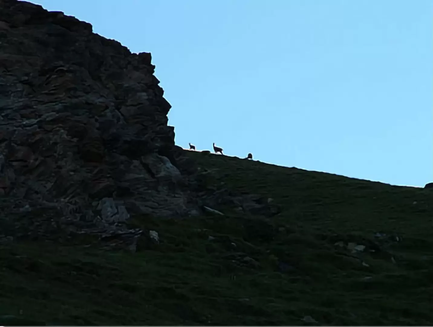
The wood is steep so you climb in zig-zag fashion in the cool of the morning, coming out into the open after a good hour's ascent and having gained about 300 metres in height; from here onwards you can begin to observe the slopes to your right and left: it will not be difficult in the early morning hours to see chamois and marmots. It is a magnificent sight, but at the same time also a tender one when you observe the little chamois following their mothers almost fearfully....
The chamois often notice the presence of the hikers, look at them and accept them... but the hikers (humans in general) need to understand that to be accepted is already to be respected and therefore, in turn, they cannot fail to respect and protect nature...
Looking back towards the north-west, you can see the mountains on the opposite side bathed in the early morning sun.
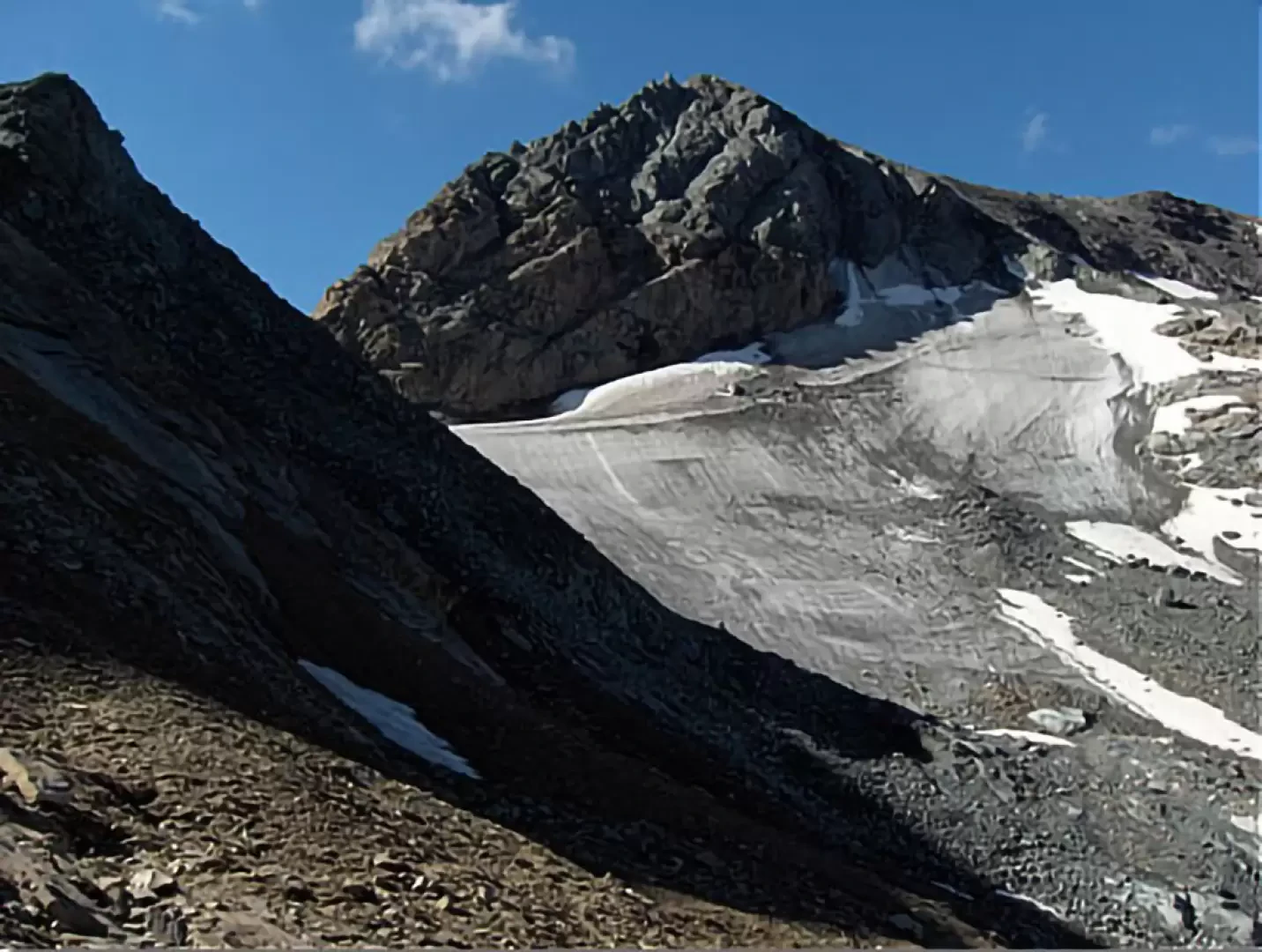
The path continues alongside the stream along meadows and scree to the Casotto del Guardaparco and, shortly afterwards, to the newly renovated alpine pasture at an altitude of approx. 2440 m, then winds its way up a grassy ramp until it comes out at the base of the moraine below the Vaudalettaz glacier, still in the valley of the same name.
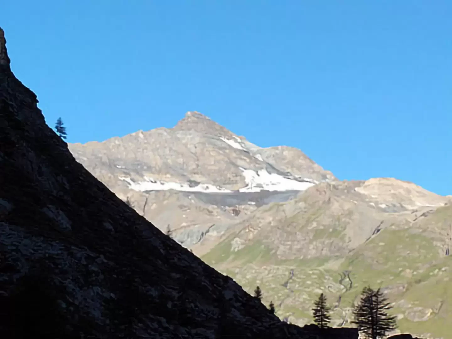
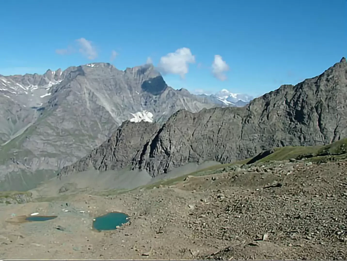
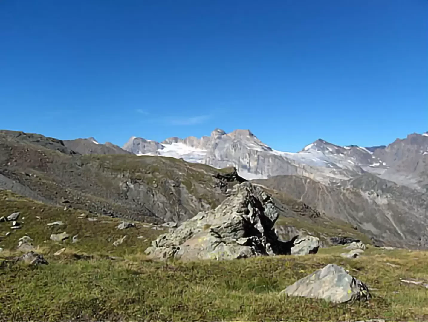
You already arrive at an altitude of approx. 2600 m and your gaze begins to wander: the Granta Parei, so imposing as seen from the chief town of Rhêmes, is now observed from an unusual angle and is surrounded by other peaks, almost forming a chain.
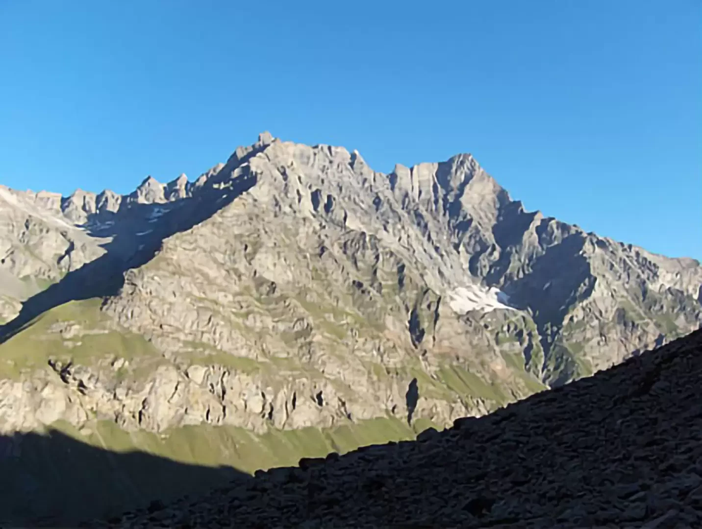
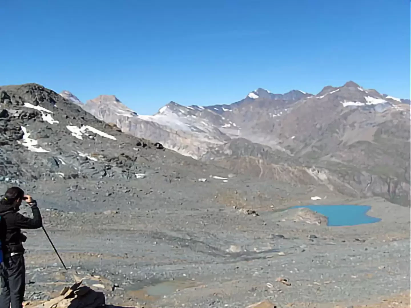
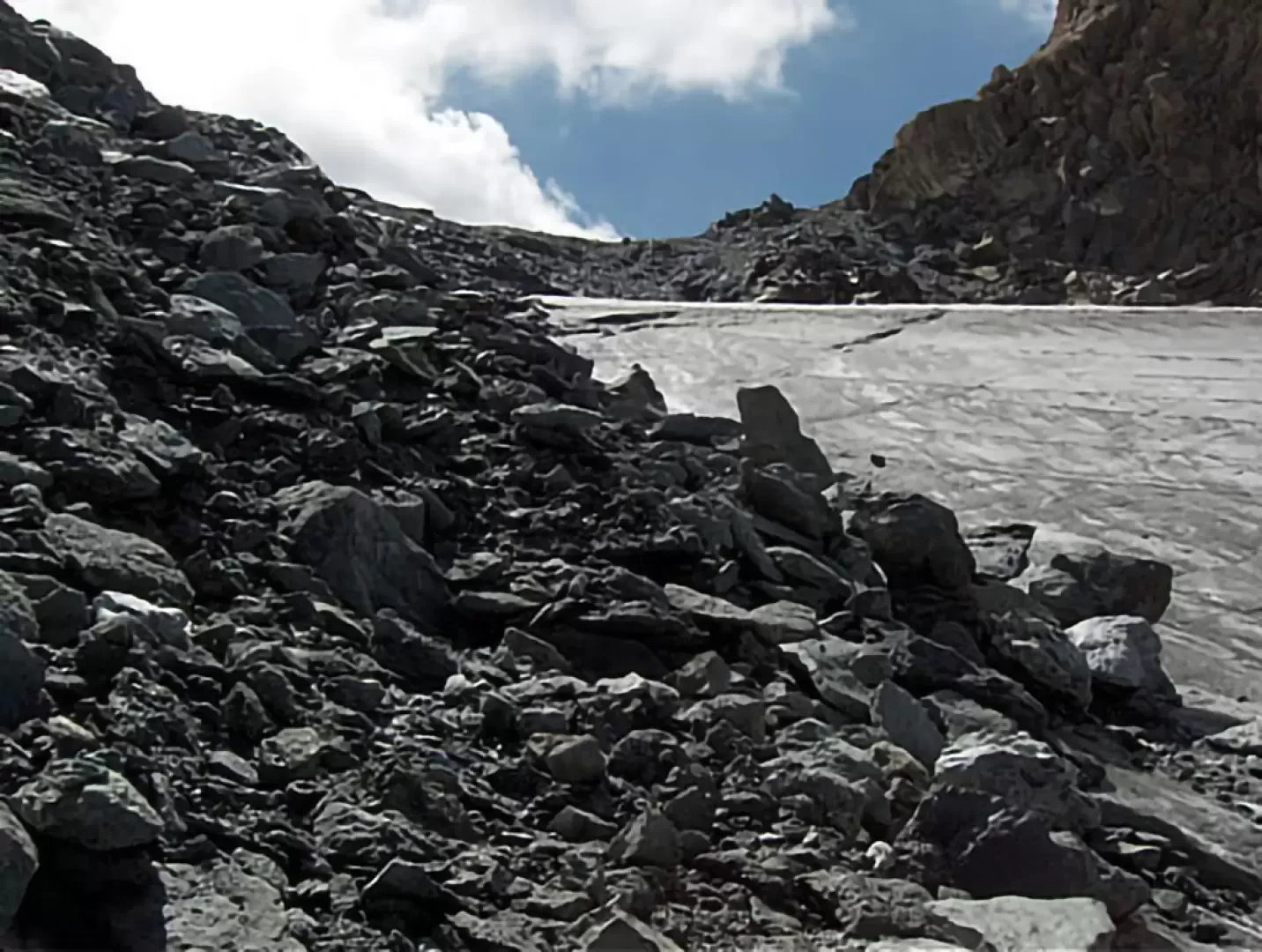
The long moraine scree slope is crossed in a southerly direction on half-steep trail tracks, referring to the little markers. The section is dominated by the north-west face of Mont Taou Blanc (watch out for any movement of stones!) while to your right below you can see some moraine lakes and the magnificent backdrop. Continuing on you will reach the end of the moraine pointing at the most evident little marker at an altitude of around 2900m; from here you lose all trace of the path and must ascend in a southerly direction keeping between the glacier, exposed to the north, and the stones of the wall: in the opinion of the writer but also of the park ranger this solution is the one that offers greater stability because if you keep further to the left, against the mountain: you will find yourself moving in the midst of mud, unsteady stones and loose ground.
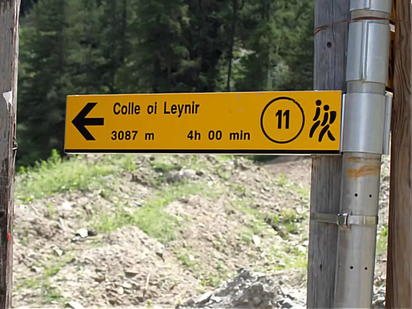
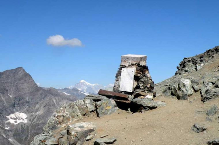
Progressing as described, you will quite certainly arrive at the Col du Leynir (3084 m, 4h00') with great satisfaction and admiration.
On the col, the view is somewhat limited by the presence of the Punta di Leynir to the right and the Taou Blanc to the left.
The view can, however, sweep by looking at:
- to the south the Punta Fourà and the Levanna on the border between Italy (Piedmont) and France.
- towards the north-west (the view is wider) the Punta Calabre, the Punta Tsanteleyna, the Granta Parei, the Becca di Traversière, the Grande Sassière, the Bassac Peaks, the Grande Traversière, the Grande Rousse and Mont Blanc.
The descent is made on the same route as the ascent (2h15').
Possibilities
From the Col it is possible to extend the hike as desired:
- descending from the other side towards Pont di Valsavarenche
- descending from the other side towards Lake Rosset and then up to Col Rosset and back down into Val di Rhêmes
- ascending on the left to Mont Taou Blanc (m. 3438) in about 1h 30'
Table of march
Piazzale | 1848 m Thumel | 1879 m | 31 m | 0h10' | partly asphalted road | South-West Out of the forest | 2200 m | 421 m | 1h15' | zig-zag path | South-East .zag | South-East Casotto - Alpine pasture | 2440 m | 140 m | 0h45' | Path on prairie | East End of moraine | 2900 m | 196 m | 1h15' | Path on prairie and on scree | South after a wide curve Col du Leynir | 3084 m | 166 m | 0h30' | Stones, boulders and ice | South
Dal termine del sentiero (2197 m) grandi ometti ben visibili fanno attraversare in piano sulla destra passando accanto al laghetto quotato 2919 m e da qui attraversando in leggera salita sin sotto la verticale del colle da cui su una bassa cresta morenica c'è un grosso ometto con un sasso giallo in cima punto di partenza per la salita diretta al colle.
Questo itinerario, confrontato con i rilevamenti del GPS, rimane più in basso rispetto al tracciato originario del sentiero riportato sulla cartina (in questo caso la numero 3 de L'Escursionista Editore): io infatti, volendo seguire fedelmente l'itinerario della cartina, mi sono trovato poi a dover attraversare più in alto per la scomodità della progressione sui grossi massi instabili e per il pericolo di eventuali cadute di pietre dalla bastionata rocciosa (molte sono rotolate dalla vicina Punta di Leynir).
All'andata la neve molto dura consigliava di procedere sul lato destro orografico del nevaio/ghiacciaio per rocce mobili e terriccio fradicio e franoso mentre al ritorno si poteva scendere (scivolare) direttamente e comodamente sulla neve che aveva mollato.
Bello tra l'altro anche il lago glaciale con un bel colore azzurro intenso, insolito per acque di fusione vicine ai ghiacciai, e che si raggiunge sia a vista che seguendo alcuni vecchi ometti di pietre che poi sembrano continuare dalle sue sponde verso nord-ovest: chissà dove portano?


Comments (0)
Sign in to leave a comment