Col Lazouney, from Niel


Edited by:
Massimo Martini
Updated at: 05/03/2026
Access
After 150m from the motorway junction exit at Pont-Saint-Martin, turn right and take the second exit at the first roundabout. A little further on at the second roundabout: take the third exit, and enter the town of Pont-Saint-Martin. After a few hundred metres, turn right onto for the Valle del Lys. Go up the regional road for 17.3km, passing the villages of Lillianes, Fontainemore, Issime and Gaby. At the centre of the village, just before the bridge over the Varail de Niel dsvolve to the right and take the narrow communal road which, after a succession of hairpin bends and 5.1km, reaches the pretty village of Niel: just before the village there is a car park 🅿️ with about 10 spaces where you can leave your car free of charge. If there is no space, turn around and leave your car in one of the two small car parks on the side of the road.
[0h3'7] - [23.8km]
How to get there with GMaps
How to get there with Apple Maps
The directions given here were verified at the time of the route survey. Before setting off, it is advisable to ensure that no substantial changes have occurred on the route to the starting point. We therefore recommend the use of the satellite navigation apps provided by Google or Apple for up-to-date and detailed directions.
Introduction
L’itinerario al Col Lazouney ha origine dal villaggio di Niel, in alta valle del Lys, nel comune di Gaby, lungo il versante valdostano delle Alpi biellesi‑valsesi. Il percorso risale il vallone di Niel seguendo antiche mulattiere selciate e sentieri pastorali, che collegano una serie di alpeggi ancora utilizzati con il valico verso la valle di Loo. Il tracciato si sviluppa principalmente su terreni erbosi e detritici, con brevi tratti più ripidi concentrati nella parte centrale del percorso. La difficoltà è classificata come E, ma il dislivello complessivo e la continuità della salita richiedono un buon allenamento e condizioni meteorologiche stabili. In presenza di neve residua o ghiaccio, in particolare nei canali e nei tratti superiori, l’itinerario può presentare criticità che impongono l’uso di attrezzatura adeguata e una valutazione attenta delle condizioni. Il periodo consigliato coincide con la stagione in cui gli alpeggi sono generalmente liberi dalla neve, e la segnaletica è facilmente individuabile lungo tutto il percorso.
Description
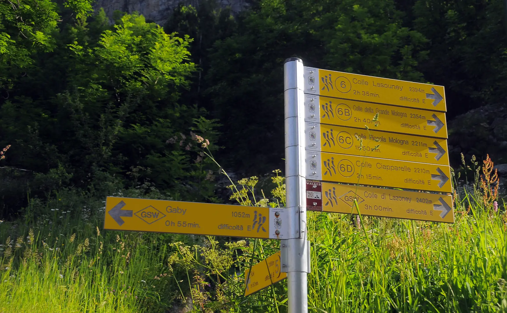
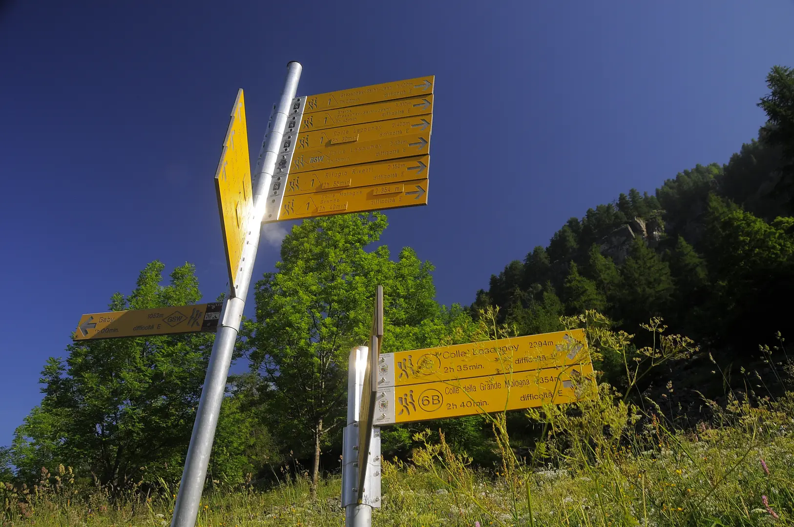
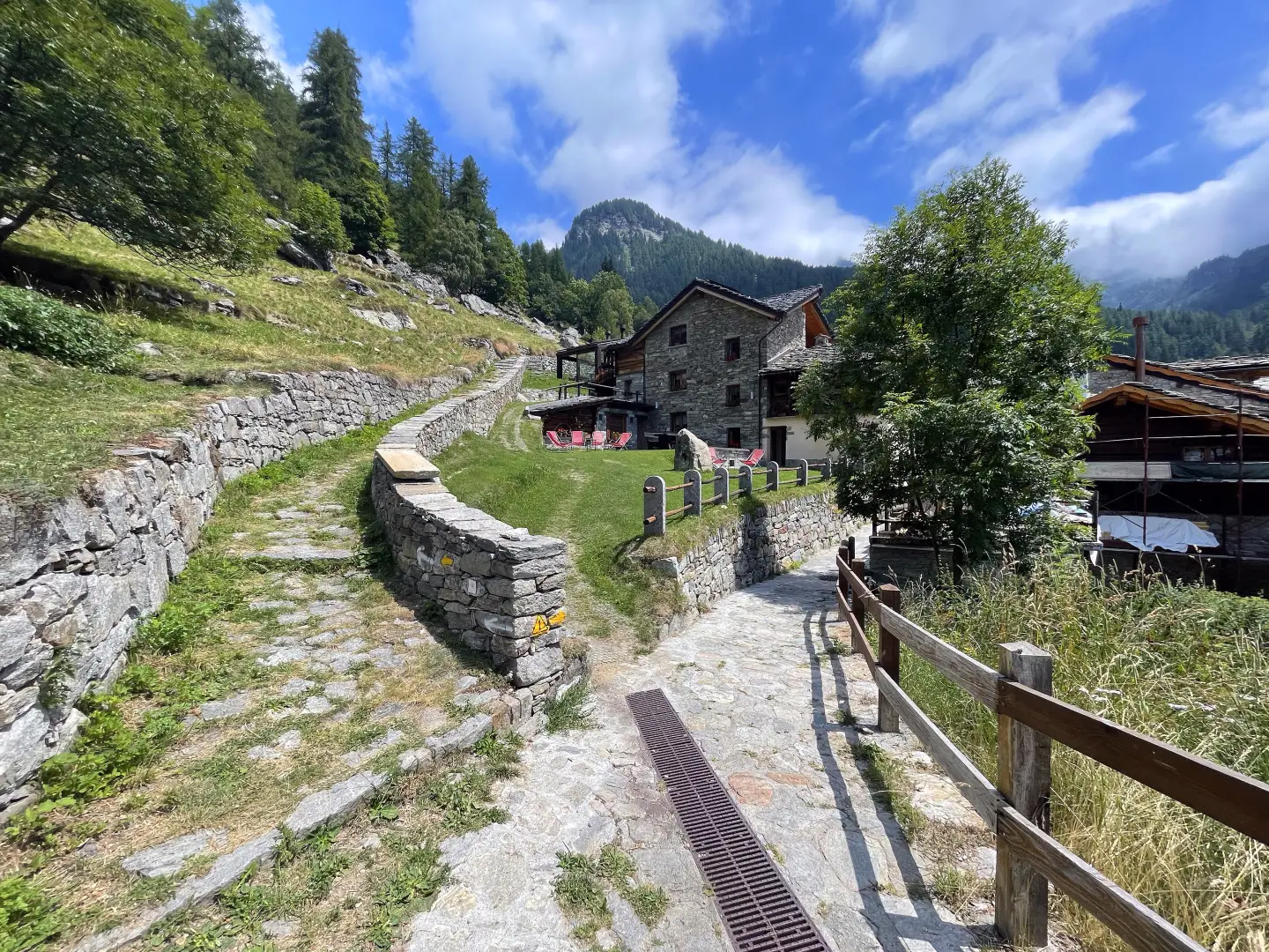
0h00' In the Niel car park, you will come across a sign board indicating the destinations in the area: take the path that crosses several hamlets and soon reaches a first fork in the road. Disregard path unable to parse for the Col de la Mologna Piccola, which branches off to the right, and continue straight ahead along the beautiful paved mule track that slowly leaves the village of Gruba. The mule track quickly leads to the farmsteads of Péiri (1651m) and then flattens out a little to reach the alpine pastures of Mattà (1697m).
0h20' Just beyond the alpine pasture, turn right, cross a small bridge and meet a fork in the road: go straight on, leaving behind trail for Col Lazouney, and continue briefly through the pastures to Schtovela (1760m).
From the post, take the paved mule track, well indicated by numerous markers, that towards the right begins to penetrate into the valley; when you reach the markers located near the nearby huts above, where there is also a stage point for hikers, go up the beautiful and not steep staircase to the left. Around the lower edge of a little wood, turn left passing the Péiri huts (1657 m) and, still on a paved path, go past the neighbouring huts of Matta and Stubin (1699 m) to arrive at a wooden bridge beyond which there is a fork in the path at some posts (1740 m). At the crossroads, take the path to the left that climbs up a small wooded rib, at the end of which a steep grassy gully is climbed in narrow hairpin bends; at its summit there is a large stone with a small ruined hut at its base (1905 m), which is passed to the left where the path flattens out a little, passing over more open ground. One then passes an isolated hut (1984 m) from which one continues to the right passing in front of a rocky rampart; above it is the panoramic Jazit alpine pasture (2038 m) after which one must ascend a wide slope crossed by a large landslide at the top of which is the Boudou hut (2168 m). From here, continue up the gently sloping grassy slopes on which there is a low rampart of compact rock, which you pass, arriving shortly afterwards at two large stone cairns located in front of the ruined Kiwsull huts (2341 m). Passing them on the right, you soon come to a large stone cairn situated at a crossroads (2374 m), at which point you ascend to the left along a slightly ascending traverse, at the end of which is the Col Lazoney (2403 m); here the path ends and you now turn right along the wide ridge of grass and large stones, passing by a long, smooth and slightly inclined rock.
.Punti di interesse
- Niel
- Col Lazouney
Collections
escursioni a Niel – sulla mappa
escursioni in valle del Lys – sulla mappa
escursioni in Valle d’Aosta – sulla mappa
escursioni ai colli tra valle del Lys e valle di Gressoney – sulla mappa
Galleria fotografica