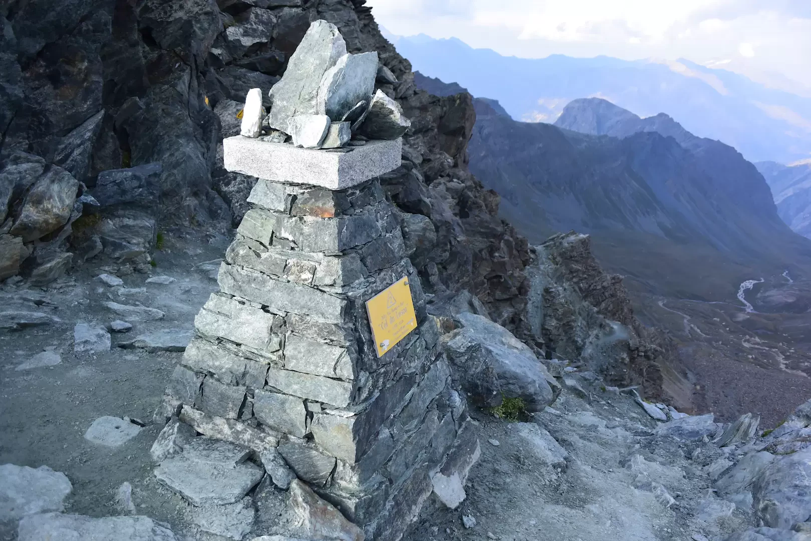
Col du Loson, from the Valnontey car park

Access
Leave the motorway junction at Aosta-West and turn right to take the Valle di Cogne. Drive through the village of Aymavilles and after 1.50 kilometres at a roundabout take the second exit. Go up the regional road for 18.70 kilometres passing through the villages of Vieyes, Epinel and Crétaz until you reach a roundabout: take the first exit onto Avenue G.F Cavagnet, to be followed for about 350 metres. Inside the village of Cogne, turn right onto the small road that after about 2.70 kilometres reaches the village of Valnontey anticipated by the large car park 🅿️ for a fee (from 8am to 8pm - 4€ full day) located to the right of the road.
Distance and journey time
🕒Travel time: 34 minutes
📏 Distance: 23.40 km
GPS navigation
📍 How to get there with Google Maps
📍 How to get there with Apple Maps
ℹ️ Important note
The information provided was checked on the date of the route survey. Before departure, it is advisable to check for any changes to the route. For up-to-date and detailed directions, we recommend the use of Google Maps or Apple Maps.
Introduction
The Col Loson (3,299m) is an iconic landmark for Valdostan hiking: it represents the highest altitude of the Aosta Valley's Alta Via 2, the so-called 'high nature trail' that crosses the southern slopes of the region, and is also the Cima Coppi of the Tor des Géants, a famous endurance trail race.
The itinerary from Valnontey runs entirely within the Gran Paradiso National Park, crossing environments rich in wildlife with frequent sightings of chamois, ibex and marmots. The ascent follows the entire Vallone di Loson along the route of Alta Via 2, with an intermediate stop at Rifugio Vittorio Sella, before tackling the steepest and most exposed slopes leading to the pass.
From the summit, the view sweeps from the glaciers of Gran Paradiso to the main peaks of Valsavarenche and Valle di Cogne, in one of the most vast and evocative panoramas of the entire massif.
Description
0h00' 0.00km From the Valnontey forecourt, follow the little tarmac road for a short distance until reaching the village of the same name, where there is a fountain 💧.
0h02' 0.13km Turn right and cross the Valnontey stream, taking the orographic left. Walk up the road as far as Hotel Lou Tsantelet and the square with the canopy housing the signposts of the main itineraries of the Alta Via . Take the path that crosses the pastureland and leads to the Giardino Alpino Paradisia. Skirt the south-eastern side of the garden on a comfortable mule track, enter the larch forest and gain altitude with regular hairpin bends, with panoramic views of Valnontey, until reaching a fork at an altitude of 1,950m.
0h02' 2.03km Ignore the continuation on the old royal road (closed) and continue straight on until reaching the stone bridge over the Torrent de Grand Loson, where it forms a spectacular waterfall. Cross it, go up the orographic right and exit the forest. Continue on the pastureland until the ruins of Toules (2,001m), where there is a small fountain 💧. Follow the twists and turns of the path past the hamlets of Pascieux (2,224m). Climb up between sparse larch woods and open pastures, with views of the ruins of Petit Loson and the Grand Croux and Tribulation glaciers. The trail bends to the right, crosses a short stone staircase and descends to the Torrent de Grand Loson impluvium (2,260m). Cross over a wooden bridge, then climb up the left orographic slope with long traverses until reaching the old royal hunting road. Proceed halfway up the steep grassy slopes below the Tête Tsaplane, then tackle steeper hairpin bends. Ignore the fork for the Grand Loson pastures (2,506m) and continue on a moderate ascent to the park ranger's hut, where the path forks, allowing you, with a short descent through meadows, to reach the Vittorio Sella hut (2.584 m) 💧.
2h30' 5.79km Return to the park ranger's hut and take the Alta Via 2 trail again in the direction of Col Loson. The trail crosses open pastures and climbs up the valley, keeping to the orographic left, until reaching a wide sandy plateau near the junction for the Col de la Rousse (2,850m).
3h15' 7.62km Ignore the path to the right and continue along the main route. The gradient gradually increases, making the ascent more challenging. The path climbs with numerous hairpin bends towards the rocky crags of the Becca di Vermianaz, until reaching a panoramic col from which Col Loson is clearly visible. Continue along a narrow track that crosses exposed ledges, equipped with metal girders and fixed ropes in the more delicate sections. Pass a short traverse under the rocks and tackle the last scree gully, steep and unstable, but devoid of technical difficulties, except for the physical effort required. Finally, you reach the iconic Col du Loson (3,299m) 4h30' 10.39km .
The return follows the same route as the outward leg, retracing the path until returning to the starting point at the Valnontey car park 3h15' 10.39km (0D+) .
.Points of interest
- Valnontey
- Paradise Botanical Garden
- Toules
- Pascieux
- Grand Loson
- Rifugio Vittorio Sella
- Col Loson
- Cogne
- Parco del Gran Paradiso