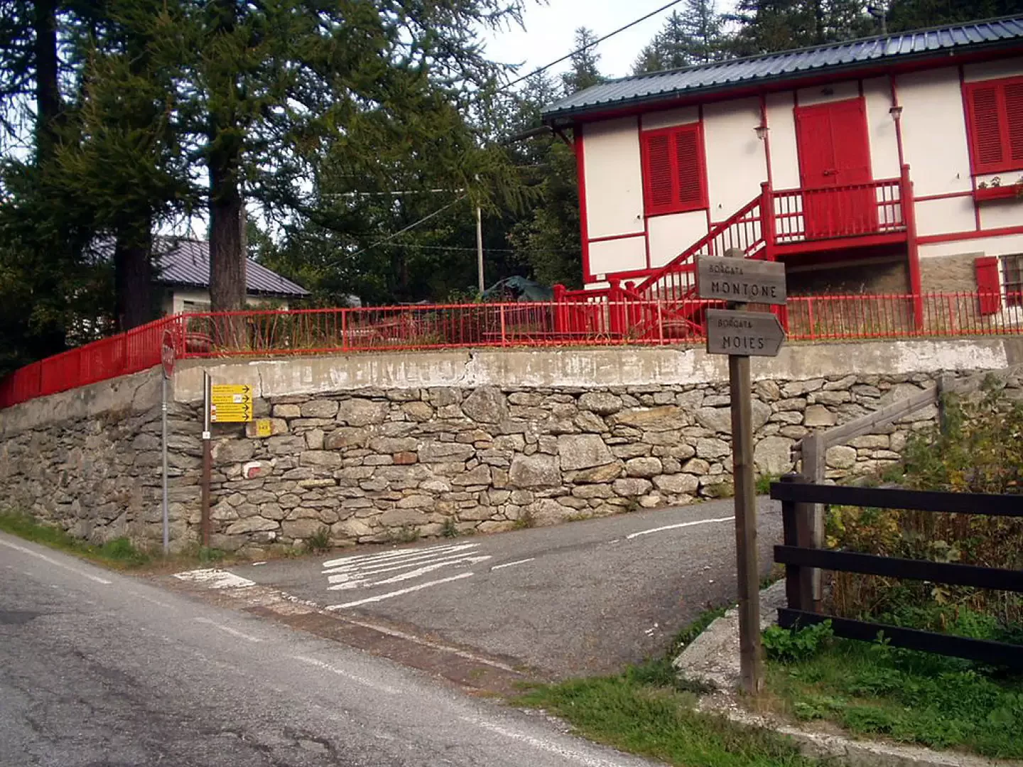
At the motorway exit of Ivrea, take the state road, known as the Pedemontana, and at Castellamonte the state road of Ceresole Reale. Go up the Orco valley, passing Locana and Noasca. After the tunnel, you cross the villages of Bianchetti, Prese and Brengi. After the hairpin bends around a church, at the edge of the hamlet of Montone, a few dozen metres after the turning on the right for Moies, in front of an AEM building, you can park your car.
[1h03'] - [56.8km] How to get there with GMaps How to get there with Apple Maps These indications are based on direct verification carried out at the time of surveying the route, therefore the information must be verified before starting the hike. We recommend using a GPS navigator or map app on your smartphone to get up-to-date and detailed directions.
Introduction
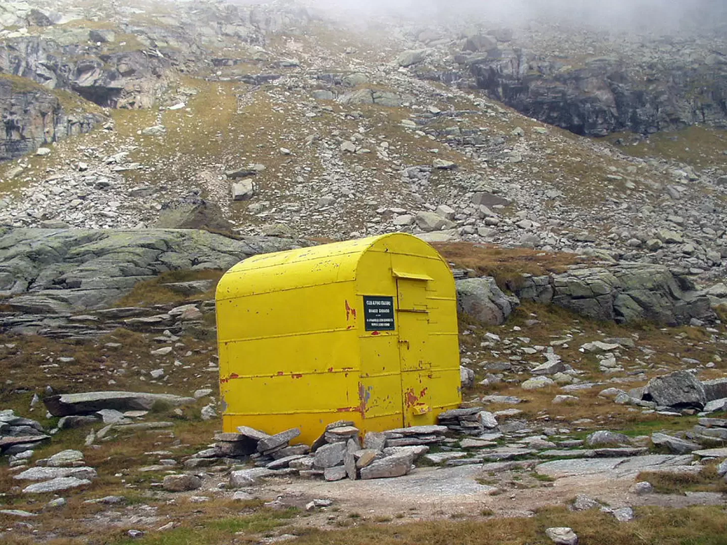
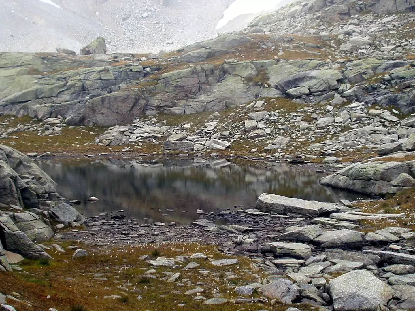
The Giraudo bivouac is located in the upper Roc valley, south of the Ciarforon and the Broglio glacier, on a ledge a few dozen metres from a small lake. The bivouac, not visible during the entire ascent, rises a few metres beside a large cairn of stones. The itinerary climbs initially, and with a moderate gradient, to the Colle Sià, then heads towards the Roc valley, climbs some grassy slopes and climbs the rampart that precedes the bivouac. For a good part of the route, it is very common to spot chamois and ibex.
Description
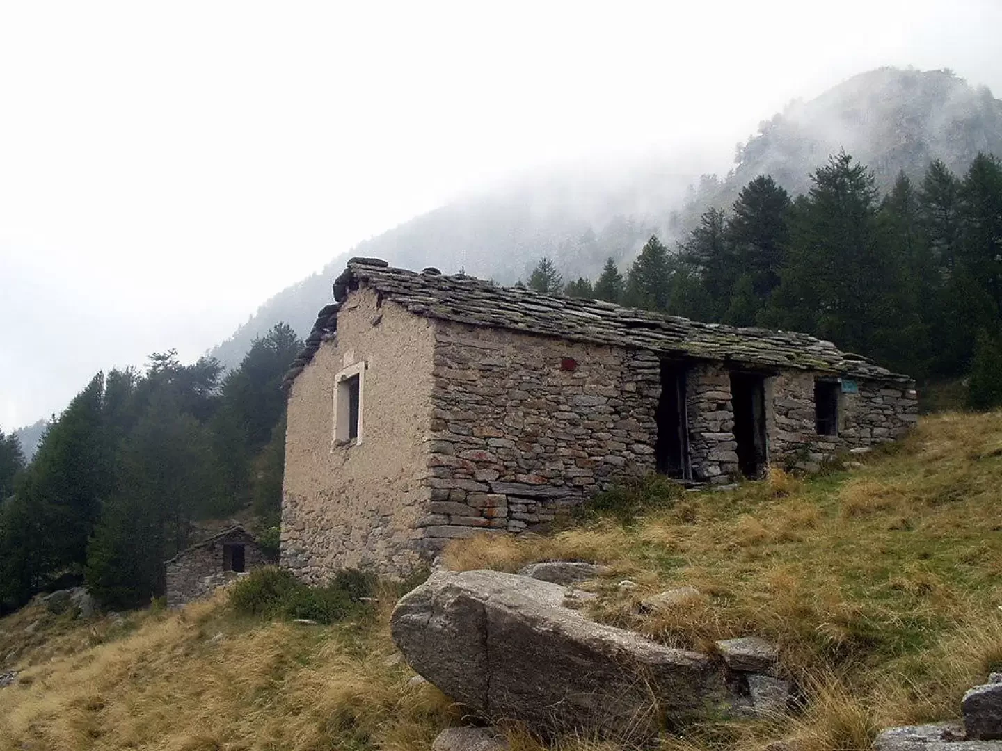
0h00' From the car park (1550m), follow the tarmac road towards the valley as far as the diversions to the left for the hamlet of Moies. At the end of the road, near the hamlets, near a bench, the III Reggimento Alpini Brigata Taurinense path begins (signposted on site), marker . The mule track climbs to the left with a few steps and enters the woods. After a few minutes' walk, ignore the track to the left for Pian della Balma and continue on a long diagonal, and with a slight incline, towards the north-east among beautiful larches. Neglecting the diversions to the left of the "Sentiero degli Alpini - I sensi in gioco" and passing the houses of Truc, Visiret and Reposa, you come out at the meadows preceding the Casa Bianca (1,947m, 1h00'), with its characteristic lime-plastered façade.
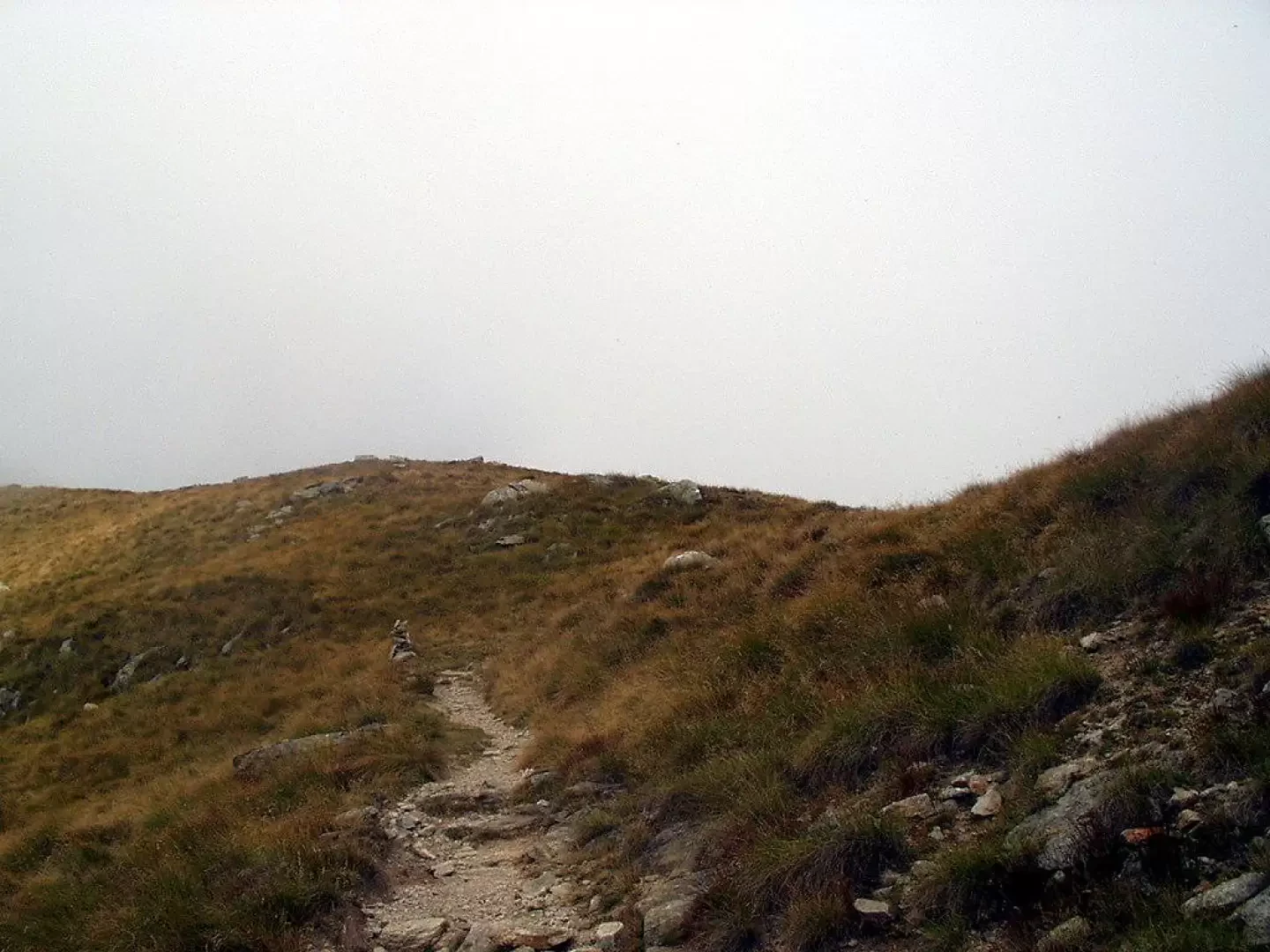
Ahead of the buildings, on the left, at the edge between the fir wood and a grassy hollow, the track rises up to Pra' del Cres. There, leave the turnoff to the right for Borgovecchio and climb to the left to the Ramà and Ciaplus mountain pastures. The trail turns right and over grassy slopes reaches the modest saddle of Colle Sià (2278 m, 1h55').
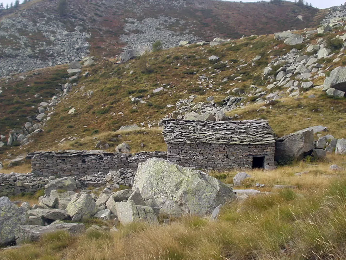
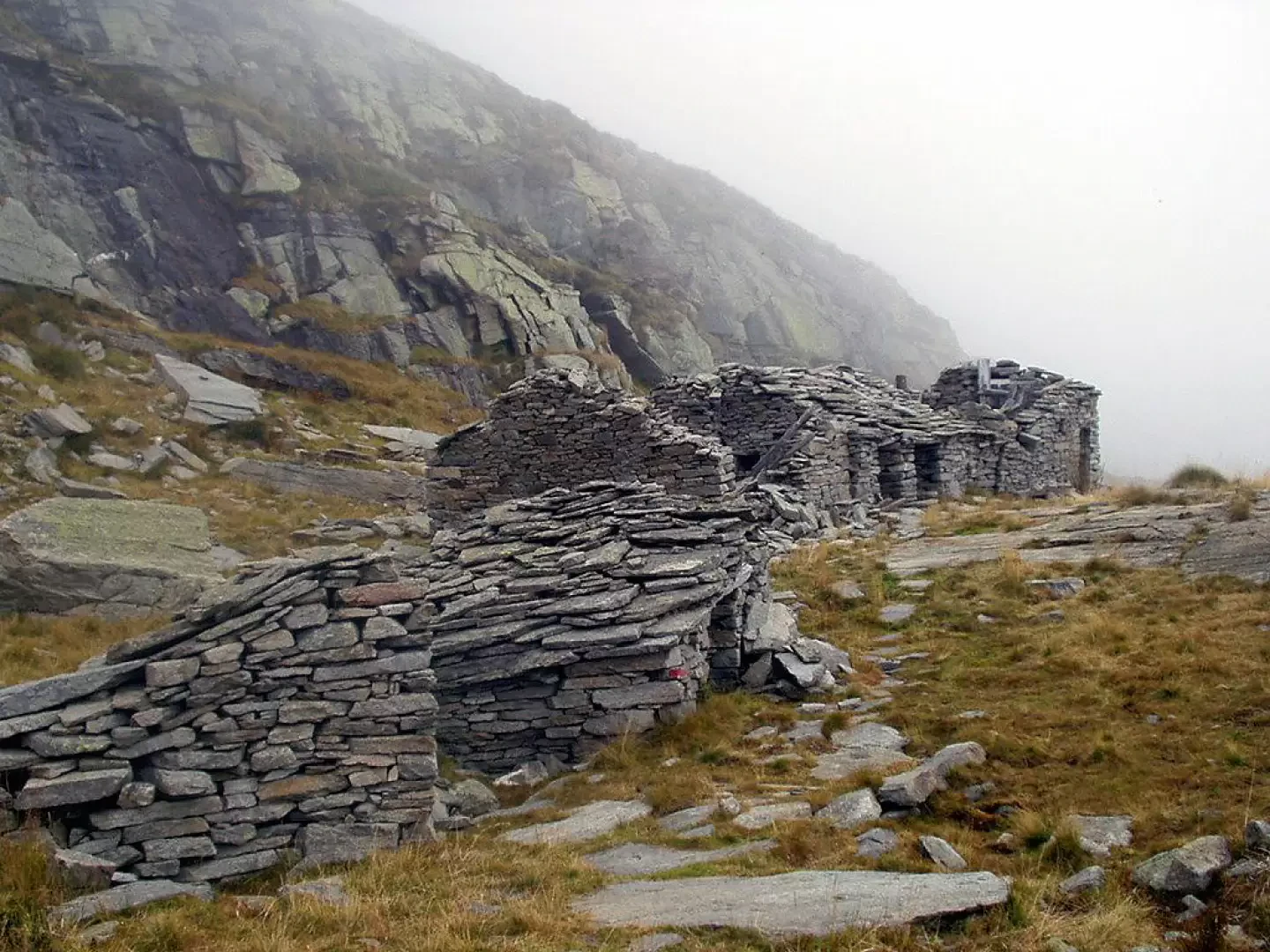
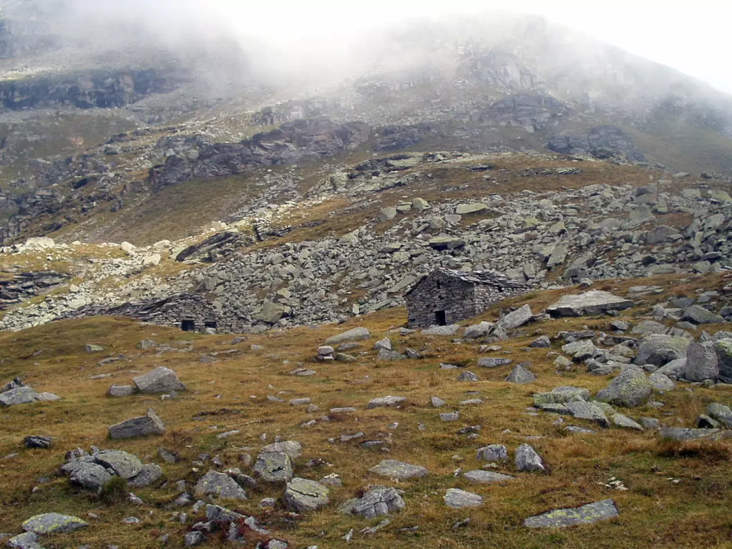
Now proceed with a few ups and downs on the opposite slope, keeping above the Roc valley, between grassy plateaus and a few stones until the huts of the Loserai di Sotto mountain pasture (2210 m, 2h20').
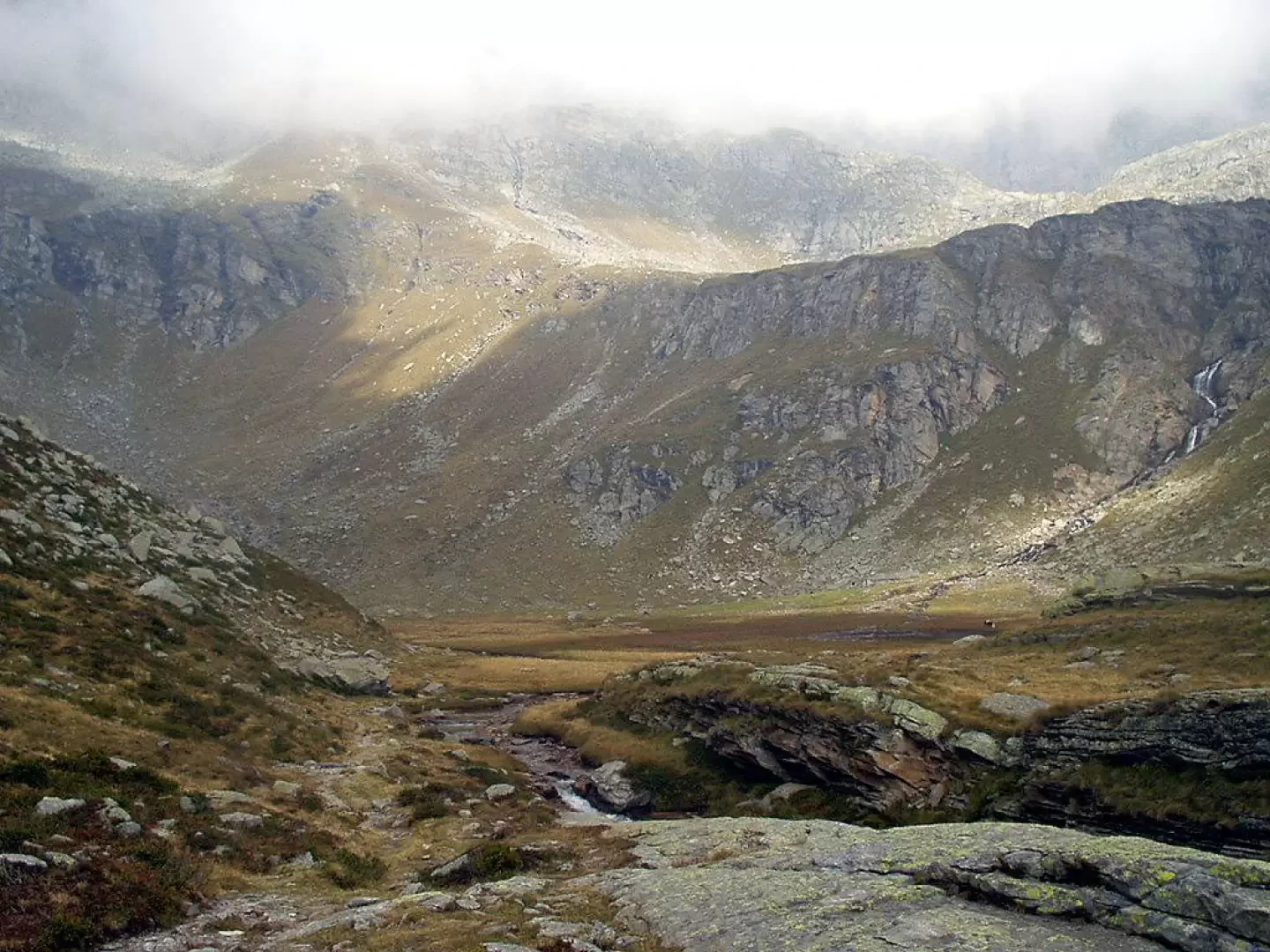
At the base of a rampart, we pass an area of mounded rocks, approach a waterfall of the Roc and go to the edge of the Broglietto basin. Once you have forded the stream, turn right to go round large mounded rocks and climb up to the junction with the Gran Piano trail. Keeping to the left, go up the grassy slopes to the edge of the Alpe Broglio plateau (2407 m, 3h10').
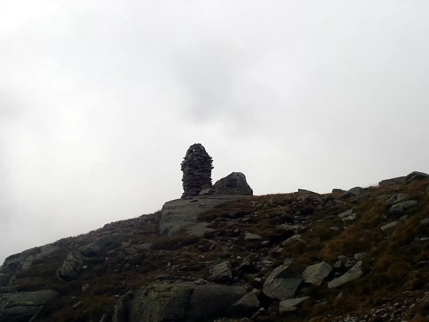
Having left the track for the Colle della Porta, go along the edge of the plateau to the base of a rampart that goes up between some scree and scree to the large cairn before the Bivacco Giraudo (2620 m, 3h50'). The descent is along the same route: go down to Loserai di Sotto (2210 m, 1h15'), go up and down to Colle Sià (2278 m, 1h40'), go down to the Casa Bianca (1947 m, 2h20'), then to Moies and the car park (1550 m, 3h10').
Bella escursione, partenza dalla Borgata Moies di Ceresole Reale, nel primo tratto il sentiero sale nel bosco con lunghi tornanti, quindi il sentiero non è mai troppo ripido. Usciti dal bosco il sentiero sale verso il colle Sià sempre con una pendenza moderata, raggiunti il colle si può godere di un paesaggio meraviglioso. Dal colle ora il sentiero prosegue in leggera discesa per un lungo tratto, sino ad oltrepassare un alpeggio abbandonato. Dall'alpeggio ora sale leggermente per poi scendere ancora sino a raggiungere il Pian del broglietto (2250 m.), ora bisogna guadare il torrente, che in questa stagione non crea problemi. Dal Pian del Broglietto, dopo un tratto pianeggiante il sentiero si fà più ripido e con numerosi tornanti raggiunge il Pian del Broglio (2387 m), bellissimo alpeggio con bestiame che pascola. Attraversato il Pian del Broglio il sentiero entra nella pietraia e sale fra di essa fino a superare una bastionata rocciosa sopra alla quale sorge il bivacco che si vede solo all'ultimo (2630 m.). Il bivacco è pulito e molto confortevole. Acqua nel laghetto dietro il bivacco. Discesa per lo stesso itinerario.
Avvistamenti faunistici: Marmota marmota


Comments (0)
Sign in to leave a comment