Alta Luce, from the Staffal car park

Edited by:
Massimo Martini
Updated at: 01/09/2026
Access
Road directions
At the toll booth exit at Pont-Saint-Martin, follow the for 750m (750m). At the roundabout, take the third exit and join the . Continue along the for 450m (1.2km), then turn right onto Via Gressoney and continue along the for 26.8km (28km), passing through the villages of Lillianes, Fontainemore, Issime, Gaby and Gressoney-Saint-Jean. Turn right to stay on the for a further 6 km (34 km), then continue on the for 3.1 km (37.1 km) to Gressoney-La-Trinité. Keep right on the for a further 1.2 km (38.3 km) to the village of Staffal.
Car park
In the village of Staffal, opposite the Gabiet cable cars, there is a pay-and-display car park 🅿️. This is the starting point of the route.
Access by public transport
The village is served by the Pont-Saint-Martin – Gressoney bus route operated by Autolinee Vita Group (V.I.T.A. S.p.A.). The relevant bus stop is Staffal-Anderbatt. The service operates during the winter season; to check the latest timetables, visit the Vita Group website.
Distance and journey time
🕒 journey time: 52 minutes
📏 distance: 38.2 km
GPS navigation
Important information
The directions provided were verified on the date the route was mapped. Before setting off, we recommend checking for any changes to the route or road conditions. For up-to-date information, please consult Google Maps or Apple Maps.
Introduction
A round-trip route ascending to the summit of Alta Luce (Hochlicht, 3,184 m), situated on the ridge separating the Lys Glacier from the Indren Glacier in Val di Gressoney. The route starts from Staffal and gradually climbs the valley through the woodland, then across open terrain to the scree slopes and glacial cirques at high altitude. The main reason for climbing here is the view: from the summit, the vista stretches across much of the Pennine Alps and, in the foreground, over the Lys Glacier with the massif of Monte Rosa towering above it. Another feature that catches hikers’ attention is the distinctive summit bell, which has become the classic subject of the customary photo taken at an altitude of 3,184 metres. Just below the summit lie the remains of the former Passera bivouac, now reduced to nothing but its outer walls: a subtle reminder of how the landscape changes over time. The best time to tackle the ascent is July, when the remaining snowfields have largely melted and the path is passable without additional equipment. This is a challenging hike, with a significant elevation gain and a few short sections of more technical terrain in the upper reaches: it is recommended for fit hikers and experienced mountaineers, but does not require mountaineering skills.
Description
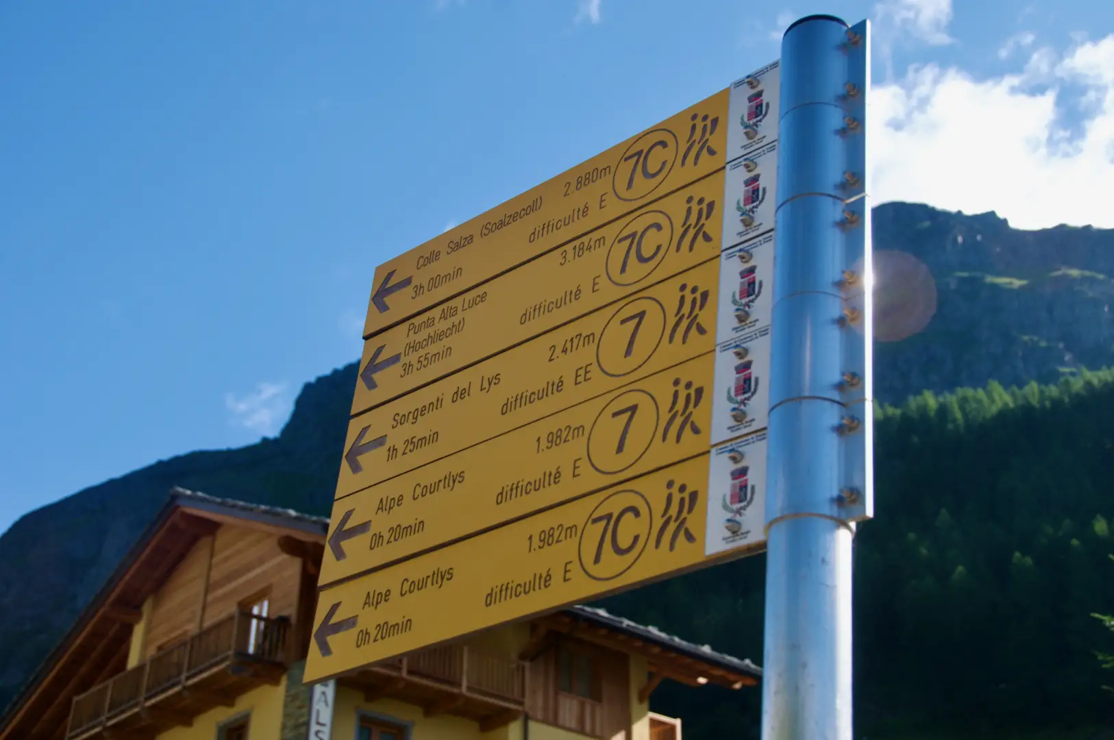
0h00' 0.00km Leave your car in the Stafal car park; before crossing the small bridge, take the farm track on the left bank of the Lys stream, marked by two signposts. At the end of the track, on the right, the proper footpath begins, which follows the valley with a few ups and downs, leading into the stream’s watershed, before climbing again with a few bends up to the vicinity of Cortlys (1,993m).
0h34' 1.10km Continue climbing through the woodland on a steep but steady gradient. The track gradually moves away from the valley floor and reaches a small valley enclosed on one side by the base of the glacial moraine and on the other by a steep ridge rising towards the Alta Luce. At the bottom of the small valley, you’ll find signposts for the Mantova and Gnifetti mountain huts along the path .
1h25' 2.84km Continue along the track as it leaves the woodland and heads into more open terrain towards higher ground. The path now climbs steeply and is exposed in places, alternating between short flat sections and passages over scree.
2h25' 4.19km Continue over scree with a steep gradient. Walking over scree, you pass the Passera Bivouac (3,150m) and make your way towards the summit bell of Alta Luce (Hochlicht). A few metres further down, a wooden platform provides a convenient resting spot. Continue for the final few metres until you reach the summit of Alta Luce (3,162m) 3h55' 6.37km .
The return journey follows the same route taken on the ascent, taking care on the scree sections during the descent 2h30' 6.37km (0 m ascent) (1,409 m descent).
Places of Interest
Staffal
Cortlys
Colle della Salza
Alta Luce (Highlight)
Comments (0)
Sign in to leave a comment