Bardoney, from the car park at Lillaz

Edited by:
Massimo Martini
Updated at: 01/09/2026
Access
At the Aosta Ovest motorway junction , turn right and take the regional road towards the Cogne Valley. Drive through the village of Aymavilles and, after 1.3 kilometres, take the second exit at the roundabout. Follow the regional road for 19 kilometres, passing through the villages of Vieyes, Epinel and Crétaz, until you reach a roundabout: take the second exit, following the signs for Lillaz. Continue along the local road for about one kilometre until you come to another roundabout; carry on straight for a further 1.8 kilometres until you reach the large, free car park 🅿️ in Lillaz.
0h32' - 24.0km
How to get there with GMAPS
How to get there with Apple Maps
The directions provided were carefully checked on the date the route was mapped. However, we strongly advise you to check for any changes that may have occurred since then, particularly regarding the route to the starting point. Before setting off, it is advisable to consult up-to-date navigation tools to obtain precise and current directions. We recommend using satellite navigation apps, such as Google Maps or Apple Maps, to ensure the greatest accuracy and safety on your journey.
Introduction
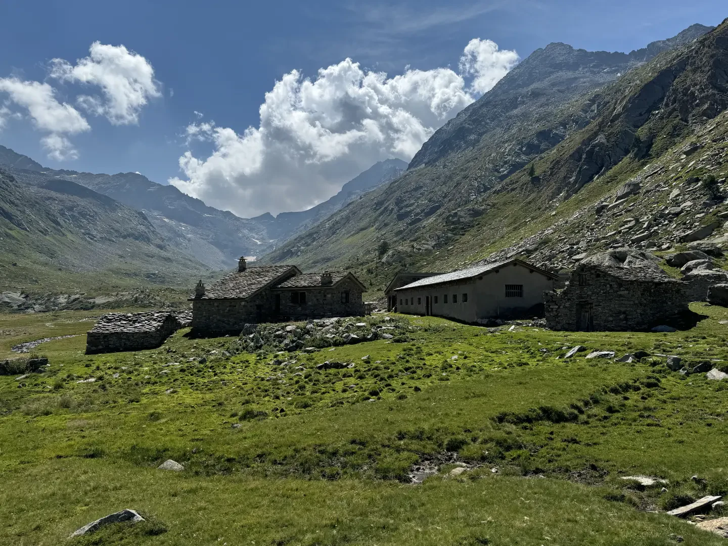
The hike to the Bardoney mountain pasture is an enchanting journey into the heart of the Gran Paradiso National Park, ideal for nature and mountain lovers. This route offers the chance to explore an unspoilt valley, surrounded by majestic Alpine peaks and criss-crossed by crystal-clear streams. The Bardoney mountain pasture, situated at an altitude of 2,200 metres, is the perfect destination for those seeking a spot immersed in the tranquillity and beauty of alpine pastures.
The route begins in the village of Lillaz, famous for its waterfalls, and follows the path that climbs up the Bardoney valley. Along the way, you pass through larch and spruce forests, flower-filled clearings and steep grassy slopes, where you may spot the park’s typical wildlife, such as ibex and marmots. The view that opens up towards the head of the valley is one of rare beauty, dominated by the imposing peaks surrounding the valley.
The walk, which takes around 3 hours, is suitable for hikers with a basic level of fitness, thanks to the trail’s moderate gradient and well-distributed elevation gain. Once you reach the mountain pasture, you can enjoy spectacular views of the surrounding mountains and relax in the shade of the stone huts, a testament to the rural high-mountain way of life that still endures in these remote places.
This well-marked and accessible route allows you to immerse yourself completely in nature, discovering the secrets of the Bardoney Valley, a wild and unspoilt corner of the Aosta Valley.
Description
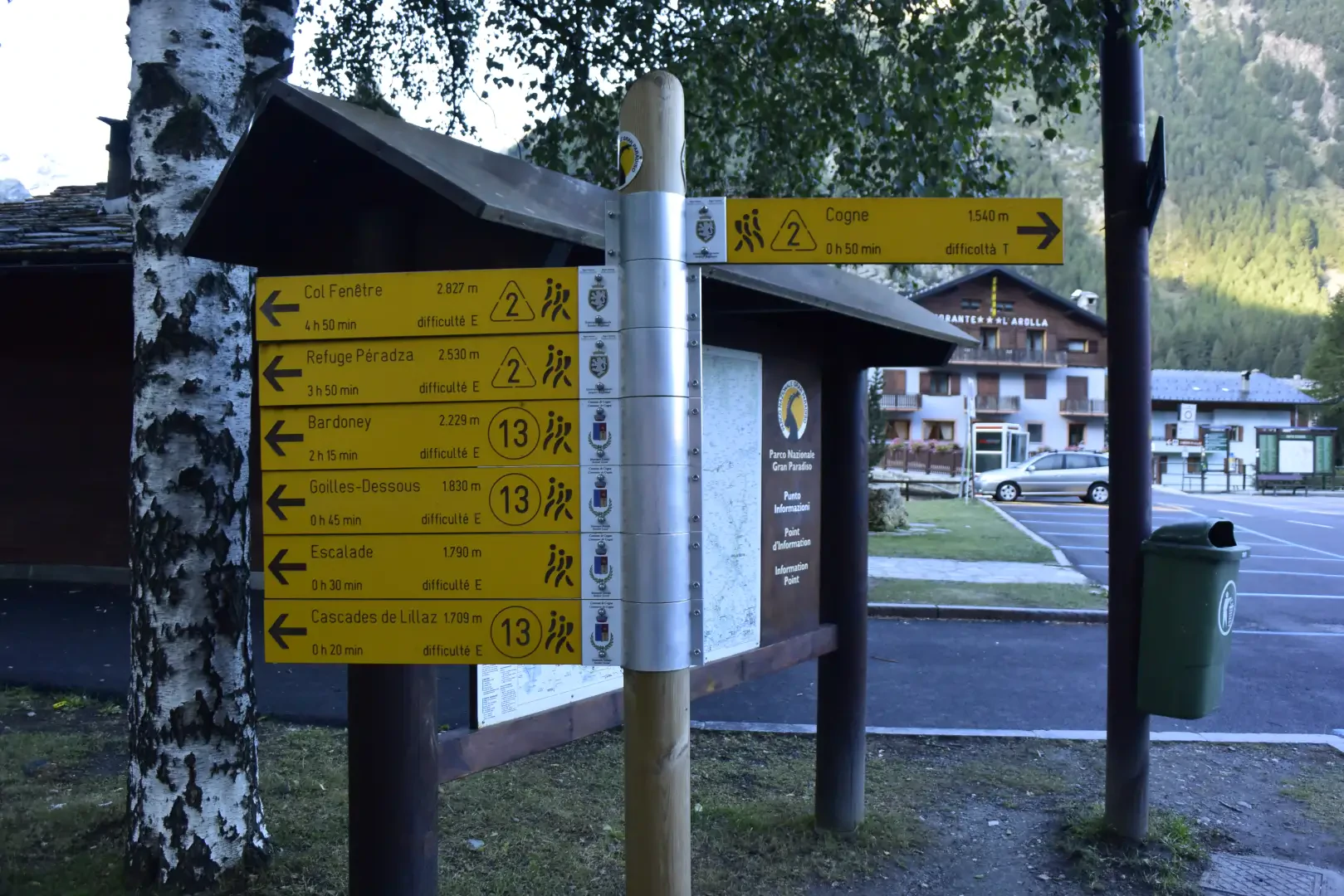
0h00' 0.00km Leave thecar and walk towards the shelter where the main trails in the area are marked: follow route , which leads to the Sogno di Berdzé mountain hut at Peradzà. Take a narrow track that runs alongside the Urtier stream and, after a few minutes, you’ll reach the ‘no entry’ sign. At the fork, take the track on the left and, shortly afterwards, you’ll come across the sign marking the start of the path. Begin the ascent through the larch forest, leaving the last houses of the village behind. Within a few minutes, gain altitude via a series of hairpin bends until you reach the junction for the Lillaz waterfalls .
0h12' 0.41km Continue straight on; you’ll soon reach a narrow track. Turn left and then, after a few metres, turn right, following the signs for the climbing wall. Proceed along an open stretch until you reach the junction for the climbing wall (on the right).
0h12' 0.41km Continue towards a rocky spur. The path veers to the right; cross the penstocks of the Lillaz CVA power station and reach a wayside shrine situated above the waterfalls (1726m, 0h20').
0h12' 0.41km (71 m elevation gain) Here, the path descends slightly until it reaches the foot of some mountain pastures, where it begins to climb again, crossing them, until it reaches Goilles Desot (1,834 m, 0h 35′).
Once past the village, take a narrow farm track which soon leads to a bridge crossing the Urthier stream. Once on its orographic left, the path begins to climb through the woodland; you come to a small clearing where you ignore a farm track on the left and continue back into the woodland. The ascent follows an easy mule track that climbs the ridge below the lake. After climbing up a wide gully, the path levels out slightly before climbing again just before a couple of bends, supported by dry-stone walls edged with wooden railings. Swiss stone pines (Pinus cembra) now appear in the woodland and, after crossing a small stream via a wooden footbridge, you head towards a gorge formed by the Urtier stream. You go round the gorge and soon reach the junction for the Bardoney valley (2129m, 1h30').
Follow the signposts for Col Bardoney and ignore route to the Sogno di Berdzé mountain hut, which branches off to the left. After an initial flat stretch, the path curves slightly to the right and begins to climb a small drop where the Bardoney stream forms a small waterfall. Continue along the beautiful paved mule track until you reach the pastures below the Bardoney mountain pasture; you’ll pass through a bucolic landscape until you reach another junction (2,215 m, 1h 45’s).
Places of interest
Lillaz Waterfalls
Lillaz Climbing Wall
Goilles
Bardoney
Collections
Photo gallery
Comments (0)
Sign in to leave a comment