Trentino-Alto Adige

Edited by:
Massimo Martini
Access
The accesses are natural along the Brenner axis. The motorway connects Modena to the pass and crosses the entire region; the Brenner railway (Scandinavia-Mediterranean TEN-T corridor) connects Verona to Fortezza and the international bridge to Innsbruck, with key regional branches: Val Pusteria (Fortezza-San Candido), Val Venosta (Merano-Malles) and the Trento-Malé-Mezzana railway to Val di Non and Val di Sole. The Bolzano/Bozen airport (BZO) offers seasonal and annual scheduled connections; the main reference airports for national and intercontinental flights are Verona (VRN) and, across the border, Innsbruck (INN), with dedicated bus services to the main valleys. Historic state roads such as the Brenner State Road , the Tonale State Road and the Valsugana State Road complete the network, as do a dense network of Alpine passes (Brenner, Resia, Sella, Gardena, Pordoi, Rolle, Costalunga).
.Introduction
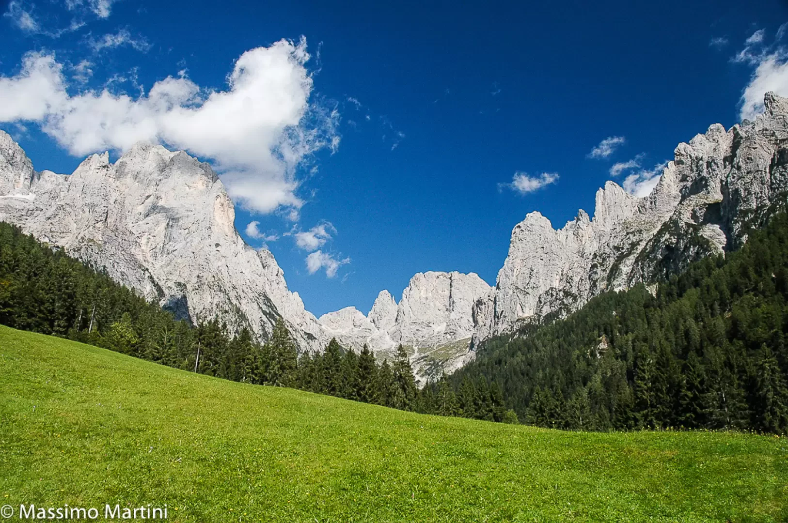
A region with a special statute in the far north of Italy, Trentino-Alto Adige borders Austria and Switzerland and embraces some of Europe's most famous Alpine landscapes. From the Adamello-Presanella massif and the Ortles-Cevedale group to the Brenta, Fassa, Gardena and Fiemme Dolomites, the entire territory is mountainous and sculpted by wide valleys, forests, pastures and lakes; in the Trentino sector, Garda wedges like a fjord between steep walls. It is a land of passage and of encounter between the Latin and Germanic worlds: two autonomous provinces - Trento (of prevalent Italian culture) and Bolzano/Bozen (of prevalent German culture with Ladin areas) - share the great Adige ridge and the historic Brenner axis. Towns and villages - Trento, Bolzano, Merano, Bressanone, Brunico, Rovereto - boast arcades, castles, sanctuaries and museums; spa resorts such as Merano, Levico, Comano, Peio and Rabbi renew a tradition of healing alongside mountaineering and skiing. The tourist offer is state-of-the-art, with winter resorts and networks of trails attracting visitors in every season.
Description
The territory is entirely mountainous in altitude classification and organised around the Adige/Etsch furrow, which receives the Isarco and Rienza rivers in Bolzano and the Noce and Avisio rivers further south; to the north-west stretches the Venosta and Ortles-Cevedale Valleys, to the east the Pusteria Valley, and in the centre the Dolomites with their plateaus and passes. Among the lakes are Molveno, Braies, Carezza, Tovel, Levico and Caldonazzo, as well as the northern edge of Lake Garda. Environmental protection is capillary: the Stelvio National Park unites the Trentino and South Tyrolean slopes around the Ortles-Cevedale; in Trentino there is the Adamello-Brenta Nature Park (also a geopark), while in South Tyrol a network of nature parks (Sciliar-Catinaccio, Puez-Odle, Fanes-Senes-Braies, Gruppo di Tessa, Vedrette di Ries-Aurina, Tre Cime, Monte Corno) protects the main Dolomite and Alpine systems. The Dolomites have been a UNESCO World Heritage Site since 2009, and some prehistoric pile dwellings around the Alps have significant sites in Fiavé and Ledro. The relatively geologically stable environment has been cared for by mountain agriculture for centuries; the main risks are avalanches, punctual instabilities and the effects of glacial retreat.
History intertwines Romanity and Rhaetian and Tyrolean traditions. For centuries, the present territories were part of the Episcopal Principality of Trento and the County of Tyrol in the Hapsburg area; after the First World War, the border passed to the Brenner Pass. The De Gasperi-Gruber Agreement of 5 September 1946 sanctioned linguistic protection for the German-speaking population; the Special Statute of 1948 established the Autonomous Region and that of 1972 transferred most of the competences to the two Autonomous Provinces, a model that is still the basis of coexistence and multi-level government.
The economy has three pillars: tourism, widespread manufacturing and quality agro-food. Tourism, as strong in winter as in summer, revolves around ski resorts such as Dolomiti Superski and Skirama Dolomiti, historical resorts (Madonna di Campiglio, Canazei, Moena, San Martino di Castrozza, Val Gardena, Plan de Corones, 3 Cime/Alta Pusteria) and a capillary system of mountain huts. Manufacturing is pulverised into medium-small companies in mechanics, wood-paper, food and construction; in Val di Cembra, porphyry quarrying and processing have an international scope. Hydroelectricity is strategic and historically linked to Alpine dams and large power stations. Agriculture is dominated by fruit growing (apples in primis, with a strong cooperative organisation), mountain vineyards (Trentino DOC, Alto Adige DOC, Trento DOC metodo classico), alpine dairy farming and typical productions that have consolidated a mixed Alpine-Mitteleuropean and Italian gastronomic identity. Symbols such as Speck Alto Adige PGI, Puzzone di Moena PDO, Spressa delle Giudicarie PDO, Teroldego Rotaliano and Müller-Thurgau tell of the variety of the territories, to which are added customs such as the autumn Törggelen and artisan traditions of wood, copper and weaving.
Tourism and active tourism are a common language. The Brenta Dolomites are home to the famous 'Bocchette' via ferrata system; popular outings include the Catinaccio with Vajolet, Odle, Tre Cime and plateaus such as Sciliar and Fanes. In Adamello-Presanella and Ortles-Cevedale the big mountains offer glaciers and classic high routes; the lakes of Tovel, Braies, Carezza and Molveno are iconic and easily accessible destinations. On the cycling side, the Via Claudia Augusta traverses the entire region along the ancient Roman artery, joining Resia, Merano, Bolzano and Trento before forking off towards Ostiglia or Altino; the Valsugana connects Trento to the Veneto; in winter, the Sellaronda and the Pusteria Nordic Rings expand the offer. Spas add wellness to the valley, while Christmas markets in Bolzano, Merano, Bressanone and Trento and castles (Buonconsiglio, Tirolo, Roncolo, Avio) punctuate the cultural calendar.
Information
Capital city: Trento
Area: 13606.87 sq. km
Minimum elevation: 73m
Maximum elevation: Ortles (3903m)
Number of inhabitants: 1,059,477 (29.02.2016)
Name in dialect: Südtirol
Name in dialect: Trentine and South Tyrolean (or South Tyrolean)
Provinces:Province of Bolzano, Province of Trento
Municipalities: 326
Bordering regions: Lombardy, Canton of Graubünden, Salzburg, Tyrol, Veneto
Institutional site: www.regione.taa.it