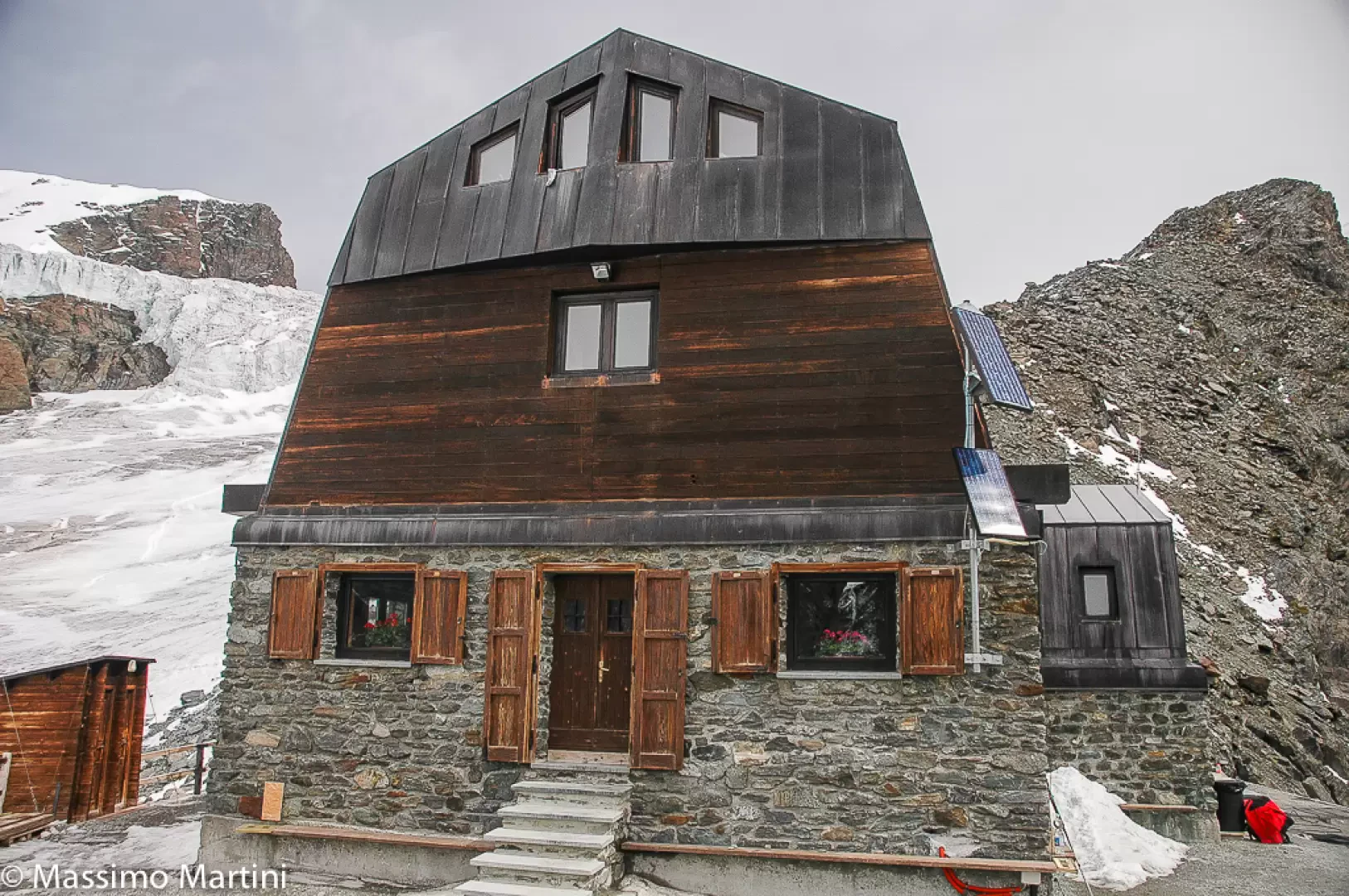
Ayas Guides Refuge

Access
The winter room, which is always open, is accessed via a small staircase on the east side of the building. A small anteroom gives access to the kitchen-dining room equipped with a cooker, cookware, gas bottle and a table seating 10. The dormitory, with 20 beds, 4 of which are two bunk beds, is located beyond the glass door and is equipped with mattress covers, pillows and blankets. The toilet shed is located on the north side near the helicopter landing site.
.Introduction
Situated on a rocky outcrop between the Great and Small Verra Glaciers, it was completed in 1991 to facilitate the approach of mountaineers, to whom it is strictly addressed, to certain peaks of the Monte Rosa massif. Different meanings have been attributed to the place name Lambronecca. According to some, it derives from the Walser language "Am brun Ekko" meaning "on the brown high ground". According to others, it would derive from lambruna, a term used to define blueberries in some Piedmontese dialects; according to still others, the name would be the combination of Lamb and Ekke and would therefore mean 'moraine of the lambs'.
Description
Refuge information sheet
Altitude: 3420m
Location: Rocce di Lambronecca near the Verra Glacier
Ownership: Guide di Ayas
Manager:
Place-beds: 72
Place-beds in the Winter: 16
Lighting:electric
Wifi:not available
Device Charging: not available
Water:in the hut
Hut Book: present
Contacts
Opening Period: 15.04 / 15.05 and 15.06 / 16.09
Telephone: +39 (0)125-308.083
Cellphone: +39 339-49.45.998
email: info@rifugio-lambronecca.com
Description
The winter room, which is always open, is accessed from a small staircase on the east side of the building. A small anteroom gives access to the kitchen-dining room equipped with a cooker, cookware, gas bottle and a table seating 10. The dormitory, with 20 beds, 4 of which are two bunk beds, is located beyond the glass door and is equipped with mattress covers, pillows and blankets. The toilet block is located on the north side near the helicopter landing site.
Accesses to the hut
Routes from the hut
- Castor
- Pollux
- Black Rock
- Black Rock
- Eastern Breithorn
- Central Breithorn
- Western Breithorn
- Rollin's Hump
Excursions/traverses/climbs
traverses
- The Matterhorn Guide Hut 3480m - Breithorn Col 3826m
- Monte Rosahutte 2795m - Colle di Verra 3846m
- Rossi and Volante Divacs 3750m
- Quintino Sella Refuge 3620m
- Capanna Margherita 3554m
- Mezzalama Refuge 3004m
- Gressoney - Col di Bettaforca 2672m
ascensions
- Castore 4226m
- Polluce 4090mn
- Gobba di Rollin 3899m
- Breithorn Orientale 4141m and Centrale 4160m
- Roccia Nera 4073m
- P.ta Perazzi 3906m
Information
Situated on a rocky outcrop between the Grande and Piccolo glacier of Verra, it was completed in 1991 to facilitate the approach of mountaineers, to whom it is strictly addressed, to certain peaks of the Monte Rosa massif. Different meanings have been attributed to the place name Lambronecca. According to some, it derives from the Walser language "Am brun Ekko" meaning "on the brown high ground". According to others, it would derive from lambruna, a term used to define blueberries in some Piedmontese dialects; according to still others, the name would be the combination of Lamb (lamb) and Ekke (moraine) and would therefore mean "moraine of the lambs".
The access route, starting from the Mezzalama hut, is demanding and reserved for experienced hikers. The path starts behind the Mezzalama hut, from the helicopter pad. You go around the rocky rampart on the left and soon reach a tongue of the Verra Glacier. Depending on the conditions, it may be advisable to put on crampons, which are in any case to be had. One then continues to the right across the glacial plain, in the direction of the rocky spur of Lambronecca on which the hut stands. You climb up the scree and rocky slopes and zigzag, keeping the tower on the left, until you reach the last section equipped with fixed ropes and wooden footbridges. The walking time from the Mezzalama hut is about an hour and a half.
Mountaineers who reach it are treated to a high-altitude cuisine that has nothing to envy to that of low altitudes.