Quincinetto

Edited by:
Massimo Martini
Access
Access to Quincinetto is facilitated by its strategic position on the road route between Piedmont and Valle d'Aosta. The town is a very short distance from the motorway exit on the Turin-Aosta [A5] motorway, providing easy access both to Ivrea and Canavese, and to nearby Donnas in Valle d'Aosta. The nearest railway station is located in Settimo Vittone, while essential services and parking facilities are available in the town centre. There are bus lines connecting the municipality with towns in the valley and the main cities.
.Introduction
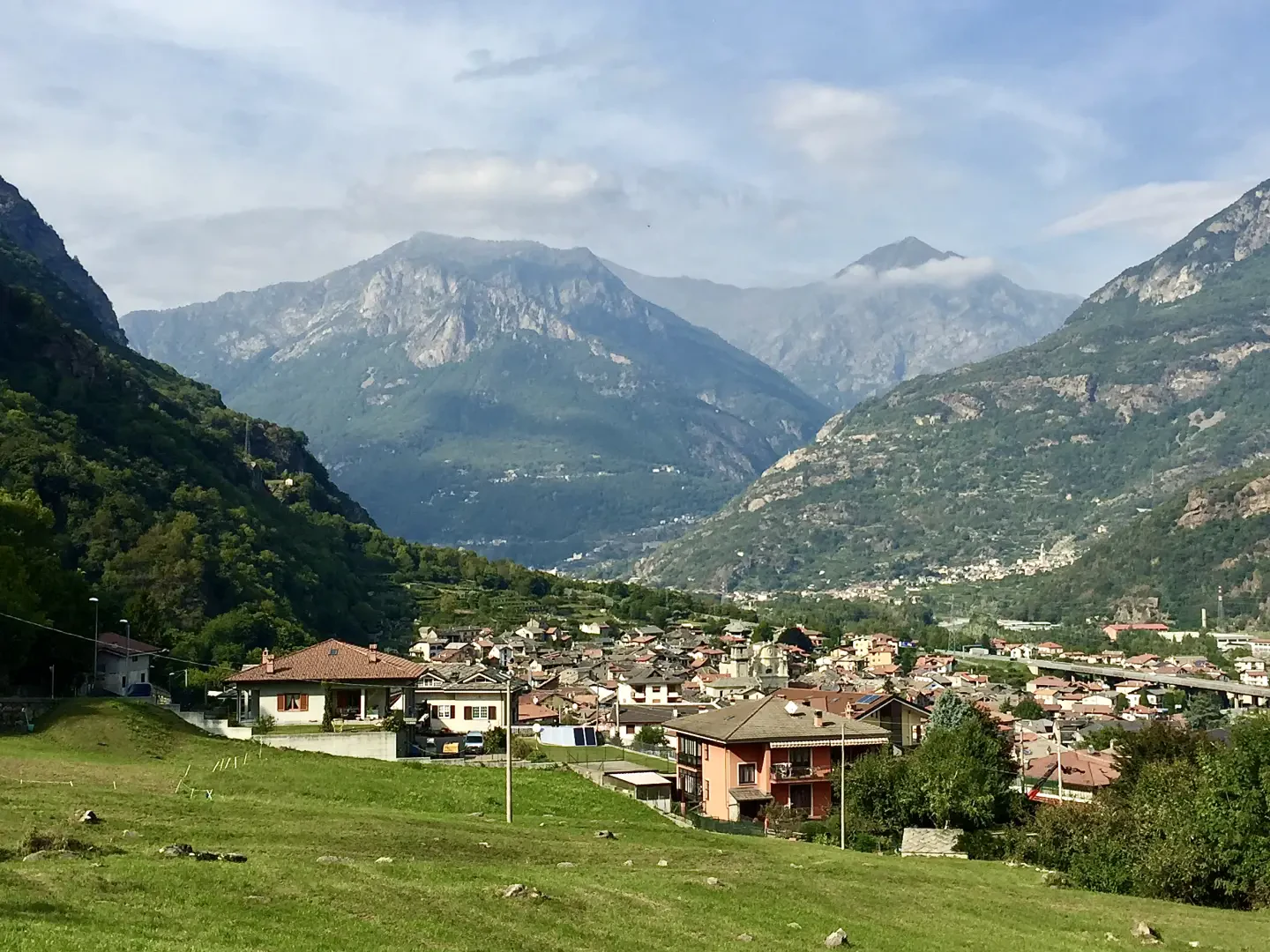
Located along the right bank of the Dora Baltea river, near the border with Valle d'Aosta, Quincinetto is one of the largest municipalities in the Canavese area, in the metropolitan city of Turin. The territory covers almost 18 square kilometres and has a considerable altitude range: it goes from the 295 metres of the main town to the 2,596 metres of Cima di Bonze, the peak that dominates the northern ridges. This borderline position, between the valley floor and the alpine environment, has always marked the character of the place and its inhabitants, who are mainly concentrated in the main nucleus.
Description
Human presence in the area has been ascertained since prehistoric times, as shown by the rock engravings on the rocks of the Bec Renon summit; these are cup-marks and symbols attributed to the Bronze Age, which make the area an object of archaeological interest. The place name itself, according to some hypotheses, derives from the Celtic root associated with watercourses and appears for the first time in a document of 1222 with the name Castrum Quingenati; however, no trace remains of any medieval fortified structures. Over the centuries, Quincinetto has developed a rural and mountainous identity, also visible in the layout of the villages and hamlets, located in strategic points of the territory.
Worthy of note are several elements of traditional architecture: the old houses in local serizzo stone with slate roofs, often along paved streets, form a robust and characteristic built landscape, harmoniously integrated with the surrounding natural resources. The parish church of Gesù Risorto, dedicated to San Salvatore, is one of the main urban landmarks: rebuilt in 1770 to a design by architect Bella, it has a late Baroque layout, 18th-century decorations by Giovanni Cogrossi and a façade enriched with statues and bas-reliefs. One of the most evocative historical routes is the mule track that leads to the top of the so-called Rupe, a 200-metre high rock face that towers above the town and offers sweeping views of the plain and surrounding peaks.
In terms of the environment and hiking, Quincinetto offers a remarkable variety: woods, high-altitude pastures and water environments, with itineraries that climb up to panoramic mountain pastures, rocky ridges and archaeological sites. The section towards Bec Renon offers the opportunity to observe rock engravings and wide views of the peaks of the Matterhorn and Monte Rosa; other routes reach Cima di Bonze and the mountain hamlets, offering opportunities for both nature and historical excursions.
Information
Area: 17.79 km²
Altitude: 295m
Maximum elevation: 2,596m - Cima di Bonze
Number of inhabitants: 1.061 (updated to 2024)
Name in dialect: Quisné in Piedmontese
Inhabitants: QuincinettesiPatron Saint: Saint Saviour
Bordering municipalities: Carema, Donnas, Settimo Vittone, Tavagnasco, Traversella, Trausella, Valchiusa
Website: www.comune.quincinetto.to.it