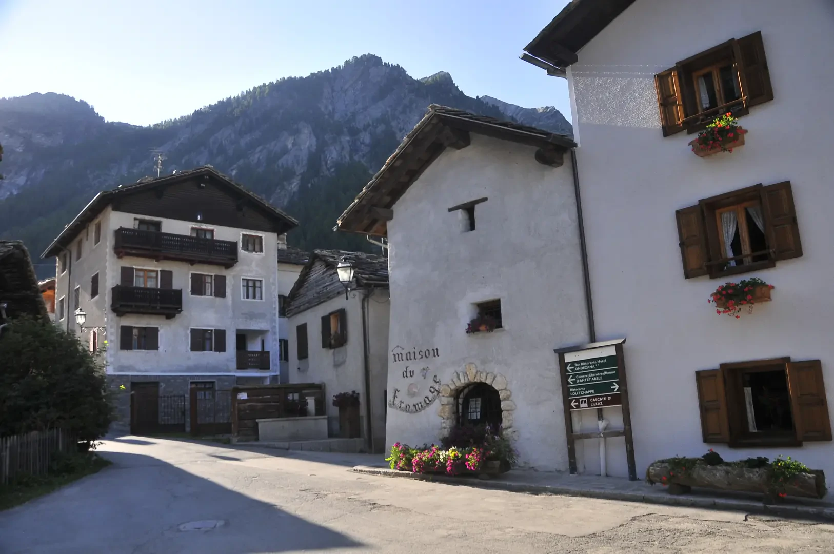
Lillaz

Access
At the motorway junction of Aosta West, turn right and take the regional road for the Cogne valley. Drive through the village of Aymavilles and, after 1.3 kilometres, take the second exit at the roundabout. Go up the regional road for 19 kilometres, passing the villages of Vieyes, Epinel and Crétaz, until you reach a roundabout: take the second exit, following the signs for Lillaz. Continue on the communal road for about one kilometre until you reach another roundabout; continue straight on for another 1.8 kilometres until you reach the large free car park 🅿️ in Lillaz.
[0h32'] - [24.0km]
How to get there with GMAPS
How to get there with Apple Maps
The directions provided have been carefully checked at the time of the route survey. However, it is highly recommended to check for any changes that may have occurred since then, especially regarding the route to the starting point. Before embarking on your journey, it is advisable to consult up-to-date navigation tools for accurate and up-to-date directions. We recommend the use of satellite navigation apps, such as Google Maps or Apple Maps, to ensure the most accurate and safe route.
Introduction
Lillaz is a village located at 1613 metres above sea level, whose toponym probably derives from 'ila' or 'lila', terms indicating land situated on the banks of a stream, subject to frequent flooding. The regional road that connects Cogne to Lillaz follows the old route and splits before entering the village and then rejoins it upstream to the south. The road that continues into the Valleille valley is still present and bordered by small walls in the section near the village. However, the construction of new driveways has altered the routes of the main paths, although small paths leading to neighbouring land are still present.
Description
The village still maintains the practice of grassland cultivation in the flat area immediately to the south, while the remaining areas, west of the Valleille stream and in the steeper areas, are used as pastureland. The steeper areas are predominantly forested, and in the northern part of the village there are terraces, albeit small ones. The ru network, with open stretches, is still used, at least in the flatter part.
The chapel in Lillaz, dedicated to St. Clement and formerly to St. Anne, was founded in 1606, destroyed in the flood of 1863 and rebuilt in 1875 away from the stream, on the other side of the village. According to the Census of Rural Architecture, there is no longer any trace of the village oven, which could hold up to 110 loaves and was still in use until around 1980. The school, built in 1941, was active until the 1980s, before being converted into a tobacco shop in the 1990s. Oral tradition reports that until the 1920s there was also a dairy, used exclusively for goat's milk. The Champlong mill, which has now disappeared, was used to grind cereals. Four fountains have been found in the village.
Information
Itineraries
Collections
- the villages of Cogne - on the map
- points of interest in Cogne - on the map
- the villages of the Cogne Valley - on the map