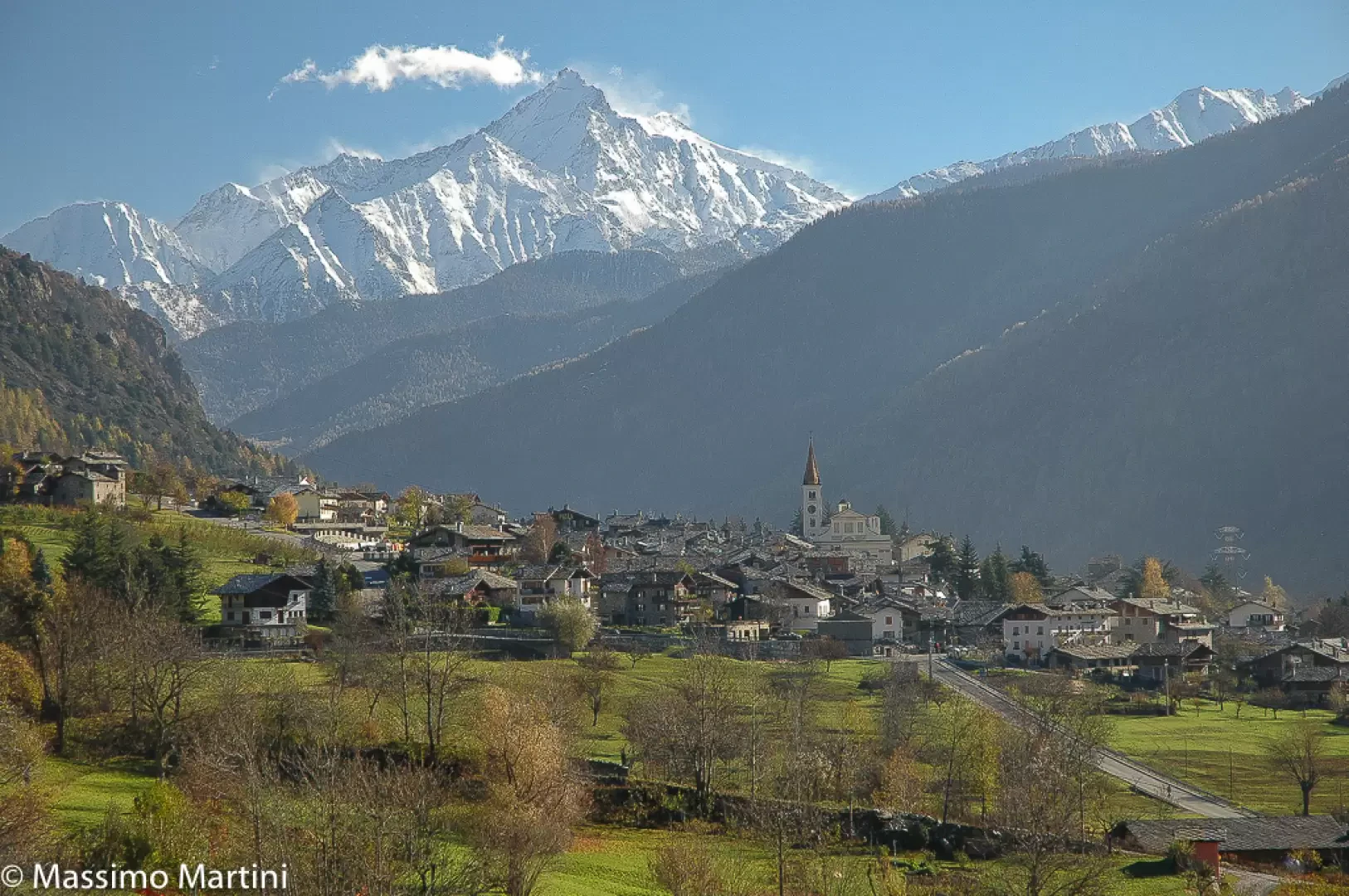
La Salle

Access
Accessibility to the municipality is guaranteed by the Valle d'Aosta state road, which crosses the valley floor between Aosta and Courmayeur, and by a dedicated junction on the Turin-Aosta-Monte Bianco motorway, which provides a direct link to the municipal capital. Public transport is provided by regular buses with stops at the centre and the main hamlets. The nearest railway station is in Morgex, on the Aosta-Pré-Saint-Didier line, which can be reached in a few minutes. For air travel, the regional airport of Aosta is the closest reference, while the international airports of Turin and Milan provide the main access from outside the region.
Introduction
La Salle is a municipality in the upper Valle d'Aosta located in Valdigne, positioned at around 1,000 metres above sea level on a wide sunny terrace overlooking the course of the Dora Baltea and the entrance to the Mont Blanc valley. The municipal territory, extensive and articulated, comprises cultivated valley floors, wooded slopes and high-altitude areas that reach the crests of Grande Rochère, the municipality's highest elevation. The settlement landscape is characterised by numerous hamlets and historic villages, in which rural alpine architecture is integrated with more recent buildings, while the main town retains its role as an administrative and religious centre, even though it is now closely linked to the tourist flows of the valley.
Description
The strategic location along the ancient route leading to the Petit St Bernard pass made La Salle an important passageway to Savoy and France. The historic village, built around the parish church, preserves valuable buildings and evidence of the past, including fortified structures and traditional stone and wooden houses. The main nucleus houses the Museum of Sacred Art, which collects liturgical furnishings and works of significance for local religious history.
In terms of history, La Salle reflects the events common to the upper Aosta Valley: from the pre-Roman alpine populations to the Roman period, which controlled the main transalpine routes, to its incorporation into Savoy rule in the medieval and modern periods. The territory was affected by the presence of noble families and a network of castles and strongholds, including that of Châtelard, testimony to the control over passages and agricultural resources. In the 20th century, the municipality witnessed the decline of traditional agriculture and the growth of tourism, favoured by its proximity to the Mont Blanc area and the accessibility guaranteed by the infrastructure of the central valley.
The current economy is linked to tourism and the residential sector, but maintains a significant agricultural role. Mountain viticulture is a distinctive feature, in particular through the cultivation of Prié Blanc on historic terraces and the most exposed slopes. With the vineyards of Morgex, La Salle contributes to the production of Vallée d'Aoste Blanc de Morgex et de La Salle AOC, from the highest vineyards in Europe at the foot of the Mont Blanc massif. Grazing meadows, alpine pastures and small-scale livestock farms remain active, preserving the structure of the alpine agrarian landscape and supporting traditional cheese production.
The cultural fabric of the municipality revolves around the parish church and the chapels in the hamlets, elements that have marked the life of the communities spread across the territory for centuries. The patron saint is San Cassiano di Imola, celebrated on 13 August with religious moments and community events in the main town. The local dialect calls the village 'La Sala', an expression of the Francoprovençal linguistic tradition, while the inhabitants are called 'sallereins', a term that keeps alive a clearly recognisable local identity.
The territory offers a wide choice of hiking trails that pass through forests, historic villages, ancient alpine pastures and panoramic slopes overlooking the Valdigne and the Mont Blanc massif. The network of trails allows itineraries suitable for different levels of experience, with routes that ascend towards the Grande Rochère and secondary peaks, or that connect the numerous hamlets via farm tracks and mule tracks. At high altitudes, the network of ancient alpine pasture tracks retraces the history of summer grazing and today allows the relationship between agro-pastoral activities and the mountain environment to be interpreted.
Information
Area: 83.94 km²
Altitude: 1-001m
Maximum elevation: 3,326m - Grande Rochère
Number of inhabitants: 2,004 as of 31.07.2025
Name in dialect: La Sala
Inhabitants name: sallereins
Patron Saint: San Cassiano di Imola (13 August)
Neighbouring municipalities: Avise, Courmayeur, La Thuile, Morgex, Saint-Rhémy-en-Bosses
Internet site: www.comune.lasalle.ao.it