Gignod

Edited by:
redazione
Access
Gignod can be reached via the [A5] Turin–Aosta motorway, taking the Aosta Est exit, from where you continue north on the Gran San Bernardo road; until June 2027, the link between the motorway and the main road is closed for tunnelling works, and the route involves travelling through the town of Aosta. The main road crosses the municipal area at the entrance to the valley; from the valley floor, municipal roads branch off to the hillside hamlets and the Buthier basin. The nearest railway station is Aosta, on Trenitalia’s (TI) Chivasso–Aosta line; the section between Aosta and Ivrea is closed for electrification works and is served by replacement buses, with a phased reopening scheduled to begin in January 2027. Local public transport is operated by Arriva Italia, with interurban routes connecting Aosta to the Great St Bernard Valley. The nearest airport with scheduled flights is Turin-Caselle’s “Sandro Pertini” Airport. During the winter months, the mountain roads may have snow-covered or icy sections and require winter tyres or snow chains to be carried in the vehicle.
Introduction
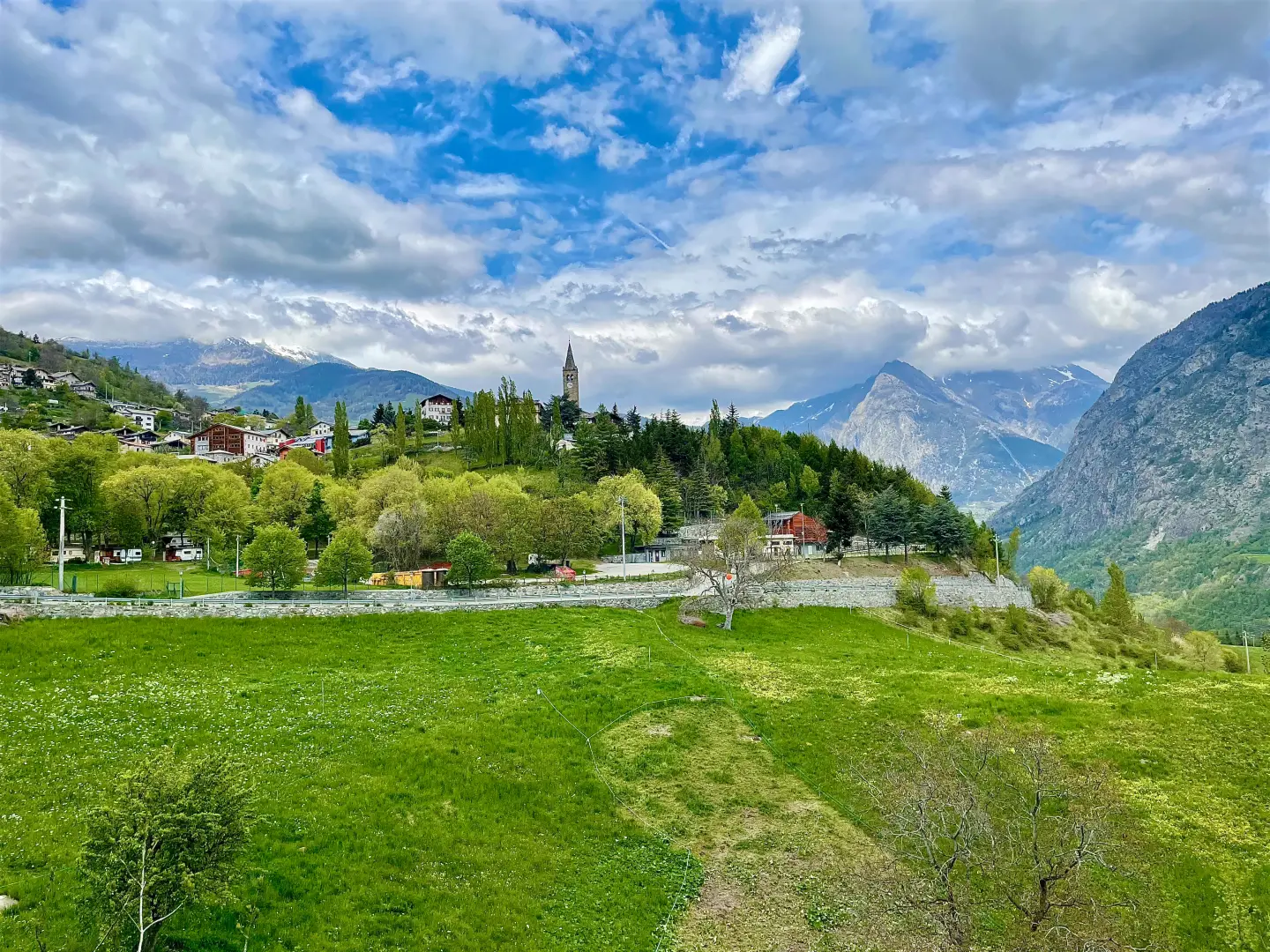
Gignod is a municipality in the Aosta Valley situated at the head of the Great St Bernard Valley, north of Aosta, at the point where the valley meets the Valpelline. The town centre, in the hamlet of Le Château, lies just below 1,000 metres, whilst the municipality’s territory rises from the valley floor up to the ridge of the Pointe de Chaligne, at over 2,600 metres. The municipality borders Aosta, Sarre and Saint-Pierre towards the basin of the regional capital, Roisan and Doues towards the Valpelline, and Allein, Étroubles, Saint-Oyen and Saint-Rhémy-en-Bosses as one travels up the valley. Its location at the entrance to the valley made it, in the Middle Ages, the seat of noble families and a stopping point along the mountain pass road.
Description
The area occupies the basin to the north of Aosta, where the Artanavaz stream, flowing down from the Great St Bernard Valley, joins the Buthier, which comes from Valpelline. From the meadows on the lower slopes, the area rises through coniferous woodland to the mountain pastures and the ridge which, from the Pointe de Chaligne, separates the basin from the municipalities of Sarre and Saint-Pierre. The settlement is fragmented into numerous villages and rural hamlets, including Variney, Buthier, Arliod, Caravex, Clémencey, Le Château and Gorrey.
The area was already inhabited in prehistoric times, as indicated by the pottery fragments found at Châtellair, a soapstone bracelet and a cist grave at La Condéminaz; remains of bricks and slag dating from the Roman period have been interpreted as part of a kiln. In the Middle Ages, the lords of Avise granted the fief to the de Gignio family, mentioned in a document dated 1095, who owned a castle near the church, documented in 1228 and ceded to the House of Savoy in 1319 by Ibleto de Gignio; some forty years later, it reverted to the lords of Avise and its stones were subsequently reused in the construction of the parish church. In the mid-13th century, the House of Savoy assigned the territory to the lords of Quart, who retained it until 1378; in 1584, the barony of Gignod was established, which also included Étroubles, Saint-Oyen, Saint-Rhémy-en-Bosses, part of Allein and two districts of Aosta. On a hill in the locality of Château stands the Gignod Tower, dating from the 12th–13th centuries and also known as the Calvin Tower due to a tradition linking it to the threat posed by the Swiss Reformers in 1536; downstream from the tower stands the fortified house of Archiéry, first documented in 1409 and restored in 1596 by Antonio d’Avise, provost of Aosta Cathedral. The parish church houses 15th-century frescoes that were uncovered during a restoration in 1895. Between the 18th and 19th centuries, Gignod was home to a blast furnace for processing ore extracted from the mines at Ollomont and Cogne.
The local economy has long been based on agriculture and livestock farming; its proximity to Aosta has, over time, encouraged residential growth in the municipality. In August, the Féta di teuteun takes place, dedicated to the salt-cured cow’s udder typical of the Aosta Valley. On 16 August, a procession climbs from Gignod to the summit of the Pointe de Chaligne, in thanksgiving for the end of the 17th-century plague epidemic; a second procession sets off from the hillside hamlets of Aosta. The municipality takes part in the Coumba Freida Carnival and is a member of the Unité des Communes valdôtaines Grand-Combin.
The network of footpaths links the villages to the higher mountain pastures and the ridge of Pointe de Chaligne, which can be reached via several routes and circular walks; in the mountain pasture area, above Buthier, lies the Chaligne Refuge, a destination for summer hikes and snowshoe walks. The valley floor is crossed by the Via Francigena, which winds its way up the valley towards the Great St Bernard Pass.
Information
General information
Area: 25.98 km²
Altitude of the main town: 988 m
Highest point: 2,607 m – Punta Chaligne
Population: 1,679 (as at 1 January 2026)
Name in the local dialect: Dzegnoù
Name of the inhabitants: gignoleins
Patron saint: StIlario, celebrated on 13 January
Neighbouring municipalities: Allein – Aosta – Doues – Étroubles – Roisan – Saint-Oyen – Saint-Pierre – Saint-Rhémy-en-Bosses – Sarre
Region: Aosta Valley
Country: Italy
Official website: Sarre
Country: Italy
Official website: Sarre
Country: Italy
Official website: Sarre
Country: Italy
Official website: SAosta
Country: Italy
Official website: municipality.gignod.ao.it