Aurigo
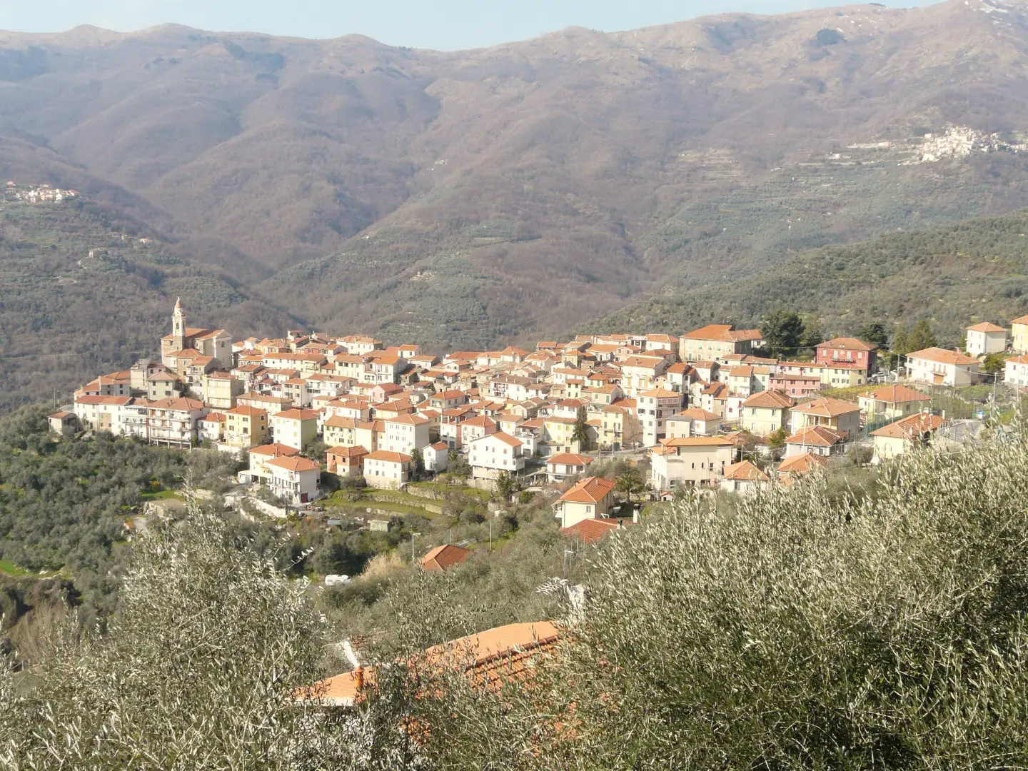 Photo by
Davide Papalini - Opera propria, CC BY-SA 3.0

Edited by:
Massimo Martini
Access
The town can be reached from the Imperia Est exit on the[A10] Genoa–Ventimiglia motorway, from where you take the via Colle di Nava towards Pieve di Teco as far as San Lazzaro Reale, at the entrance to the Maro Valley. From San Lazzaro Reale, the road winds up the valley to Borgomaro, where the begins, climbing to the main town and continuing towards Conio. The connects the area with Carpasio, Caravonica and Cesio. The main railway station is Imperia, on the Genoa–Ventimiglia line operated by Trenitalia (TI); from the station, connections to the interior are by road. Local public transport is operated by Riviera Trasporti S.p.A., which manages the province’s inter-urban service with routes from Imperia towards the Maro Valley. The nearest airport with scheduled flights is “Nice Côte d’Azur” in Nice; on the Italian side, the main airport is “Cristoforo Colombo” in Genoa.
Introduction
Aurigo is a municipality in the hinterland of the province of Imperia, in the valley of the Maro stream, a tributary of the Impero Valley. The main town lies at an altitude of 431 metres on the slopes of Mount Guardiabella, whose ridge separates the Maro valley from the Arroscia basin; the other inhabited localities are Poggialto and Guardiabella. The terrain rises from 222 metres at the valley floor to 1,218 metres at the summit. It borders Borgomaro to the south and west – which occupies the rest of the Maro valley – and Rezzo and Pieve di Teco to the north, both municipalities in the Arroscia Valley. Olive cultivation on terraces, using the Taggiasca variety, has shaped the contours of the slopes and remains the main agricultural activity.
Description
The municipal area covers the slope of the Maro valley between the valley floor and the ridge of Monte Guardiabella. The Maro stream is joined by the Lacori, Coette, Succo and Banco streams before flowing into the Impero at San Lazzaro Reale. Along the northern watershed lie the Passo del Lupo, at 1,118 m, and Monte delle Valasse, at 1,206 m. The slopes are characterised by terraces supported by dry stone walls. The place name is thought to derive from the Latin apricus, meaning ‘sun-exposed’, or from the name of Germanic origin Aurigis.
The site was chosen in the 13th century by the Counts of Ventimiglia for a castle. On 2 December 1242, Aurigo and Poggialto submitted to Count Filippo of Ventimiglia; around 1270, the area was conquered by Charles ofAnjou, and in 1273 the Ventimiglia family recaptured it with the help of Genoa. In 1480, Giovanni Antonio di Tenda, of the Lascaris family, attacked and destroyed the castle: the fief remained with the Lascaris of Tenda until 1511, when the Ventimiglia family regained control with the support of Renato of Savoy. After a period under the Marquisate of Dolceacqua, in 1575 the Oneglia valley passed to Emanuele Filiberto of Savoy; the administration of the fief was entrusted to the Lascaris of Ventimiglia and then to the De Gubernatis, whose palace stands next to the castle ruins. On 14 April 1800, during the Napoleonic campaigns, the houses were set alight on the orders of General Jablonoski. Following its annexation to the Ligurian Republic and the French department of Montenotte (1801–1814), the territory returned to the Kingdom of Sardinia. The earthquake of 23 February 1887 claimed 10 lives. From 1928 to 1954, the municipality was incorporated into Borgomaro; during the Second World War, the main town was home to the headquarters of the 4th Garibaldi Brigade “Felice Cascione”. The religious heritage includes the parish church of the Nativity of the Virgin Mary, theOratory of St John the Baptist with late 17th-century stucco work by Gio Paolo Marvaldi, the church of St Bernard in Poggialto with a 17th-century wooden altarpiece, the sanctuary of StAndrea, mentioned in a document dating from 1242, and the sanctuary of San Paolo in the hamlet of the same name.
The local economy is based on olive growing: there are three active olive mills in the area – two in the main town and one in Poggialto – and some of the abandoned terraces have been restored. The municipality falls within the production area of the ‘Riviera Ligure’ PDO extra virgin olive oil, with the geographical indication ‘Riviera dei Fiori’, and that of the ‘Riviera Ligure di Ponente"; the vineyards are concentrated in the Aurighi area, near the sanctuary of Sant’Andrea. The municipality is part of the Union of Municipalities of the Impero Valley and the Maro Valley.
Terraced olive groves predominate on the lower slopes; higher up, they give way to chestnut woodland (Castanea sativa) and downy oak (Quercus pubescens), whilst the ridge of Monte Guardiabella is covered in grasslands used for grazing and dotted with stone huts.
The ridge of Monte Guardiabella is the municipality’s main hiking area: the routes start from San Bernardo di Conio, in the municipality of Borgomaro, or from Colle San Bartolomeo, and follow the watershed between Monte Guardiabella, Passo del Lupo, Monte delle Valasse and Monte Aurigo, at 1,122 metres. The ridge can also be explored by mountain bike.
Information
General information
Area: 9.14 km²
Altitude of the main town: 431 m
Highest point: 1,218 m - Monte Guardiabella
Population: 336 (as at 1 January 2026)
Name in the local dialect: Aurigu
Name of the inhabitants: Aurighesi
Patron saint: St Paul, celebrated on 29 June
Neighbouring municipalities: Borgomaro - Pieve di Teco - Rezzo
Province: Province of Imperia
Region: Liguria
Country: Italy
Official website: comune.aurigo.im.it