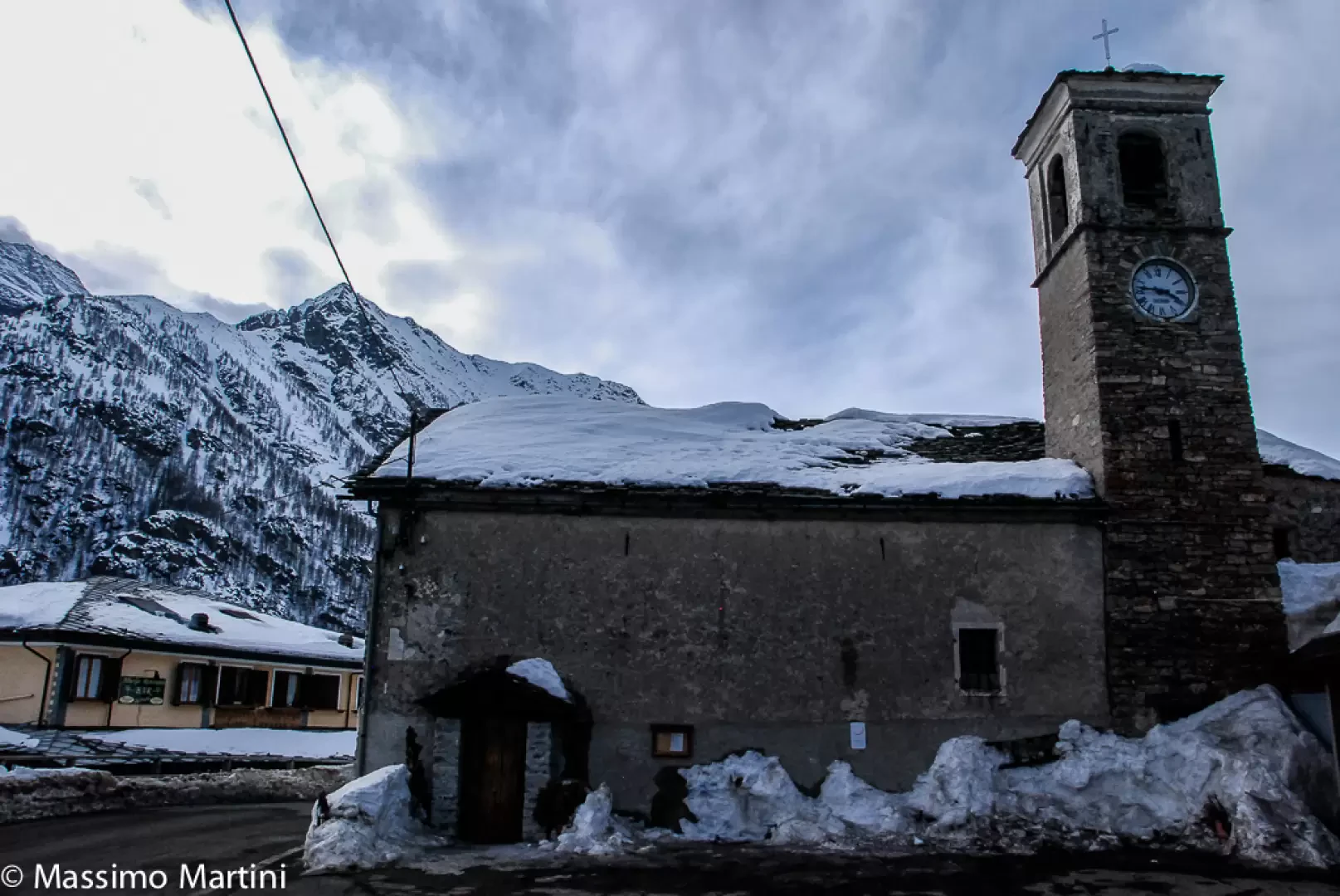
Ceresole Reale

Introduction
Ceresole Reale is a small and charming Alpine municipality located in the upper Orco Valley, in the Piedmontese Canavese region, within the Metropolitan City of Turin. Located at an altitude of 1,620 metres, it covers an area of almost 100 km² and borders some important localities in the Graian Alps such as Bonneval-sur-Arc, Groscavallo, Noasca, Rhêmes-Notre-Dame, Val-d'Isère and Valsavarenche. Its territory includes a large portion of the Gran Paradiso National Park, an area of great naturalistic importance and a historic destination for hikers and naturalists, also made famous by the scenery dominated by the powerful outline of the Gran Paradiso and Levanne mountains. Famous peaks such as Il Roc (4,026 m) rise to its heights, offering a particularly spectacular panorama representative of the Western Alps.
Description
The main settlement lies on the shores of the artificial lake of Ceresole - a stretch of water created by a dam in the early 20th century - which distinctively characterises the landscape and lends the area a note of unique Alpine charm. The scattered hamlets, high-altitude mountain pastures and numerous hamlets bear witness to an ancient history of scattered settlement, where the traditional activities of mountaineering and craftsmanship were integrated with the mountain environment. The area is in fact rich in evidence of Celtic origin and also preserves traces of Roman domination, as shown by some underground corridors of local mines. The first documented historical mentions of Ceresole date back to the year 1000, with the Orco Valley first donated by Emperor Otto III to the bishop of Vercelli, then passed under the rule of the Valperga family in the following century, when municipal statutes were granted. There is no lack of peculiar episodes in Canavese history, such as the Tuchini revolt against feudal oppression.
Ceresole Reale was chosen by the Savoy royal house in the 19th century as a privileged place for hunting and an alpine residence: 'Reale' appears in the toponymy precisely because of the privilege attributable to the monarchy. In the 20th century, the construction of the hydroelectric dam profoundly changed the appearance of the basin, giving impetus to a new tourist season and a partial transformation of the local economic fabric, traditionally linked to high-altitude farming, livestock breeding and dairy production. Today, the main economic resource is nature and sports tourism, with numerous opportunities for summer hiking, cycling, ski touring and the discovery of high-altitude flora and fauna. Mention should be made of the production of alpine toma cheese, an appreciated local speciality cured directly in mountain cottages.
The cultural and religious traditions are well rooted: the patron saint St Nicholas is celebrated on 6 December and the celebrations unite the community of residents, called Ceresolini or, in local patois, Les Birus. Some mountain customs are still alive, as well as small craft activities and the valorisation of legends and tales passed down between generations. The name of the municipality survives in ancient dialectal variants ('Ceresòle') and in French ('Cérisoles'), reflecting the linguistic influences of the border area.
Ceresole Reale welcomes holidaymakers and sportsmen from all over Piedmont and neighbouring France, thanks also to its scenic access routes. The centre can be reached from Turin via State Road 460 of Valle Orco, with continuation on SP50 leading to the well-known artificial lakes of Serrù and Agnel and, in summer, to Colle del Nivolet. The alpine conformation of the area, the well-marked car parks in the main town and the presence of the Gran Paradiso House guarantee welcome and information support. In the warmer months there are also a number of seasonal services for tourists and hikers wishing to immerse themselves in the trails of the National Park. Municipal webcams give real time updates on weather conditions.
Very popular with mountain enthusiasts, Ceresole Reale offers numerous hiking itineraries of varying difficulty, such as the famous Giro Lago (about 7.6 km loop route between the banks, the dam and the cool woods) and the numerous traverses to refuges, alpine passes and high-altitude lakes. The environment, dominated by the influence of the Gran Paradiso Park, guarantees unique biodiversity, fauna observation (ibexes, marmots, eagles) and opportunities for in-depth naturalistic study.
Information
Area: 99.57 sq km
Altitude: 1,620m
Maximum elevation: 4.026m - The Roc
Number of inhabitants: 164
Name in dialect: Ceresòle, Cérisoles
Inhabitant names: Ceresolini, Les Birus
Patron Saint: St Nicholas (6 December)
Neighbouring communes: Bonneval-sur-Arc, Groscavallo, Noasca, Rhêmes-Notre-Dame, Val-d'Isère, Valsavarenche
Website: www.comune.ceresolereale.to.it