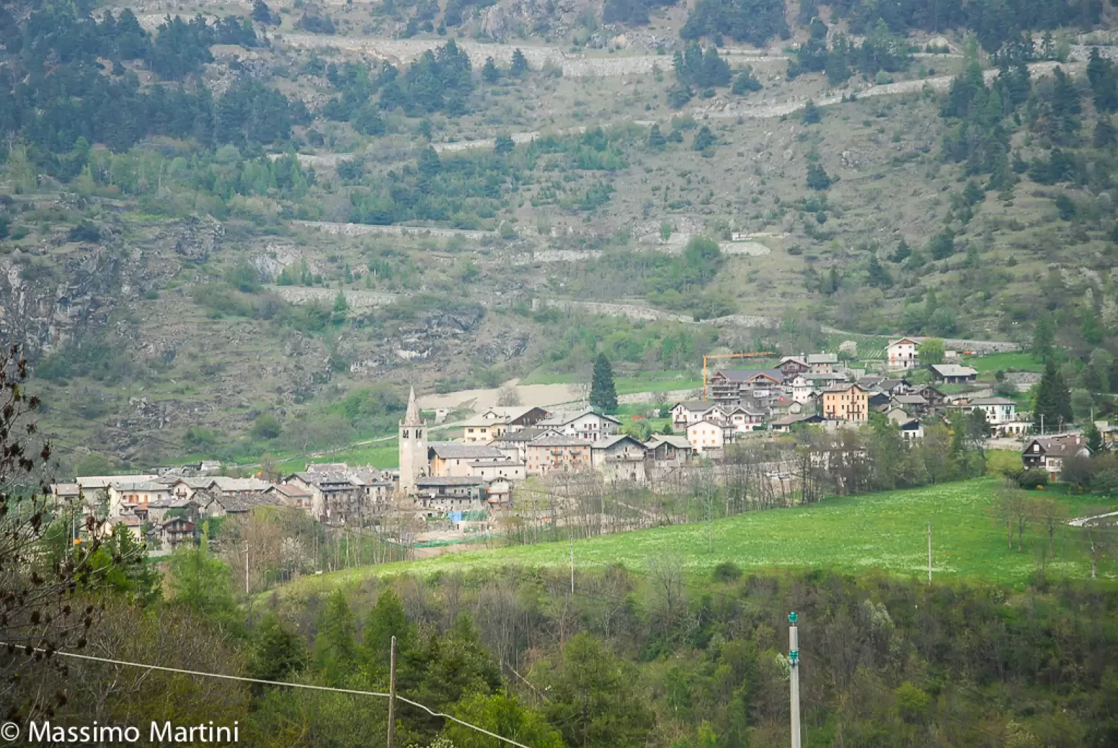
Antey-Saint-André

Access
Antey-Saint-André è un comune situato nella media valle del Cervino, in Valle d'Aosta, a un'altitudine di circa 1.100 metri. Per raggiungerlo, si possono considerare diverse opzioni di trasporto.
In auto, provenendo da Torino, si percorre l'autostrada in direzione Aosta fino all'uscita Châtillon - Saint-Vincent; da Milano, si segue l'autostrada verso Torino, per poi immettersi sulla fino al medesimo svincolo. Una volta usciti, si prosegue sulla Strada Regionale della Valtournenche in direzione Breuil-Cervinia, attraversando località come Antey-Saint-André.
Per chi preferisce i mezzi pubblici, è possibile raggiungere in treno o autobus la stazione di Châtillon. Da qui, si può prendere un autobus diretto a Valtournenche o Torgnon, scendendo a una delle fermate di Antey-Saint-André. Gli orari sono consultabili sul sito della compagnia Arriva.
Gli aeroporti più vicini sono quelli di Torino Caselle e Milano Malpensa. Da questi scali, è possibile proseguire in auto o con i mezzi pubblici fino a Châtillon e poi seguire le indicazioni precedentemente menzionate per raggiungere Antey-Saint-André.
La rete viaria provinciale è ben sviluppata, con strade che collegano agevolmente le diverse località della Valle d'Aosta, rendendo Antey-Saint-André facilmente accessibile sia per chi viaggia in auto che con i mezzi pubblici.
Introduction
Antey-Saint-André è un incantevole comune situato nella regione autonoma della Valle d'Aosta, nel nord-ovest dell'Italia. Con una popolazione di circa 538 abitanti, si trova a un'altitudine di 1.074 metri sul livello del mare, all'ingresso della Valtournenche, la valle che conduce al maestoso Cervino. La sua posizione strategica lo rende una meta ideale per gli amanti della montagna e della natura.
Il territorio di Antey-Saint-André è caratterizzato da ampi prati e boschi di conifere, che creano un paesaggio alpino suggestivo e incontaminato. Protetto dai venti dominanti grazie alla conformazione orografica, il comune gode di un clima temperato, ideale per attività all'aria aperta. Tra le bellezze naturali spicca il Lago di Lod, situato a breve distanza dal centro abitato, le cui rive ospitano una flora rara e in via di estinzione, rendendolo un luogo di grande interesse botanico.
Description
Information sheet
Area: 11.80 square km
Altitude: 1074m
Maximum elevation: Bois de Supplin (2112m)
Number of inhabitants: 626
Name in dialect: Antéy
Inhabitant name: Antesans - Antesan, Antesane
Patron Saint: Saint Andrew the Apostle (30 November)
Website:www.antey.it
Webcam:
Neighbouring municipalities: Chamois, Châtillon, La Magdeleine, Saint-Denis, Torgnon, Valtournenche
Villages and hamlets: Avout, Bourg, Buisson, Cérian, Challien, Chesod, Chessin, Covalou, Épaillon, Fiernaz, Filey, Grand-Moulin, Hérin, Liex, Lillaz, Lod, Moulin, Navillod, Noussan, Nuarsaz, Petit-Antey, Poutaz, Ruvère, Villettaz
Alpeggiations:
Description
This is the first commune you come across on your way up the Valtournenche. Situated at an altitude of 1074m on a vast plateau, it offers a very famous view of the landscape: it is from here that the entire silhouette of the Matterhorn can be seen for the first time, which appears isolated at the bottom of the valley, often cloaked in white contrasting with the green of the woods and the blue of the sky.
The history of the village is linked to that of the Valtournenche.
The history of the village is linked to that of the seigniory of Cly, which originally belonged to a branch of the Challant family. From 1376, when Amadeus of Savoy regained direct control of the seigniory due to the misdeeds of his feudal lords, it passed from family to family until 1843. Antey only occupied a prominent place in regional history between 1522 and 1523, when the presence of Protestant preachers on its territory is attested. The parish was placed under interdict and the so-called reformers were driven out.
The parish was also banned.
Like all the municipalities in the valley, Antey had an almost exclusively agricultural economy, which today has turned into a purely touristic one. Its medium altitude makes it an ideal resort for children and the elderly, especially in the summer, but there is no shortage of infrastructure for sports enthusiasts either: there is a paragliding centre, some sport climbing walls and, in the winter months, snow permitting, a popular cross-country skiing ring.
This is the first municipality one encounters on the way up the Valtournenche. Situated at an altitude of 1074 m on a vast plateau, it offers a famous scenic view: in fact, it is from here that the entire outline of the Cervino, which appears isolated at the bottom of the valley, often cloaked in white contrasting with the green of the woods and the blue of the sky.
The history of the village is linked to that of the seigniory of Cly, which originally belonged to a branch of the Challant family. From 1376, when Amadeus of Savoy regained direct control of the seigniory due to the misdeeds of his feudal lords, it passed from family to family until 1843. Antey only occupied a prominent place in regional history between 1522 and 1523, when the presence of Protestant preachers on its territory is attested. The parish was interdicted and the so-called reformers were driven out.
Like all the municipalities in the valley, Antey had an almost exclusively agricultural economy, which today has turned into a purely touristic one. Its medium altitude makes it an ideal resort for children and the elderly, especially in the summer, but there is no shortage of infrastructure for sports enthusiasts either: there is a paragliding centre, several sport climbing walls and, in the winter months, snow permitting, a popular cross-country skiing ring.
Information
Superficie: 11,68 kmq
Altitudine: 1.074m
Maggior elevazione: 2.112m - Bois de Supplin
Numero abitanti: 557 (al 31.12.20)
Nome in dialetto: Antéy
Nome abitanti: Antesans - Antesan, Antesane
Santo Patrono: Sant'Andrea Apostolo (30 novembre)
Comuni confinanti: Chamois, Châtillon, La Magdeleine, Saint-Denis, Torgnon, Valtournenche
Sito internet: www.comune.antey-st-andre.ao.it
Punti di interesse
Itinerari
- escursionismo - mappa
- mountain bike - mappa
- racchette da neve - mappa
- sci-alpinismo - mappa
- trail running - mappa