Lhotse

Edited by:
Massimo Martini
Access
Lhotse shares the entire approach route with Everest up to around 7,600–8,100 metres, diverging from it only on the final stretch towards its own summit: theaccess is therefore via the same South Base Camp (5,364 m), across the Khumbu Glacier and through the Valley of Silence, sharing the entire infrastructure of camps, fixed ropes and logistics with expeditions bound for Everest. For this reason, Lhotse is often climbed in conjunction with Everest as part of the same expedition. The standard route, whilst not presenting the same technical difficulties as the south face, remains a challenging ascent due to the extreme altitude. Climbing permits are issued by the Government of Nepal; the recommended seasons are spring and autumn.
Introduction
Lhotse, at 8,516 metres, is the fourth-highest mountain on Earth. It rises on the border between Nepal and Tibet (China), and is directly linked toEverest via the South Col (7,906 m), of which it is in many ways the ‘twin mountain’ — the ascent route is shared by the two peaks up to a considerable altitude. The name, which in Tibetan means ‘southern peak’ due to its position south of Everest, was proposed in 1921 by the British explorer Charles Howard-Bury: the mountain does not appear to have a traditional name of its own in either Tibetan or Nepali, a rare circumstance amongst the great Himalayan peaks. The massif comprises three distinct summits — the main summit, Middle Lhotse (or Lhotse Mig) and Lhotse Shar — and features on its south face one of the most challenging and long-unclimbed walls in the entire Himalayas.
Description
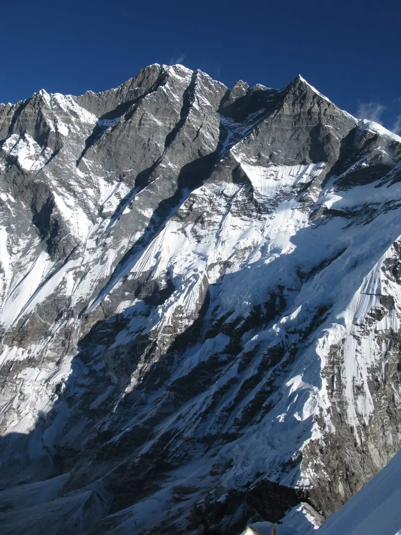
Lhotse rises immediately to the south of Everest, separated from it by the South Col, and shares with the world’s highest peak the entire orographic structure of the headwaters of the Khumbu Valley. The eastern flank of the mountain lies within the Tibet Autonomous Region, whilst the western flank lies within Nepalese territory. The massif comprises three peaks aligned along the ridge: the main summit (8,516 m), Middle or Eastern Lhotse (8,372–8,414 m depending on the source) and Lhotse Shar (8,383 m), the latter marking the eastern end of the summit ridge. The south face, which drops more than 3,000 metres down into the Khumbu Valley, is considered one of the most formidable faces in the entire Himalayas due to its verticality, exposure and unstable terrain, and for decades repelled attempts by the world’s finest mountaineers before finally being conquered.
The first ascent of the main summit took place on 18 May 1956, when the Swiss climbers Ernst Reiss and Fritz Luchsinger, members of the Everest-Lhotse expedition which that same year took other members to the summit ofEverest that same year, reached the summit via the South Col. Lhotse Shar was first climbed in 1970 by the Austrians Sepp Mayerl and Rolf Walter — a date reported by an international encyclopaedic source, whilst some Italian sources cite 1979 for the same pair of mountaineers: this discrepancy remains unresolved in this section. Lhotse Middle, the last of the three peaks to be conquered, was only summited in 2001 by a Russian expedition, making it one of the last Himalayan sub-peaks above 8,000 metres to be climbed for the first time.
The south face of Lhotse holds a special place in the history of mountaineering, having been, for decades, one of the most coveted and frequently failed objectives in the entire Himalayas, attempted by some of the strongest international expeditions before finally being conquered. On 16 October 1986, Reinhold Messner reached the summit of Lhotse via the normal route, becoming the first mountaineer in history to complete theascent of all fourteen of the world’s eight-thousanders — a feat that made Lhotse the mountain symbolically associated with the completion of that achievement. Three years earlier, in 1989, during an attempt on the south face, the formidable Polish mountaineer Jerzy Kukuczka — then in fierce competition with Messner for the same record — lost his life when asudden snap of a rope: his death left Messner as the sole record-holder, with one of the most intense and tragic rivalries in the history of Himalayan mountaineering remaining indelibly linked to this mountain.
Information
Elevation: 8,516 m
Prominence: 610 m
Mountain range: Mahalangur Himal
Alternative name: E1 (historical code used by the Indian Survey Department, in the absence of a traditional name)
First ascent: 18 May 1956
First ascenders: Ernst Reiss, Fritz Luchsinger
First winter ascent: unknown
First winter ascenders: unknown
Summit logbook: none
Non-European information
climbing permit: Government of Nepal; permit often combined with the Everest permit for the same season
protected area / national park: Sagarmatha National Park (Nepal, UNESCO) — same boundaries asEverest, with Lhotse sharing the approach slope
Guide or agency compulsory: common practice, not verified as a specific regulatory requirement
Regulated opening period: no formal closure — actual climbing windows in spring and autumn
Ascent routes
from South Base Camp (5,364 m), Khumbu Glacier, Valley of Silence and South Col – normal route, shared with Everest up to approximately 7,600–8,100 m
south face – ED, one of the historically most difficult faces in theHimalayas, conquered only after numerous failed attempts
Support points
South Base Camp (5,364 m) — shared with theEverest, on the Nepalese side
Collections
peaks of Nepal | list – map
Peaks of China | list – map
peaks of the Mahalangur Himal | list – map
peaks of theHimalayas | list – map
14 eight-thousanders | list – map
peaks in Sagarmatha National Park | list – map