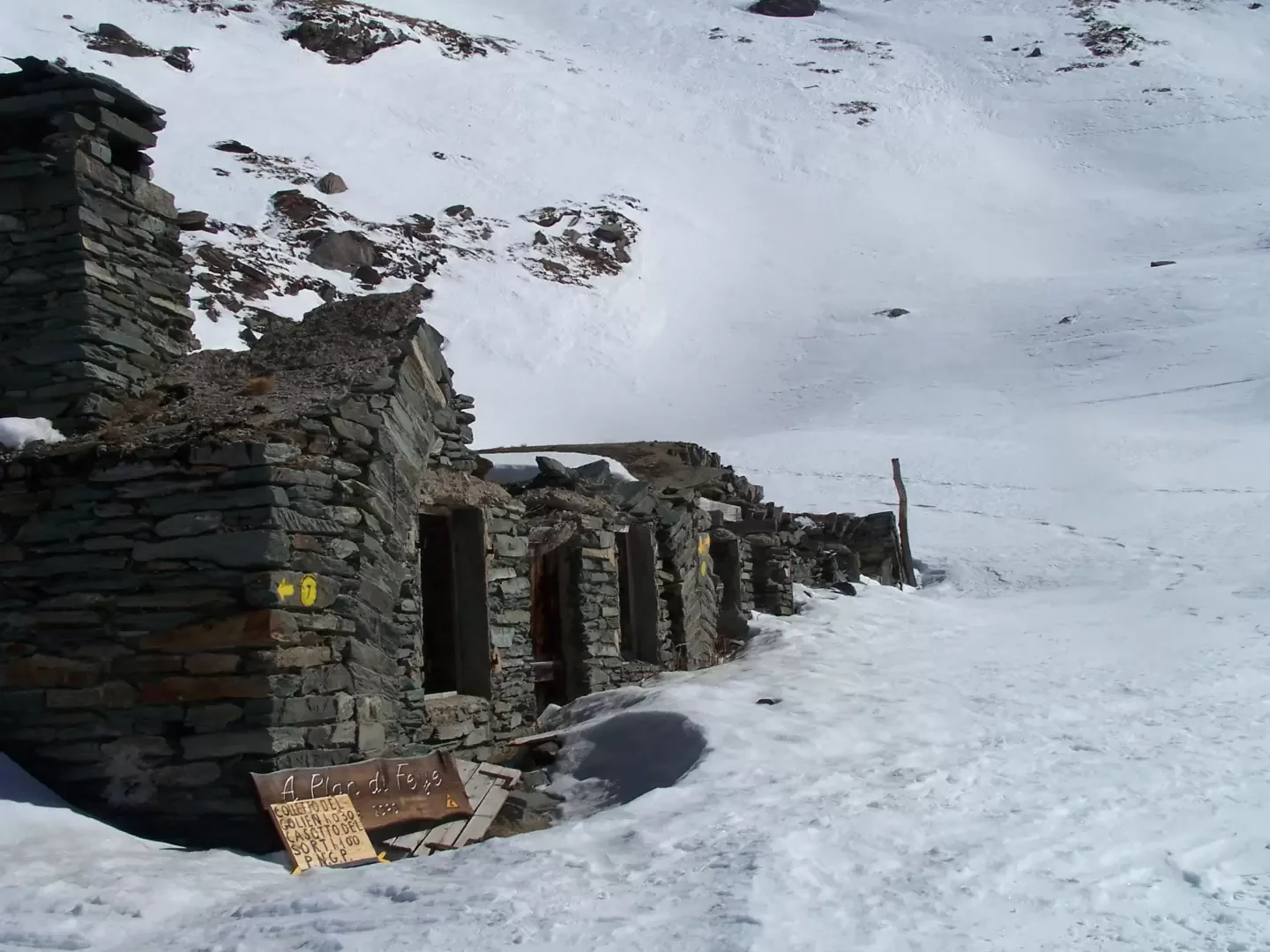
Feye Plan, from Bruil


Edited by:
Giancarlo Beretta
Updated at: 20/10/2025
Access
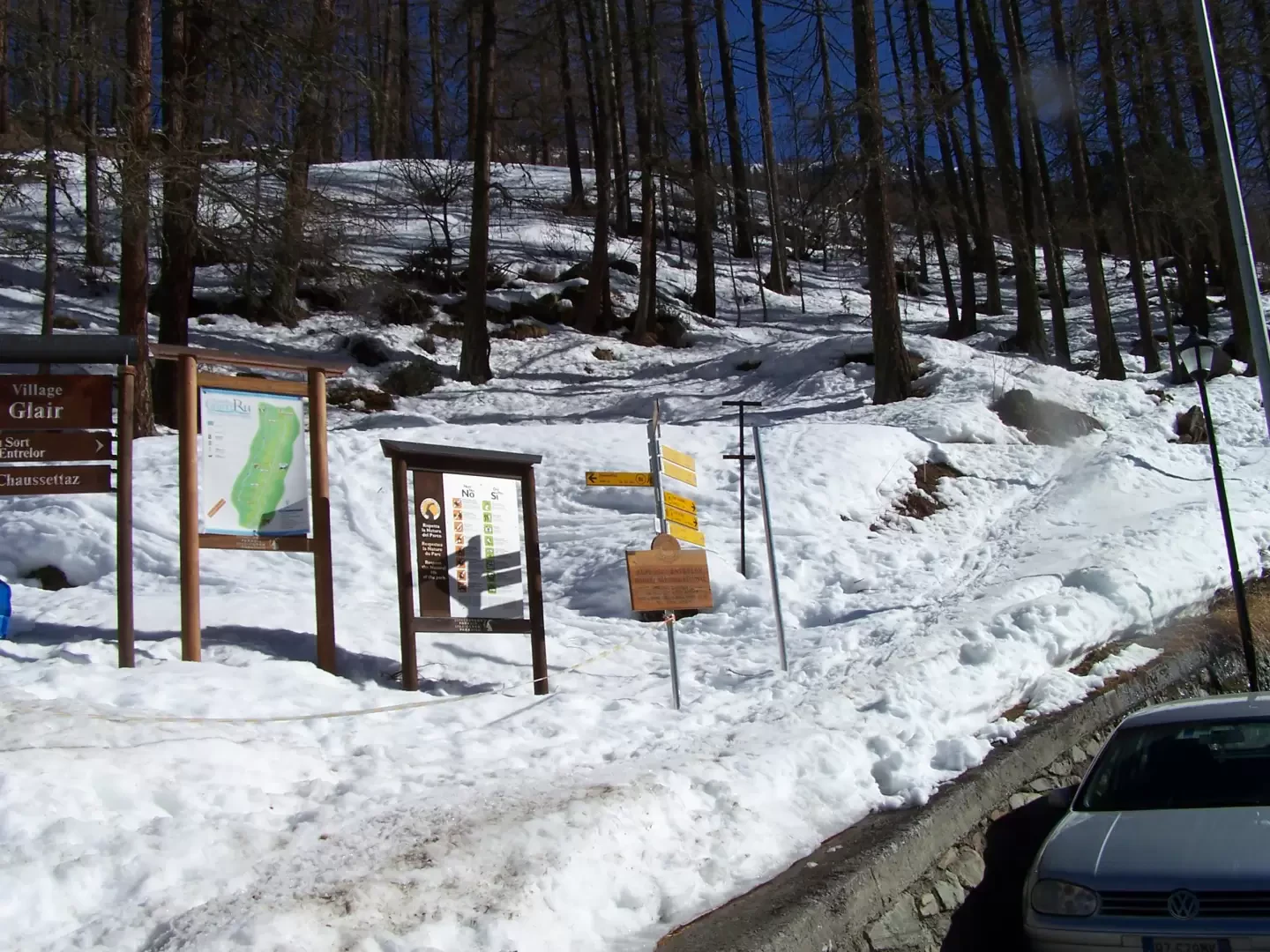
Leaving the A5 motorway at the Aosta West exit, continue in the direction of Courmayeur. After passing Saint-Pierre you reach Villeneuve where you meet the junction for Val di Rhêmes. You take the SR24 road of Val di Rhêmes, passing the municipalities of Introd, Rhêmes-Saint-Georges and Rhêmes-Notre-Dame: when you reach the church in the centre of Bruil, turn left and park in front of the town hall.
.Introduction
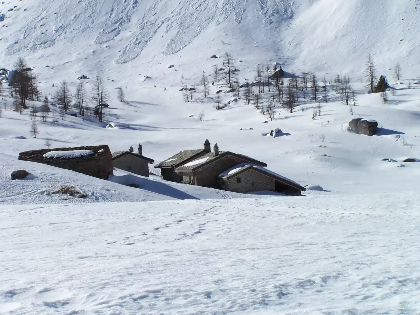
This hike leads to the partly ruined mountain pasture located higher up in the Entrelor valley with its typical half-roofed architecture. The trail is usually well signposted up to the cross just below the Entrelor alpine pastures, which is worth a visit on the return leg of the hike.
Description
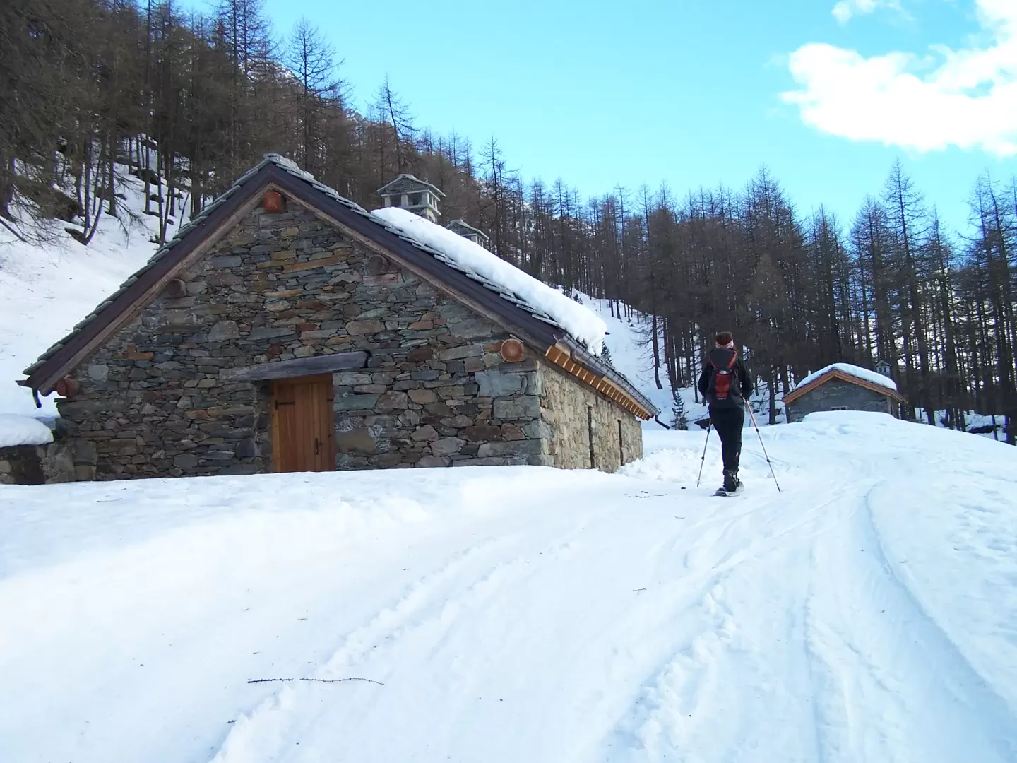
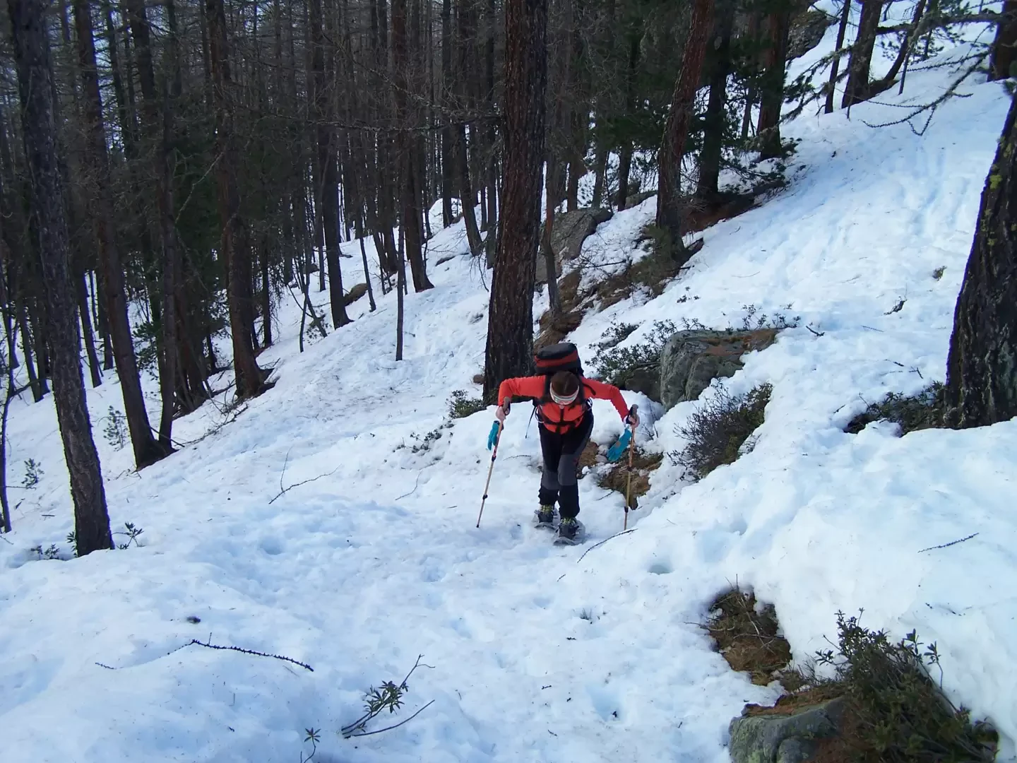
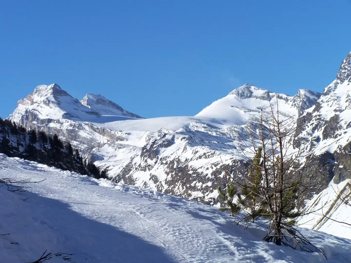
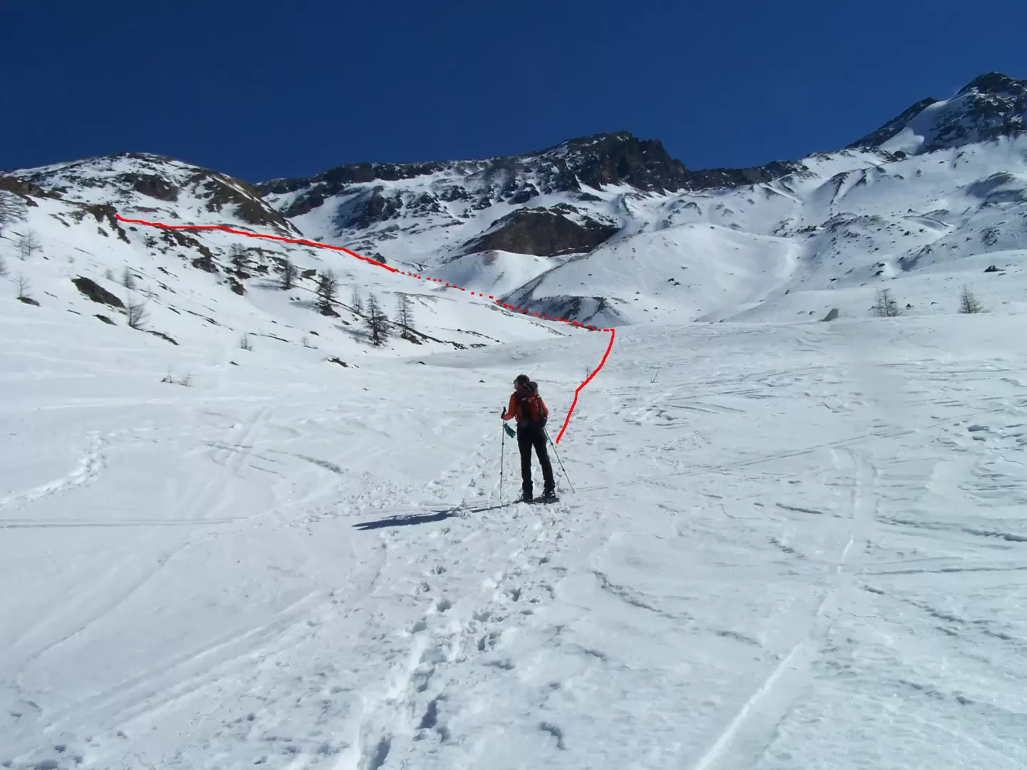
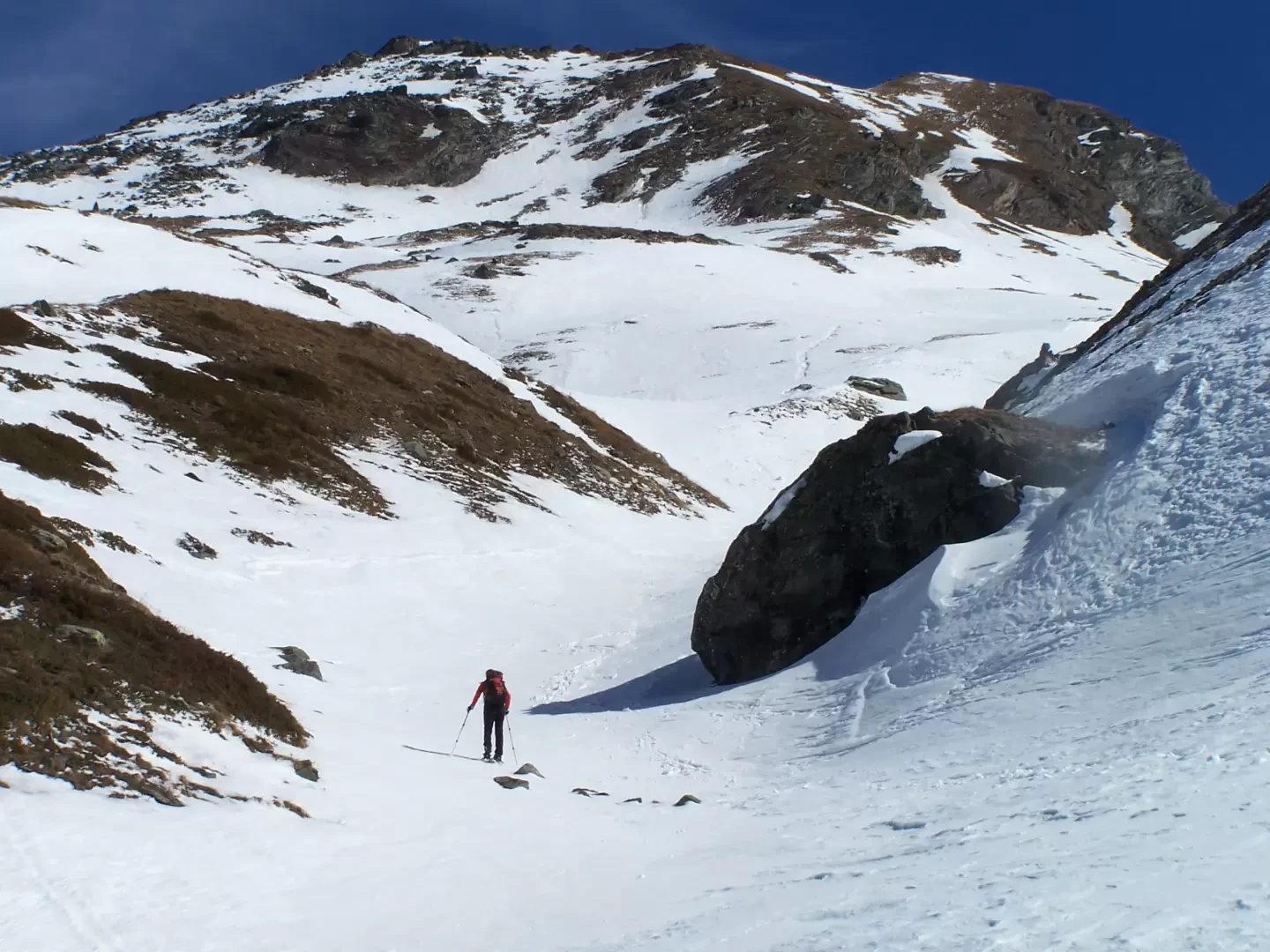
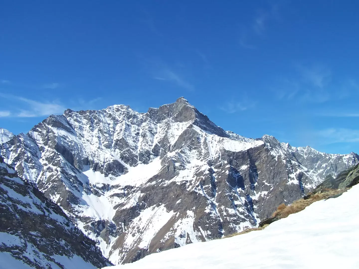
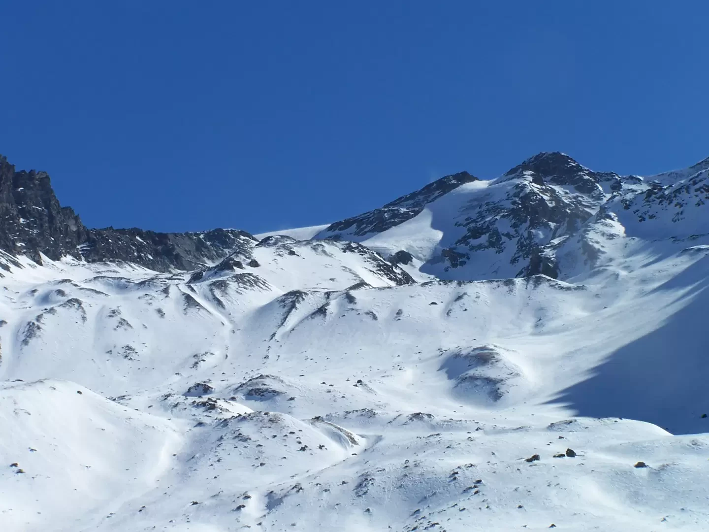
From the car park, pass in front of the town hall and cross the village on the right, following the signposts of the Alta Via 2 high route; cross a small wooden bridge and, near the park ranger's hut, you will find the route's starting points. Climb up for a short distance and cross the cross-country track to head, following the road first to the left and then immediately to the right or cutting directly across the short slope, further up towards the obvious buildings of Pré du Bois. Now the track goes up the forest with many hairpin bends and, having reached a fork with a signpost, climbs to the right passing below the Chatêau Quelet. After many hairpin bends with some stretches where the gradient increases a little, without ever being excessive, after a short traverse to the right, you reach a wooden cross, from which, looking west, you have a magnificent view of the magnificent 'triptych' Granta Parei - Tsanteleina - Traversiére. Just past the cross, leave the tracks to the right that lead to the Entrelor alpine pastures and skirt the left (orographic right) side of the valley to take, after a short falsopiano, an evident little gully that begins near a large rock and climbs to the left with the slope now increasing considerably. When you reach a fork in the path, you turn sharply to the left and, after a few short ups and downs, you reach the alpine pasture. From Plan de Feye, you have in front of you a beautiful panorama of the upper part of the Entrelor valley, with the pass of the same name, the Percià and Entrelor peaks, while to the north, the Grand Rousse rises imposingly.
Notes
Up to the wooden cross, it is a quiet and well-trodden route, but beyond, especially in the gully, the condition of the snowpack above must be assessed and, in the event of heavy snowfall, attention must be paid to the falsopiano passage to the left of the gully below the steep slopes of Testa di Entrelor.
General Information
Path:
Signposts:not visible
Type of route: a/r
Recommended period: December, January, February, March
Exposure to sunlight:West
Photo gallery
Comments (0)
Sign in to leave a comment