Weissmies, from the Zwischbergental


Edited by:
Franco Rossi
Updated at: 16/11/2025
Access
From Domodossola, follow the road to Simplon. At Gondo, just after the Swiss customs post, a downhill road branches off to the left, which crosses the Diveria river and climbs into the Zwischbergental valley. From an altitude of 1300 metres, only residents are allowed to drive on the gravel road.
- How to get there with GMAPS
- How to get there with Apple Maps
Introduction
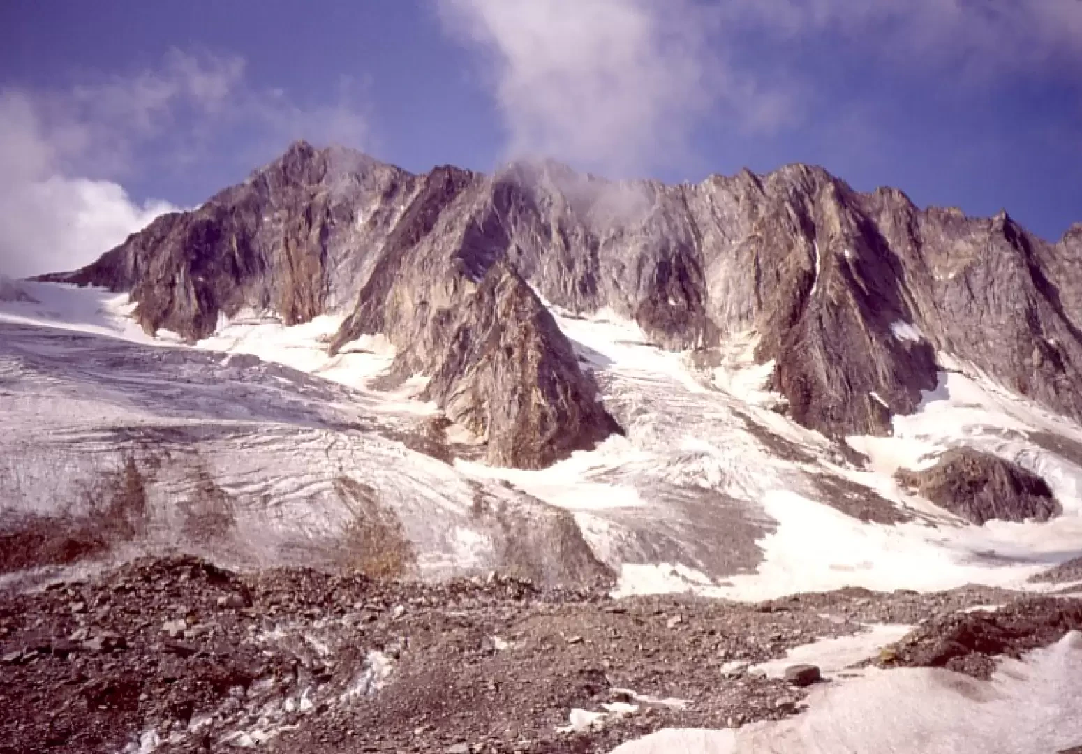
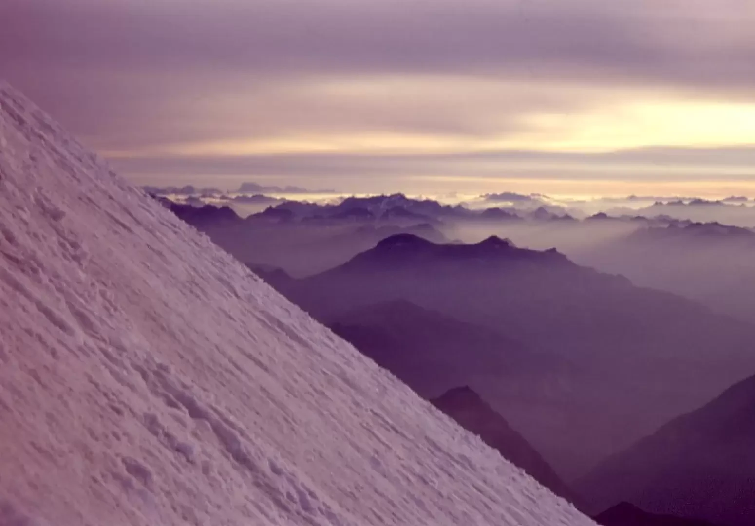
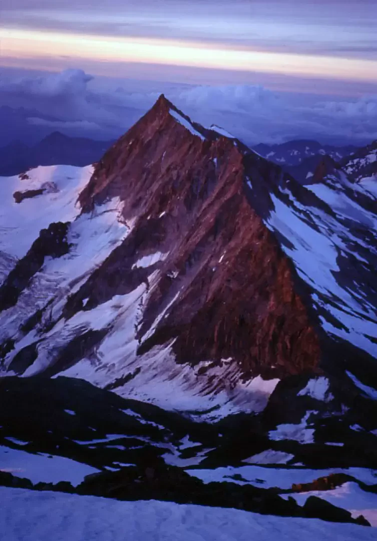
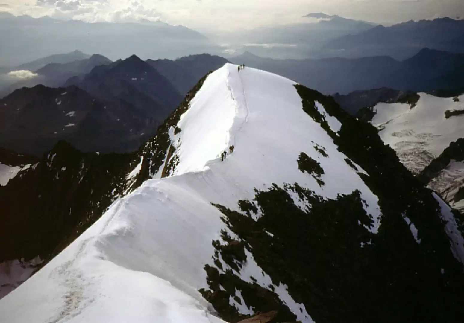
The Weissmies is one of the easiest 4000 m peaks, reached by traversing a completely solitary valley with no huts, remnants of un-cracked glaciers, a snowy chute and a final crest that is first rocky and then snowy. To be walked in two or better three days, for a complete immersion in the peace and solitude of the mountains, in the Zwischbergental (located just over the Swiss border, from Gondo via the Simplon road). You will only meet mountaineers on the final ascent to the summit along the SE ridge, on the third day, mountaineers from the Almagellerhütte on the Saas Fee side. Tent sites can be found on the first day at an altitude of 2300 m in the valley (nice little meadow) and on the second day at 3300 m at the col. From the Zwischbergenpass, the ascent to the summit involves overcoming a nice snowy chute (30° slope) and an easy rocky ridge (I or at most II passes if you don't follow the easiest route) to reach the summit peak; from this to the summit, the ridge is very sharp and not easy to traverse, if there wasn't always a well-traced track. The panorama from the summit is simply fantastic. All in all, starting from an altitude of 1300m and relying only on your own equipment, it really is a summit that can only be reached 'by fair means'!
.Description
From Gondo (via Domodossola, Simplon road, just past the Swiss customs post), a narrow asphalted road branches off to the left and leads into the Zwischbergental valley, as far as the no-transit sign, located near a power station, at an altitude of around 1300 metres. Continue on foot along the dirt track to the Cheller cottages and the long Bidemji plateau, which you cross. The road turns into a path, which is always followed along the valley floor. At an altitude of about 2100m there are two possibilities:
- follow the signs that lead you up the grassy ridge on the right and then, keeping at the same altitude, go along the entire left orographic side of the valley (easier but longer and with some ups and downs);
- continue in the valley along the old path, with possible difficulties in fording the stream at some points above about 2300m (possible bivouac point). In any case, the two itineraries rejoin at around 2600 m, a plateau just below the glacier front. Once past the frontal moraine, climb up the un-cracked glacier, keeping to the right-hand edge, and finally between large boulders and debris you reach the Zwischbergenpass (second bivouac).
The following morning, climb up the debris and snow patches to the SE snow chute of the Weissmies (approx. 30° slope; crampons often indispensable), which you follow up to the highest point, where, on the left of the wall (red arrows), a rocky gully leads to the ridge, which you follow (I and II steps) up to the summit; from here, a well-marked track along the sharp, airy ridge leads to the summit. Grandiose panorama. Descent by the same route.
.Photo gallery
Comments (0)
Sign in to leave a comment