Rimpfischhorn, from Britanniahutte


Edited by:
Giancarlo Beretta
Updated at: 15/05/2026
Access
Introduction
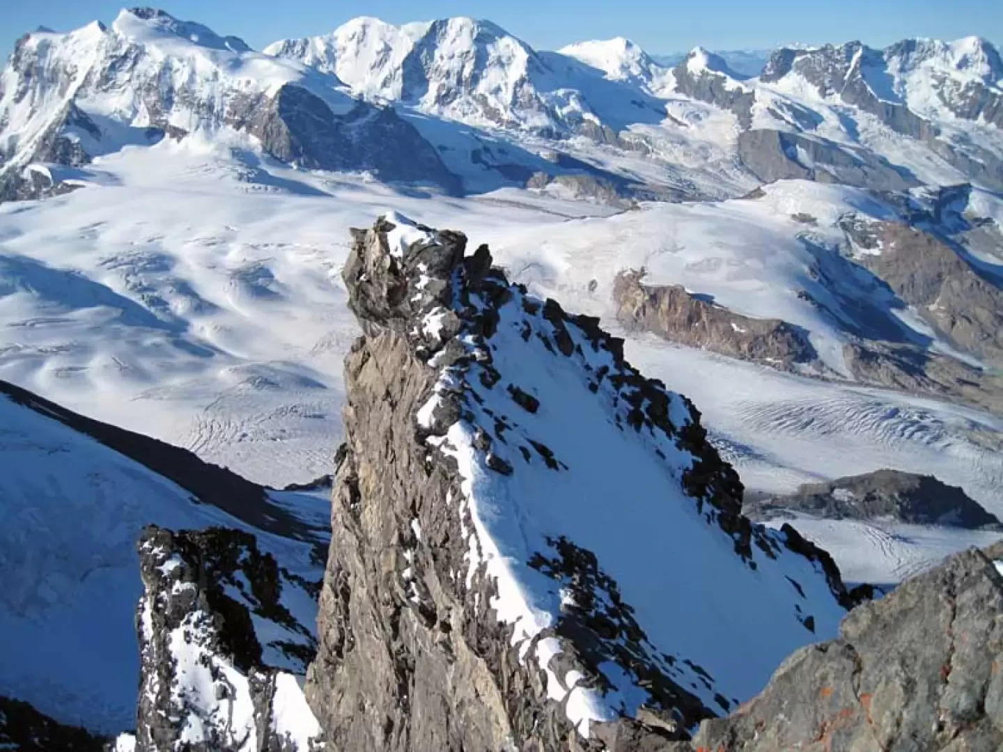
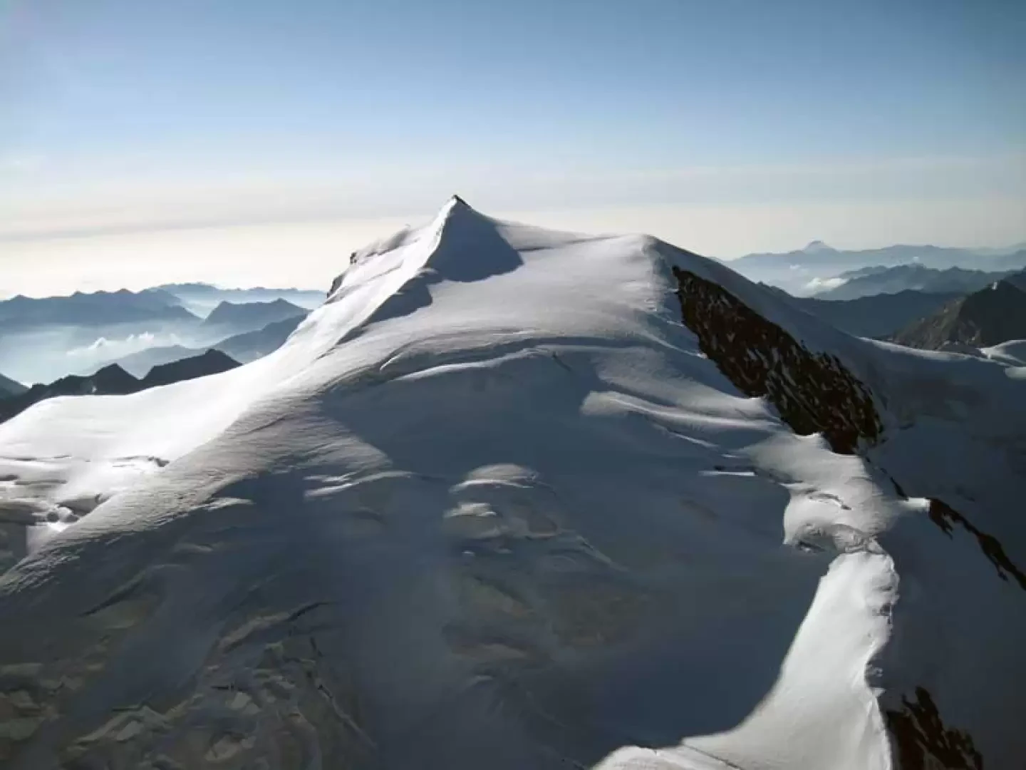
The Rimpfischhorn is one of the 4000-metre peaks that divide the Saastal from the Zermatt valley and offers two completely different sides: the eastern side is a high, rocky wall, while the western side is completely covered by ice; these two sides are separated by a long ridge that is at first ice-covered, elegant and sinuous, and later jagged and rocky. The ascent to this 4000 m peak is the longest and most strenuous of the climbs starting from the Britanniahutte, and covers a distance of around 18 km; the steep climbs to the col at 3138 m and to the hut must also be taken into account in the overall height difference. The reward for this truly strenuous ascent, however, is the joy of enjoying a spatial and indescribable panorama of the other numerous 4000 m peaks that surround it, and a progression through immense and very impressive high mountain glacial environments.
.Description
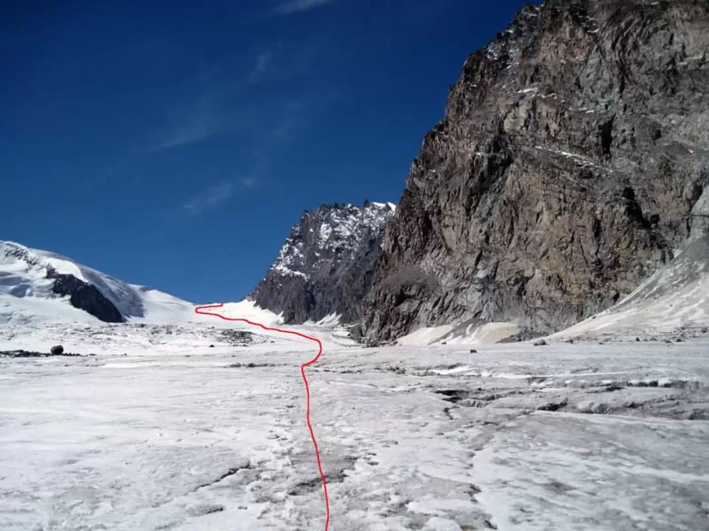
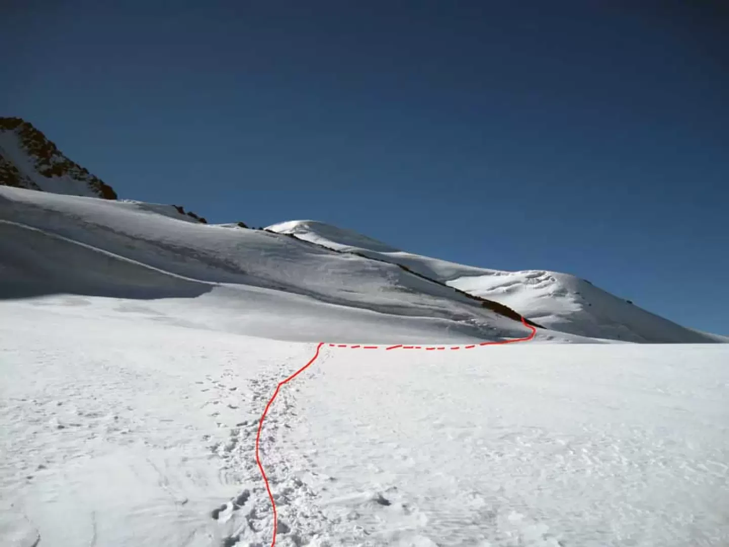
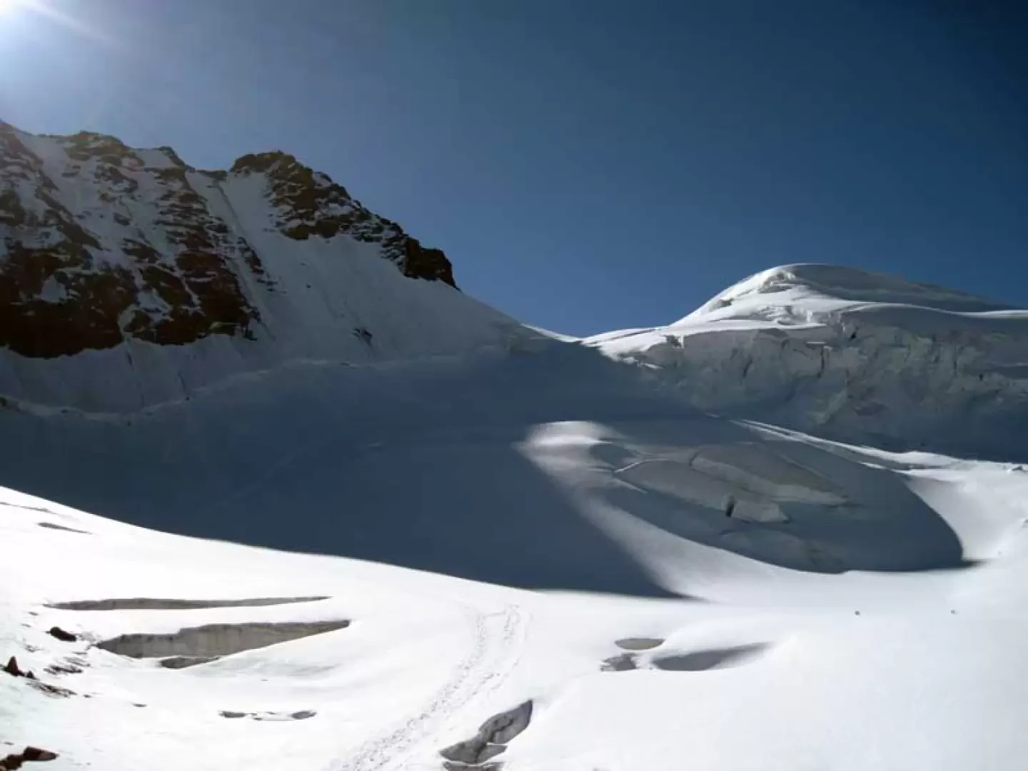
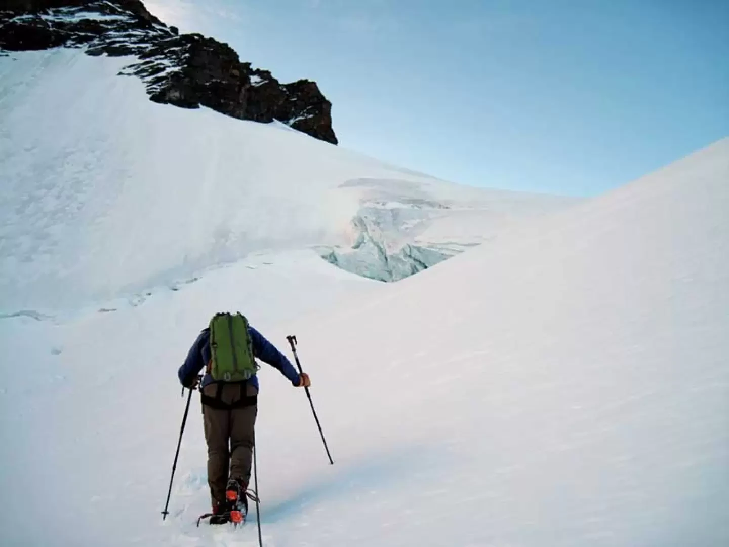
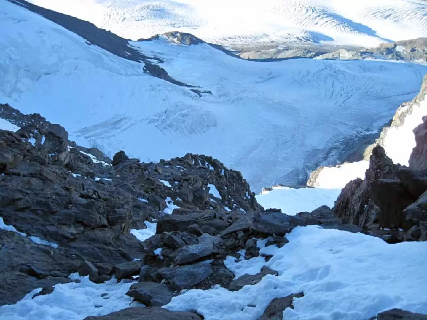
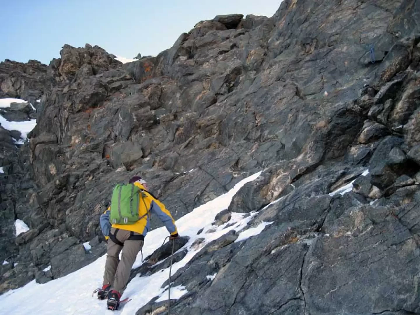
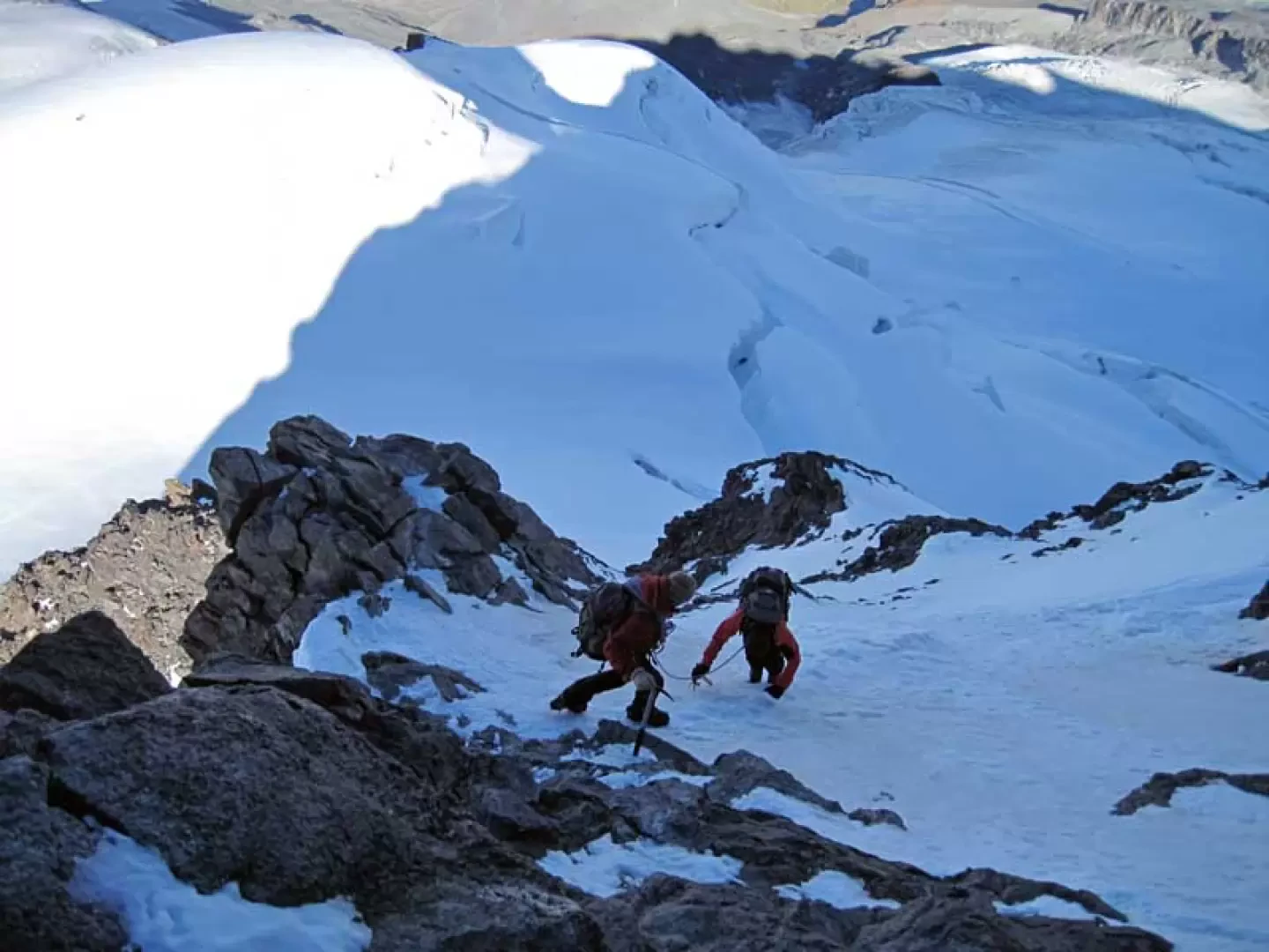
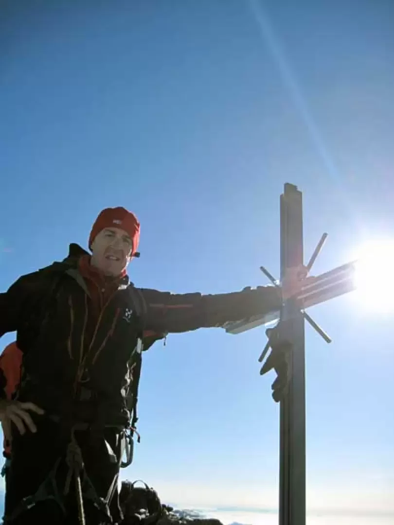
First day: From the arrival of the cable car, take the track that starts right in front and heads towards the slope of ice and boulders; the well-trodden track passes over stony terrain alternating with sections of ice and borders the northern flank of the Hint Allalin. The progression, in the virtual absence of uphill sections, is not tiring, but one must nevertheless pay attention to the various cuts in the ice and the many moving stones. You will soon reach a clearly visible col, where you will find the arrival point of a ski lift, and at which you continue to the right, aiming for the clearly visible construction of the Britanniahutte hut; after another short section over mixed terrain, you will reach the col where it is located. Second day: From the hut, take the track that starts to the left of the posts in front of it and begins at a rock with a blue-white marker. The path descends at first with a slight slope and then heads decisively down into the morainic valley, losing almost a hundred metres in height to reach the final tongue of the Hohlaubgletscher. Having reached the lowest part, go up the path to the left, gaining little height and crossing many crevasses perpendicular to the direction of travel, which are more or less open but easy to overcome, aiming for a rocky collar on the lower part of the ridge that descends from the Alallinhorn. When you reach the little stone cairn placed on it (3138 m), descend a little on large boulders to reach a small snowfield that you cross to reach another col, lower than the previous one (3123 m). From here, descend further, losing about a hundred metres in height difference, on a steep but evident dirt track that is then lost on the rocks below. Having reached the lowest point, cross the large stone blocks, ascending slightly and keeping to the left until setting foot on the Alallingletscher. Now go up the slope of the slightly sloping glacier on the right, paying attention to the numerous crevasses that are located transversally to the direction of travel and that force you to zig-zag to overcome them; after about 30-40 minutes of walking, depending on your pace, and without crossing a stony strip that is located at the confluence of the two glacier tongues, keep to the right, heading towards the slope of ice that descends from the Alallinpass. At first, you ascend it, staying to the right fairly close to the rocky flank of the Alallinhorn and then, high up, cut across the slope to the left to reach the wide creek (3599 m). You contour the icy slope slightly uphill to the left, heading towards the lower part of a long snowy ridge, which is rocky at the top in late season, and here there are two ways to continue: the first goes directly up the crest through snow and stones, reaching a small stone cairn (3672 m) from which one descends steeply in a few minutes to the glacier below, while with the second, which is a little longer, one continues to descend following the base of the crest, which immediately, as soon as the lower part is reached, deviates decisively to the left to go up the slope of the large glacier. During this ascent, we climbed both of them: the first on the outward journey and the second on the return; it is only necessary to add that for the second, in addition to being longer and increasing the altitude difference, one must be careful of a few crevasses as one climbs the slope halfway up. When you reach the southern tongue of the Mellichgletscher, cross it in a south-easterly direction, climbing up it laboriously, aiming for a large serac that you pass on the right on a snow bridge; continue to climb steeply, passing a few more evident crevasses, and you will reach the wide and panoramic Rimpfischsattel (4004 m). From this point, turn left and climb up a steep, icy slope to the right of a pronounced rocky outcrop for about thirty metres and then traverse over a short rocky ledge to the left, recognisable also by the numerous crampon marks, after which you climb up a short mixed ridge that leads to a small notch. From here too, depending on the ice conditions, there are two ways to climb: the first moves to the left on the steep and exposed icy slope (50°), which is then climbed for about twenty metres, while the second can be used to climb the rocky ridge directly with an easy climb (II), where there are a couple of metal ropes and relative ropes for possible belays or abseils. Having reached an anticima, which is located in front of the summit, we descend a few metres to a short but very aerial crest after which we climb the short but exposed final section of rock that leads to the metal cross placed on the small rocky terrace.
.Photo gallery


Comments (0)
Sign in to leave a comment