Gonella Refuge, from La Visaille


Edited by:
Maurizio Bergamini
Updated at: 10/02/2025
Access
From the motorway exit near Courmayeur, drive past the tourist resort and into Val Veny. After a few kilometres, depending on the chosen approach, drive up to the junction for Frêney near a bar-restaurant on the right; or proceed by car until the road closes. The two solutions are basically equivalent, in fact with the first one you immediately climb into the forest reaching the Miage glacier diagonally. With the second, you proceed a long way along the road (on foot both on the outward and, above all, on the return journey) to Combal and then attack the glacier perpendicularly.
.Introduction
We propose the first of the two solutions below, which includes an intermediate stage at Lake Marmotte (which no longer exists): from there on, things get more complicated and the itinerary is only recommended for those with good mountain experience and good physical preparation.
Description
Leaving the car in the square behind the restaurant at the junction for Frêney, we set off along the dirt road. After passing two small bridges, you soon come to a signpost showing several indications, including the Lago delle Marmotte located about an hour's walk away. The path is not difficult, although after the junction for the [[Monzino Refuge]], it becomes less easy because it is traced between the stones of a first morainic line.
What was once Lake Marmotte is now just a large wetland, a sort of reed bed: probably, judging by the numerous signs still present, in October 2000, the year of the disastrous floods in the whole of Valle d'Aosta, the natural dam that dammed up the lake must have given way, allowing the waters to drain away for good. Nevertheless, it remains a pleasant green valley, very peaceful, ideal for picnics far from the hubbub of civilisation.
The path makes a semicircle to the right and climbs along the ridge of the Miage glacier moraine, skirting the base of the rocks of the Aiguille du Breuillat. Observing the meagre pastures above us, it is not improbable to spot ibex.
Depending on the season, one or more small snowfields may cut across the path and should therefore be passed with caution. The valley narrows and a moraine line that previously ran to our left joins our path just after a snowfield; it is also evident that it will no longer be possible to continue keeping to the orographic left.
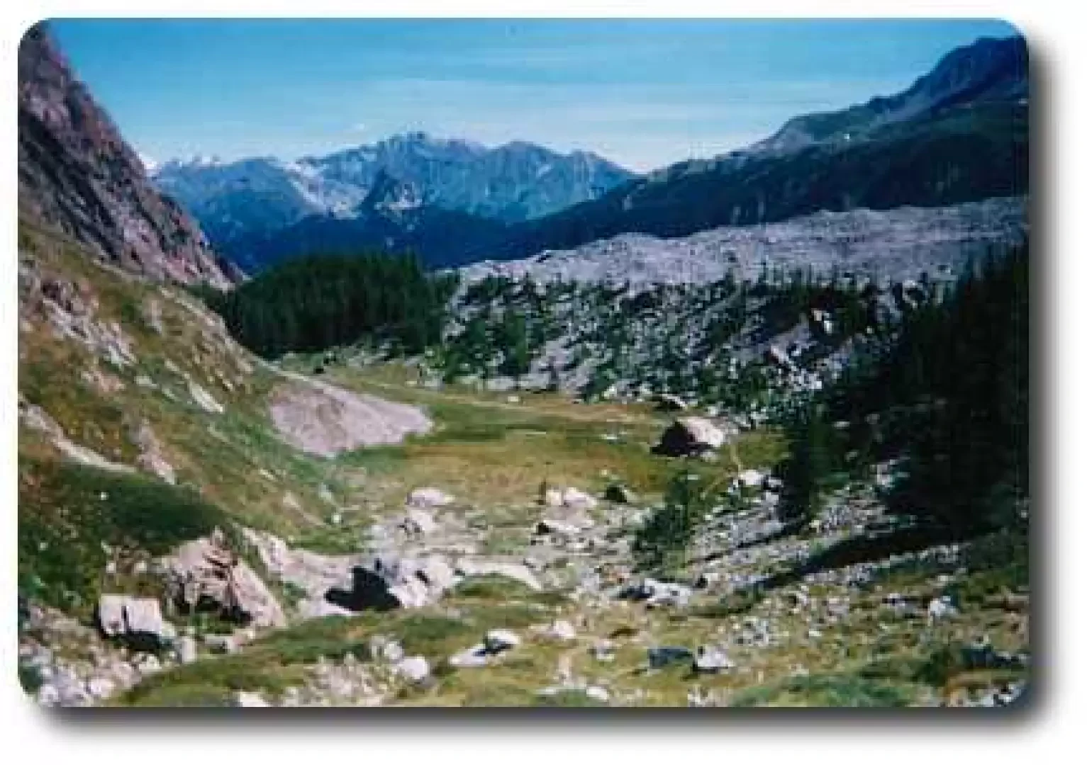
It is time to head towards the centre of the valley, which appears to us as an endless stony ground: let us not forget that there is a glacier under those stones, which is clearly visible by observing some large chasms that open up from time to time between the rocks. When we reach the centre of the glacier, we can see traces of a path and cairns of stones indicating the direction to follow.
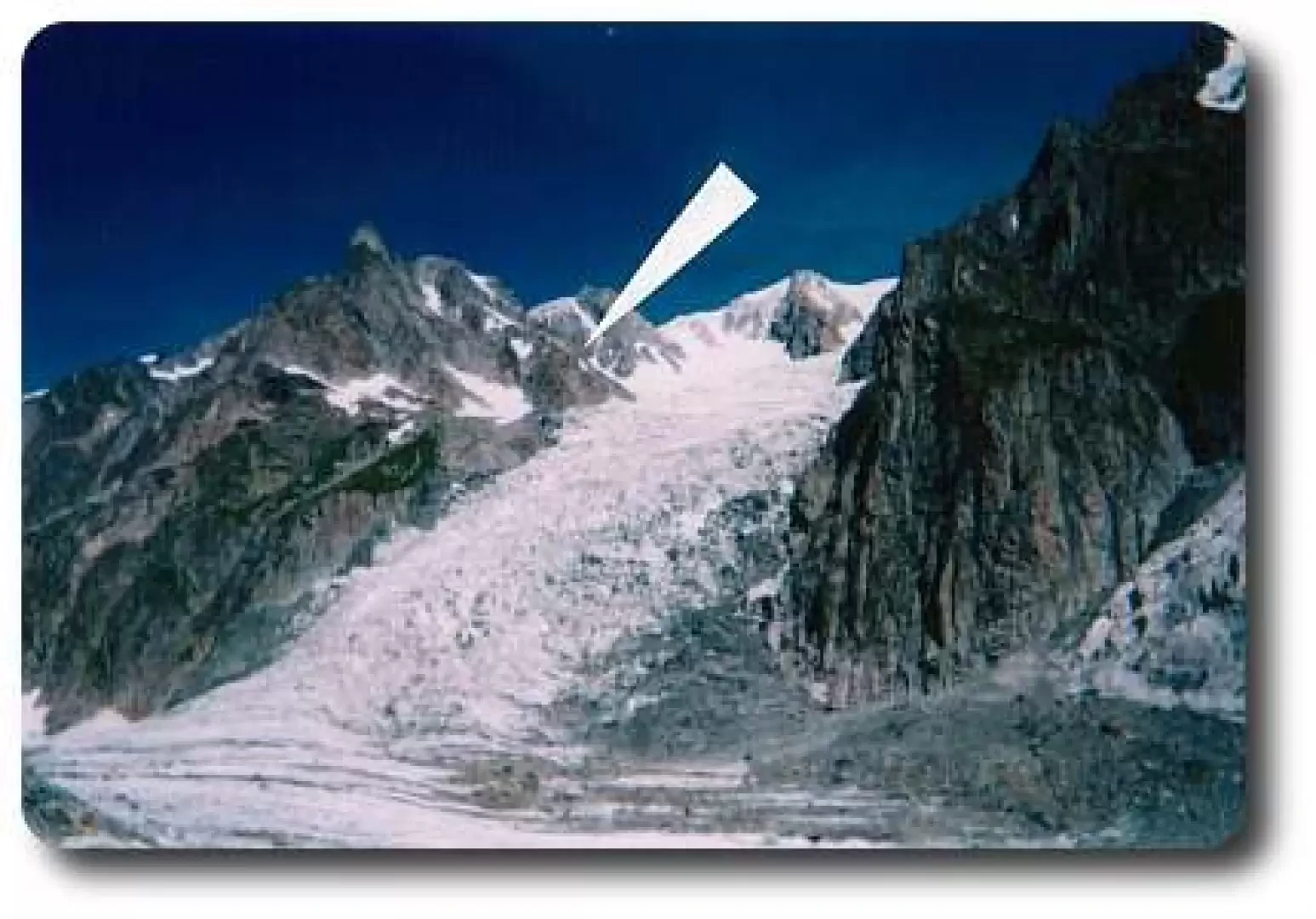
The walk is tiring, however, because the terrain is basically composed of scree and because we will have to proceed in this way at least until the third hour of the walk is completed. At the end of the scree slope, an enormous white sloping plane opens up: the Miage glacier takes on the more classic appearance of a "white sea", while looking to the right, high up among the rocks, above the cascade of seracs of the Dôme glacier, we can make out a little yellow dot: the Gonella hut.
At the end of the scree slope, a section begins that can prove insidious: a wide semicircle must be made from left to right to get around a crevasse area. If the track in the snow is clear, there is not too much danger, but always maintain a high level of attention, as you will still have to climb over several small crevasses.
In the event of bad weather and/or strong wind that erases the track, it is not possible to give more precise indications: proceeding further can become very risky if you are not familiar with the area or are an experienced mountaineer. It would be desirable for some signs to be placed at the beginning of the season to help those who cannot benefit from a track.
In this section it may become necessary to resort to the mountaineering equipment we have recommended. Without forgetting, therefore, to make a wide manoeuvre around it, we will soon see on the rocks to our right huge yellow markers, which indicate the start of the last stretch to the refuge. It is an hour of strenuous ascent along a very exposed path, which often turns into an easy climb of a few metres.
In the slightly more difficult places, there are chains and iron ladders. It is still necessary to cross a couple of fairly sloping snowfields, so in the absence of a solid track, care must be taken.
The hut is rather spartan and has no heating (which is far from negligible): the alarm clock is set for midnight for those intending to continue, and 8 a.m. for those descending. It is a stopover point only for mountaineering itineraries: generally for the ascent to Mont Blanc via the col and the Bionnassay ridge.
The panorama is in any case grandiose and wildly beautiful.
Hut information
Type: Guarded hut
Sleeping places: 42
Water: in the hut
Lighting: Electric
Winter room: 25 places
Telephone: 0165-885101
Ownership: CAI UGET Torino (011-537983)
Opening: 01.07 - 07.09
Photo gallery
Comments (0)
Sign in to leave a comment