Dom de Mischabel, from Randa


Edited by:
Giancarlo Beretta
Updated at: 16/11/2025
Access
From Italy, you reach Switzerland via the Simplon or Great St. Bernard Pass and, continuing on the Valais valley road, follow the signs for Visp, where you will find the junction for Zermatt and Saas Fee. When you reach Stalden, you will find a roundabout at which you turn right into the Zermatt valley and, continuing into the upper valley, you will arrive in Randa; here you enter the village, heading towards the small railway station where you will find a convenient covered car park (for a fee) and where you can leave your car.
Introduction
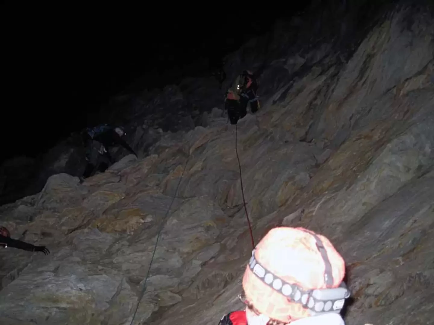
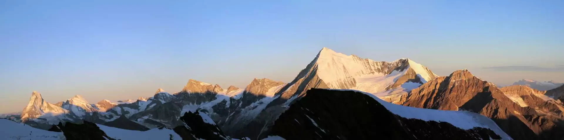
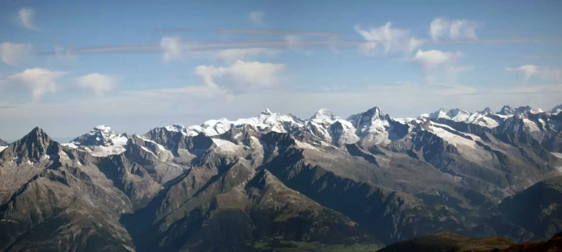
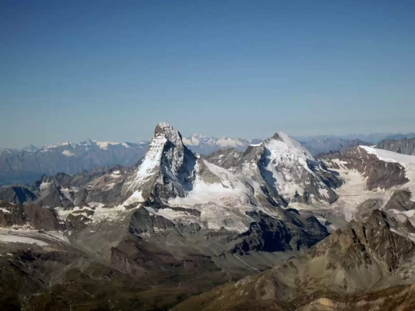
This long and strenuous ascent takes you to the highest peak located entirely on Swiss territory on its grandiose northern icy slope. Since there are no ski lifts, one must necessarily start from the bottom of the valley, and every metre of ascent can be described as sweaty, both because of the constantly sustained gradients and because of the development of the entire route of around 23 km. Although it is, as we have said, long and tiring, this climb is fairly busy with the track on the upper part of the glacier almost always present and, in any case, with a logical and intuitive itinerary, while, in the first part beyond the large moraines above the hut, it is necessary to tackle the first part of the glacier at night, which has many crevasses and whose crossing can involve some zigzags and crossings over snow bridges and where, in general, great care must be taken. On the rocks, which are mobile and on unstable ground, that you have to climb to reach the Festijoch, there are a few belays on bolts that facilitate any anchorages on the ascent, while for the descent, having two 50m ropes, you can make a single abseil that avoids having to retrace this treacherous stretch on the descent. From the summit, the view is simply stellar and includes an exceptional panorama of the alpine chain with dozens of 4000 m peaks surrounding it, with beautiful close-up views of those in the nearby valleys of Zermatt and Saas Fee; the Domhütte hut is also located in a very panoramic position and can be reached from Randa by a long, steep path, partly equipped. For the complete itinerary, it is necessary to calculate at least 11 hours of ascent, of which about 6 hours are for the part from the hut to the summit, while for the return one must take into account that, after the 1600 m of elevation gain in the morning, one must face the more than 3100 m of descent.
.Description
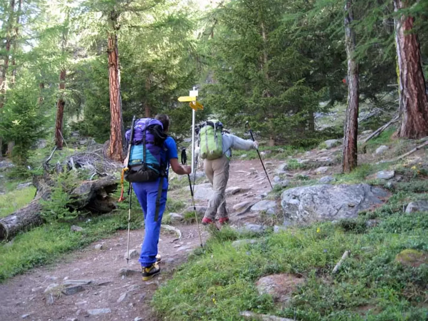
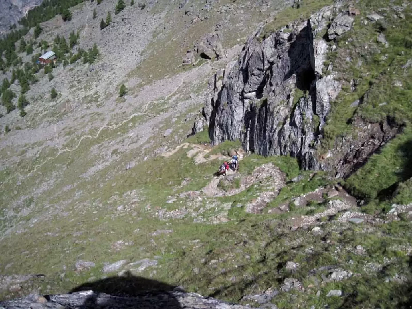
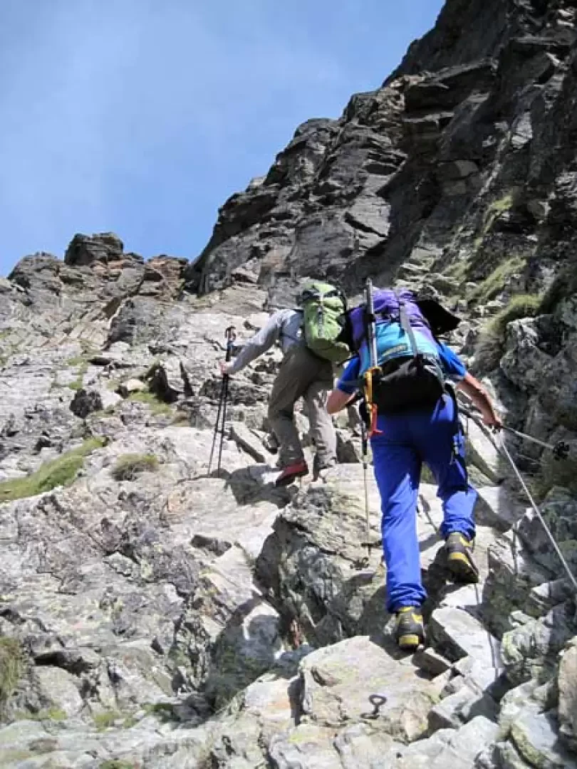
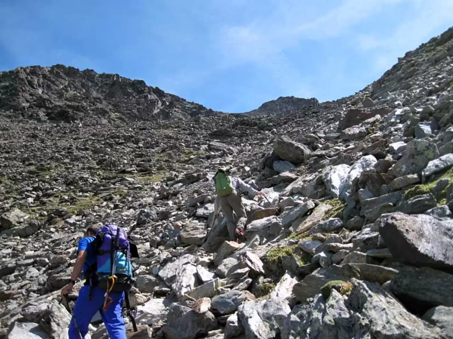
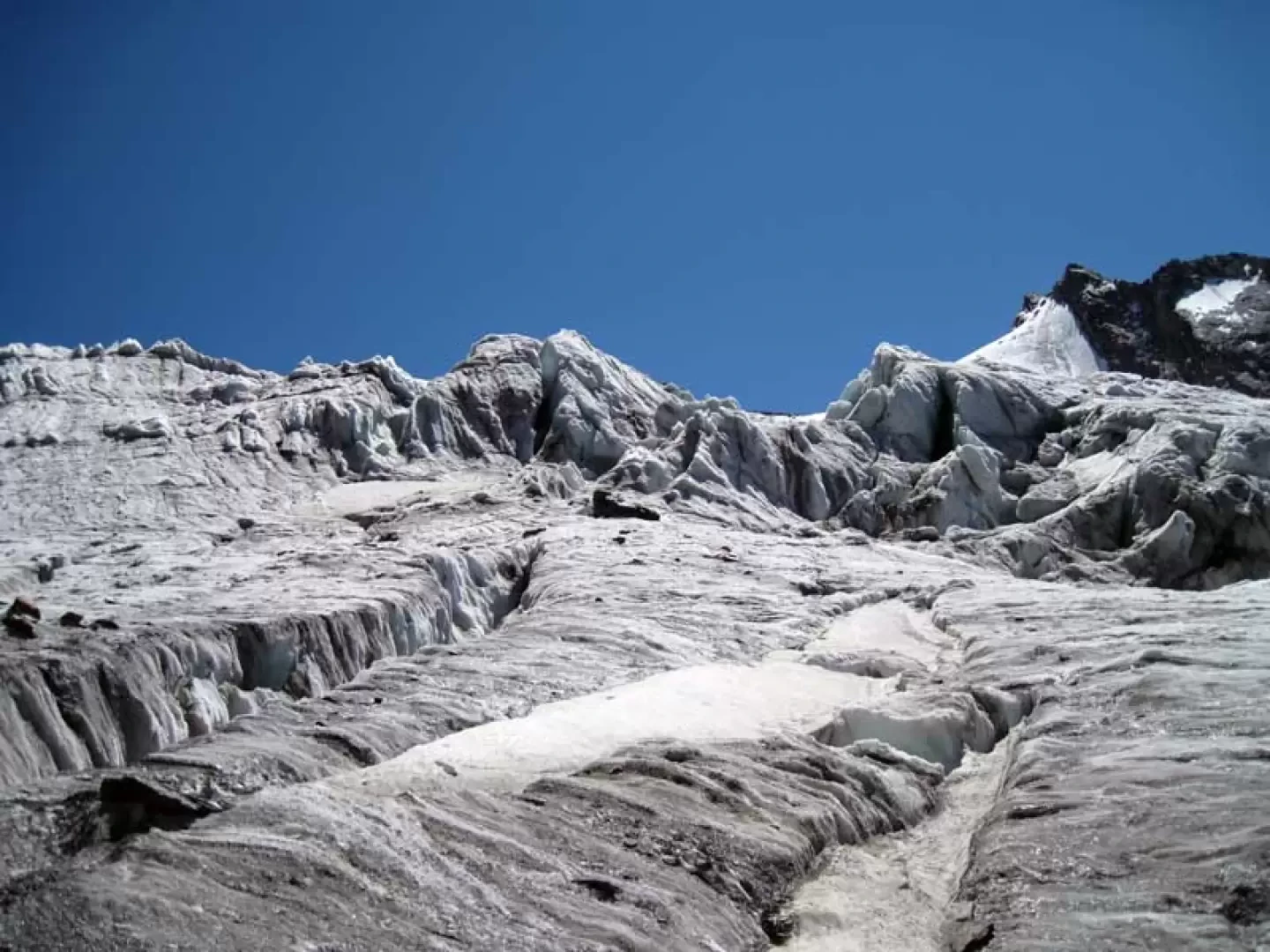
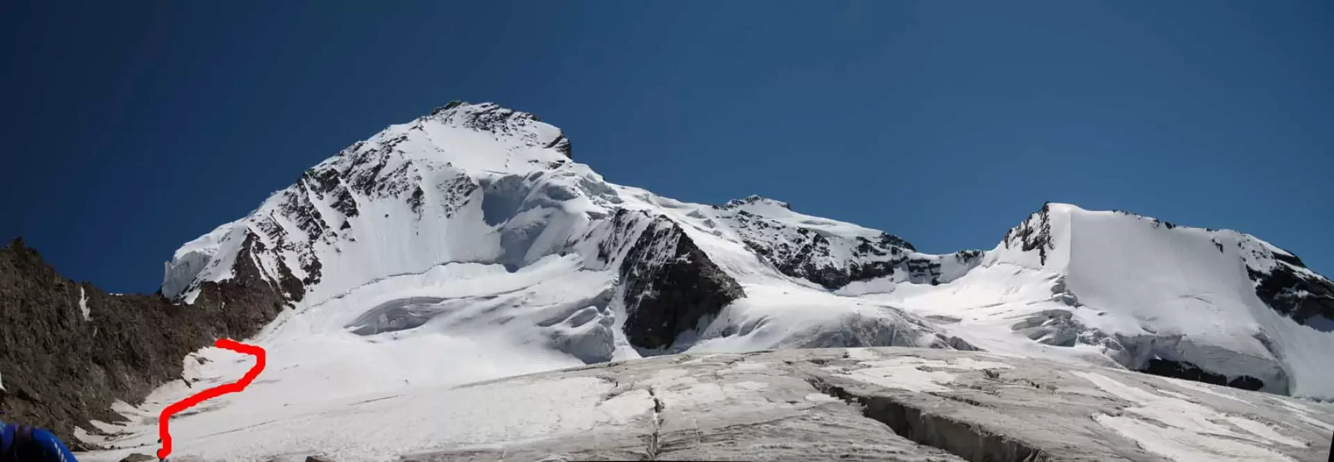
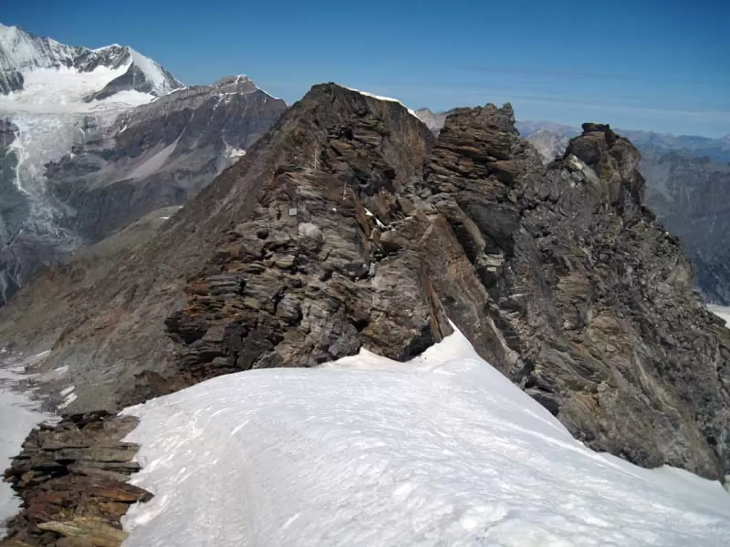
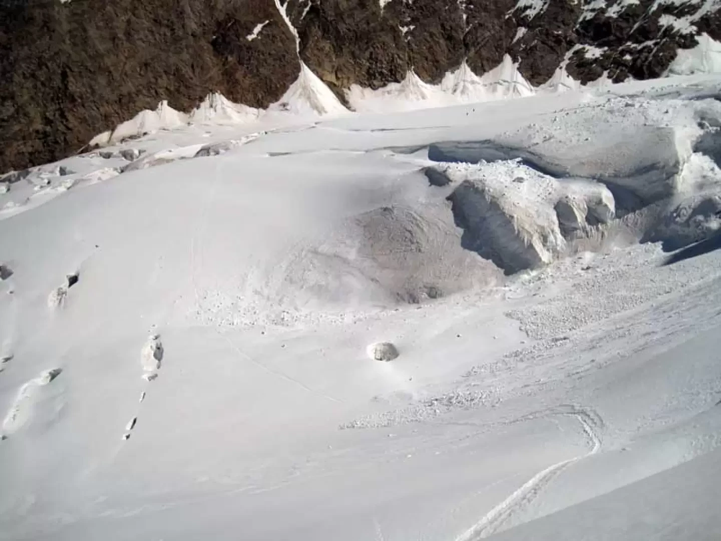
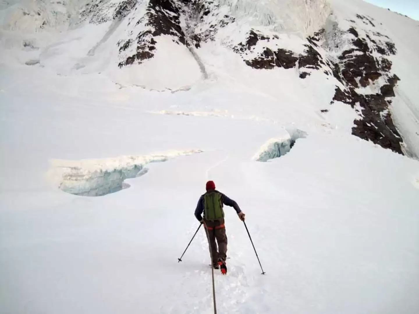
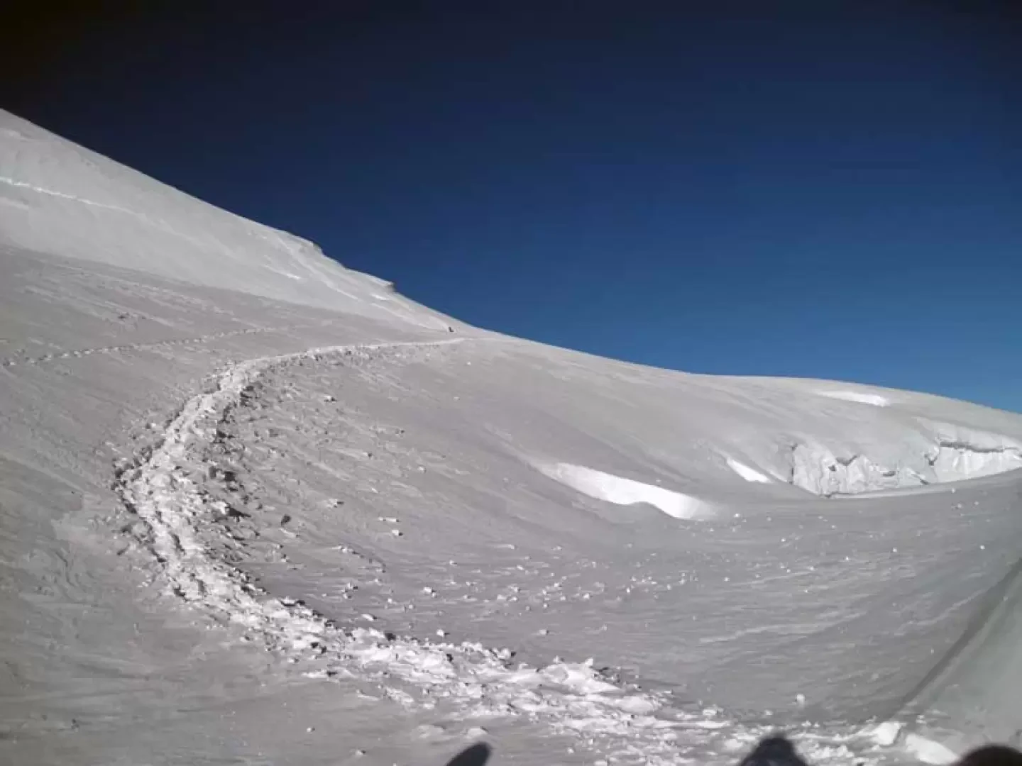
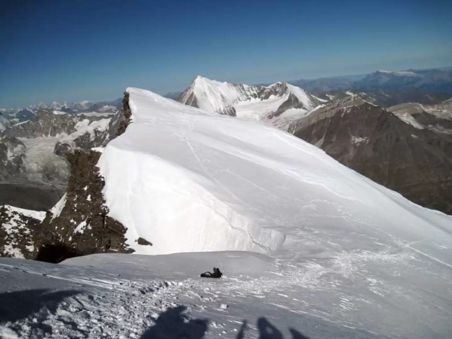
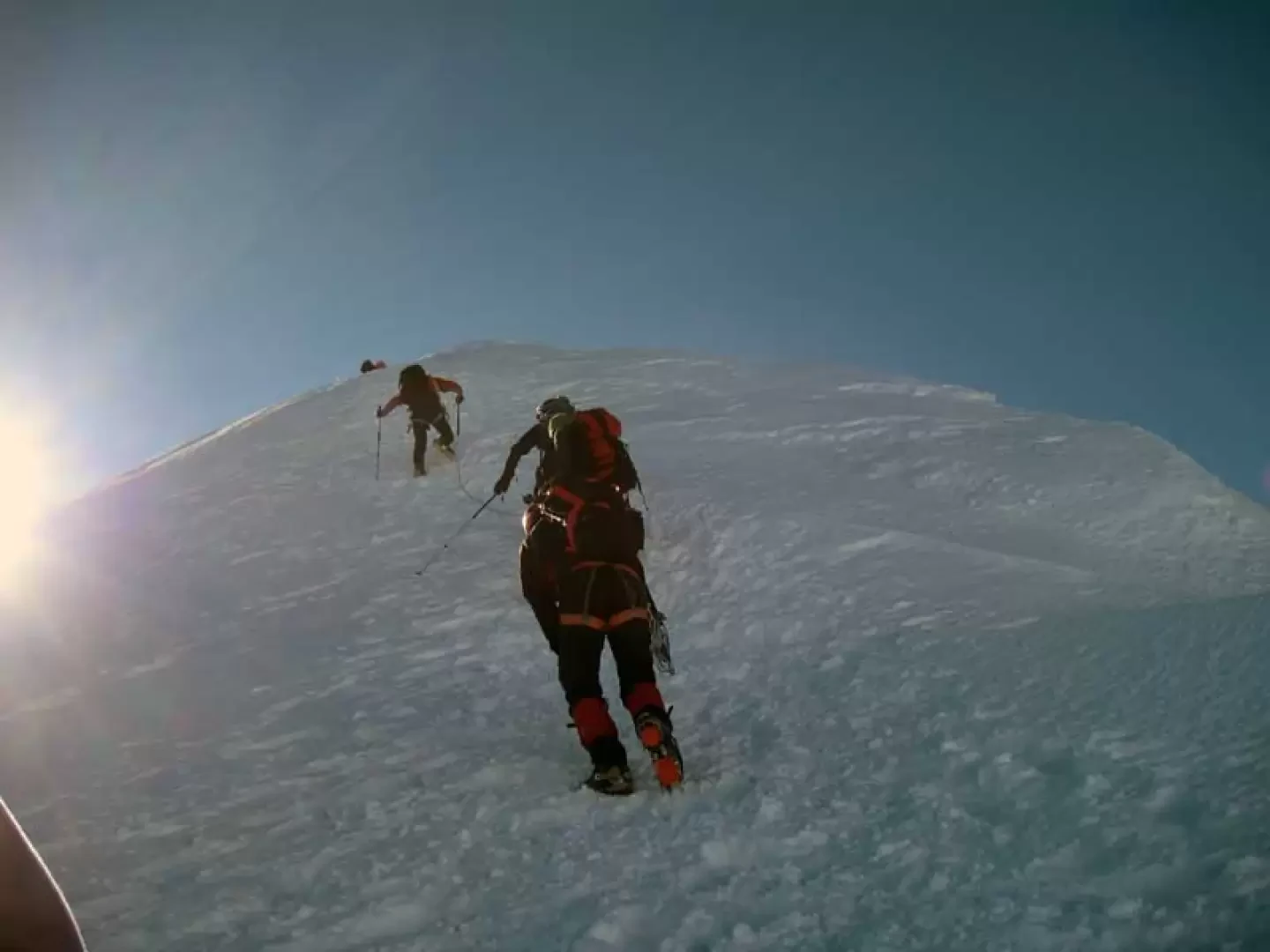
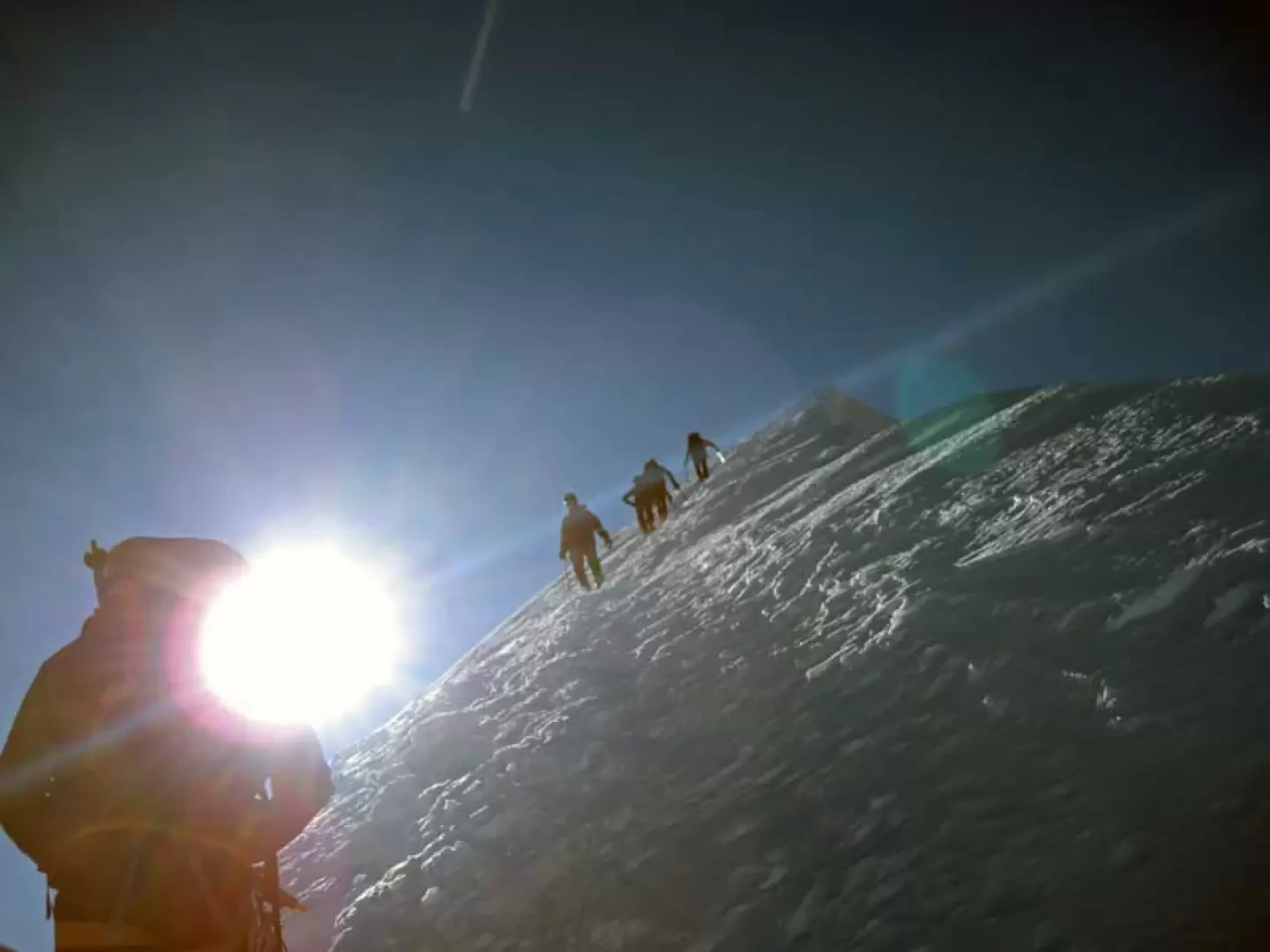
Going out of the car park, turn left and climb up to the road that enters the village, immediately finding the signs indicating the itinerary; continue to the right and immediately at the first fork, turn left passing between the houses until reaching a small road that climbs to the right with a no-trespassing sign and clearly visible indications. Once on the road, go up between the well-kept houses in the village, arriving in front of a large wooden hut from where, on the left, the path continues, indicated by a wooden sign; having come out into the upper pastures, continue along a traverse and approach the riverbed, which you cross on a wooden bridge (1545 m) beyond which, near another fork with signs, continue to the right and enter the woods. The trail continues at a good gradient, gaining height quickly, leaving the turnoff for Gere (1618m) to the left and then, past a small hut, reaching another fork in the road at Lärchberg (1855m), where you continue straight on, following the marker signposted Europahütte. Now continue for a long stretch in the wood, climbing steadily upwards and, after leaving a path to the right near a marker post, you come to a branch-off closed off by a wooden gate (2174m) beyond which, after a few hairpin bends, there is the last fork, at which you keep to the right, following the blue marker for the Domhütte (2244m). After a few tens of minutes, leave the path to the left for the Europahütte for those coming from above and approach a rocky bastion that you go round at the base and, with a steeper slope, climb up the steep grassy flank to the right; you then approach, climbing up some exposed rocks, a small gully that you cross to the left reaching a grassy promontory and continue for a short distance towards a small rocky ridge where the equipped section begins (2446m). Climb up the ridge for a few dozen metres helped by metal ropes on exposed rocks and then traverse to the left on somewhat smooth slabs to reach another ridge where, again helped by the ropes and a few iron steps, you arrive at the top at a fairly high metal ladder beyond which you will soon reach a large stone cairn. This is the end of the equipped section, after which you enter a vast, steep scree slope that you climb up again on a good track, remaining a little to the right and, when you reach a slightly pronounced spur, the slope lessens, after which, turning to the right, you come to the Domhütte hut, which is easily reached in a few minutes (2946 m). From the hut, climb up the short but steep moraine behind it on a clear track and then continue on a slight incline along its flank, following a few cairns of stones to set foot on the lower part of the crevassed Festi glacier at about 3200 m altitude. From here you climb up with little slope but you must pay close attention to the numerous crevasses, even wide ones, that cut perpendicularly across the direction of travel; having arrived at a more peaceful area, so to speak, the slope increases and you head towards the bottom of the glacial basin with the gradient gradually increasing and, moving to the left, you reach the base of the little rocks of the crest below its lowest point (about 3700 m). One ascends for about fifty metres up the rocks, which are mobile and on friable terrain, with the possibility of making a few belays on the bolts found on site, thus reaching Festijoch (3749 m); from here one must descend the steep slope, losing about seventy metres in height difference, to reach the large Hobar glacier and continue, passing under large seracs, on a slight slope to then deviate to the right, ascending the glacial slope. Go over several large crevasses on snow bridges, circumventing a large serac on the left and continue, with the slope gradually increasing, towards the bottom of the glacial basin. Just before the pass at the head of the glacier (Lenzjoch) at about 3950 m, turn sharply to the right onto the slope, which now begins to become steeper, and more or less directly up the slope on slightly crevassed terrain. When you reach a wide snow bridge over a large crevasse (approx. 4100 m), the slope temporarily decreases and then, with a slightly sloping traverse to the right, you approach the next icy slope; this, ascended with a few wide hairpin bends to overcome a few large crevasses, leads to a col where the exit of the Festigrat is located (approx. 4430 m). Now the final steep slope must be tackled, which is climbed a few metres below the ridge line, arriving in a short time at the narrow summit where there is a metal cross.
Photo gallery


Comments (0)
Sign in to leave a comment