Wyssbodehorn, from Engiloch


Edited by:
Matteo Lazzati
Updated at: 04/05/2025
Access
By car, after Domodossola, drive up towards the Simplon Pass; enter Switzerland, pass the village of Simplon Dorf and a few kilometres before the pass park your car in Engiloch. The forecourt is not the hotel forecourt on the right-hand side of the road on the way up to the pass, but the forecourt at the side of the road a little further on to the left.
- How to get there with GMAPS
- How to get there with Apple Maps
Introduction
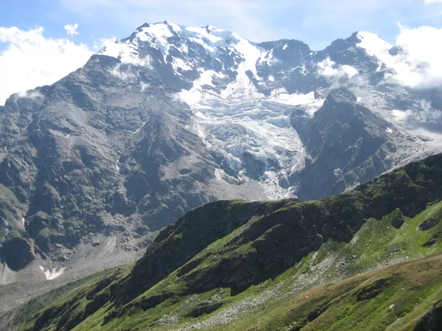
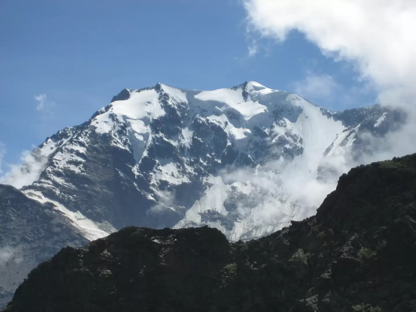
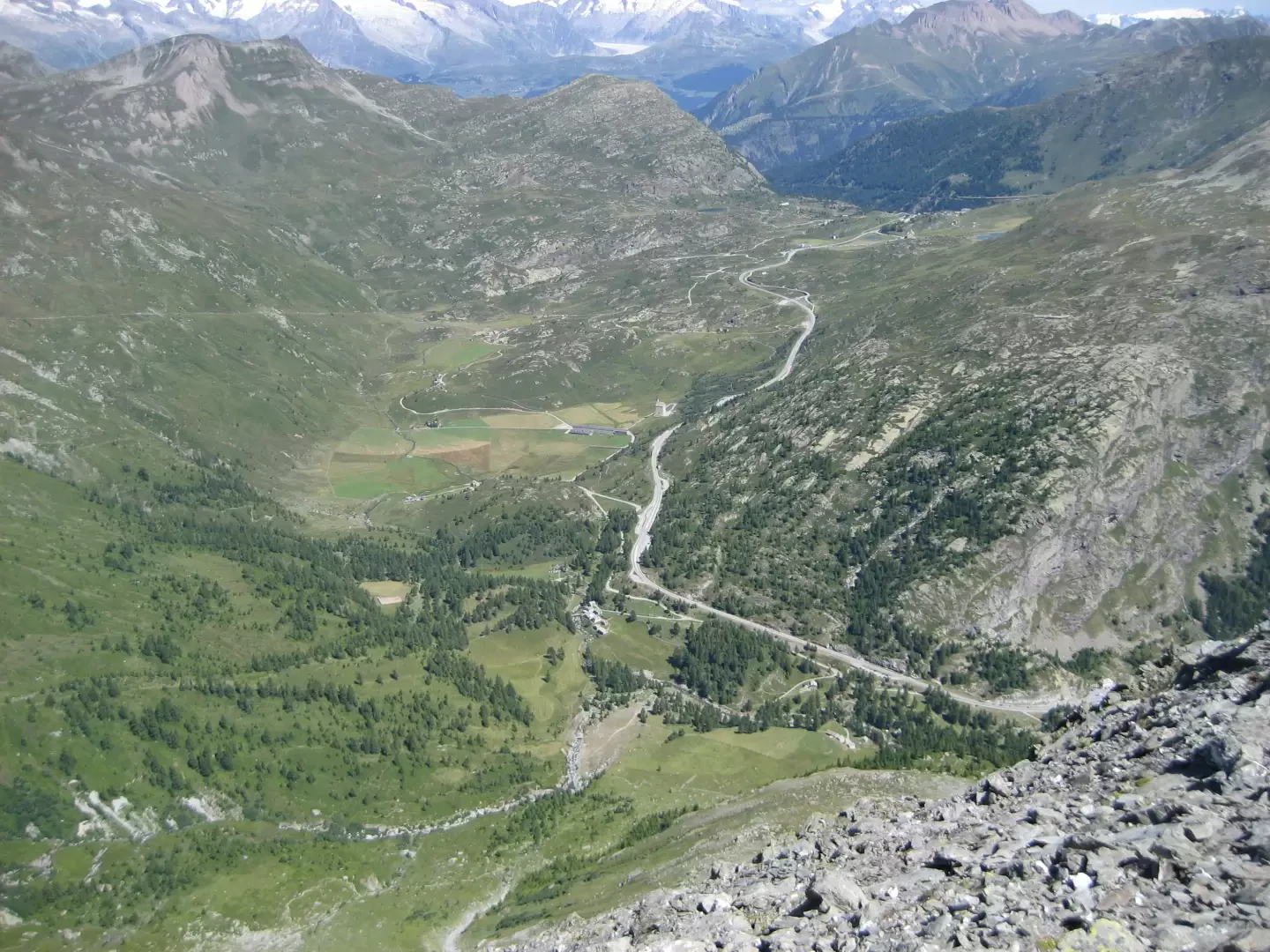
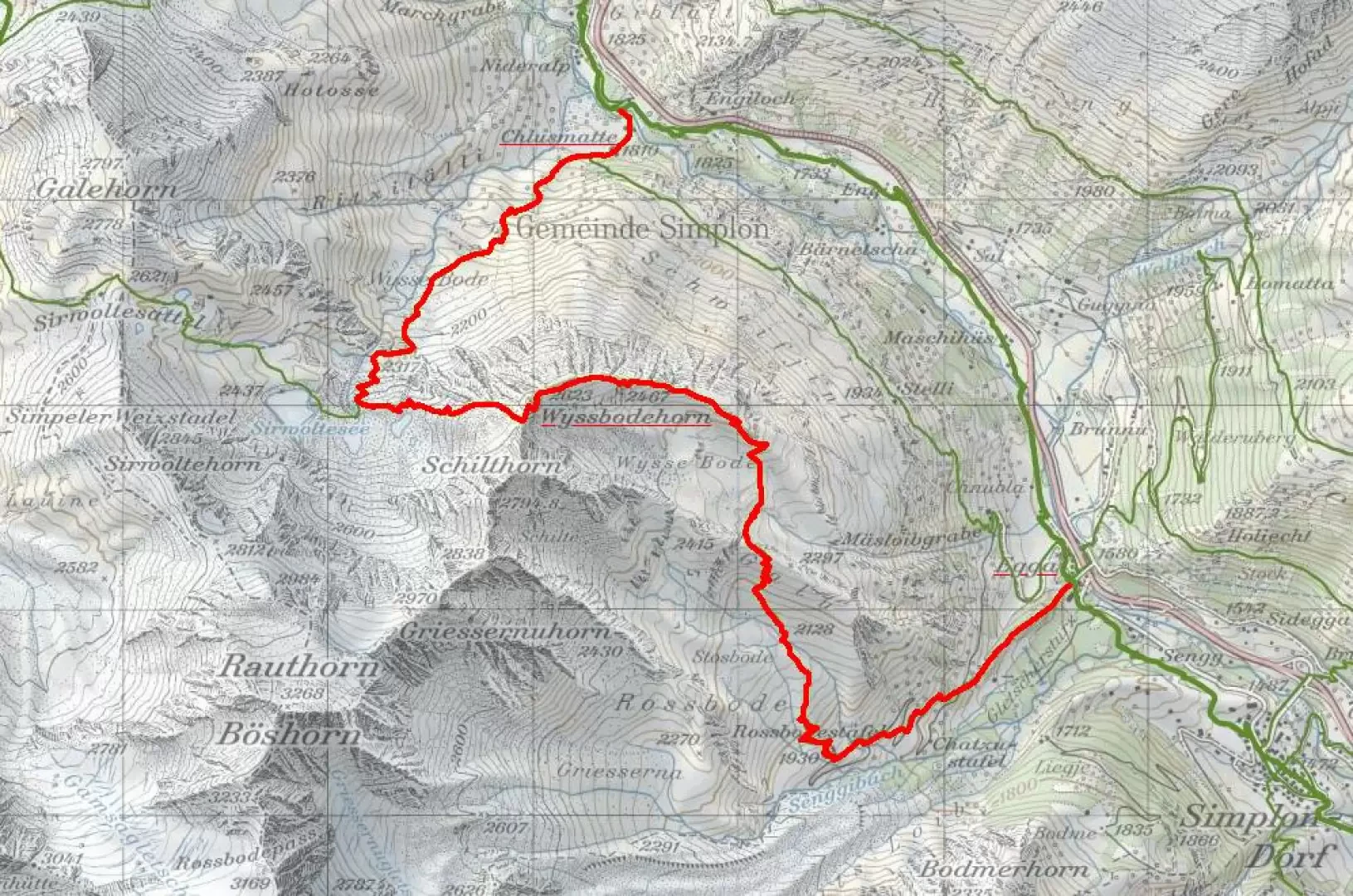
Partially circular hike in the Simplon Pass area with departure from Engiloch 1800m and arrival at Egga 1580m via the Wyssbodehorn 2623m. The ascent route runs along the Wysse Bode valley to the orographic right of the stream generated by the Sirmoltensee lakes. The descent, on the other hand, takes place along the slopes leading to the Rossbode cottages and then to the village of Egga. This side of the hike is followed in the opposite direction as a ski tour to reach the Schilthorn 2974m. The only parts of the hike that require particular attention are the waterfall and the scree slope that leads from the lakes to the pass, but these are no major problems, just be sure-footed and watch your step (although this should always apply, so...). However, the length and overall height difference must be taken into consideration, and combined with the fact that you are above 2000m most of the time, it requires good training if you don't want to reach your destination.
Description
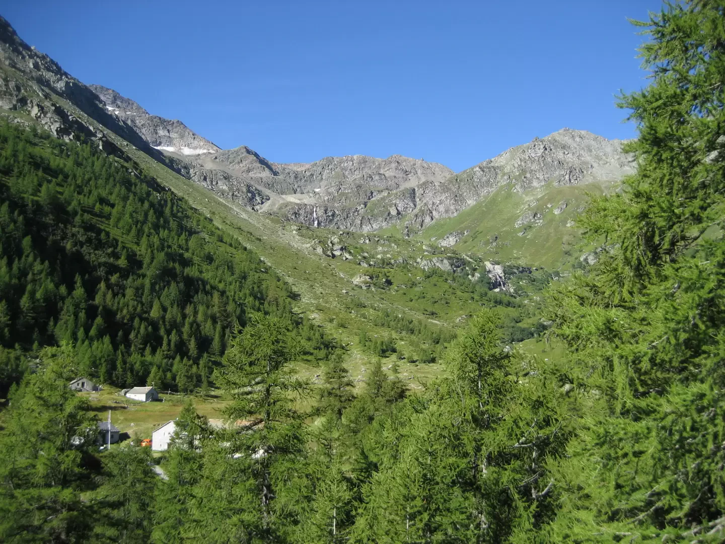
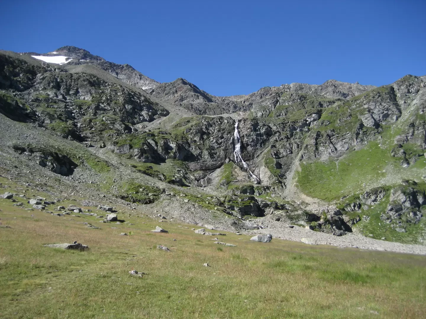
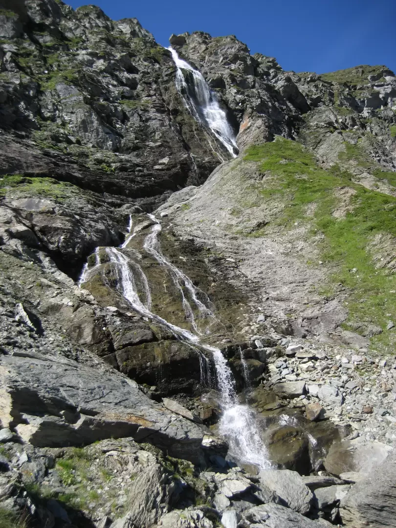
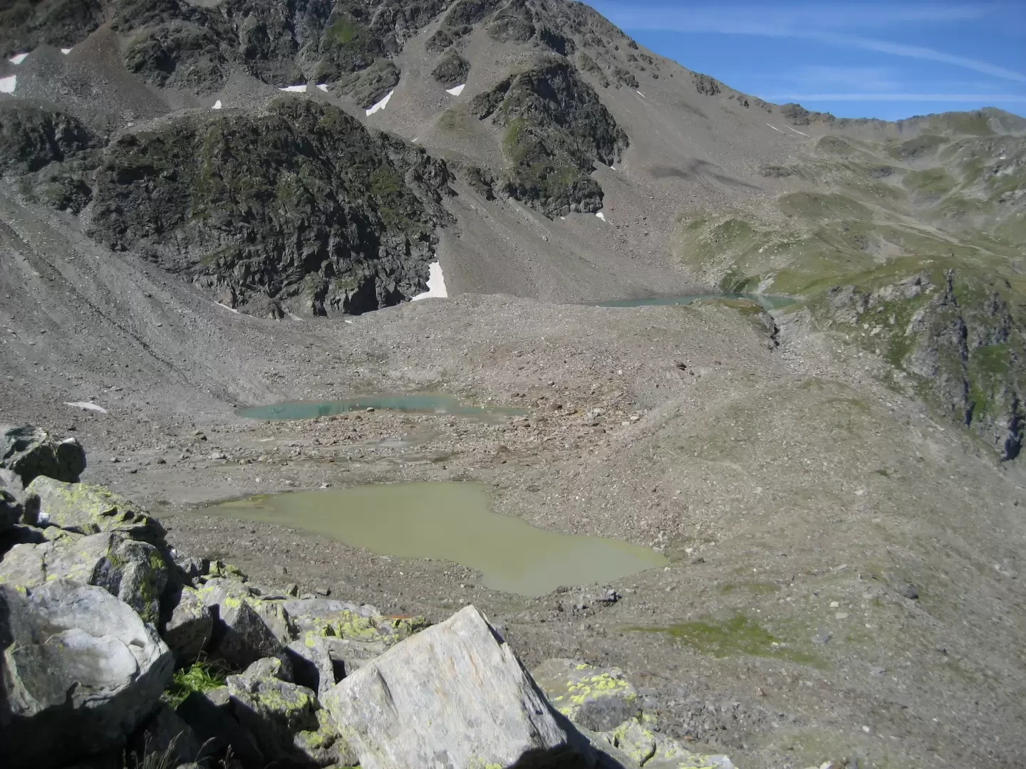
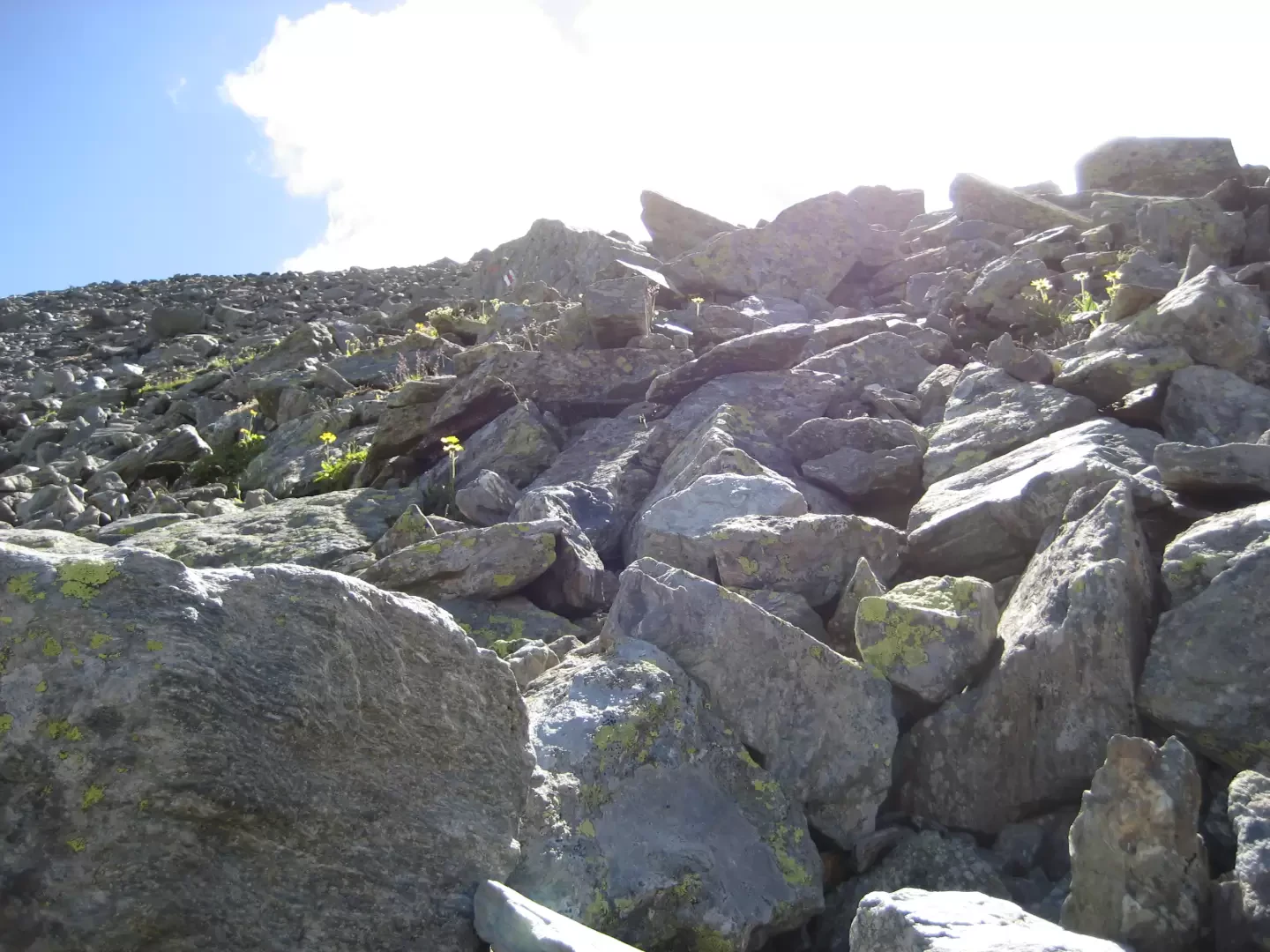
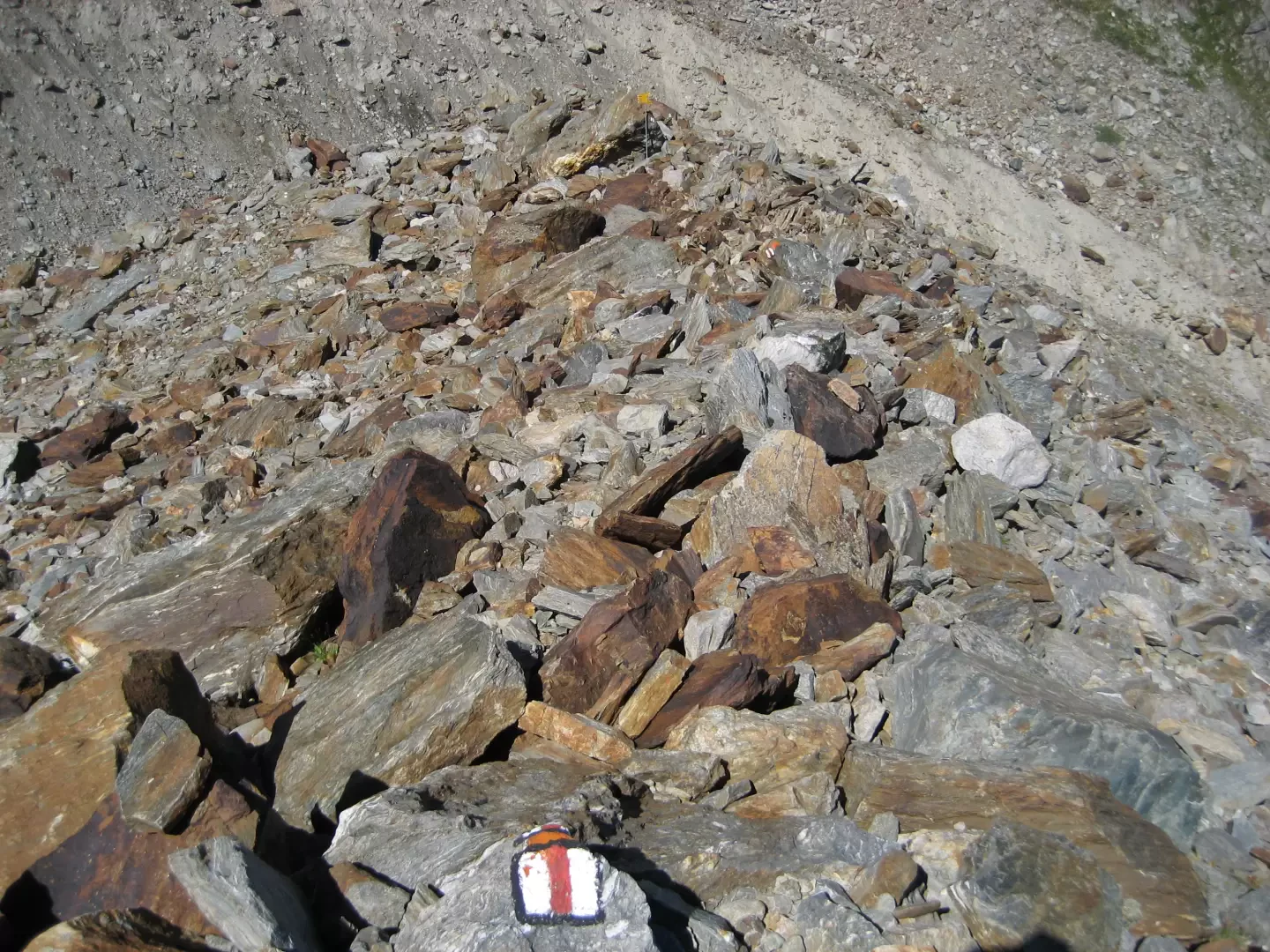
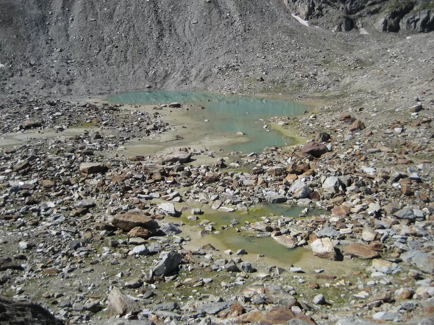
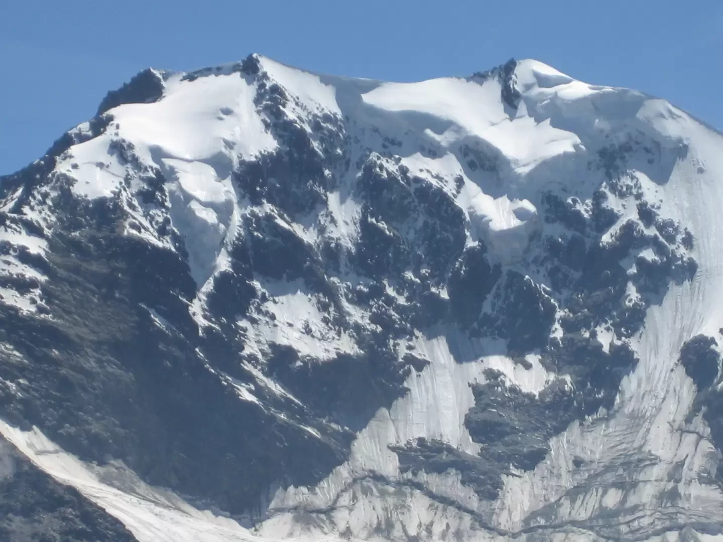
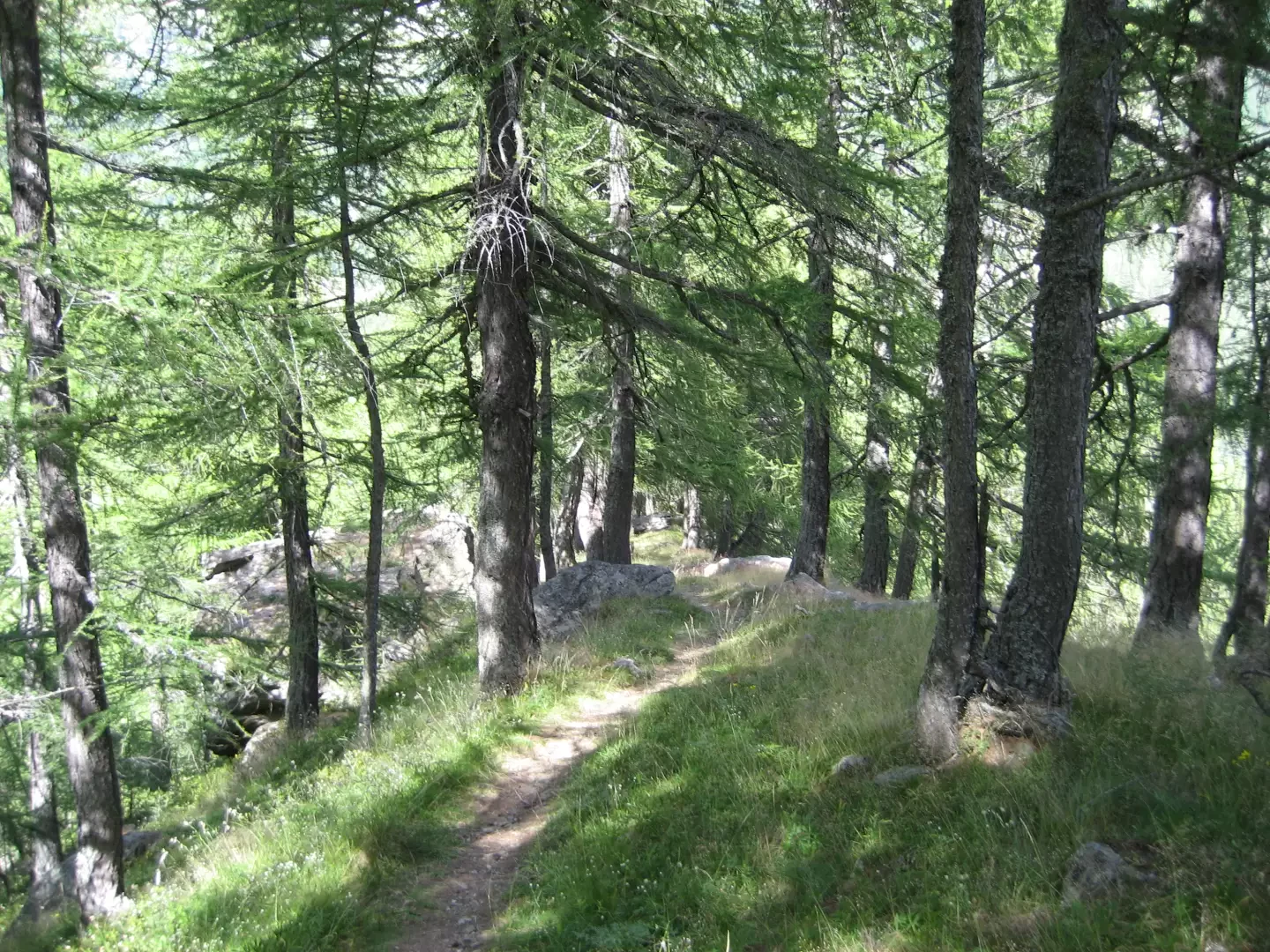
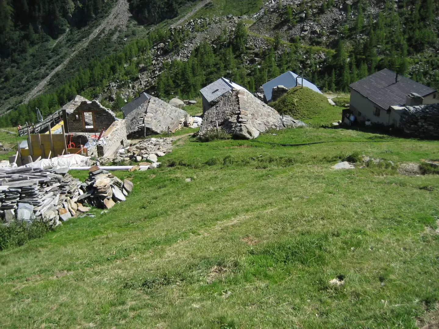
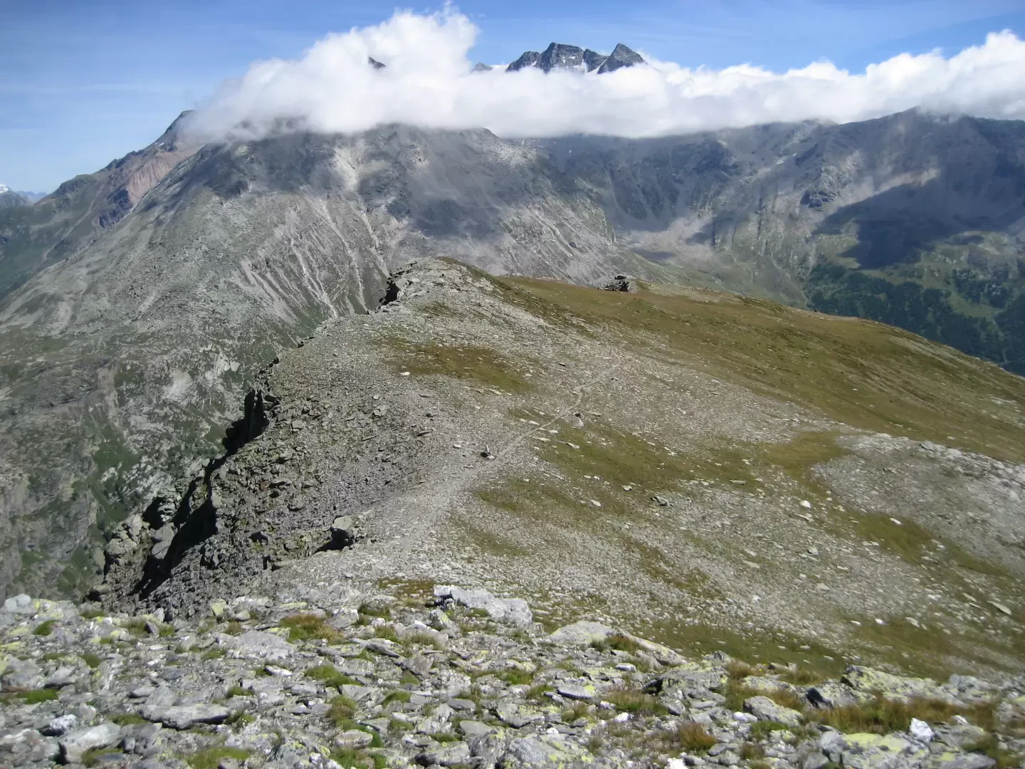
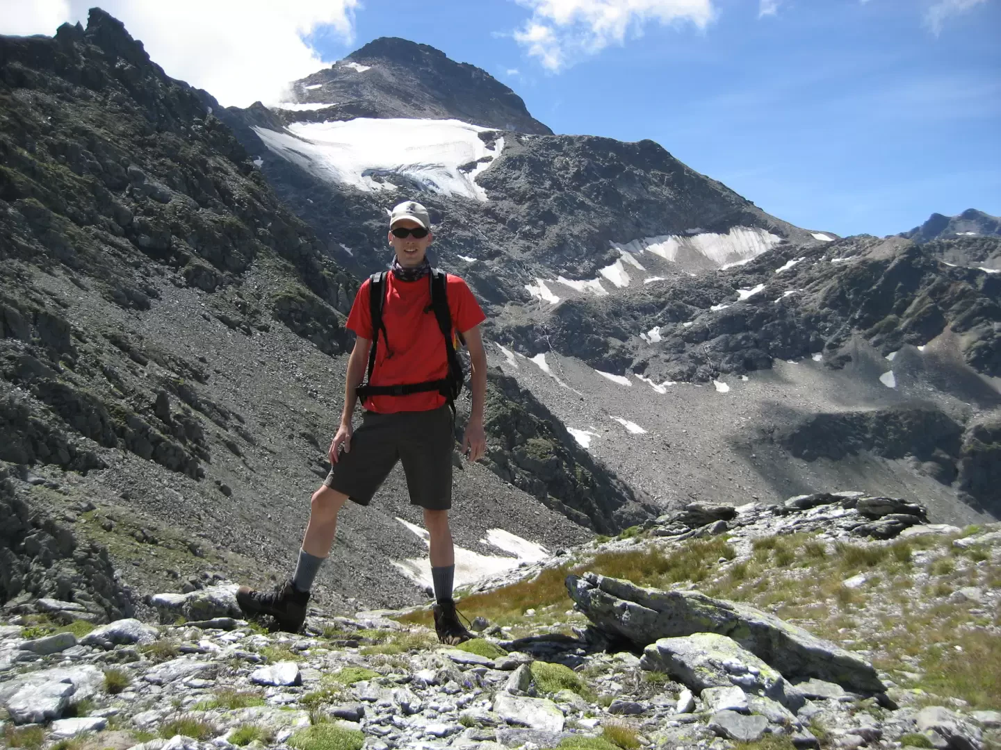
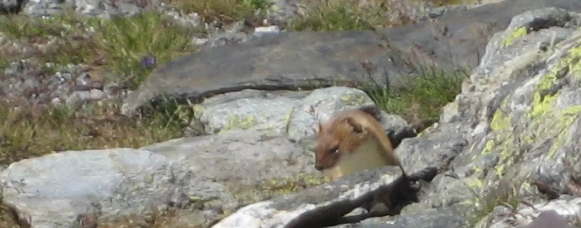
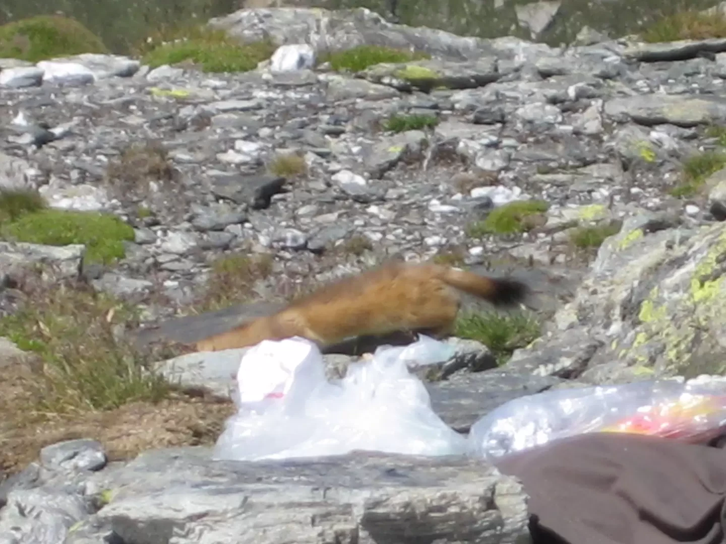
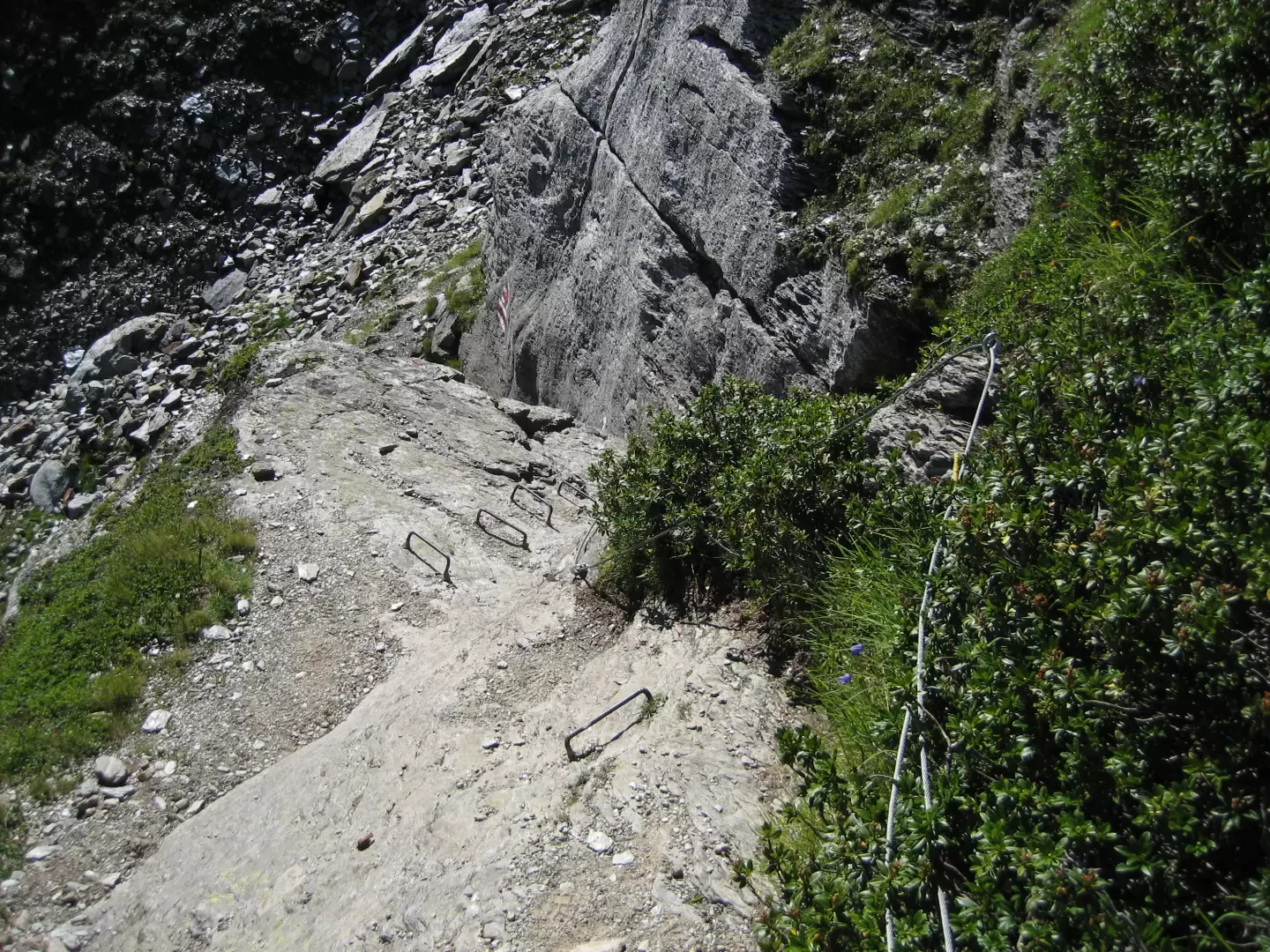
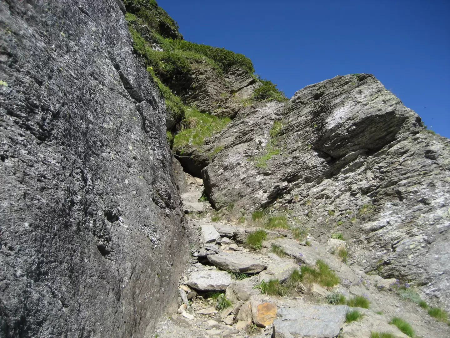
Park the car in the lay-by along the road leading to the Simplon pass and walk down the asphalt road below to reach the Chluismatte cottages. The path starts at the back of the hamlet, roughly behind the last hut on the left, skirts the meadow at the foot of the slope and then climbs up the valley. When I walked it (10/08/2008), the path was not numbered but was well signposted with the classic red-white-white symbols. After an initial ascent, one reaches the Wyssebode plateau dominated by the beautiful waterfall in the background. Along the stream bed, the disasters of the 1993 flood that drained the lake above are visible. Cross the plateau to reach the foot of the waterfall and ascend the slope to the orographic right. The path here becomes quite steep and also has a small section equipped with single rungs and the classic steel cable. Don't be impressed, these are only 'four steps' that allow you to easily overcome a section that would otherwise present many more difficulties. At the top of the waterfall, take the path up the scree slope on the left, which leads us to the plateau where the Sirmoltensee lake once stood. The landscape is impressive: only a couple of modest pools now remain of the large lake. To the right of the path, you can still see the erosion channel that has completely emptied the original lake. There are currently three 'lakes', which can be clearly seen on the way up to the pass, the first two are immediately visible, while the third is located to the right of the plateau behind a scree ridge, so if you want to visit the latter lake, you must go there before ascending to the Wyssbodehorn. The path up to the Wyssbodehorn is well signposted and starts, looking at the first lake, to the left of the marker at the beginning of the plateau. Climb up the scree slope following the red-white-white signs, paying close attention to where you put your feet because after an easy first part, the slope becomes steep and a fall now would not be at all pleasant! If, during the ascent of the scree, one turns around, it is possible to observe all three small lakes. Following the path, you reach the summit of the Wyssbodehorn at 2623 m, marked by the classic stone cairn. From here you have a wonderful view over the entire Simplon pass, you are below the summit of the Schilthorn and you have an excellent view of the Galehorn (this is the mountain with the large antenna at the top). If you follow the view in the direction of the Simplon pass proper, you can also see the Aletsch glacier with its characteristic 'curve'. My advice is to stop for lunch at the top and enjoy the silence of the mountain, and if you're lucky you might even meet someone special... "...the day I went up, despite it being a Sunday and August, the few hikers I met during the climb stopped at the lakes below and at the top of the pass there was only me. Having finished eating my sandwiches, I decided to enjoy the sun in the shelter behind the little man from the cold wind that was blowing. I was lying there when I felt something jumping on my belly... I heard the sound of 'little nails' on the fabric of the shell I was wearing, I opened my eyes and found myself face to face with a beautiful ermine! The time for a glance and off he goes, taking refuge on the other side of the little man, I grab my camera and move away so as not to disturb him. He, the quintessence of curiosity (you only have to look at his snout to see that), enjoys popping out on either side of the little man of stones. Having gained more confidence, he overcomes his fear and starts eating the crumbs of the sandwiches he had previously eaten - here's an opportunity for a photo! Despite the fact that I was in the wind and some metres away, as soon as the camera (a compact digital camera) came into focus he could still hear the noise and took refuge behind the stones. After giving me a couple of shots he decided to go back free into his mountains. An unforgettable experience." Having taken the classic summit photo, we descend from the opposite side of the mountain to where we climbed. The path first descends gently down the slope and then more steeply until it becomes a thin track through the meadows (testimony to the fact that the route is really not very busy). In foggy weather, this could lead to orientation problems. Continue to descend until the path becomes well-marked again, and admiring the beautiful scenery around us, we arrive at the Rossbodestafel pastureland 1922 m. Here, follow the path to the left of the houses, which in no time at all takes you past a stream with a beautiful waterfall to a dirt road. Here you can either go back down the road or pay attention to the various cuts that the path makes until at a certain point you can take the path that leads away from the road to Egga 1580m.
General Information
Signposts:
Type of route: crossing
Recommended period: June, July, August, September
Exposure to sunlight: north
Photo gallery
Comments (0)
Sign in to leave a comment