Via delle Cappellette in Valbrevenna: from Carsi to Avosso


Edited by:
Maurizio Loconti
Updated at: 23/03/2026
Access
From the Busalla exit, take the road for Casella to Avosso, where you leave one vehicle. With the other you go up the SP11 of the Valbrevenna and after the Santuario dell'Acqua (ruined by the 2015 flood) you turn right for Carsi until you reach the village at 865m - medium/small car park.
comment: It's a fairly easy route and the only difficulty lies in having to use two cars. It was particularly useful to have 'designed' the route as it developed (i.e. from top to bottom) in order to simplify an outing that was a bit long in the end anyway.
Description
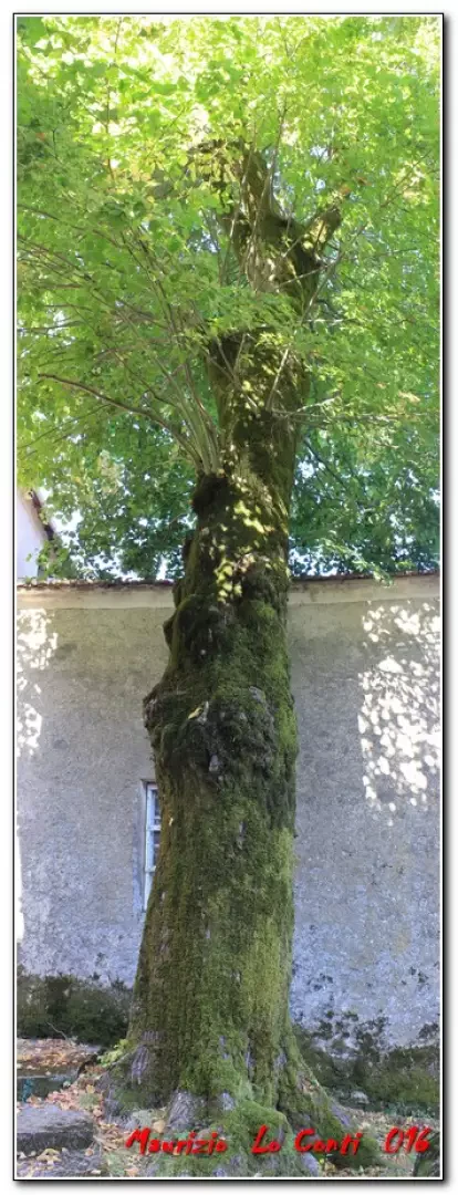
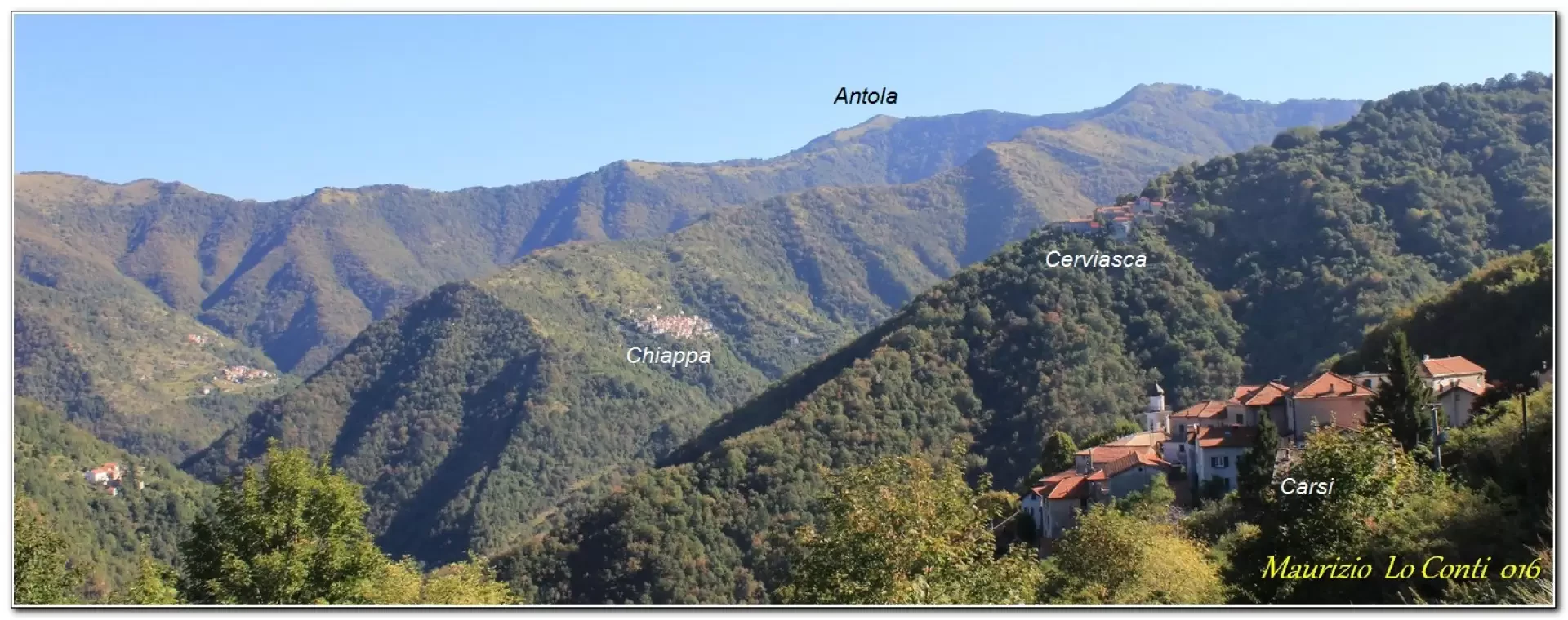
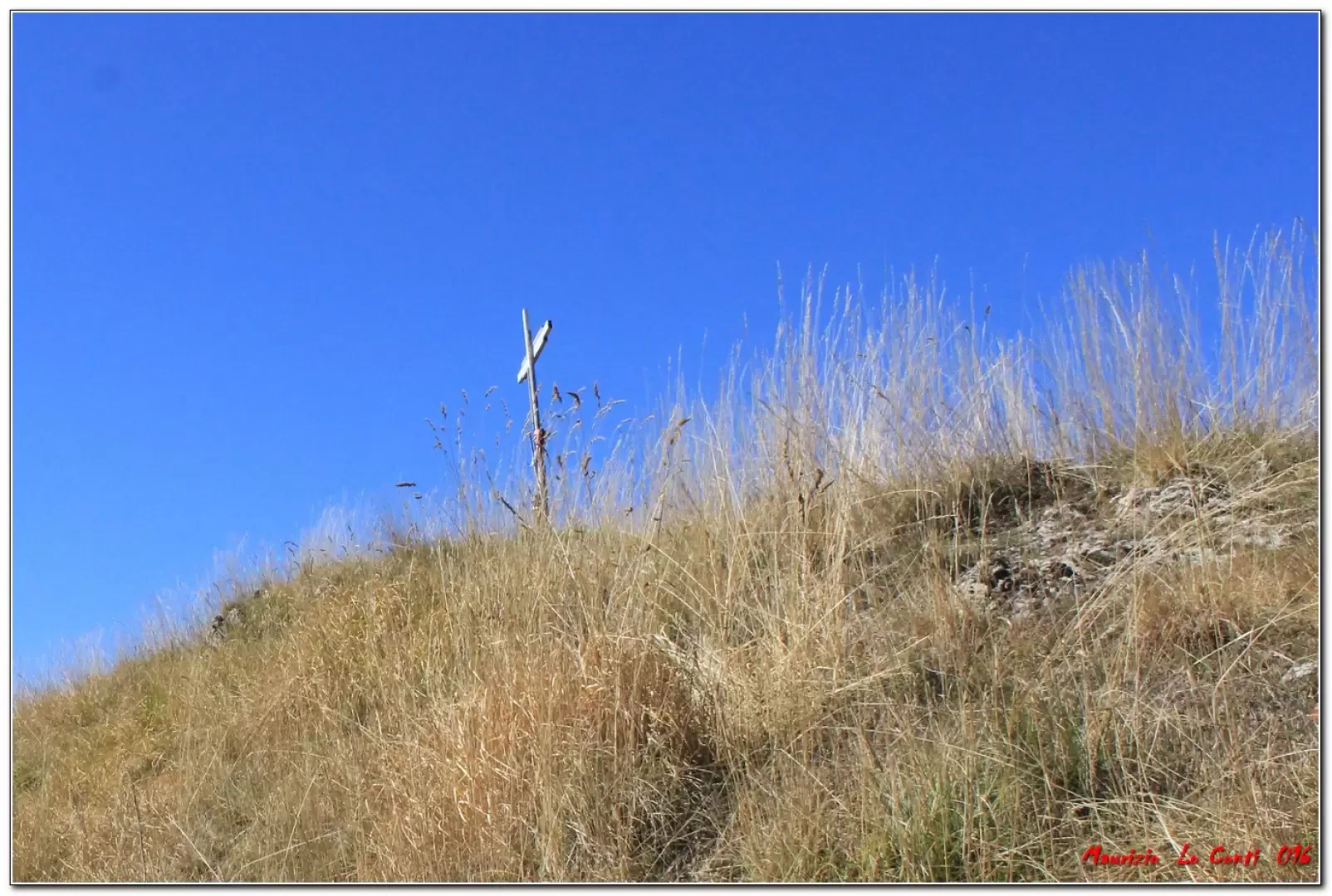
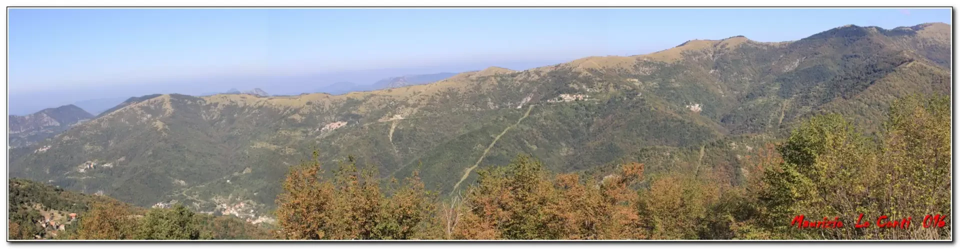
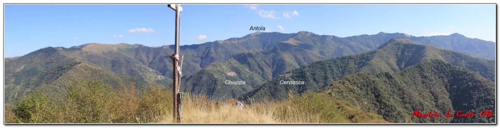
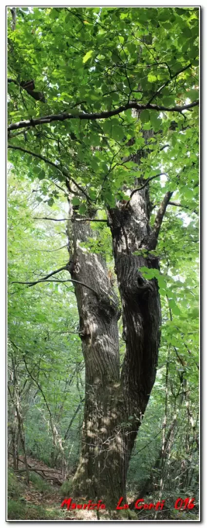
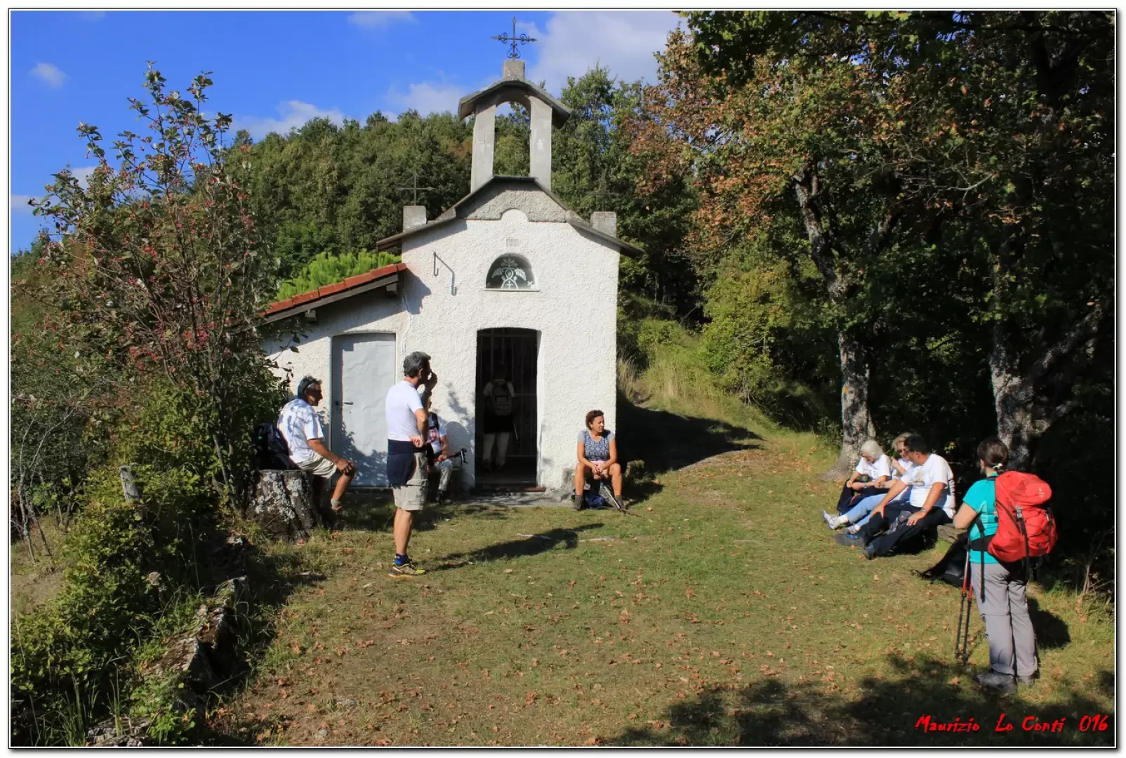
We visit the village, which until the 1920s was the municipal seat (church from 1669). You then climb up to Case Gherfo (935m - near the Tan-na da Reixe cave for cavers only), where you meet some cows. Keep to the right and in 5' there is a new fork (a few symbols on stones but no signs). Here you climb to the left towards the nearby Liprando mountain. Theoretically it would be marked, but in reality there are some old signs right from a fork (still to the left). The last climb is a little steep, but after all, the diversions only involves +100 m in height difference. This leads to a handmade summit cross (25' - 1122m). Beautiful views in all directions, on a very favourable weather day. Some hamlets, now abandoned, stand out on the left below (Cognoli, Case vecchia, Poggio). Retrace your steps in 20' and return to the main road and turn left. The forest is slowly taking on the colours of autumn and monumental chestnut trees can be seen. We arrive at Crosi (40' - 878 m), with some buildings that appear to be in the process of partial recovery. Immediately afterwards there is the first small chapel of the day (15' - tot. over 2h), near which we take a break for lunch.
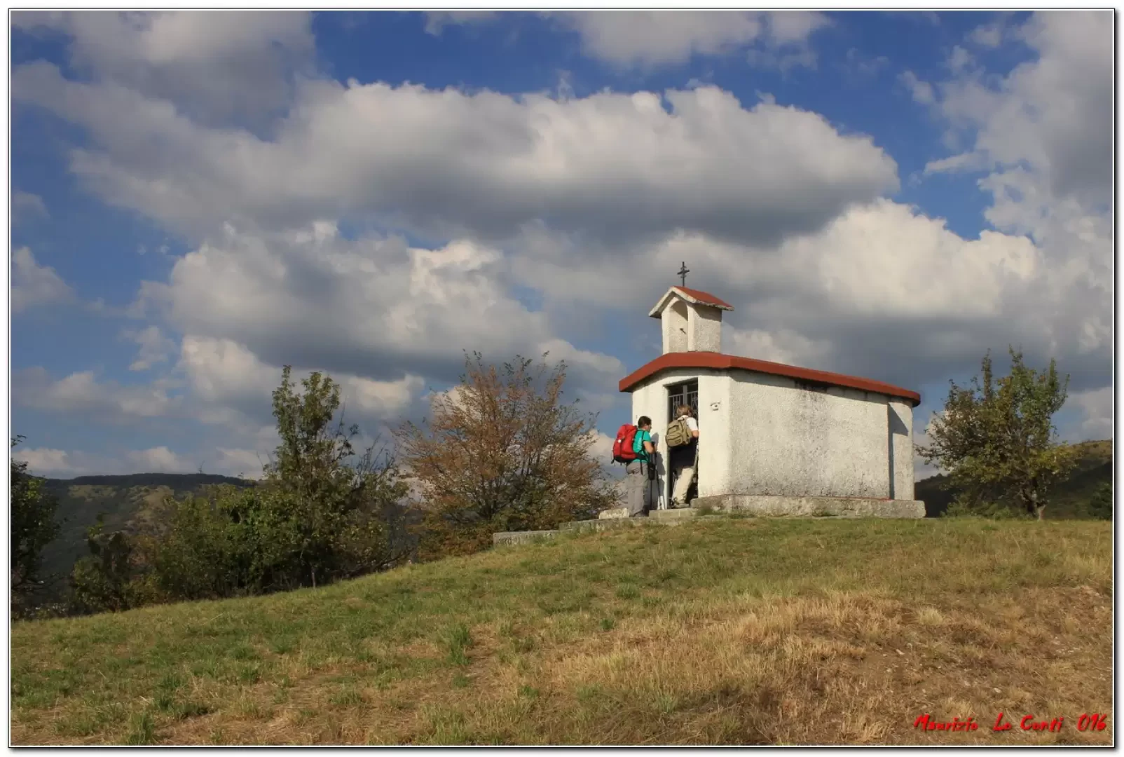
Afterwards we continue on and for a moment lose sight of the symbols... You can see the houses above on the left, but the dirt track goes flat... the track joins the asphalt where you go up to the left to the village of Piani, finding the markings again (25' - 848 m). In hindsight, it would have been better to take a lunch break here. However, an obvious contrast does not go unnoticed: a barn and a satellite dish! The season is still nice and many houses are open... After Piani, we tackle a chestnut grove with large trunks. Once past the forest, from a bend, you notice a house and the Grisu chapel just below (30' - 867 m). In another 10', you are at the Cappelletta del passo Banca (843 m), just above Frassineto (whose church is dedicated to Our Lady of Loreto). Go straight on, ignoring the ascent to Monte Banca, and in 25' you reach Case Fasicou (805). Continue along a dirt track and then, when the road bends to the left, go straight on, entering the woods. You arrive at the beautiful Chapel of San Bernardo (770 m), which invites you to take a break... Go down to the Cassinetta below (5'), where you can buy some potatoes that have just been taken out of the earth... then continue along the path, following the asphalt for 15', to the Chapel of America (673 m), where you keep to the left into the wood. The path becomes steeper and steeper until it plunges down to Avosso right by the church with benches and water (30' - 417 m). To the right, 5' away, are the cars left in the morning.... (Total after lunch break: almost 3h).
All in all: Disl. approx. +300m -700m Travelling time: approx. 13km and almost 5h + stops and breaks (4h15 without the necessary diversions to Liprando) for a time superior to the Fie table that gave 3h15 from above Carsi. It has to be said that we went slower than usual and this extended the time even further, but by going slowly we saw much more detail and this is ultimately the most important thing. However, the views were interesting and beautiful... that is also what counts...
Trip photos:
http://cralgalliera.altervista.org/CarsiAvosso016.pdf
http://cralgalliera.altervista.org/anno2016.htm
General Information
Tour:
Signposts:
Tour type: a/r (traverse)
Recommended period: May, June, September, October
Exposure to sunlight: north
Objective hazard:none
Exposed Tracts: none
Useful Equipment:normal hiking equipment
Water:
NB: in the event of an outing, always check with FIE, Cai, any park authorities or other institutions, pro loco, etc., that there have been no changes that have increased the difficulties! No liability is accepted. This text is purely indicative and not exhaustive.
Info Hiking Section Cral Galliera: http://www.cralgalliera.altervista.org/esc.htm
trips 2016 at link: http://www.cralgalliera.altervista.org/gite016.pdf
Photo gallery

Comments (0)
Sign in to leave a comment