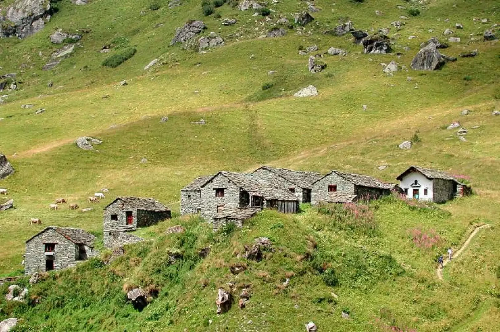
Otro Valley, from Alagna Valsesia

Introduction
The Otro valley is a collection of beautiful Walser villages, with typical, well-preserved dwellings, which can be reached from Alagna via a steep path that climbs to the left in the valley preceding the Olen valley. In the Middle Ages, it was a rich alp belonging to the Counts of Pombia; in 1025, some members of the family, including Riccardo, owner of Otro, were punished by Emperor Conrad II for their support of King Arduino d'Ivrea, and their property was confiscated. The alp of Otro was donated first to the bishop of Vercelli and then to that of Novara. Although the confiscation was reiterated in numerous diplomas by the various emperors of Germany, the very powerful lords of Pombia managed to remain in possession of the property, and Guido donated the alpe d'Otro together with other assets owned in Valsesia, to the monastery of Cluny, which in turn transferred the properties to the Cluny monastery of Castelletto Cervo, a private monastery, founded in those very years by the Counts of Pombia, who with this move secured their property from confiscation and maintained control over it, with the appointment of the abbot and financial management, according to the custom of the time. In the 13th century, thanks also to the favourable climate, as in other areas of Valsesia, the Counts of Biandrate and Canavese and the religious orders favoured the settlement of Walser settlers in the valleys, so that they could make a profit from the land; settlers from Gressoney arrived in the Otro valley, but perhaps also from Val Vogna and Macugnaga. When the climate became colder in the 16th century, the area was no longer inhabited all year round, and the valley dwellers came down from the high mountain pastures on Christmas Eve and went up again on St Joseph's Day. The Otro valley is triangular, and is divided into three valleys, bordering the Gressoney valley: the first, the southernmost, is traversed by the Tailli stream (Tailli Wasser), which feeds two lakes; in the second, the central one, flows the Otro stream (Olter Boch); it includes the area of the Corno Bianco and Strailing (das Kufers grod); the third borders the Olen valley, which can be reached via the Foric pass. The villages in the Otro valley have typical Walser houses, which are very well preserved, bread ovens, and the well-restored Puttero Mill.
Description
Leaving the car behind, climb up the beautiful mule track following the signpost [3], which is the "mother" of the paths in the entire Otro valley, and arrives at Bivacco Ravelli and then at Passo dell'Uomo Storto (2880m). You can start either from the Resiga hamlet or from the centre of Alagna. When the two routes join, the Olterstiga, or Otro climb, begins. Leaving on the left the path to the Caldaia d'Otro (Olter Chessi), a form of erosion created by water, and leaving on the right the path to the abandoned manganese mine, we continue along the very well traced footpath, quite steep in places, that climbs into the dense wood shaded by conifers, with serpentines that help us gain height quickly. We pass a little chapel, zigzag our way up again, then after a short, less steep section we leave the forest, leave the houses of Felleretsch and Ciucche to the right, and find ourselves at the first village, Follu (1684m), a scant one and a half hours from the start (the ascent is steep and steady, it 'pays off'...). The beautiful meadows towards Felleretsch are cultivated against the mountain in potatoes, vegetables, cereals. At Follu there is a lovely church dedicated to Our Lady of the Snows, some beautiful houses, a fountain and a refreshment station; most hikers stop here...
We continue across the meadows towards the other villages, Dorf and Scarpia (1726m), with their beautiful houses protected by avalanche guards; we pass the bread oven, and in the middle of the houses, instead of following the high path around them to the right. Here the path is gentle, the difference in altitude little. We continue through alder bushes accompanied by the cowbells of the cows grazing under the mule track and in half an hour we are first at Pianmisura Piccola, greeted by a friendly braying donkey, with houses no longer made of wood but of stone, all in a row and with beautiful square vegetable gardens in front of the doorway, protected by nets. In front of us, on the hump, across the Foric stream, are the houses of Pianmisura Grande (1854 m), unfortunately partly abandoned, with their small church and fountain. Before crossing the stream towards Pianmisura Grande, a diversion to the right, the [3b], leads to the Foric pass and the Zube pass, and is part of the Monte Rosa tour, which is very well signposted. Beyond Pianmisura Grande, trail 3c goes up to the Granus alp, then to the Revelli bivouac, the Tailli pass and down to the lakes of the same name, from where trail
takes us back to Follu.
Returning back along the same route in about 45 minutes.